
dmcginvt
-
Posts
515 -
Joined
-
Last visited
Content Type
Profiles
Blogs
Forums
American Weather
Media Demo
Store
Gallery
Everything posted by dmcginvt
-
72683371705__2884BBF6-2230-4A22-9715-454E32FE9D17.MOV Now s+, it’s dumping
-
Took awhile but it started about an hour ago came down hard for a bit but still moderate now, and definitely breezy, 0.5 in so far
-
I just went outside, it;s not snowing at all
-
Just no snow, it's refusing to snow. Must be evaporating over our heads
-
Better than the GFS by a huge margin, 2 storms in the long run even if one of them magically goes back NNW straight into VT and drops 20-30 mb. Let's just enjoy chaos and hope it signals change. Sensitive dependence on initial conditions FTW
-
changed to rain/sleet, total 7.5 inches. 31F
-
up to 30.4 flakes getting bigger now but pouring down, cracks in the ice
-
snowing sideways and you cant even see a flake it's moving so fast now. Wind is picking up and temp going up rapidly, 24 to 28 in less than an hour, had to clean off the weather station after 4 inches stopped the anenomoter
-
I wish I wasnt doing a timelapse right now and you could see this blizzard we are having. But it's insane. Snowy and blowy doesnt do it justice. It's the first time I ever did this and watch it be shit
-
I dont care if it changes to rain, these snowfall rates I am seeing right now are worth it. It's just silly and presumably early still. 2/14/2007 is the only time that comes close. It's snowing so hard.
-
1/9-1/10 Now Morphing to Less-Than-Exciting Power Cutter
dmcginvt replied to Torch Tiger's topic in New England
grew up in Cinnaminson, that's some wind! thanks @rcostell -
1/9-1/10 Now Morphing to Less-Than-Exciting Power Cutter
dmcginvt replied to Torch Tiger's topic in New England
I think the ski areas are going to weather this fine. Net gain. Same with the next. And then hopefuly the euro gives that depiction for the storm after because that's a perfectnorthern vt snowstorm going right over the canal. Not holding my breath but would be nice -
1/9-1/10 Now Morphing to Less-Than-Exciting Power Cutter
dmcginvt replied to Torch Tiger's topic in New England
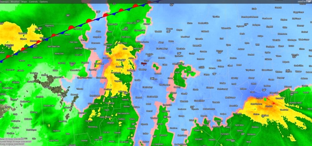
Snow started at 5 pm, currently 3 inches, most of that came in the last 2 hours, temp is 25f compared to Das -
Im at 3 now
-
1/9-1/10 Now Morphing to Less-Than-Exciting Power Cutter
dmcginvt replied to Torch Tiger's topic in New England
Im seeing approx half the intensity as valentines 2007 here in VT subjectively of course. But I know 2 in an hour when I see it. And Im close to seeing it, it's literally pouring. got a time lapse on hoping to prove it. -
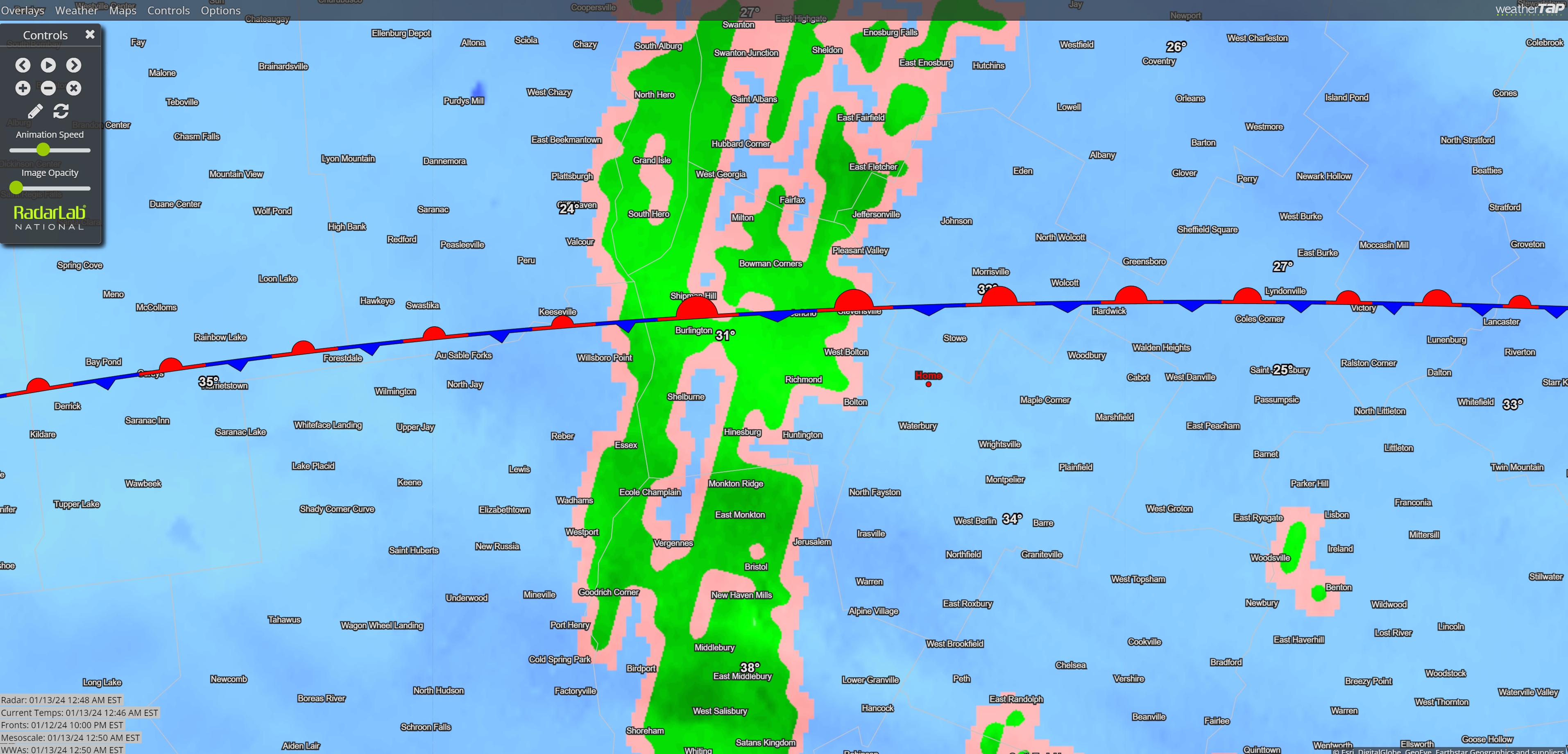
I see similar, it's earlier, who knows when it turns to rain but it is ahead of schedule, I have time lapse on this, it's easily half of valentines 2007 (my benchmark) as far as rate so far.
-
I agree, I dont see that much rain behind this. Especially with elev. Mtns will do good. That wind in the middle of the night will be interesting. Hope I sleep through it and wake up safe and sound I love a storm where you can actually see it accumulate. And that's happening now
-
1/9-1/10 Now Morphing to Less-Than-Exciting Power Cutter
dmcginvt replied to Torch Tiger's topic in New England
Just cleared of the rail (not my snowboard) https://share.icloud.com/photos/06cn9HTsna9RiYi9s5nHwoYDg -
1/9-1/10 Now Morphing to Less-Than-Exciting Power Cutter
dmcginvt replied to Torch Tiger's topic in New England
Its puking here, an inch in the last hour easy. -
What a wild place you live in. I have been paying attention to your measurements for years but especially since I lived in the Village from 2015-2018, and since I've live on Gregg Hill at 820ft since 2019. In the village I never beat you, you always had more. But since 2019 at GH in a few elevation events I beat you handily, but I do see looking at point forecasts that they are calling for 3-7 for me and 4-8 for you. Of course my old village location shows 4-8 too. Snowing nicely out there right now that's for sure and we are nowhere near the meat for a few hours., The microclimates of Vermont intrigue me. The Garfield Section of Hyde Park/Moville/Wolcott the most. Its a magical place
-
Just started snowing Moderately here
-
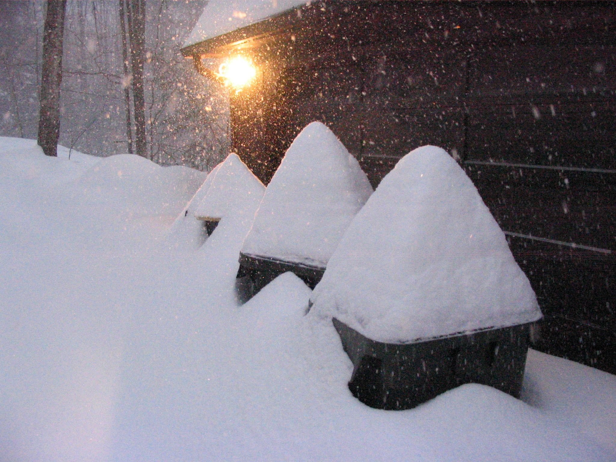
settled at 7.4, midway on Gregg Hill In Waterbury Center. 820'. Good storm.
-
LOL Ill answer for him. He was against anyone saying more than 12. But boy I saw ocean effect on the north shore get this thing going so much so that my sister said I got a few inches and then it stopped this is a bust. And I said what you shouldnt even have snow yet the storm hasnt started!! (the ocean effect confused her) And then so much enhancement. And the track was just perfect. for NE MA. Everything came together perfectly
-
So happy for you to jack!!! Wooooooooo, You have been waiting a while for this, enjoy for 2 days