winter_warlock
-
Posts
2,257 -
Joined
-
Last visited
Content Type
Profiles
Blogs
Forums
American Weather
Media Demo
Store
Gallery
Everything posted by winter_warlock
-
Only shows 19 inches at my house. Throw it out! Lol
-
Toii me the GFS looked a little disjointed compared to EURO,UKMET AND GEM
-
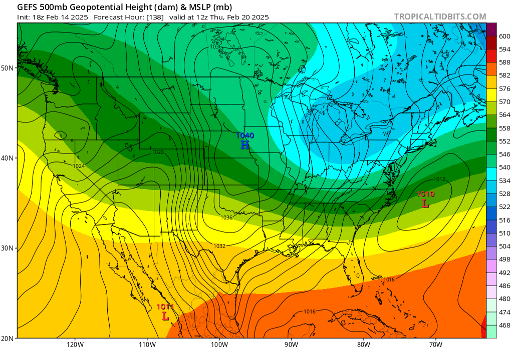
18z GEFS. not exactly terrible

-
An Improvement from 12 z
-
To my untrained eye. That doesn't look bad at all
-
I hope u never get a job as a motivational speaker cause ud suck at it lol
-
I think gfs. Is dragging those totals down a bit lol
-
Might be hope yet for the PSUHOFFMAN storm!!!!
-
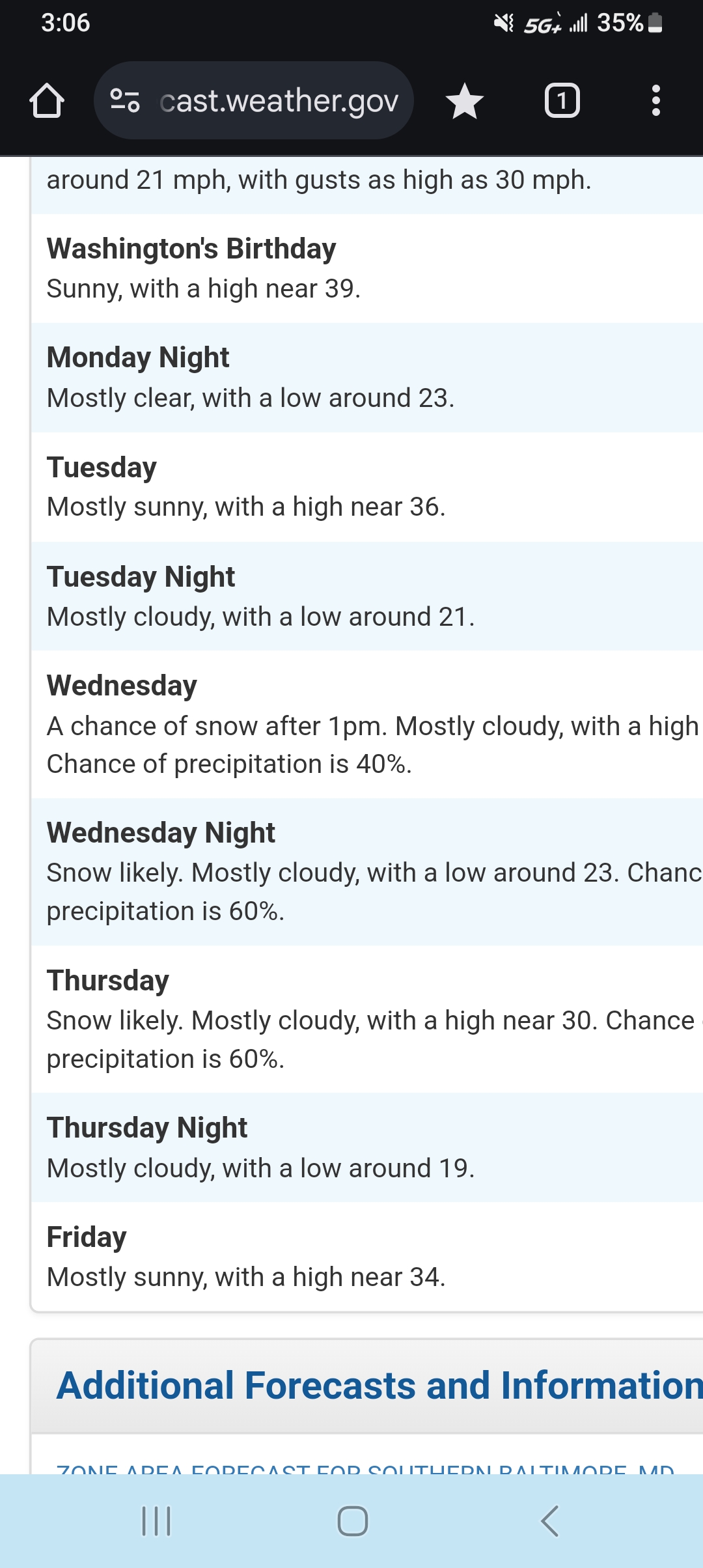
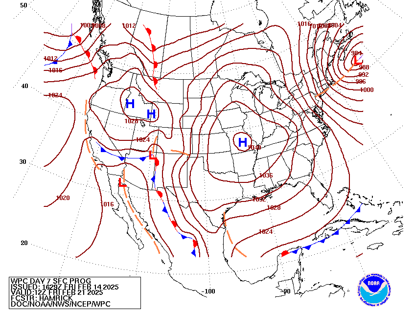
LATEST DISCUSSION FROM WPC!! The prospects for an impactful winter storm have increased over the past 12-24 hours, with the new WPC winter weather outlook now up to 50-60% for Thursday across portions of the Mid-Atlantic, and this also holds true for Friday into southern New England. Both the NBM and the majority of the deterministic guidance has trended higher with QPF across this region as the surface low tracks farther north compared to earlier forecasts. With abundant sub-freezing temperatures in place ahead of this storm system, widespread snow is becoming more likely, with a corridor of mixed precipitation farther to the south.
-
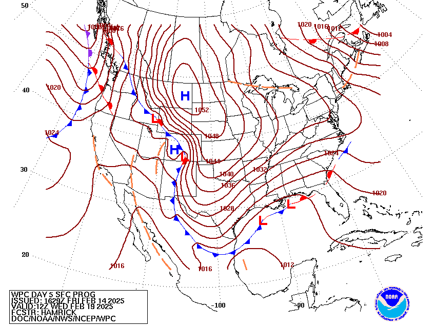
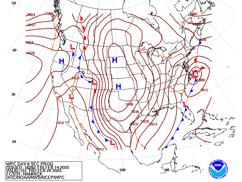
Latest from WPC!!.... INTRESTING!!!
-
LWX seem pretty confident .....
-
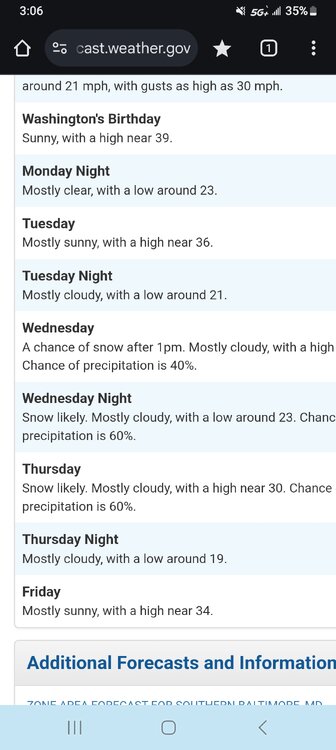
That 43 hours will never go away lol
-
After seeing the GEM...UKMET...EURO...... the GFS us looking kinda stupid lol
-
Seeing these. Bombastic models runs are amazing.. considering we're no longer in fantasy land. We're only 4 to 5 days out
-
Jesus effin christ!! Lock that muddafucka in!!!
-
Jesus Pepco went up just like BGE did. Energy prices are crazy when it's cold
-
Holy crap!! Dam cmc. And ukmet both are nicee if euro. Shows the same thing the. I'll agree with alot of tou... fuck the gfs lol
-
A few light sprinkles lol
-
If the GEM were to verify ..man we'd have a blizzard party in here!!
-
I didn't know it was better then gfs. That's my mistake
-
Ohh ok I did not know that. Ok I take back my bashing
-
Anyone know how accurate the GEM is compared to other models?
-
I mean. I've seen alot of people bash the GEM lol. Now if euro shows same thing as GEM then Im All on board!!
-
I don't wanna be a debbie downer but. Does anyone really. Take the GEM seriously? Lol
-
Common core math lol