winter_warlock
-
Posts
3,373 -
Joined
-
Last visited
Content Type
Profiles
Blogs
Forums
American Weather
Media Demo
Store
Gallery
Everything posted by winter_warlock
-
Let's get past the one for the 20th before we start worrying about fantasyland on the 24th lol
-
That's 10 days out lol
-
True lol
-
Lmaoooo I only 12 days away
-
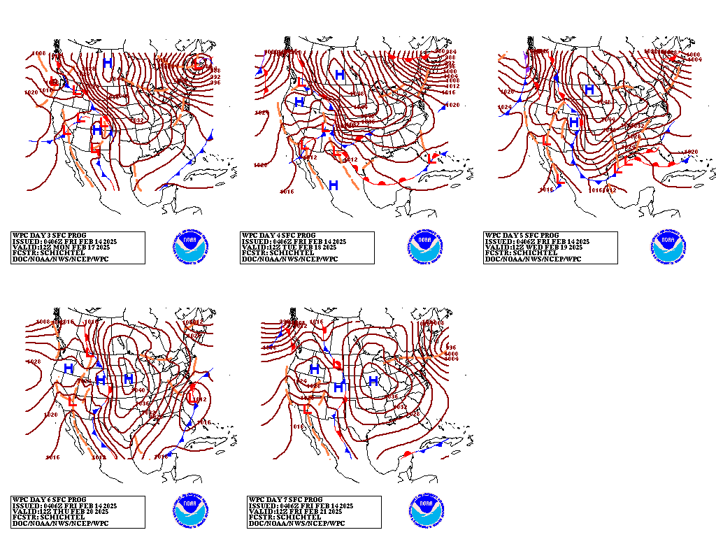
From WPC for what it's worth

-
From LWX disco this morning..... "This high will keep temperatures Monday night, Tuesday, Tuesday night, and Wednesday below average. This reinforcement of cold air could set the stage for a winter storm that could bring accumulating snow to much of the region Wednesday night through late Thursday."
-
That's not bad for 6 days out lol
-
Pull the plug on a storm 6-7 Days out??? Wtf?
-
Never thought I'd see the day when Mappy loses it!!
-
So its like the DGEX lol
-
Is spire a good model??
-
Nice NW tick!!!
-
Didn't even know they had a model lol
-
URGENT - WEATHER MESSAGE National Weather Service Baltimore MD/Washington DC 348 PM EST Thu Feb 13 2025 DCZ001-MDZ003>006-008-011-013-014-503>508-VAZ028-031-053-054-505-506- WVZ052-053-140300- /O.EXB.KLWX.WI.Y.0006.000000T0000Z-250214T0300Z/ District of Columbia-Washington-Frederick MD-Carroll-Northern Baltimore-Cecil-Southern Baltimore-Prince Georges-Anne Arundel- Northwest Montgomery-Central and Southeast Montgomery-Northwest Howard-Central and Southeast Howard-Northwest Harford-Southeast Harford-Frederick VA-Clarke-Fairfax-Arlington/Falls Church/Alexandria-Western Loudoun-Eastern Loudoun-Berkeley- Jefferson- 348 PM EST Thu Feb 13 2025 ...WIND ADVISORY IN EFFECT UNTIL 10 PM EST THIS EVENING... * WHAT...Northwest winds 20 to 25 mph with gusts up to 50 mph. * WHERE...DC, central, north central, northeast, and northern Maryland, northern and northwest Virginia, and panhandle West Virginia. * WHEN...Until 10 PM EST this evening. * IMPACTS...Gusty winds will blow around unsecured objects. Tree limbs could be blown down and a few power outages may result. PRECAUTIONARY/PREPAREDNESS ACTIONS... Winds this strong can make driving difficult, especially for high profile vehicles. Use extra caution. &
-
Niceeee
-
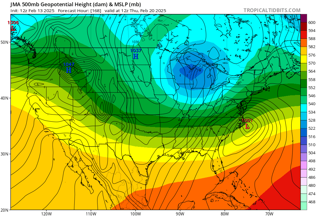
FWIW ... JMA is on board

-
True but they also mentioned the coastal in the disco. So there's that lol
-
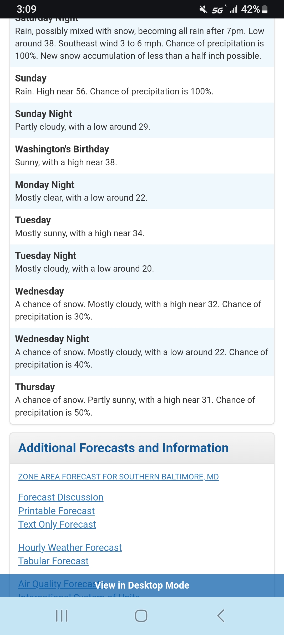
Sterling has snow forecasted for. Central md..... Kinda Ballsy for 6 days out
-
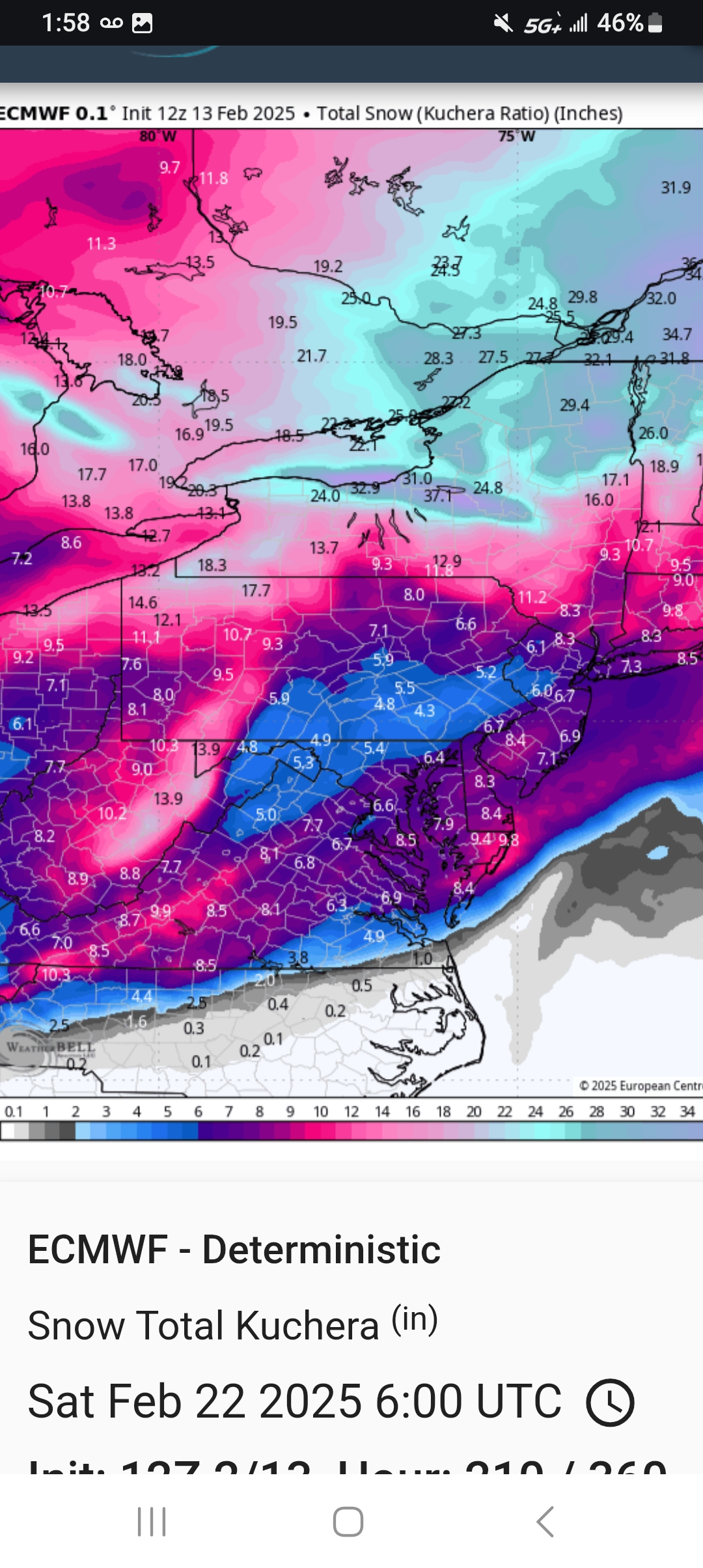
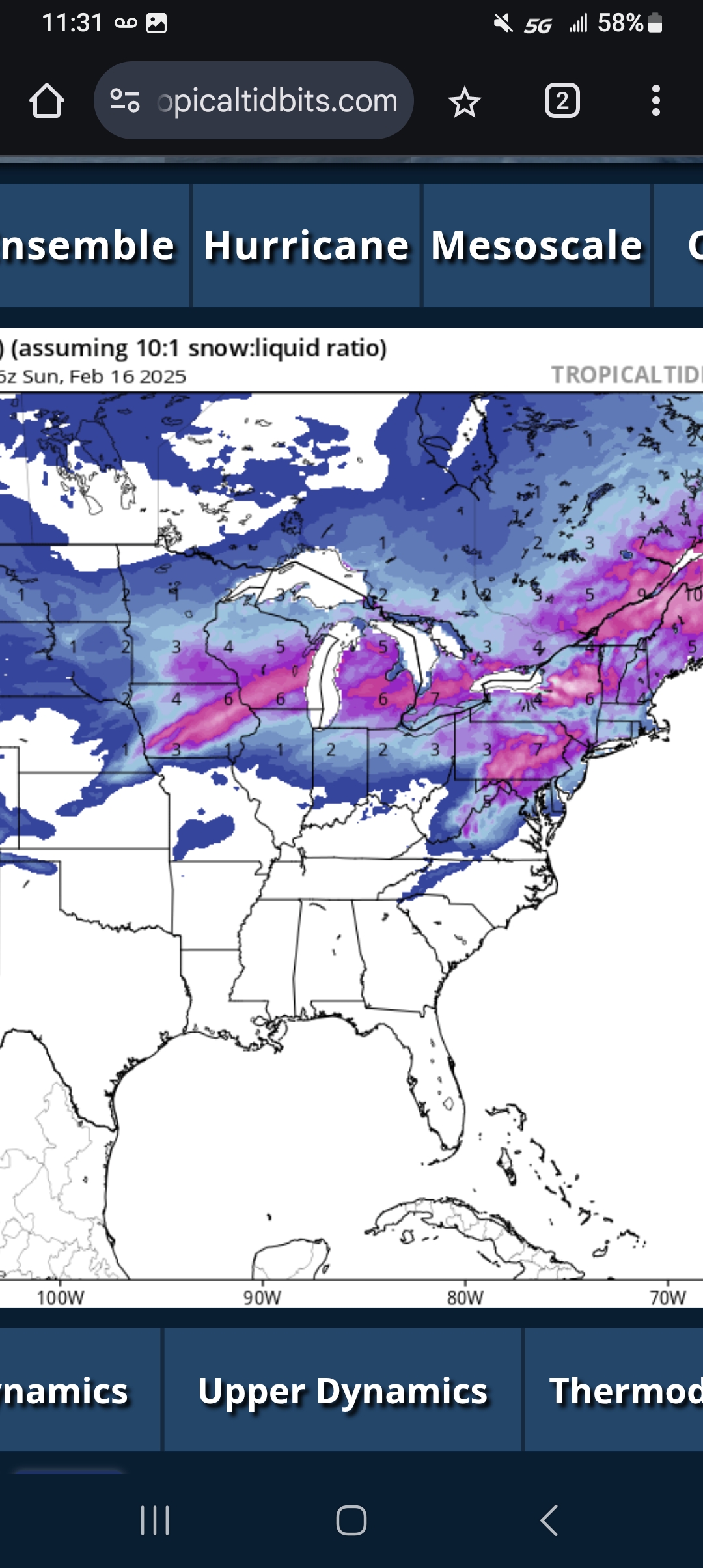
12z euro snowfall kuchera

-
Not bad at all
-
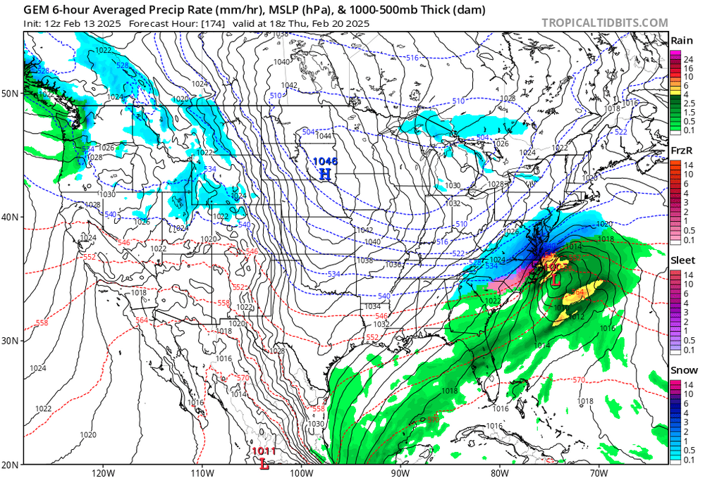
Considering it's 6 days out the cmc/gem don't look bad at all!!!
-
I don't beleive ut either but it does add to the total snowfall maps
-
This is gfs thru sunday....

-
Some of that is this Saturday
-
If GFS and EURO shows what icon showed this forum will explode lol