From sterling....
.LONG TERM /TUESDAY THROUGH FRIDAY/...
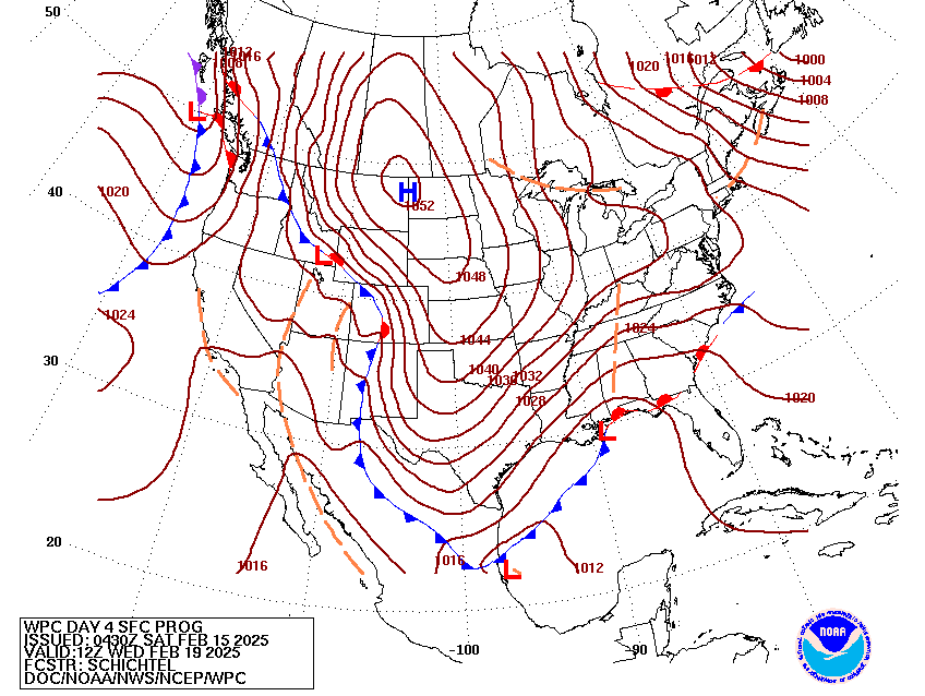
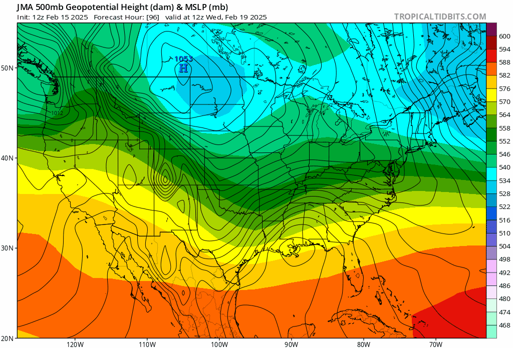
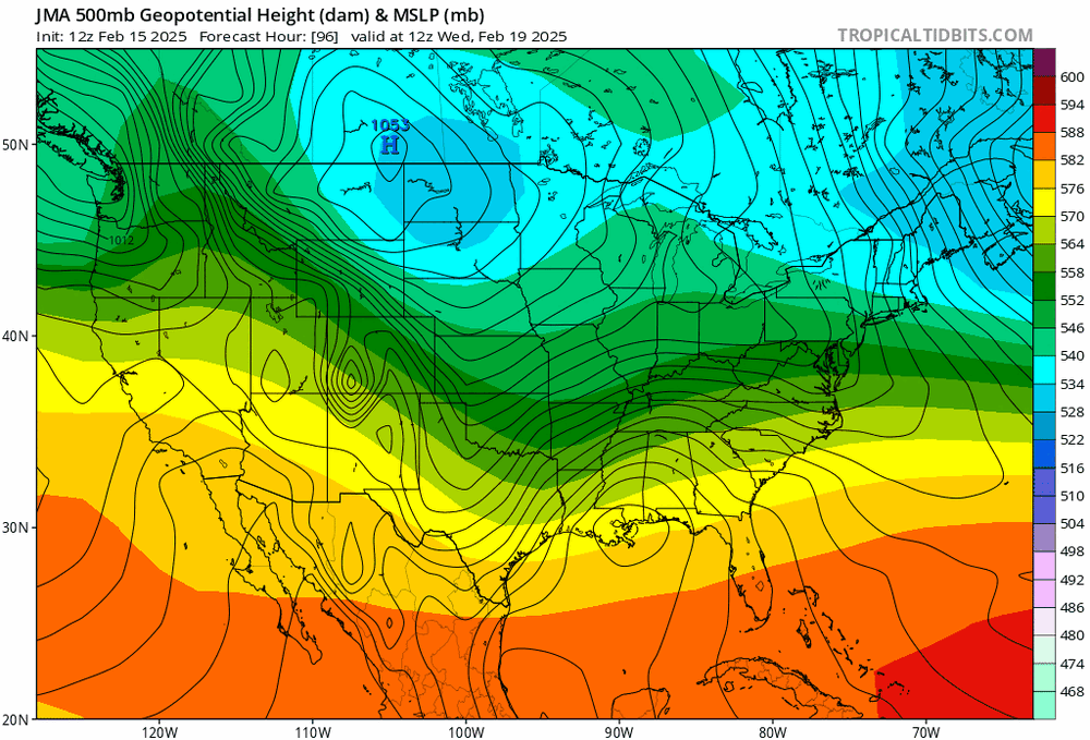
A cold dome of high pressure overhead will move off to our north and
east on Wednesday. A low pressure system will quickly develop over
southeast Georgia around late morning or midday Wednesday, before
moving up the Eastern U.S. Coastline toward Cape Hatteras and
rapidly intensifying into a big winter storm Wednesday afternoon,
Wednesday night and into Thursday morning.
Temperatures on Wednesday will be about 10 to 15 degrees below
average only reaching near or slightly below or slightly above
freezing, setting the stage for some accumulating snowfall
widespread across our region.
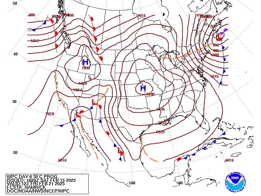
The winter storm expected Wednesday into Thursday shows a track and
intensity that could equate to several inches of snow. This
particular winter storm is still 4 to 5 days out from now so there
remains some uncertainty as to the exact track and exact intensity
and which model leans toward the best solution.
The NAM model only goes out as far as midday Tuesday and can only
show us signs of some front-running warm advection light snowfall
spreading east across the western Ohio Valley.
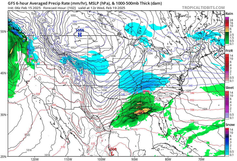
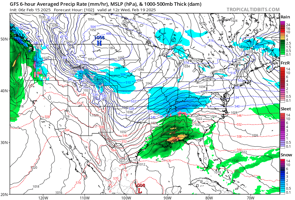
The GFS model shows a fast moving winter storm that could stay just
offshore from Georgia to the Outer Banks and then out to sea. Thus,
this track and speed would favor a few inches of snow across the
southeastern third of our region from midday Wednesday through late
Thursday.
The UKMET is between the GFS, and the models listed below.
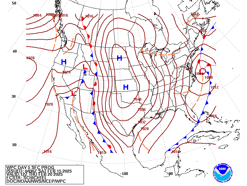
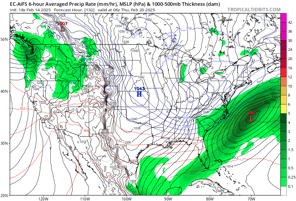
The EUROPEAN model shows a strong winter storm that rides along
the coastline from Georgia to the Outer Banks, slows slightly
while moving north into southern New England, while rapidly
intensifying. Because this model shows the rapid intensification
between the mouth of the Chesapeake and New Jersey, it has much
more snow than the GFS in our region.
The CANADIAN shows a fast moving winter storm that rides along the
coastline as well with a similar amount of snow as the EUROPEAN but
may have its track a few miles inland which could decrease totals a
little.
Bottom line is that we may be looking a major winter storm but with
subtle to moderate uncertainties in terms of snow amounts


.gif.98a404ba1c95889ba01e9a1eb1f91046.gif)
.gif.d2247ea8a05f5e4efbeff4e5bff54bfa.gif)