winter_warlock
-
Posts
2,257 -
Joined
-
Last visited
Content Type
Profiles
Blogs
Forums
American Weather
Media Demo
Store
Gallery
Everything posted by winter_warlock
-

January Medium/Long Range: A snowy January ahead?
winter_warlock replied to mappy's topic in Mid Atlantic
What I like is to my untrained eye it looks like a Miller A... better then that Miller B crap! -
Depending on what model you use I guess lol
-
3 to 6 in md? That seems kinda low when u factor al the models
-
Looks like 8 to 12 would cover both DC and balt
-
I see People complaining a south shift on some if the models. Yet it still gives people their biggest storm in years lol relax if the models all of a sudden take the storm down to florida,then you can panic lol
-
Rgem after 50 hours isn't all that accurate . We're still 3 days away. Models will meander
-
Because of a icon run??? Lmao
-
That's only till 7pm monday
-
Hmm well the euro is trending north. That's a good sign
-
Euro and UK is kinda on their own compared to all the other models
-
Ive never even seen LWX even mention the icon model in any of their discussions lol
-
Its the icon lol
-
Classic comma head shape
-
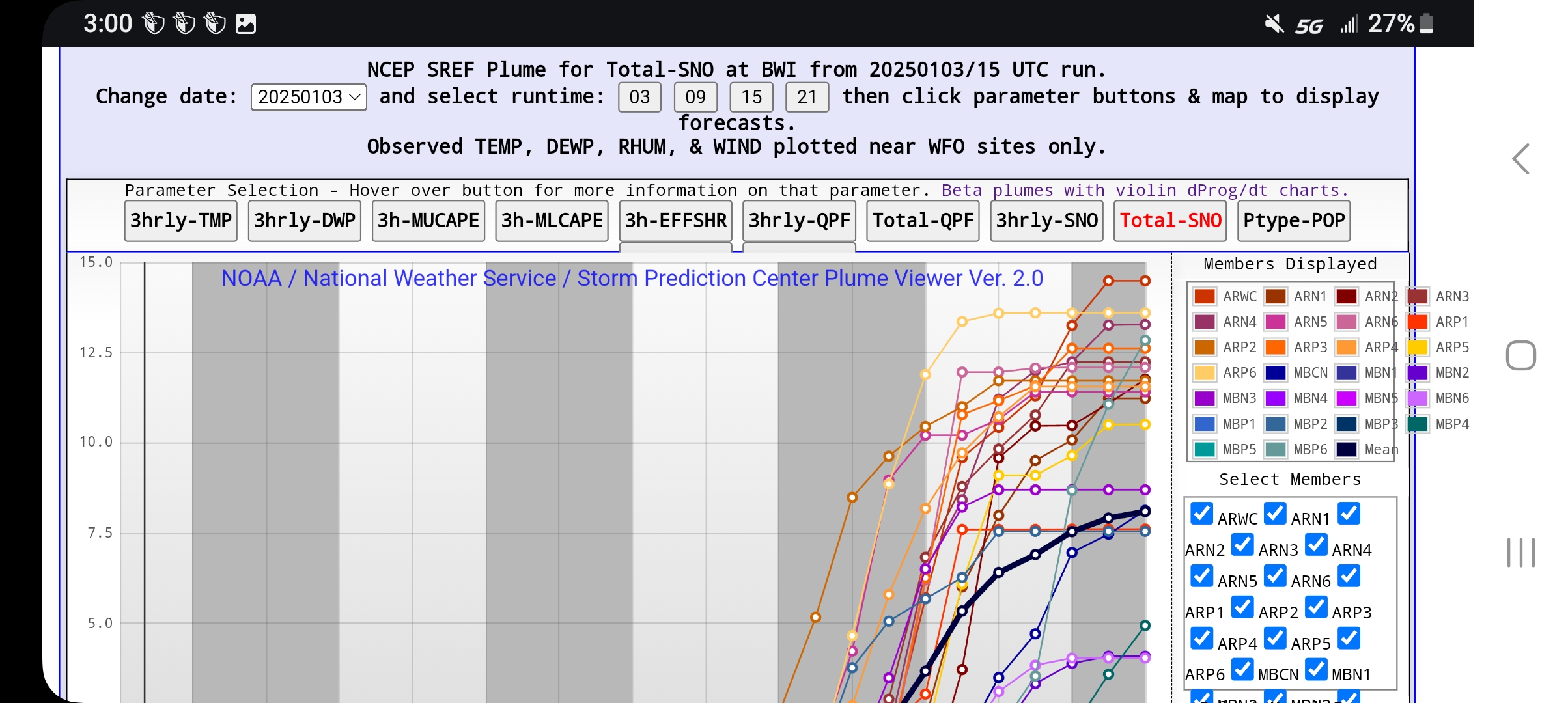
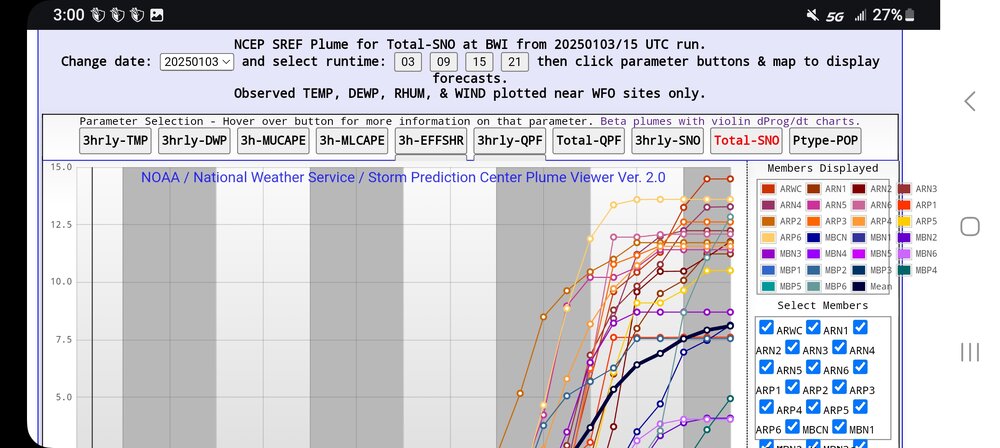
Latest SREF has bwi at 8 inches and storms not over yet...
-
Is it me or does that look better for northern maryland then 6 z did
-
I'm sure the storm keep going after hour 84. So we could add to those amount
-
What good is cold with out the snow lol
-
Link?
-
Breathing room for the south people maybe
-
Hope the ukie follows the Canadian
-
Heuy guys. question for ya... its Nam still known to have a warm bias ?? I remember years ago it did have a warmish bias
-
What exactly is the 5 contour?
-
Pretty consistent in my opinion
-
January Medium/Long Range: A snowy January ahead?
winter_warlock replied to mappy's topic in Mid Atlantic
That's A great spot for 8 to 9 days out!! -
FWIW. From Joe Bastardi... "the axis of the heaviest snow looks like you take I-70 from the plains to BWI and then just extend it east. In this band about 150 miles wide is 6-12 inches of snow which is 10 to 1 south of the axis and up to 20 to 1 north of it. Some 15-inch lollipops will occur. "