winter_warlock
-
Posts
3,378 -
Joined
-
Last visited
Content Type
Profiles
Blogs
Forums
American Weather
Media Demo
Store
Gallery
Everything posted by winter_warlock
-
Plzzz come north!!
-
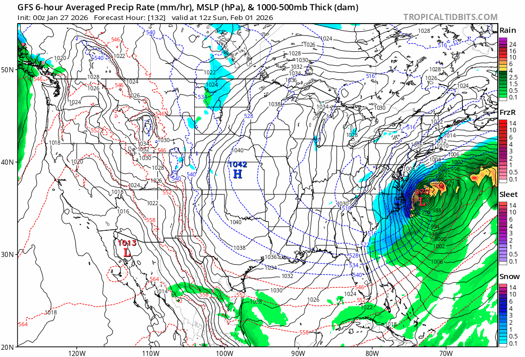
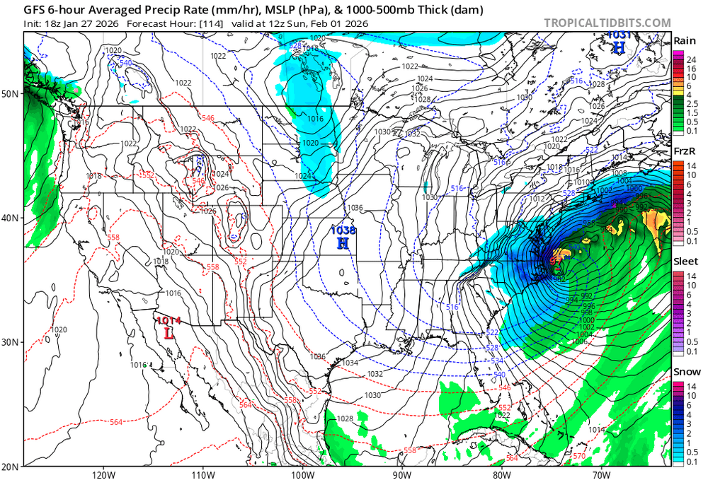
988mb!!!!
-
Slow mover would be nice!!
-
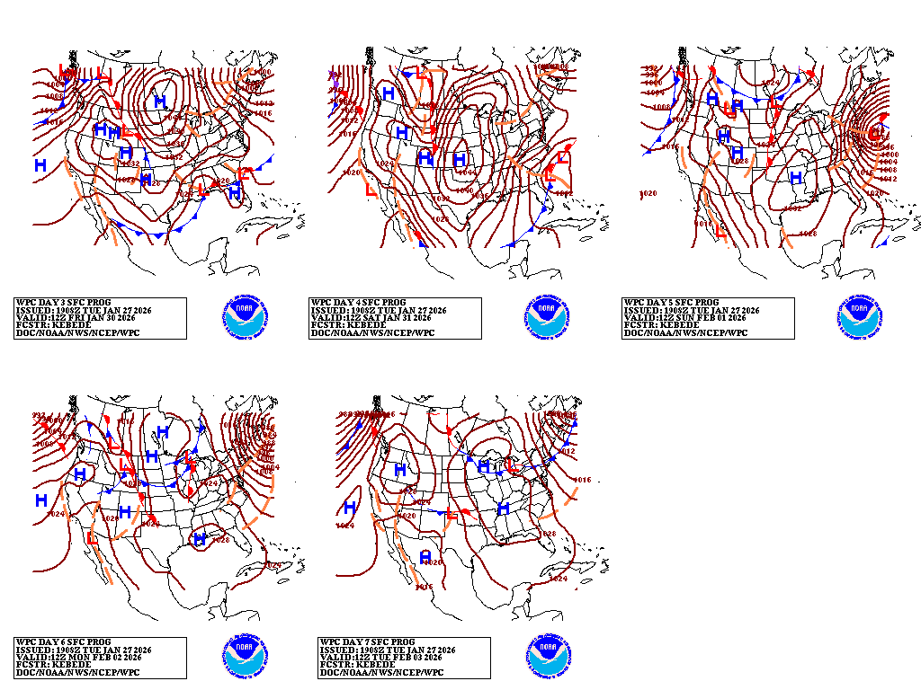
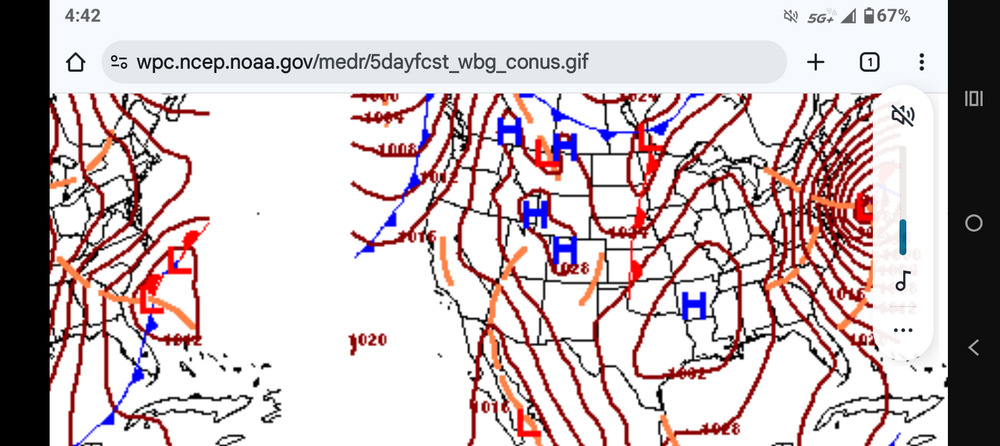
Interesting where the WPC has the storm. Kinda close to coast. They must be riding the GFS.. unless they see something we dont
-
Well it could be my way of not accepting reality too lol
-
Just remember folks.. the last storm ended up going west as time got closer. Went west enough to a point that we all got ice mixing in. I say give it time. Still over 100 hours away.. at least give it till were within 48 hours
-
Models are close enough to something big that we gotta keep checking them every 6 hours lol can't walk away
-
Alot closer and we're still over 100 hours away so we got time
-
If euro and Euro AI shows this. This board will crash lol
-
I'd rather have nothing instead of a cutter
-
How do u know they get worse?
-
Still a miss. Closer ..ohh so close.. won't take much
-
GFS Came nw

-
Winter of 2025-2026 total snowfall IMBY() Sparrows point MD) Dec 5-6th... .75 inches of snow Dec 13-14th. 2.125 inches Jan 1st ... .100 inches Jan 18th... .30inches Jan 24-25th. 10.3 inches Feb 22-23. 3.00 inches March 2nd. 1.00 inches ________________________________ Total snow..... 17. 575 inches
-
I only said that cause the poster said he didn't understand it lol
-
I believe the NBM is a blend of all models
-
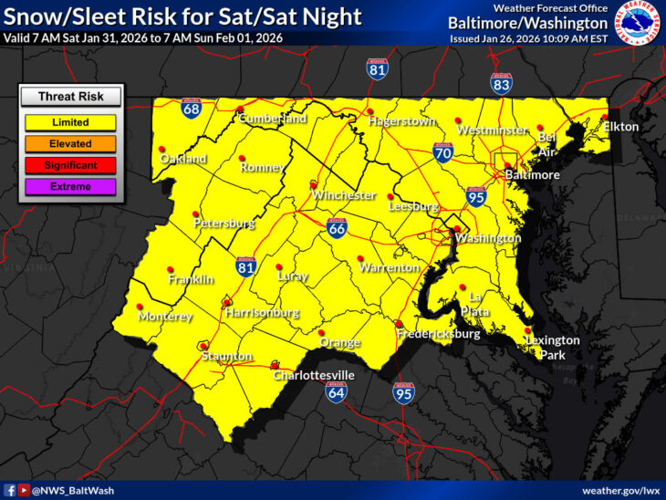
LWX posted this. So they must at least be thinking about it...
-
Why u say that? It has multiple model support and ensembles support
-
Thank God!!
-
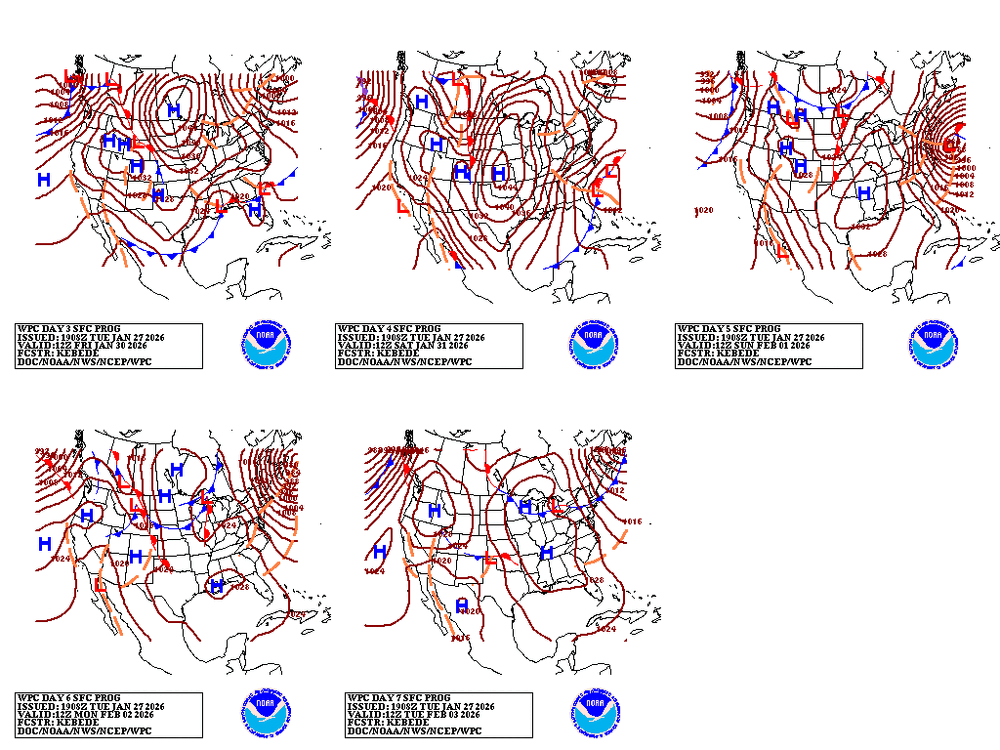
That's real nice for 5 days out!!
-
Apps runner???? Nooooo
-
Yup pretty much lol

-

-
From Mike Masco.. respected TV met FWIW.. REPEAT PERFORMANCE NEXT WEEKEND?? I’ll say this — the EURO AI Ensembles have been doing an excellent job lately identifying early storm signals well ahead of time. And once again, I’m seeing some familiar ingredients showing up… • Ridging building over the West • Upstream blocking developing • A favorable 50–50 low setup • Storm track guidance beginning to align That combination holds some potential for maybe another next weekend storm! It’s early — and plenty can still change — but this is the type of large-scale pattern that supports repeat winter events in the Northeast. When the pattern starts whispering this loudly a week out, it’s worth paying attention. More on this tonight. See you at 10pm on PIX11 News
-
967!!! Jesus