winter_warlock
-
Posts
3,373 -
Joined
-
Last visited
Content Type
Profiles
Blogs
Forums
American Weather
Media Demo
Store
Gallery
Everything posted by winter_warlock
-

Big Heat (and storms?) Week into July 4th Weekend
winter_warlock replied to yoda's topic in Mid Atlantic
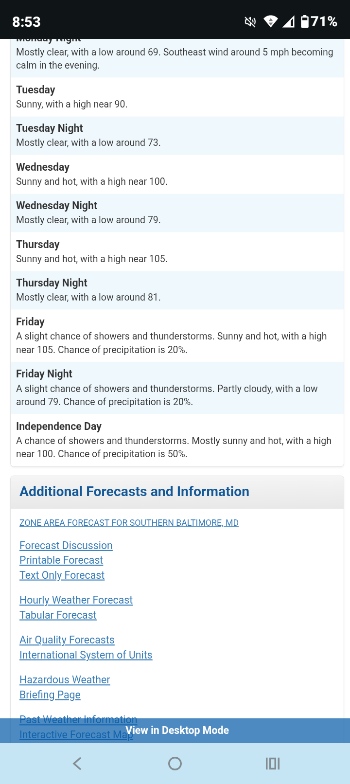
87.3 here at 8 53 am heat index at 96!!! Where I work( welding shop) just absorbs heat. Inside the shop it 114!!! The sun just bakes when it shines on the steel roof. -
Big Heat (and storms?) Week into July 4th Weekend
winter_warlock replied to yoda's topic in Mid Atlantic
Currently sitting at 84.3F at 11:45 pm!! LWX. Forecasted temps for next 3 days here in Baltimore county Downright brutal!!!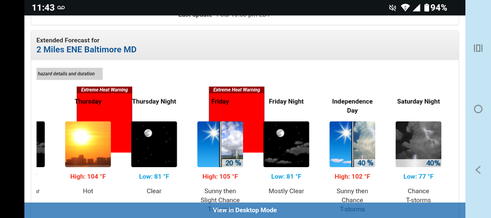
-
Big Heat (and storms?) Week into July 4th Weekend
winter_warlock replied to yoda's topic in Mid Atlantic
Extreme heat watch here ( north central md) for Thursday and Friday I beleive -
Late May/June 2026 Medium/Long Range
winter_warlock replied to JenkinsJinkies's topic in Mid Atlantic
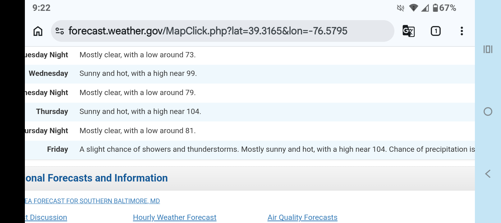
Updated LWX forecast for coming week. Brutal heat!! Temps near 105!! Hate to even imagine what the heat index will be!!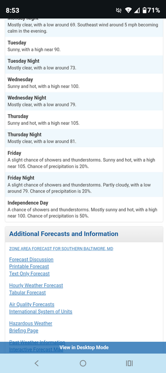
- 259 replies
-
- 1
-

-
- we got burned
- rugpull central
- (and 1 more)
-
Late May/June 2026 Medium/Long Range
winter_warlock replied to JenkinsJinkies's topic in Mid Atlantic
Damn. Stay hydrated bro!!!- 259 replies
-
- 1
-

-
- we got burned
- rugpull central
- (and 1 more)
-
Late May/June 2026 Medium/Long Range
winter_warlock replied to JenkinsJinkies's topic in Mid Atlantic
LWX forecasted highs for central md.... Brutal!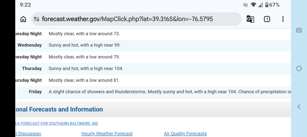
-
2026-2027 Super El Nino
winter_warlock replied to Stormchaserchuck1's topic in Weather Forecasting and Discussion
4 kids under the age of 7? Wow . Wait till they are teenagers.. then the fun really begins... -
2026-2027 Super El Nino
winter_warlock replied to Stormchaserchuck1's topic in Weather Forecasting and Discussion
Lol how can he deny it. The data don't lie. Water temps are warmer! -
Yep gonna be a scorcher!!!
-
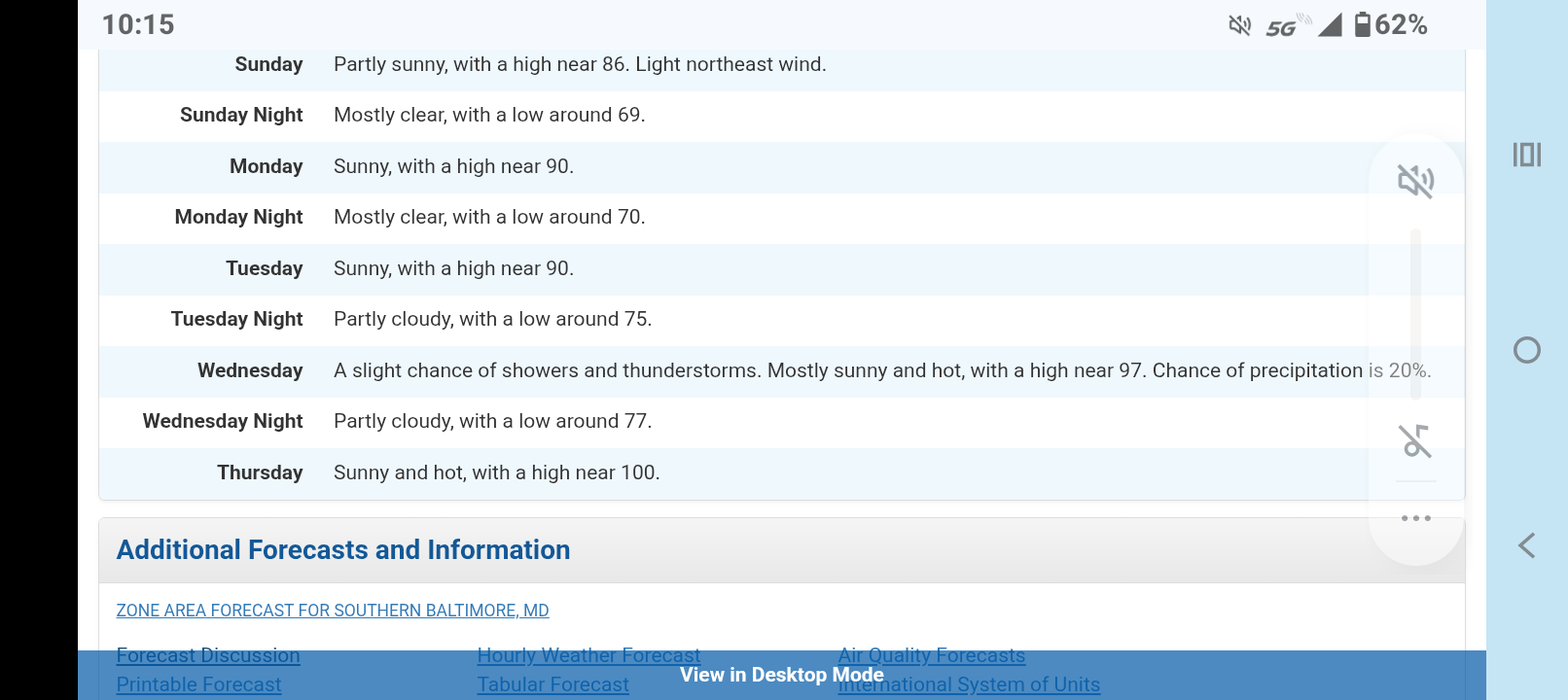
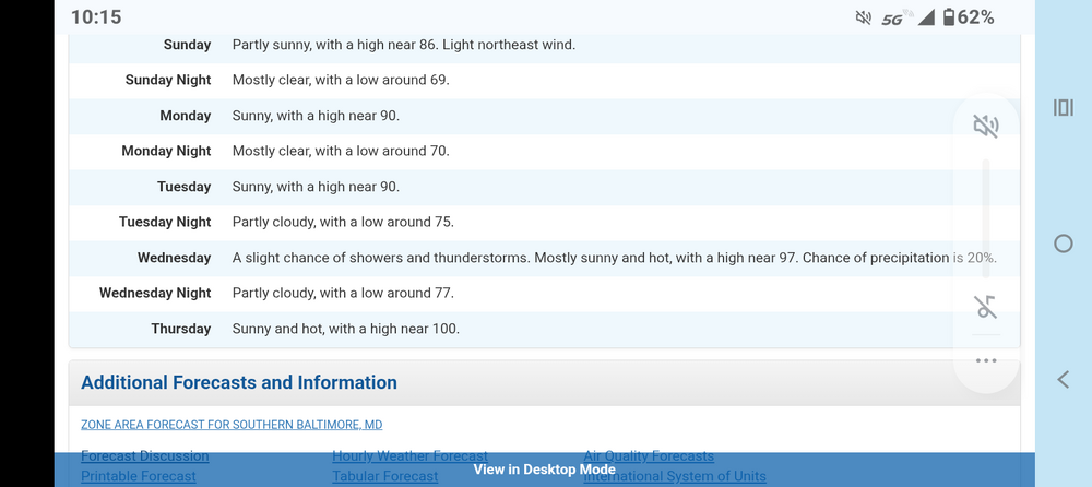
Looking like we may hit 100 here( central md) by next Thursday according to LWX.. Heat will likely steadily ramp up Tuesday through Thursday as the surface high slides offshore and the upper ridge expands eastward from the Ohio Valley. While there is still some ensemble spread in temperature data, it appears highs will be well into the 90s by mid week. Humidity will also be elevated, so heat index values could top 100 by Wednesday and Thursday. The strength and position of the ridge will determine if subsidence wins out, or if there might be an opportunity for diurnal thunderstorm development. At this time, thunderstorm prospects appear isolated through Thursday
-
God I hope ur right bro!!!
-
Well I don't mind the drought because I don't have to cut an acre of lawn every week. But I do miss the rain cause the grass is looking more brown then green
-
I had some minor branches go in ng across. The driveway but other than that, the storm were more bark then bite. Barely any rain
-
2026-2027 Super El Nino
winter_warlock replied to Stormchaserchuck1's topic in Weather Forecasting and Discussion
I believe the last real super elnino was 1998-99 and that didn't result in a snowy winter for mid Atlantic. But the strong elnino of 82-83 Did give us a snowy winter. Soo. Sort of a crap shoot to see what we get this coming winter. But hurricane activity should be less this summer. In my opinion -
I agree. Never seen that happen ...but I'm from a different time . Hell I graduated in 1985 ! I'm olddddddd
- 1,093 replies
-
- 1
-

-
- severe
- thunderstorms
- (and 1 more)
-
Damn I've never seen a school system let out early for the risk of thunderstorms . Damn
-
Thanks bro I know I saw that that's why I deleted it lol
-
80 Degrees to Ripping Snow: March 12th
winter_warlock replied to SnowenOutThere's topic in Mid Atlantic
This is obviously a typo by LWX
-
80 Degrees to Ripping Snow: March 12th
winter_warlock replied to SnowenOutThere's topic in Mid Atlantic
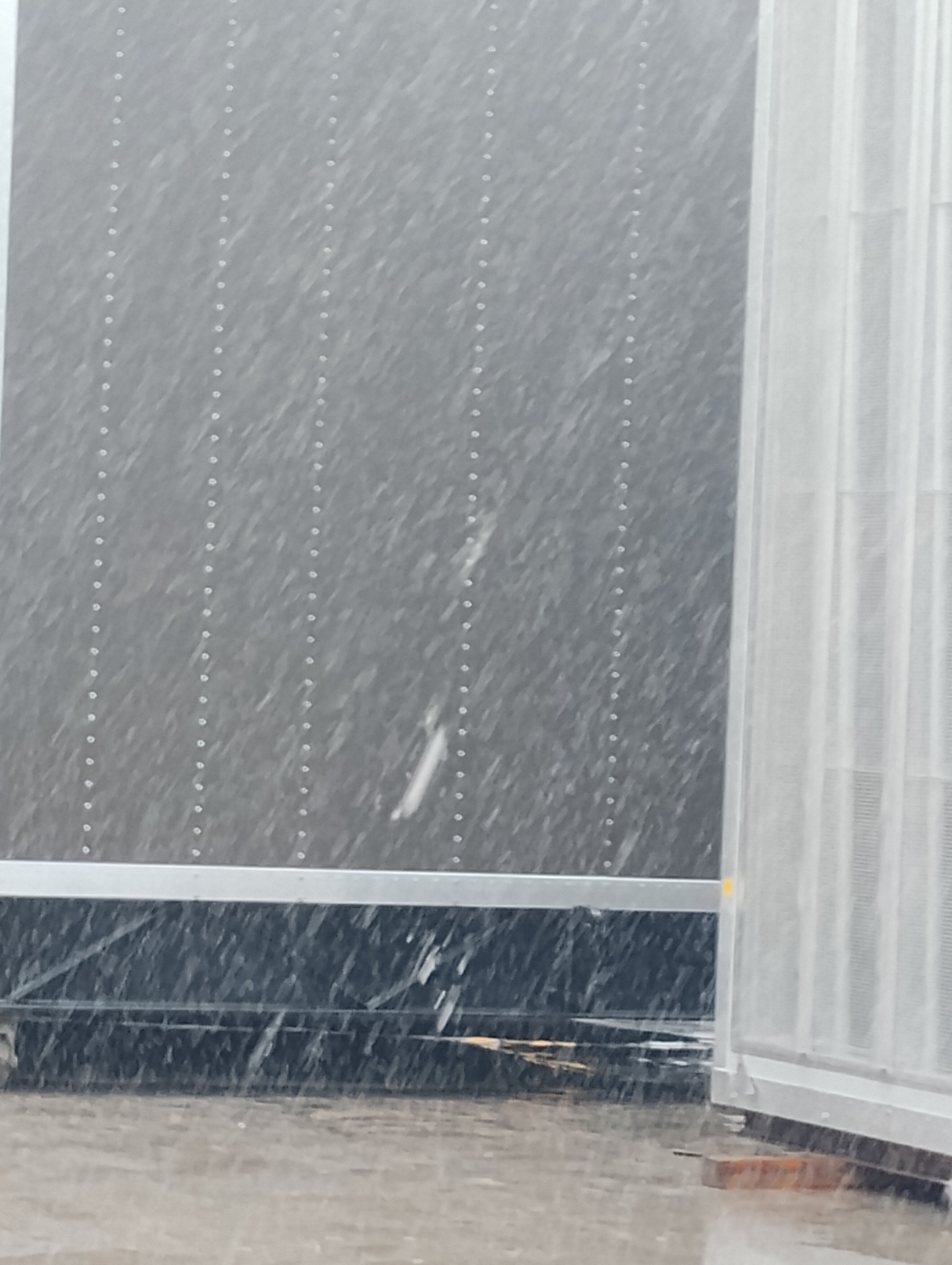
Has changed to snow here in Sparrows point MD
-
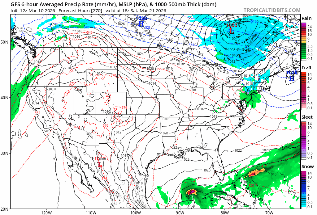
Ok real stupid question for u all... Check out this system in the gulf... Would that be a tropical system in March??

-
Winter of 2025-2026 total snowfall IMBY() Sparrows point MD) Dec 5-6th... .75 inches of snow Dec 13-14th. 2.125 inches Jan 1st ... .100 inches Jan 18th... .30inches Jan 24-25th. 10.3 inches Feb 22-23. 3.00 inches March 2nd. 1.00 inches ________________________________ Total snow..... 17. 575 inches
-
Outta gas and Outta Time: Early March Winter Storm finale
winter_warlock replied to Ji's topic in Mid Atlantic
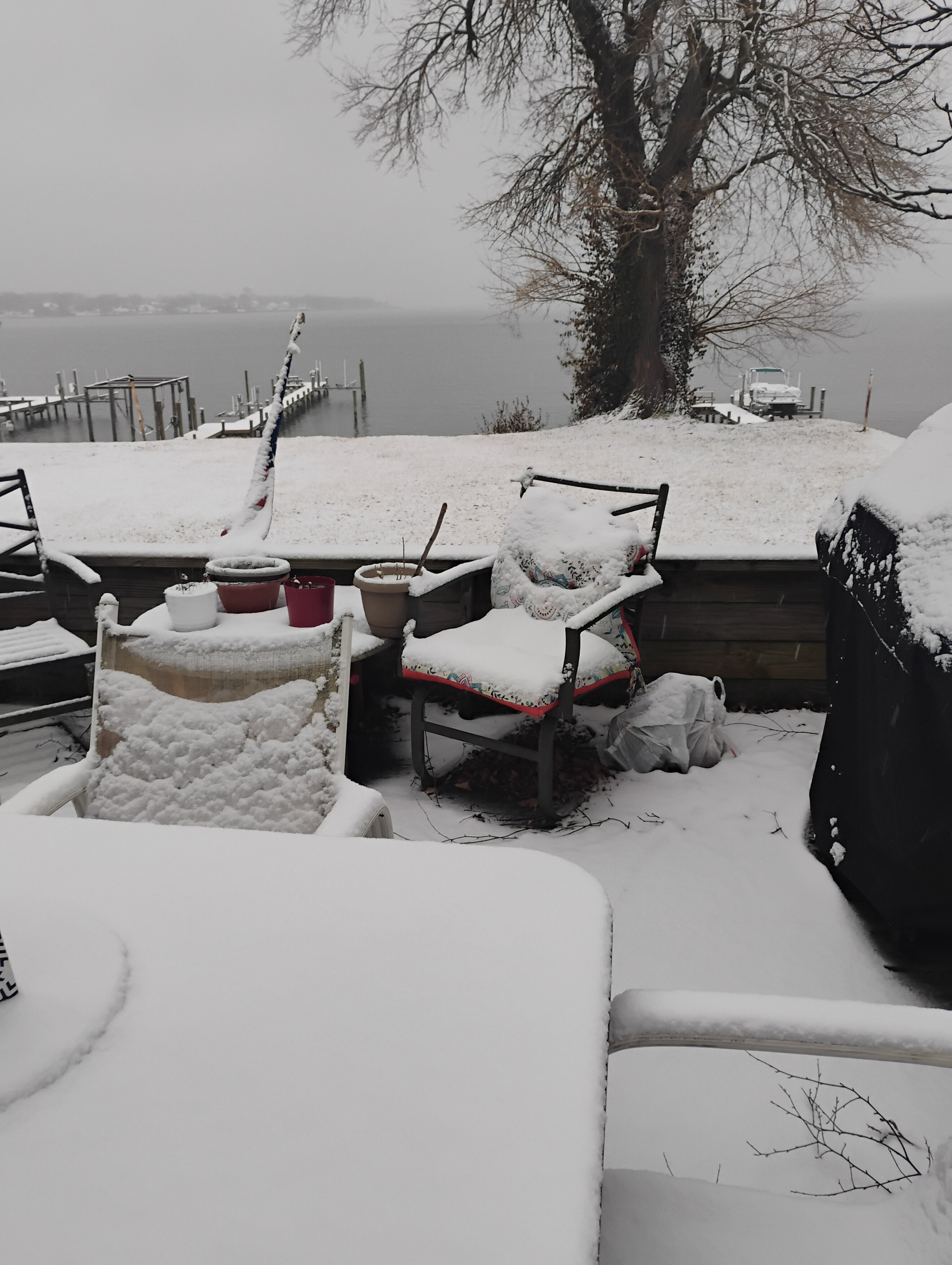
I'm up to 1 inch here in sparrows point MD 32.3 F
-
Outta gas and Outta Time: Early March Winter Storm finale
winter_warlock replied to Ji's topic in Mid Atlantic
Light snow falling here. 31 F. About .25 inches here in sparrows point MD -
Outta gas and Outta Time: Early March Winter Storm finale
winter_warlock replied to Ji's topic in Mid Atlantic
Probably cause it's nothing worth posting -
Outta gas and Outta Time: Early March Winter Storm finale
winter_warlock replied to Ji's topic in Mid Atlantic
Well at this point of the season that's better then nothing!! I'll take it!!