psuhoffman
-
Posts
27,420 -
Joined
-
Last visited
Content Type
Profiles
Blogs
Forums
American Weather
Media Demo
Store
Gallery
Everything posted by psuhoffman
-
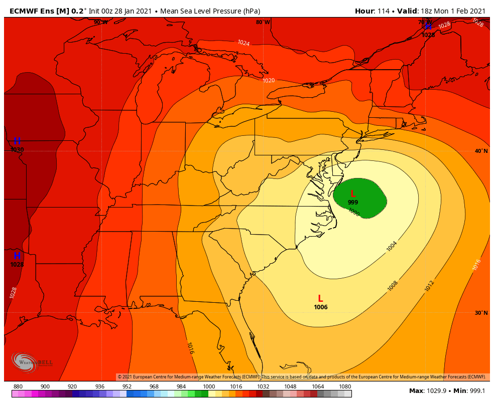
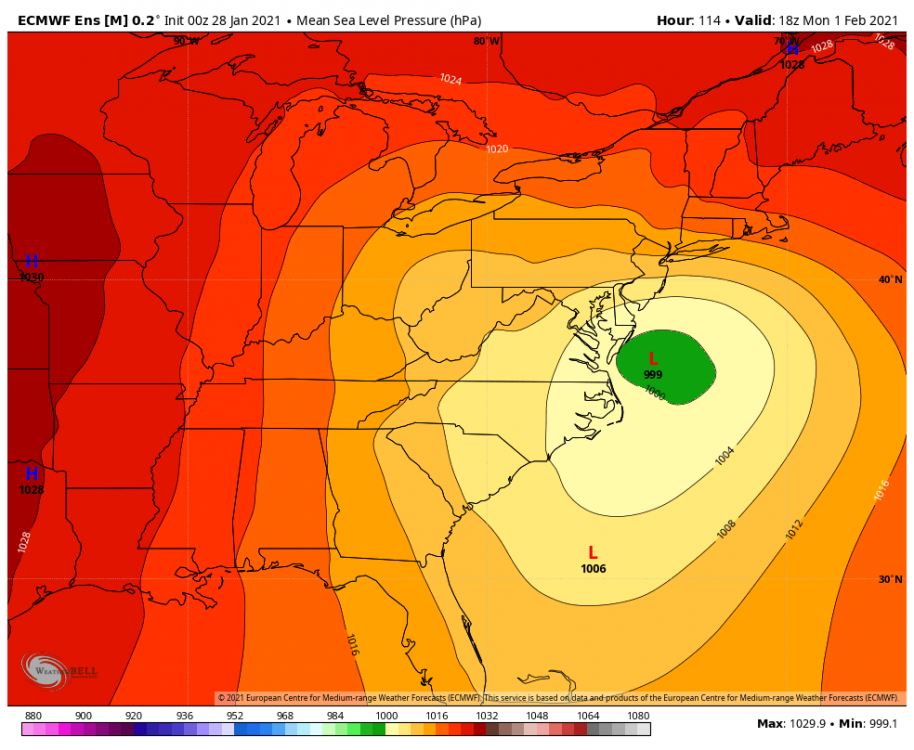
ICON makes the jump to the secondary off the delmarva. Yes the process "begins" down in NC but its really just in its infancy stage and the coastal front baroclinic zone starts to amplify...it doesn't really take over as the primary circulation until at our latitude. That is no good. We need the Euro solution of a clean transfer to the outer banks. That simple. ICON solution would still be a nice front end WAA snow though.
-
@H2O You brought up very legit points last night. Before things get crazy let me explain why suppression is my bigger concern in this situation. Partly its about hedging bets. Given the confluence to our north, the high, and the cold as the wave approaches...I see virtually no way we get totally blanked with a cutter scenario. At the least we would get a nice WAA thump snow to dry slot. Maybe that isn't the 1-2 feet some are acting like we NEED for this not to bust...but I have 2 kids that are literally asking EVERYDAY when is it going to snow and to them there is almost no difference between 4" and 12". Frankly...20" is probably TOO much for them lol. I will still take it...they can wait for it to melt some! So my first consideration is "how do we avoid the total fail" where my ground ends up bare or with some pathetic amount that precludes sledding, snow fort building and the such. And IMO that is suppressed. Rooting against suppressed may mute the chances of the 2 foot solution some...but the math in my head I separate the boom (12"+) and the bust (less then 4") scenarios. Rooting for a more squashed wave might increase the boom but it increases the bust with this. So I would take a 50/10 (boom% v bust%) type split over a 70/40 type split. Also...frankly just looking at the h5 flow over the top of us and to the NE, I think the degree to which this can go north is muted. The flow is relaxing yes but its still pretty compressed to our northeast as the system enters the midwest. The further south guidance just "feels" more realistic. I can be wrong. I've been wrong. Just my gut. Lastly...the biggest risk, as I told Ji like 3 days ago...is a split. A suppression with the WAA wave then a slow primary that meanders northwest of us causing a late secondary that misses us northeast. But that is still "suppression" imo because the WAA wave is our bread and butter less likely to fail option. The CCB of a developing secondary coastal is ALWAYS a risky proposition and better to be taken as bonus not relied on. All that said...obviously I am human and biased and the fact I live on the northern tip of our geographic region needs to be taken into consideration. But even for places like Baltimore and Frederick and Winchester...I think my thoughts are valid. If I lived south of DC I would probably have a totally different preference for how I want this to evolve.
-
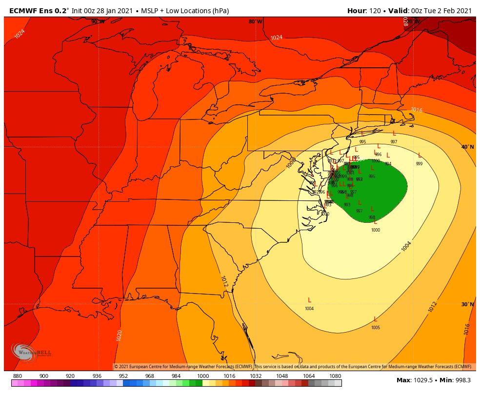
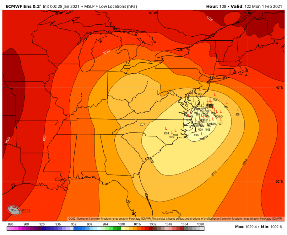
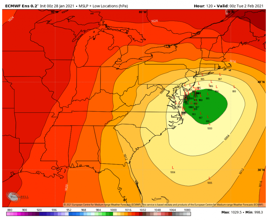
Gefs trend with the ccb last 24 hours
-
Is this where the storm develops? that looks pretty good for us to me.
-
There are some subtle differences that would help. I only see a couple members that tuck into the Delmarva like the op. The rest are at the perfect position for us just off the Delmarva coast. That would help with the mixing and getting the ccb wrapper tighter and not blowing off the the NW like the op. the op was a northwest outlier among the ensemble members.
-
I like this...history says this works
-
Eps surface track both primary and coastal is identical. But the whole system is several mb more amplified and that does lead to a warmer profile. Stronger primary even if it’s not further north will hurt some.
-
At 72 the eps is SLIGHTLY south in MO with the surface low. But it’s minor. No major differences over 18z
-
Yea the h5 pass was great but sometimes the surface doesn’t line up perfectly. The primary held on a bit too long.
-
At 6 hours I don’t see any major changes on the EPS
-
What else is new
-
@MillvilleWx the h5 progression is beautiful. I have a feeling when the EPS comes out this op was a northern solution in the envelope.
-
We’re flirting with the coastal getting going too late that’s my only concern.
-
Transfer/capture happens slightly too far north to get huge totals DC south this run.
-
@MillvilleWx btw have you looked at what mid February looks like? We might have some fun times ahead.
-
The gfs has been having some rough times lately.
-
Geps was almost a full cave to eps. It does drive the primary slightly further north but otherwise it’s pretty much gone to the euro.
-
Cmc
-
That dosent even sound like you lol HECS storms are 90% confined to El Niño’s for a reason. A 5-10” storm in a Nina is good. Doesn’t mean we can’t do better. 96 happened. 2006 came really close...I guess some isolated spots in MD did get 20” so for them that’s HECS level. But I guess my expectations this year are muted. Have to factor in the background state we’re trying to overcome. I do think the euro is more right here. But I guess I also expect it to come down to earth some. Maybe like a 60/40 compromise between the euro and other guidance. That’s still a pretty damn good storm. And if the euro caves and we get a 5-10” storm...that’s not the worst thing in the world.
-
Oh hell ya. Im good with a 5-10” event. But it has potential for more. So I’ll root for the euro but frankly every run tonight has been acceptable.
-
Looking at each individual panel of the ukmet it looks meh. Weak sauce. But it does snow on us for a long time so it adds up. We do dry slot/mix for about 12 hours also.
-
I guess the UK isn’t as bad as I thought but it kind of nickel and dimes it’s way to these totals over 48 hours and maybe the wrap around added up more then I thought but it was a lot of light stuff.
-
Uk no bueno. First really bad run tonight Imo. Weak sauce with the WAA. Drives the primary north. Weak sauce and north with the CCB. Diffuse mess of a coastal. ETA: not as bad as I thought when adding it all up. But like 48 hours of mostly light precip.
-
https://collaboration.cmc.ec.gc.ca/cmc/cmdn/pcpn_type/pcpn_type_gem_reg.html