psuhoffman
-
Posts
26,289 -
Joined
-
Last visited
Content Type
Profiles
Blogs
Forums
American Weather
Media Demo
Store
Gallery
Everything posted by psuhoffman
-
It also insists on being wrong a whole lot too so you have that going for you.
-
I think it will warm some in the dryslot when the lower levels lose saturation...but not to that extent. And temps will crash when the ccb gets going.
-
Kinda similar to the Feb 2014 storm in that regard. There was a really awful lull waiting for the upper level energy to catch up and spark the deform banding.
-
@Cashtown_Coop I am pretty sure State College will be well northwest of any bullseye. You are in the game...but I am even SLIGHTLY nervous about a suppressed outcome here. As usual, the GFS is adding more noise then it is helping. We would probably have a more accurate perception of what this storm is likely to do if the GFS simply didn't exist at all.
-
east of the bay is gonna be tough...when the low gets captured off the delmarva thats a long time under an easterly fetch. But I think its likely you get a nice WAA thump and then can catch some of the CCB if the storm slides more east then NE at the end. But I kinda doubt it stays totally 100% snow over there. But it rarely does even in the big ones.
-
If that deform band actually does setup right over us and stall for 18 hours like that yes we will. That band will juice up some imo and the ratios under that will be very high.
-
Ya'll are amateurs at worrying about the fringe. I will be all over it when a bad run comes out we need to worry about a good ol fringing. NAM/RGEM both looked good. If you look at the h5 on the NAM, its closed, amplifying, and headed right for VA. It's maybe even better then the h5 look on the euro at the same time. The low is at the same spot. That is going to capture and tuck just east of OC. Both NAM/RGEM would have been really good runs if they continued. Probably very close to the euro, maybe even a slightly quicker capture and tuck which is good.
-
The upper low is in the process of capture on both the NAM and RGEM...the low is likely to move NNE then tuck NNW a bit from there and end up just east of the Delmarva. You can see the weakness to the north in the isobars, especially on the RGEM but its hinted on the NAM also.
-
RGEM shifted a bit south too
-
fixed
-
It really should be looked at in 2 parts.... this is the WAA wave This is the coastal CCB
-
Were you here in Manchester for that storm? Do you know what the total here was?
-
I almost made a post comparing this setup to that storm earlier today...there are some differences...its a lot colder to start..we wasted a lot of the waa precip at the front end because temps were like 36 degrees. There is also more of a lag between the upper levels and the surface because this is a miller b and that was a miller a so there will be more dry slot lull with this. That storm the deform got going right behind the waa with no lull. But the eventually coastal features look very similar and BTW models didn't pick up on that crazy deform with 2006 until inside 24 hours.
-
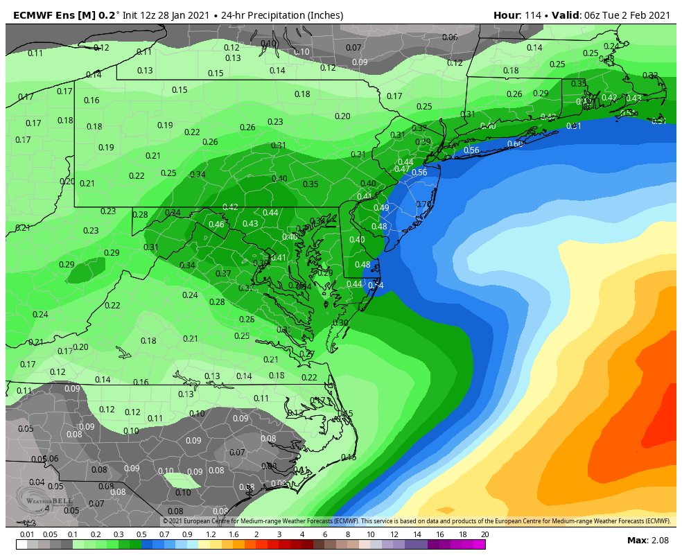
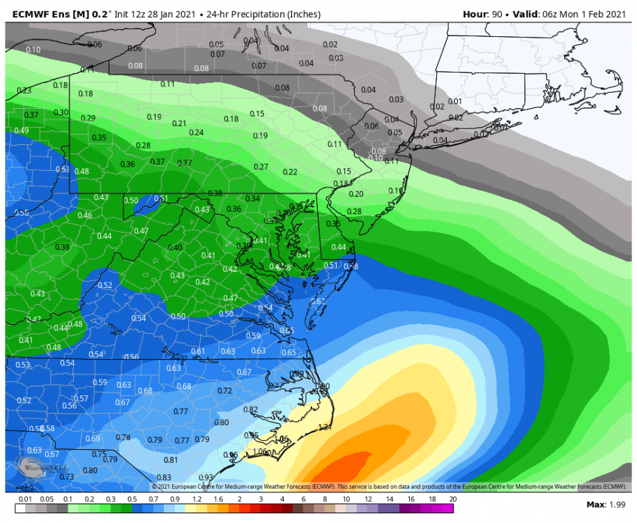
EPS mean The totals are muted some by 11/50 members by my count that are suppressed. I only count a few members that miss DC to the north with heavy snow. So this is a VERY good spot to be right now...but still...suppressed is the bigger threat then north. If we ignored the GFS completely that would probably be more apparent lol. And again...I DO NOT THINK IT WILL BE SUPPRESSED...just saying if it somehow falls apart thats the way. This isn't cutting.
-
The EPS bullseyes our area...so its a very good run...but it definitely backed off on intensity a bit so the top end potential came down some. But were still talking a 12"+ type storm possibly here in the max zone...but the crazy ridiculous 20" or even 30" idea is fading a bit. NOT saying that is unexpected and I definitely take what it is selling.
-
similar evolution but this has much more cold air in front...which would argue for a further south eventual outcome with the coastal. 90% of our snow was from the WAA in that 2003 event.
-
The snow under that slowly decaying deform band will be heavier then qpf panels would indicate. Usually get nice dendrites in that band. Fluffy stuff. Even if its only moderate it will "seem" heavier.
-
Guidance is converging
-
GEPS looked really good for northern VA and MD imo. Implies good CCB from Manassas north. South of there gets a good WAA thump at the start.
-
we already know that
-
The UKMET seems to have hiccups in both directions honestly. And I know it has very good scores but that doesn't necessarily mean it does great with the specific location and amplitude of a discreet east coast low. It seems to diverge from consensus more frequently then the other major globals in the day 3-5 range.
-
Don't mind seeing one global south...as long as the euro doesn't follow the UK.
-
UK is a great run for DC and VA. Fringed for northern MD. Again...north of DC suppression is still the greater risk imo.
-
This is the warmest panel on the UK. So some mix along 95 for a short time but temps crash again after this. NW of the fall line would likely be all snow on the UK.
-
could be the gfs bias of over focusing on the NS. Tries to merge everything instead of keeping the wave distinctly separate