

psuhoffman
-
Posts
26,289 -
Joined
-
Last visited
Content Type
Profiles
Blogs
Forums
American Weather
Media Demo
Store
Gallery
Everything posted by psuhoffman
-
I thought I controlled myself pretty well considering what they run did to me...I made like 3 posts after the euro then went to bed. lol. I still like where we stand, especially 95, I just don't like the introduction of that feature in New ENgland adding uncertainty. Uncertainty sometimes doesn't work out the way we want and damnit I want this snow curse broken NOW.
-
would you agree that if we do get a more tucked capture stall like the GGEM/UK we also likely get the typical NW deform band that guidance almost always misses with amplifying mid atlantic coastal systems. Seems to me, and please correct me if I am wrong, that guidance from range tends to focus the deform band along the best fgen associated with the moisture transport from the coastal where it intersects the CCB and the instability from the upper low. And there will be a band there...but what it often misses is the increased forcing along the NW fringe of the CCB where the moisture transport hits the "brick wall" of confluence to the north. That resistance typically seems to add lift and while its not to the degree as further south you also tend to get really high ratios there. IMO those 2 factors contribute to that deathband we often see that guidance totally misses on the northern fringes of the CCB.
-
Not as bad as on the RGEM/GGEM. My area kind of is in a screw zone of subsidence between bands but that is not something I am going to worry about at this range...and we all know that if the southern PA/northern MD area gets into the actual CCB good banding will set up here due to oragraphic influences. Mappy's area gets absolutely crushed with one of those bands but the UK has some weird dry pockets mixed in that screw over some areas (me) lol. Even if that were true it wont nail that from this range.
-
IF (huge mega if) we do get the further southwest capture/stall option guidance will underdo the snowfall in that deform bad. That is a 90% given. They also will miss the NW deathband...we all know that. But that only works out if we actually get the close to the coast capture stall option...if the storm swings out too wide due to a positive tilt precipitated by the flow too suppressive in front...the area will be robbed of the moisture transport we need off the coastal as the upper low swings through and it will just be instability disorganized areas of snow.
-
UK is a picture perfect capture/stall location for our area. Hopefully the euro follows.
-
I don't know but its obvious from the drastic shifts in guidance run to run and how closely those shifts correspond to the handling of that feature in New England, that its volatile and delicate. The guidance is having a really hard time getting a handle on what that little vort is going to do and it has a great effect on our system.
-
There are 2 obvious camps emerging in the guidance... and it involves how they are handling the upstream feature in New England. Those that are diving the vort there further southwest are suppressing the flow (NAM/Euro) and causing the trough to remain more positive with a more suppressed east solution WRT the coastal. Then a camp that is less suppressive with that feature (GFS/PARA/ICON). The GGEM/RGEM are kind of in between and so we see probably the ideal result for 95. There is honestly no way to know for sure what is going to happen with that feature in New England, but it holds the key here IMO.
-
no..true it was north then south then north and now south again...but we are getting closer now...its one thing to be jumpy at 150 hours...but this is now 5 consecutive runs it has trended south. The bigger issue is it aligns with what I always thought was the bigger threat...that the flow to the northeast would suppress. I never for a second bought or worried at all about the runs that were north. The pattern doesn't fit that. But I am open to being convinced I am just being paranoid and this euro run was garbage and it will correct back north. lol
-
Even the Navgem looks like THIS... Maybe it was just one hiccup but the trend is VERY disturbing. And not just for me. Like I said after the last run...I am one more adjustment of the exact same maginitued of the last 4 runs from being on the outside looking in....well that is now Baltimore, Columbia, Leesburg...one more after that and its DC... are we sure the south trend is over? That wave over New England squashing the flow in front keeps trending south every run! So part of me says....ok EVERYTHING else is north even the typically super suppressed NAVGEM, it was just a bad run. But on the other hand...this...is hard to ignore
-
The rest of the 0z guidance looked so good then the euro ruins my night. Lol
-
It’s a 12-15” snowstorm in DC proper. Yes with a period of mix/rain. But why is the period of mix getting as much attention as the 15” of snow?????
-
DC loses about .35 to mix/rain on the UK. Still gets 1.2 qpf as snow
-
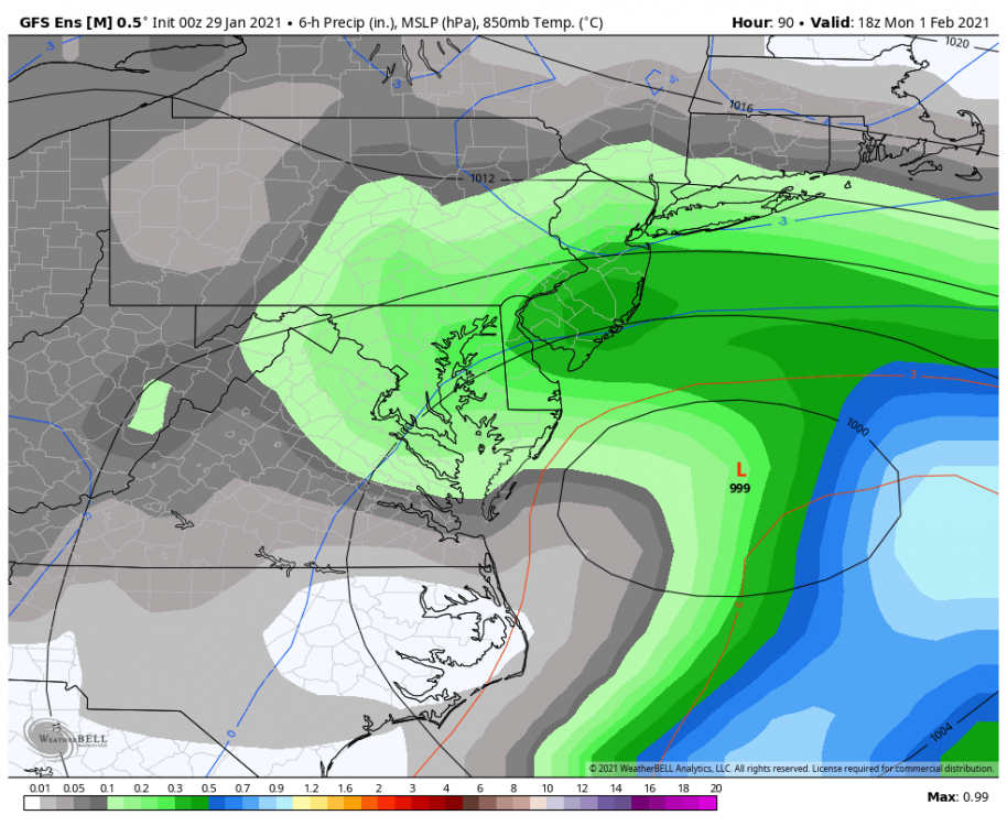
@yoda on the 10-1 map DC is 12” but the first part of the waa and the deform world be high ratios so that looks like 12-15” to me These are all 10-1 and I would adjust up. Deform will have high ratios as depicted so would the first part of the WAA IAD 16” Leesburg 17” BWI 13” winchester 13” Westninster 17” Mappy 20” EZF 11” Frederick 13” Towson 17” Columbia 15”
-
Look at the icon and Ukmet...even the gfs somewhat. We can ALL win with a more amplified solution so long as we can stomach a few hours of sleet or drizzle.
-
Ukmet is a great run. DC about 5” from the WAA thump them dryslot and some light mix then about .7 qpf as snow from the deform. That would probably be another 8-10” or so. N VA through Central MD jacks. Likely some 20” totals there.
-
The northern guidance came south. The southern guidance came north some. I’d like the euro tonight to look more like the NAM/rgem/icon/gfs/Ukmet then the ggem and para.
-
The gfs thermals are awful. Adjust
-

Feb Long Range Discussion (Day 3 and beyond) - MERGED
psuhoffman replied to WinterWxLuvr's topic in Mid Atlantic
@frd eps isn’t warm Imo that look is going to press the cold and suppress the SE ridge. There is no way we are very warm for long with that look. We will want the boundary not far to our south otherwise that would be a cold dry look. -
Gefs improved again. Honestly the gefs is slightly better then the eps now imo. Lol. CCBs the whole region Monday into Monday Night. ETA: if you adjust for their atrocious thermals. But that’s a given.
-
Yuck. It’s not that it’s north it’s late. Doesn’t get the coastal going until too late for us. Luckily the rgem doesn’t agree.
-
It has a progressive bias with the features in the PAC that will be critical to our storm. It’s slowly correcting less progressive each run.
-
Ignore it. Seriously. Unless the other better guidance goes that way...and even then I’d only buy it because they did. The gfs has been adding more confusion and noise then clarity for a while. Btw just saw the end of the rgem. Do people realize how good that was about to get. The ccb is exploding right over us and there is a lot of energy still to roll through. That was about to get GOOD.
-
What’s that word again?
-
N VA gets 10-12” lol
-
Agree. Wrt 2010 it was after the initial WAA precip during the lull before the coastal ccb blew up. Just a few sleet showers during the lull. It’s not so much south as suppressed. But the two correlate. I want an amped up STORM!!! Heavy precip. Big totals somewhere. Death bands to analyze. Even if this amps up too much and we flip we would get a heavy WAA thump first because to displace the locked in cold would take some impressive WAA. So it wouldn’t be a non event. This is preference but I would take a more dynamic event and risk mixing over a weaker mundane event. That’s the rgem. It uses the rgem to 48 then ggem after. It never changed when the rgem extended to 84.


