psuhoffman
-
Posts
26,411 -
Joined
-
Last visited
Content Type
Profiles
Blogs
Forums
American Weather
Media Demo
Store
Gallery
Everything posted by psuhoffman
-
 You misunderstand. I’m not saying people want want to dig into CC. what i meant was I think some even avoid ancillary topics like discussing why the SE ridge is so persistent simply because some of the analysis could overlap with CC and then some others go nuts about it. But we need to have the discussions. I’m not 100% sure it’s CC. What I am sure of is over the last 7 years anomalous things have been happening. I suspect things. I don’t KNOW. Maybe it’s all a confluence if other non AGW factors. But we don’t have the conversation because imo because no one wants to even get into a discussion that might even get close to the topic for fear of the reaction. It’s silly.
 -
But missed in all this, the icon was right about the lack of early phasing and resultant coastal track v cutter. This is teaching over Norfolk and east of OC. Gfs was way off on track. It just didn’t matter because it’s too warm. Nothing mattered in reality this just didn’t have a chance.
-
Fair enough. But that’s still REALLY far NW of the cities and I wouldn’t use the 12k over 3k in any situation but especially not when thermal resolution is important.
-
The “is it ever going to snow again” discussion.
psuhoffman replied to psuhoffman's topic in Mid Atlantic
I think the pdo is part of a larger equation. But it can’t be IT. The correlation between the pdo and our snow isn’t THAT high. It’s real but not enough to account for all this. First of all the last -pdo cycle lasted 35 years. And yes there were bad periods in the 50s and 70s but we had a great run in the 60s in a -pdo. 1979 was a -pdo. We had some awful cycles during the + pdo cycle also. 2018 was a +pdo and this phenomenon kept happening anyways. Dec-Jan 2011 had a -pdo and there wasn’t this issue. We had other issues lol. In past -pdo periods blocking was able to overcome and cause the trough to be more broad and suppress the SE ridge. A +AO in a -PDO was always a really bad deal but a -AO used to offset a -pdo. That’s why the +AO periods during the last -pdo cycle were bad. But the -AO periods were still very good. Maybe that’s changed but that’s a big deal. Especially since this -pdo could dominate the next 25 years based on past cycles. This isn’t a temporary problem if we can’t overcome a -pdo we’re in big trouble. The last -pdo period from the 40s to the mid 70s we were able to. -
No I do. But that’s not being discussed. I see a ton of discussion about enso and pna and epo. And when one of those things isn’t directly to blame it’s “just the pac” as some carte Blanche. There isn’t enough discussion on how the SE ridge and WAR have been an issue even when larger pattern drivers say they shouldn’t. Like im December when a SE ridge linked with a -4 block. That’s the 3rd time that’s happened recently and that’s unheard of. A SE ridge pops on the face of global teleconnections that argue for a trough in the east or in the least a suppressed ridge and no one says anything. My guess is because if the SE ridge is an artifact of the warmer Gulf than 1 it’s kinda a permanent issue and that’s depressing and 2 it’s related to something a large cohort doesn’t want to even hint at because it starts a shit storm.
-
???
-
The EPS AFTER that period rotates a lobe of the PV into a favorable spot in SE Canada. And yea it’s an op at range but the eps agrees and we’ve seen this exact progression happen numerous times and no one is talking about it or if they do it’s only to say “but the pna is awful”. Ya but WHY? Why does the pna continuously do that even when other longwave features are aligned in a way to argue against that! I think there’s more going on than these “but the pac” or “but the pna” comments account for. I think there is more than ample proof there is another additional cause here. And I’m totally ok with the possibility it has nothing to do with warming. Maybe it’s something else. But I’m not ok with just blowing it off with “but the pac”. It’s more than that.
-
@Ji @CAPE ya but look at HOW the euro gets to that awful look day 10. It goes from this to this in 24 hours!!! Then 24 more and… from a cold front just clearing and a full lat trough to a full on torch in 24 hours! We used to rely on waves attacking cold but what chance do we have when the warm air masses win in a rout that quickly without there even needing to be a wave. It’s not like that’s from some amplified cutter. That’s just ordinary return flow touting all cold from 1000 miles in 24 hours! But look HOW that happened… and yea I know this is just one projection but we’ve seen this exact progression over and over and no one is talking about it or asking WHY does this keep happening when it goes against historical wave spacing Look at the longwave pattern here look at the next wave X. Where should that go given this longwave setup? Now see what actually happens, follow X Follow X WTF? Why is every pac wave digging to Baja regardless of the longwave pattern. It didn’t do that because if the pac. The epo ridge is extending into western Canada. The trough is east of Hawaii still, that wave should progress into the central US. Over and over systems keep digging into the SW even if the pac ridge is over the top into Canada. The same happened in December. The same happened 2 years ago during blocking! The same happened over and over in 2019. Ppl keep saying “the pac” but even when we get a favorable pac for short periods it doesn’t matter the same conus effect remains. I think the SE ridge is actually as much a cause as effect here. That system is digging way west of where the longwave alignment suggests because the SE ridge is trying to resume and is resisting. No one is pointing this out because it’s true much of the time the problem has been “the pac” but we’re ignoring the times we get a window where the pac jet is actually favorable the pattern over the US still ends up sucking monkey nuts
-
The “is it ever going to snow again” discussion.
psuhoffman replied to psuhoffman's topic in Mid Atlantic
@Ji You know I am not a climate crusader on here. My concern (on here) is only related to one specific thing on here and that is our snowfall. And it's related to 3 specific factors (Pac Hadley Cell expansion, MJO changes, and the prevalence of the SE ridge) that have all been linked to the recent warming SST's. If it makes you feel better you can pretend its a cyclical thing and this recent SST warming is not at all related to AGW. I don't need to go there as when it comes to my discussions on here it is 100% related to our snowfall and factors impacting it whether they are cyclical or a longer term trend is irrelevant to how they impact us RIGHT NOW. If you read to the end of this there is a nugget you might even like, I promise! @MDScienceTeacher I do not think the couple degrees of warming in the atmosphere is primarily to blame for our struggles. What I think is having a bigger impact are 3 specific side affects of warming. Specifically the warming waters. 3 affects of that are directly impacting our snowfall in a negative correlation imo. 1) The expanding indo-pac warm pool is affecting the MJO in a way hostile to our snowfall. Due to the impacts of warmer waters there the MJO is being suppressed in phases 1-2 and enhanced it phases 3-5. Phases 1-2 correlate to troughs in the eastern US and phases 3-5 correlate to an eastern ridge. 2) The warmer waters in general are correlated to the expansion of the pacific hadley cell. This is having 2 negative impacts. It is encouraging a central pacific ridge which sets up a hostile wavelength for cold in the eastern US, and its shifting the whole thermal boundary in the Pac north, which means when we do get a somewhat hostile flow off the pacific, the air is even warmer. Pac puke is getting worse. Worse than that I see signs that even a mix of pac and continental polar air, a mix that used to work for us, is becoming hostile because the pac part of that equation is so warm it dominates the equation. 3) The warming Gulf and Atlantic waters have been correlated with enhancing the SE ridge. Any wave approaching across the CONUS has more heat to draw upon in the southerly flow ahead of it. This will push the boundary north and pump the ridge changing the storm path further north. All 3 of these factors are in a feedback loop working against us. All 3 in tandem are enhancing the SE ridge and pushing the boundary north. The first 2 are affecting what kind of airmasses are likely to even be available over North America. Together I think these 3 specific factors, which are side affects of the recent warming, are severely hurting our snow prospects here. @cbmclean @jayyy I can't say for sure exactly how much these factors have degraded our longer term chances for snow and how much have been a convergence of a cyclical down period with these CC issues. But here is my best educated guess. I do think we have had a relatively unfavorable period that would have been a down cycle in any era. But I also think this down period is worse because of these factors. Much worse. I also think the last up period was already somewhat suppressed here. We did not do as well in the last 2 "snowy" periods in the early 2000s and early 2010's as places a little colder and less latitudinally challenged. We decoupled for example with places like NYC. What I mean is...there was always a pretty consistent relationship between DC or Baltimore and some cities that got more snow in that they should, over a set period, get 30% more snow. Then suddenly they were getting 75% more snow! And it happened over 2 decades! I don't think that was a fluke...we were already not taking as much advantage of the last 2 snowy cycles as colder places were. I think that is likely to continue. There will probably be another "snowy" cycle ahead but there is a real chance for us it will be muted and yes we will do better than we have been...I don't think DC will continue to average 7" a season, but maybe in the next snowy period DC averages 15" instead of 20 or 25" in past 7 year snowy periods. The reason for my thoughts on this are I do think we will get years where the dominant pattern is so favorable it can offset these negative factors I listed above. But those factors will still fight and so we might still lose out on some snow we might have got before those factors were all lined up against us. But will a year like 2003 and 2010 suddenly be awful with like 5", I doubt that, god I hope not. My guess is the really good years will still be really good. And I do agree with @brooklynwx99 that there will be instances where warming enhances our snowfall and we might get a 20" snowstorm that would only have been 12" in the past...but I think on the whole that is not worth it and these changes are a net negative. We are hurt way more than we are helped. @Ji @Maestrobjwa @WxUSAF here is one nugget of hope...I have read a study that hypothesizes that as the oceans continue to warm as a whole...eventually the affects of the indo-pac warm pool will be muted and the longer term impact of warming might be to enhance MJO waves into the central and eastern pacific which are cold phase locations. I obviously had no part in this study but it makes logical sense to me. Right now one part of the ocean has warmed faster and is enhancing convection in places we don't want it. But as the whole ocean warms more the overall impact could just be a stronger wave in general which would make it more likely these waves make it into phase 7-8-1, which historically are the hardest locations for MJO waves to sustain. This could be a net benefit to us at some point in the future assuming the whole thermal profile of the northern hemisphere isn't too wrecked by that point for it to matter. -
@cbmclean ugh I just realized we’re in the main thread. If you have anymore questions or points let’s continue in the other thread.
-
First of all yes and this is from a study published in 2019 Here we show that rapid warming over the tropical oceans during 1981–2018 has warped the MJO life cycle, with its residence time decreasing over the Indian Ocean by 3–4 days, and increasing over the Indo-Pacific Maritime Continent by 5–6 days. We find that these changes in the MJO life cycle are associated with a twofold expansion of the Indo-Pacific warm pool, the largest expanse of the warmest ocean temperatures on Earth. The warm pool has been expanding on average by 2.3 × 10⁵ km2(the size of Washington State) per year during 1900–2018 and at an accelerated average rate of 4 × 10⁵ km2 (the size of California) per year during 1981–2018. So as you point out it’s circular thinking to say “the problem was the mjo not warming” because ocean warming has been shown to be causing the mjo to favor warm phases. So why is anyone confident the same thing won’t happen next El Niño? But the mjo can’t be blamed fully either. There were plenty of times the pac ridge still was in a decent spot and the pna trough kept cutting off under it instead of progressing east. Just like what happened in Dec this season!!! I’m seeing familiar fails happen repetitively.
-
Dunno we did have some troughs make it into the east but it was just too warm anyways so it didn’t matter.
-
2019 and 2021 still bother me a lot. 2017 and 2018 were about what they should have been given the pattern. 2020 was rightfully a dreg year. Would have been dreg in any era with that bad pac and +++A0/NAO. But 2019 there was no reason with the pac ridge constantly centered into western Canada and a decent AO that the pna kept going so negative and the SE ridge/WAR kept popping. That wasn’t right. The wavelength should have worked out for us but the SE ridge kept going ape. That’s when I first started feeling like the problem wasn’t really the pac. That was a Nino. The pac pattern was ok. But the SE ridge kept bullying the pattern and forcing trough into the SW even with a ridge poking over into west Canada. Same in 2021. Despite crazy blocking and imo a mediocre but not awful pac the same kept happening. now I saw some of those same trends in December especially this year! Everyone is waiting for the good years to come again but one reason Im so negative is imo the reason we’re in an unprecedented long bad run is that those should have been the good years but whatever is causing the SE ridge won over an otherwise pretty favorable pattern. Sorry if none of that makes sense. I’ve had a few whiskeys. Cheers.
-
That was one of only 2 single digit winters ever at Westminster. Local records here at Manchester area don’t go back that far. But even that year Westminster had a couple inches by now.
-
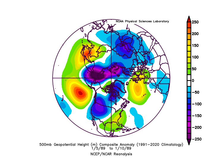
0.7” at Baltimore. But this was the pattern… look familiar? That’s the pattern likely coming up for Feb as the mjo enters warm phases. That’s what a no hope shutout should look like! But we haven’t been in that. We’ve actually had a blah but not god awful mean longwave pattern on avg so far. It hasn’t been that bad Imo. Certainly not good. The best analogs I can find are generally below avg but close to median winters. We’ve been getting shutout results from a pattern that shouldn’t be THAT bad Imo. problem is we might be about to enter a pattern that actually should be that bad! Lol
-
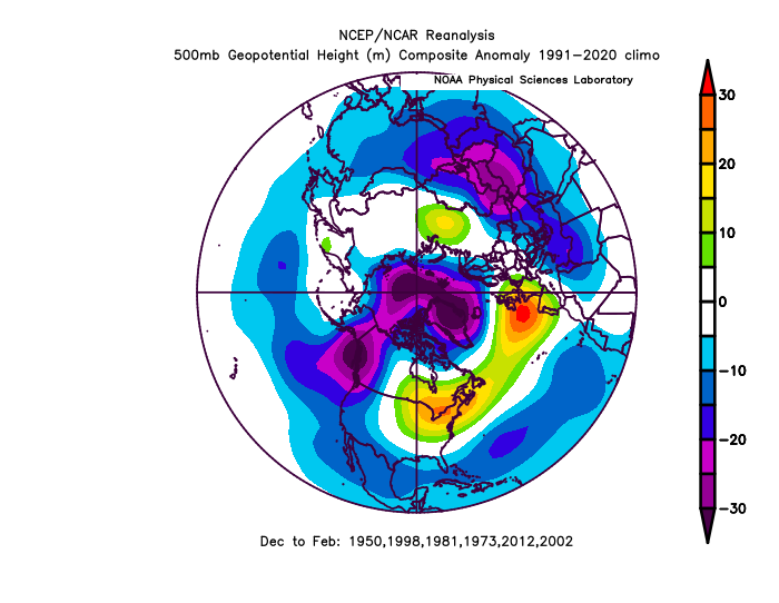
This has been our mean h5 for the whole winter. That’s not awesome but it’s certainly not a mean that would strike fear into us. That historically would just be average imo. By comparison this is the mean h5 of past really awful years that featured almost no snow in Baltimore to this point. This is what an actual awful no hope pattern should look like…
-
The worst part was it’s the worst post about the worst winter
-
Don’t tell the Giants fans they really think they’re gonna win tomorrow.
-
We don’t always need a perfect h5, this produced a 20” snow But let’s be fair the run that snows doesn’t look like the ensembles. What makes it kinda work on the op is a nice pna ridge and confluence from the lope rotating through 50/50 at the right time. There are some ensemble members that have hits too but they have a more favorable pna and Atlantic than that mean. There are lots of god awful members that take the waves day 10-15 way to our north too.
-
That’s pretty identical to the PD2 setup actually. Only difference is the cold gets bullied right out despite the 1045 arctic high. Lol
-
Oh you saw this and thought it has to be good and didn’t wait for this… to load
-
The “is it ever going to snow again” discussion.
psuhoffman replied to psuhoffman's topic in Mid Atlantic
having a whiskey sour at the only bar in Manchester. -
The “is it ever going to snow again” discussion.
psuhoffman replied to psuhoffman's topic in Mid Atlantic
@WxUSAF @Bob Chill @CAPE @Terpeast Wanted your thoughts on this. Related to the topic above but a side note kinda. For the past several years we have consistently had an issue where really good looking patterns day 10-15 become just blah patterns, not awful really but just flawed enough that in reality they can't bring snow. But I've noticed something. They aren't failing because the guidance is way off on the major pattern drivers usually. What they are off on is that the boundary ends up further north than expected. Let me give an example. The December pattern didn't fail because guidance was way off at long leads on the blocking or any major feature. But what happened is as we got closer the -PNA/SE ridge equation changed. The SE ridge pumped a little bit more that expected from long range. But should it have? This wasn't a case like a year ago where we had a crazy -PNA. Why wasn't a -4 std dv block able to bully a slightly negative PNA? From range the guidance thought it would. Then in the end what failed was there was just more SE ridge than expected. The rest of the pattern happened exactly as projected but under the block was a huge SE ridge that linked with the blocking. BTW this is like 3 times in 4 years where we got great blocking and then a SE ridge links up, and that is unheard of! What I am getting at is this...are patterns really being progged wrong...or is guidance from long leads simply repeatedly missing the warmth and the associated ridging? -
The “is it ever going to snow again” discussion.
psuhoffman replied to psuhoffman's topic in Mid Atlantic
Last one...I could do this for day's but I wont...but this one is a good comp to this week coming up. We got 2 snows during THIS LOOK.... But one of them was especially similar to the cutter front end snow setup this week. This was a similar system during a somewhat similar pattern. We didn't need a perfect track to get some front end snow out of this one. It was a couple inches in the metro areas and like 2-5" for the NW areas. But compare this to todays 12z GFS run where some where saying "we need more confluence" or other imperfections. But todays 12z GFS setup was infinitely better than this. More confluence. Same track. It was just...not as cold. Look at what did work in 91 and compare that to this weeks setup... Again, this wasn't a big snowstorm. Most probably don't remember it, just a couple inches of snow in a bad year. But storms like this are why that year wasn't a total shutout. We need to hit on these flawed setups sometimes. It shouldn't only snow here when the pattern is freaking awesome. We used to get snow from bad patterns also just not a lot of snow and not usually big snowstorms. But now...anything other than a good pattern is a garbage torch pattern and everyone makes excuses like "its the pac" or "the PNA" or "the NAO" but we didn't used to need all those damn things to be absolutely perfect to have any chance at snow. Those things are rarely ever going to all line up. We need to snow in flawed patterns. End of case.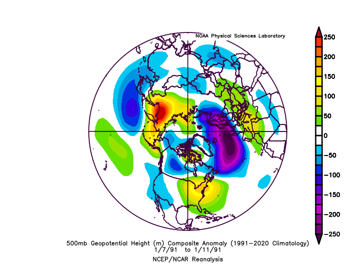
-
The “is it ever going to snow again” discussion.
psuhoffman replied to psuhoffman's topic in Mid Atlantic
And somehow this pac puke pattern didn't prevent us from getting 2 snowfall events across our area during this pattern in an otherwise bad year...but again not a total dreg year because we found a way to get some snow in what now would be a shutout no hope pattern.