-
Posts
1,972 -
Joined
-
Last visited
Content Type
Profiles
Blogs
Forums
American Weather
Media Demo
Store
Gallery
Everything posted by uofmiami
-

Moderate-High Impact Storm Noon Sun Dec 17, 2023 - 4PM Mon Dec 18. Flooding rain I95 corridor northwestward, coastal tidal flooding, brief periods of damaging 50 MPH+ wind gusts LI/CT Monday, ends as a little wet snow interior elevations Tue morning.
uofmiami replied to wdrag's topic in New York City Metro
- 489 replies
-
- 1
-

-
- flooding rains
- coastal flooding
-
(and 4 more)
Tagged with:
-

Moderate-High Impact Storm Noon Sun Dec 17, 2023 - 4PM Mon Dec 18. Flooding rain I95 corridor northwestward, coastal tidal flooding, brief periods of damaging 50 MPH+ wind gusts LI/CT Monday, ends as a little wet snow interior elevations Tue morning.
uofmiami replied to wdrag's topic in New York City Metro
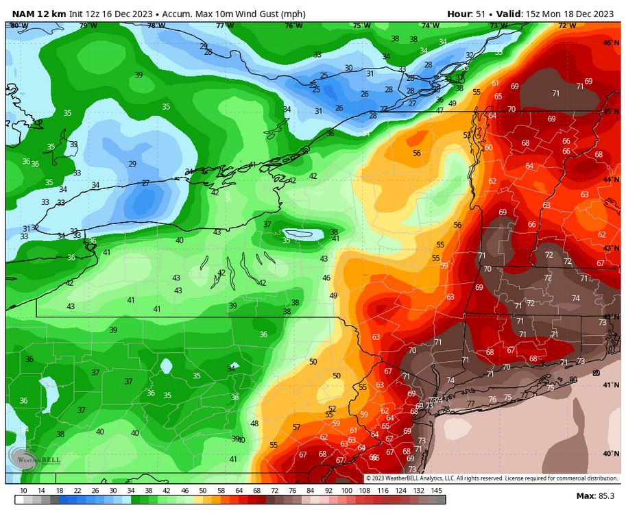
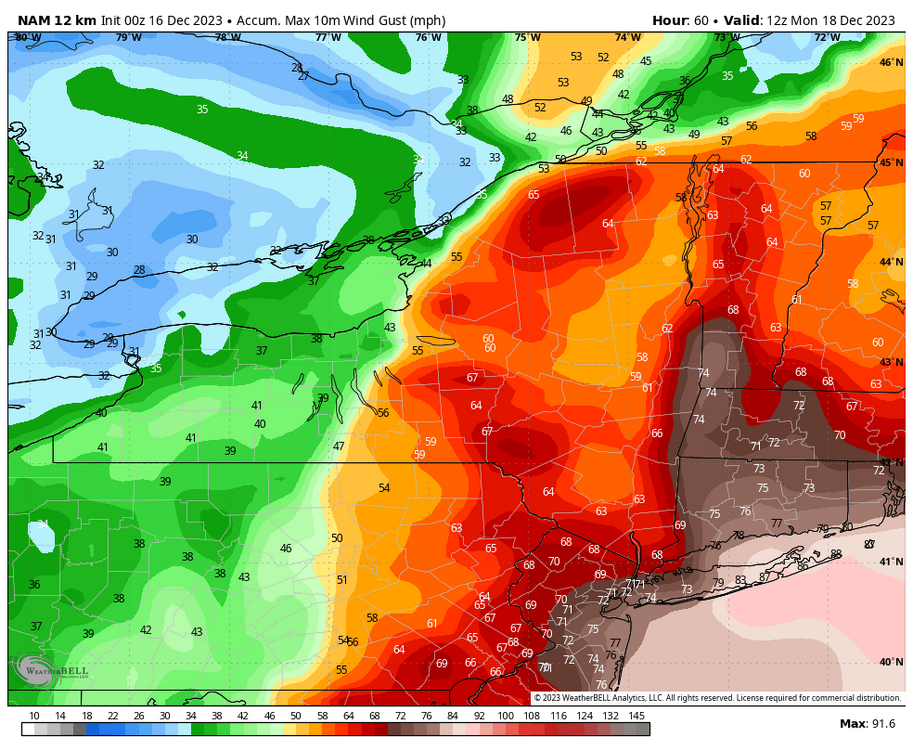
Agreed, I’d never take a wind map at face value. I’d knock 20-30 mph off the maps. Still getting wind gusts around 50-60mph. With saturated ground should be enough to drop trees and large limbs over Long Island I am sure.- 489 replies
-
- flooding rains
- coastal flooding
-
(and 4 more)
Tagged with:
-

Moderate-High Impact Storm Noon Sun Dec 17, 2023 - 4PM Mon Dec 18. Flooding rain I95 corridor northwestward, coastal tidal flooding, brief periods of damaging 50 MPH+ wind gusts LI/CT Monday, ends as a little wet snow interior elevations Tue morning.
uofmiami replied to wdrag's topic in New York City Metro
It's the mean over the 6hr period. I am sure there's higher gusts in there.- 489 replies
-
- 1
-

-
- flooding rains
- coastal flooding
-
(and 4 more)
Tagged with:
-

Moderate-High Impact Storm Noon Sun Dec 17, 2023 - 4PM Mon Dec 18. Flooding rain I95 corridor northwestward, coastal tidal flooding, brief periods of damaging 50 MPH+ wind gusts LI/CT Monday, ends as a little wet snow interior elevations Tue morning.
uofmiami replied to wdrag's topic in New York City Metro
- 489 replies
-
- flooding rains
- coastal flooding
-
(and 4 more)
Tagged with:
-

Moderate-High Impact Storm Noon Sun Dec 17, 2023 - 4PM Mon Dec 18. Flooding rain I95 corridor northwestward, coastal tidal flooding, brief periods of damaging 50 MPH+ wind gusts LI/CT Monday, ends as a little wet snow interior elevations Tue morning.
uofmiami replied to wdrag's topic in New York City Metro
- 489 replies
-
- 4
-

-
- flooding rains
- coastal flooding
-
(and 4 more)
Tagged with:
-

Moderate-High Impact Storm Noon Sun Dec 17, 2023 - 4PM Mon Dec 18. Flooding rain I95 corridor northwestward, coastal tidal flooding, brief periods of damaging 50 MPH+ wind gusts LI/CT Monday, ends as a little wet snow interior elevations Tue morning.
uofmiami replied to wdrag's topic in New York City Metro
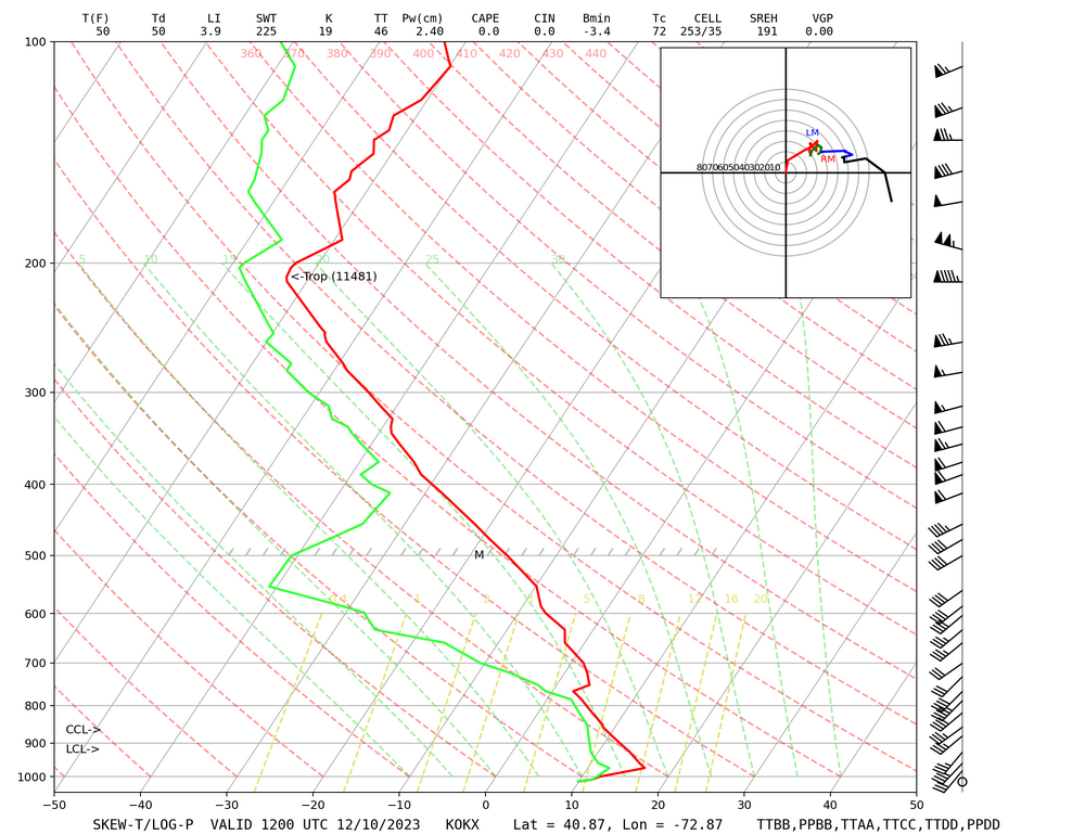
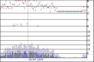
37kts for two consecutive 6hr periods on FOUS for LGA out of the SE.- 489 replies
-
- 1
-

-
- flooding rains
- coastal flooding
-
(and 4 more)
Tagged with:
-

Moderate-High Impact Storm Noon Sun Dec 17, 2023 - 4PM Mon Dec 18. Flooding rain I95 corridor northwestward, coastal tidal flooding, brief periods of damaging 50 MPH+ wind gusts LI/CT Monday, ends as a little wet snow interior elevations Tue morning.
uofmiami replied to wdrag's topic in New York City Metro
- 489 replies
-
- flooding rains
- coastal flooding
-
(and 4 more)
Tagged with:
-
-
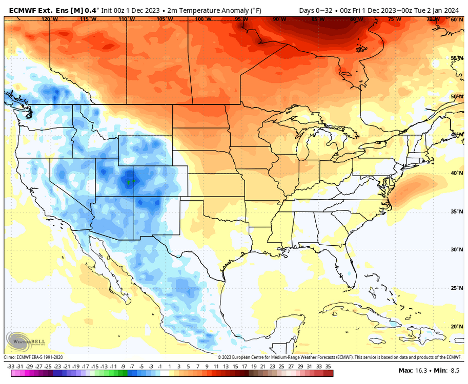
With the forecast calling for winds out of the SW, I don't see us getting anywhere near the coldest night of the season.
-
-
Winds definitely look like a real threat for coastal areas, if the models maintain the intensity, as we get closer to the event.
-

Extended summer stormlover74 future snow hole banter thread 23
uofmiami replied to BxEngine's topic in New York City Metro
FSU has good D but if they played the other teams that made it they would get destroyed IMO. It was ugly the last 2 games watching FSU's offense try to move the ball. At least next year 12 teams are in the field, so this theoretically doesn't happen.


.png.bca40673c9a13a5ed02babd4907dd2ad.png)

.thumb.png.73a036ebffcadb7f35dce393b6292b07.png)
