
KChuck
-
Posts
496 -
Joined
-
Last visited
Content Type
Profiles
Blogs
Forums
American Weather
Media Demo
Store
Gallery
Everything posted by KChuck
-
Major Lake Effect Snowstorm: Nov 29-Dec 4th
KChuck replied to BuffaloWeather's topic in Upstate New York/Pennsylvania
What camera are you using for your back yard? I'm looking and yours seems to have pretty decent coverage and resolution. Thanks. -
Not to mention have the bugs drop dead.
-
30 just north of Kernersville
-
Was it uphill one way, or both... or maybe for you it was all downhill both ways...
-
I must have memory issues setting in. I don't remember. Seems like I do remember my dad talking about it once. Seems like he mentioned walking two miles to school uphill both ways in five foot drifts.
-
What's snow???
-
And yet the death count isn't moving much.
-
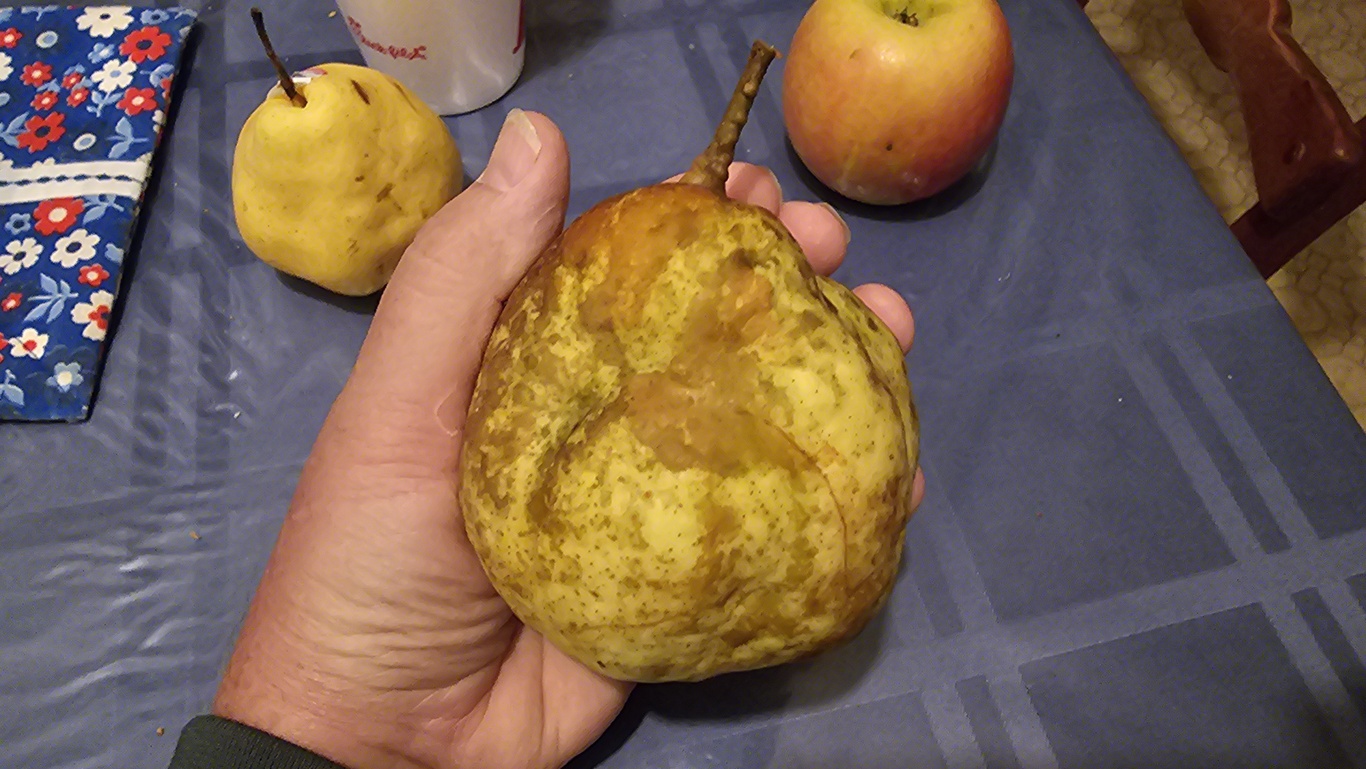
Ditto. Light coating of frost. Weather service said possible freeze so I cut the first Keifer pear that I was able to grow that survived late spring frosts from my tree.
-
Daughter left her apartment off of Wade Hampton Blvd to walk the area with a friend. She said she expected it to be bad but it was really bad with trees down all over the place. I feel for all affected. I was working McNasty's (McDonald's back in the day) in 1972 when Agnes went thru NE Pa three times (it looped) following heavy thunderstorms in the Catskills the week before. We went driving around the next day taking pictures and were shocked at the flooding. For anyone who has traveled I81 over the Susquehanna River at Harrisburg, Pa, consider the width of the flood plain at that spot and how high the I81 bridge is above the river. Susquehanna flooding was so bad that the bridge was under water. I'm not even going to mention the conditions that the flooding left the houses in. Ground was so saturated that the air-tight casket vaults were popping up out of the ground, some going down the river. Impossible to imagine but I recall the pictures on the local TV. I was living in Scranton, Pa at the time. We were making hamburgers as fast as we could, not even wrapping them, placing them in grocery bags donated by local groceries, and sending them by truck to the workers feverishly filling and placing sandbags to try to save Wilkes-Barre. They failed and water was past the second floor downtown. Awful!
-
Nope. There's concern there also. Daughter is living there with you between downtown Greenville and Taylors.
-
-
Congrats! (Read heavy sarcasm)
-
My daughter lives there also. She just texted wife and I that she's surprised that she still has power.
-
I believe that someone has his greater than or equal arrows pointed in the wrong direction. It translates to less than or equal to 105 mph and MSLP less than or equal to 960 hPa.
-
I wish that I could have put that in a sarcastic font. That link is for a flood watch and mentions locations in the triad but not the triad itself in the write up. The DISCOS usually focus on the triangle, coastal plain and sandhills areas in detail and occasionally the northeast piedmont, stating precipitation expectations and what not. Lately, they have totally ignored the mention of the triad in the discos. Why is that important to me? Because the triad is in its own weather environment and will have results and impacts separate from the others. When we are not mentioned, you have to interpolate what to expect based on what's written for other nearby weather stations adjusted by your personal experiences. We were adequately addressed when there was an active GSO weather station. Since that was dissolved in a budget cutting move, I have to interpolate between Roanoke, Greenville, and Raleigh station discos to guess what to expect here in the Kernersville area when Raleigh doesn't specifically mention the Triad. Same for radar coverage when it comes to storms based on the direction the storm is coming from. Kville is on the fringe of each of these radars so severe storms can get tricky. That's why I'm a participant in the storm watch program and attend local classes whenever they are available. The storm watchers are the eyes on that bottom 7-10k feet of atmosphere in the triad the NWS radars cannot see due to curvature of the earth. I also glean what I can from the more advanced amateurs like yourself (greatly appreciative of your work and input!!!) on these forums in an attempt to learn more about the weather.
-
I am curious... Has the NWS moved the Triad out of the RDU region and into another? The reason I'm asking is that RDU doesn't seem to mention the Triad in their discos lately and I'm thinking that I might have missed the announcement.
-
Watch what you ask for!
-
4.4" current storm total for me just north of Kville.
-
I believe that the weather service was counting on a huge fetch off of the Atlantic to account for the heavy rain training. We received a quick quarter inch yesterday and a trace this morning. Sun just came out in Kville. Told Mrs this morning my guess would be two inches tops for the triad unless something off of the ocean materializes. Weather service is still holding to their guns of 4-6 for the triad so guess we'll see. Raleigh's briefing image displays Debby with the center appearing to be filled in. That's not what the radar is currently showing. As I said, we'll see.
-
I thought wife and I had it bad here just north of you north of Kville. We're at 1.24 for the day, 2.46 for the week (basically yesterday and today), and 3.46 for the month. We were blessed with 2.52 for June. Seems like a lot compared to you in Archdale, but our grass is still brown and crunchy and our four year old dogwoods we planted in the sun by the drive are highly stressed to the point we may lose one.
-
1.17“ from roughly ten to midnight last night. Wife's garden says thank you!!!
-
IMHO... Keep in mind that models are built on past statistical analysis plus tweaking. If rules behind the current storms change, then the rules behind past analysis and current models can be thrown out the window. No???
-
Got blessed with a surprise half inch of rain overnight. Wife's garden says thank you!
-
Summary April 1, 2024 - April 30, 2024 High Low Avg Temp 88.3 °F 28.8 °F 60.7 °F Dew Point 65.8 °F 24.1 °F 49.2 °F Humidity 96 % 27 % 69 % Precip 2.54 in
-
Would be interesting to see that in the different tilt radars.