wthrmn654
-
Posts
3,069 -
Joined
-
Last visited
Content Type
Profiles
Blogs
Forums
American Weather
Media Demo
Store
Gallery
Everything posted by wthrmn654
-
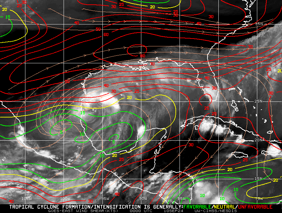
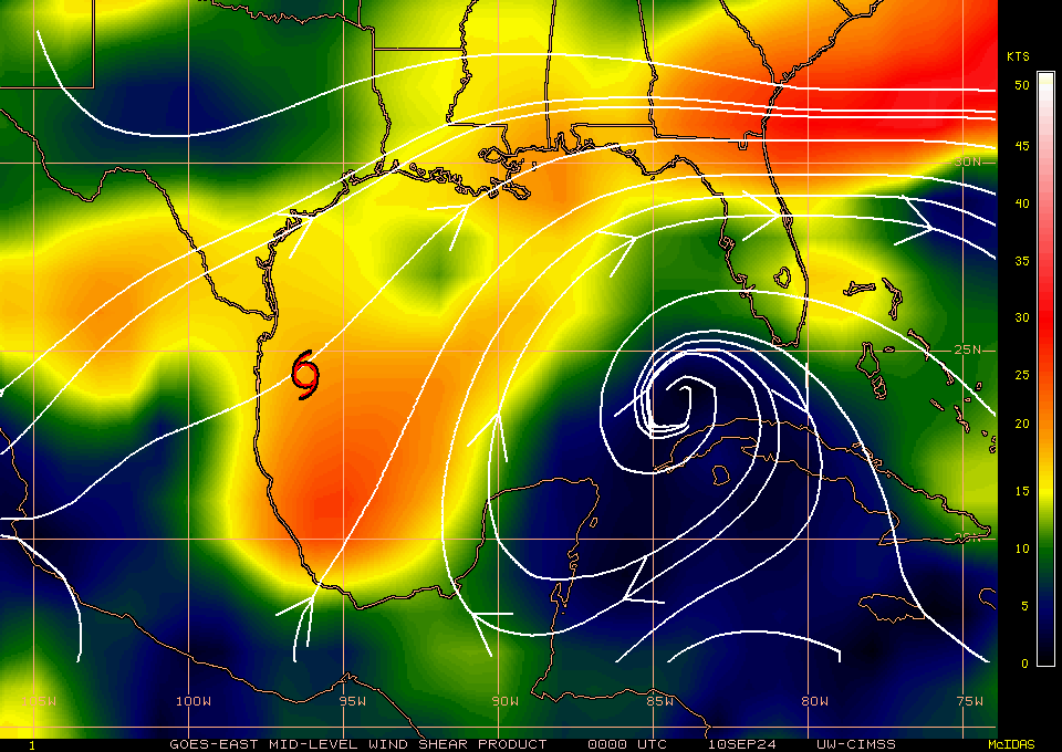
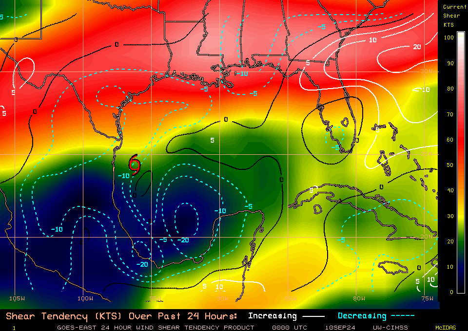
It's extremely close to the coast, an area that's been extremely hot all summer, and semi dryer environment ( I'm not totally sure on moisture levels to the west of the coast per say) . There's quite a bit of dry air to the north west of Francine too.. Look what happened to the storm that hit Bermuda, countless dry air that wasn't exactly forecasted, something very hard to perdict imo.
-
-
Former nhc guy on weather Channel speaks reality finally, dry air wrapping into storm, could affect intensity down the road possibly but will have to wait to see just what affect it has.
-
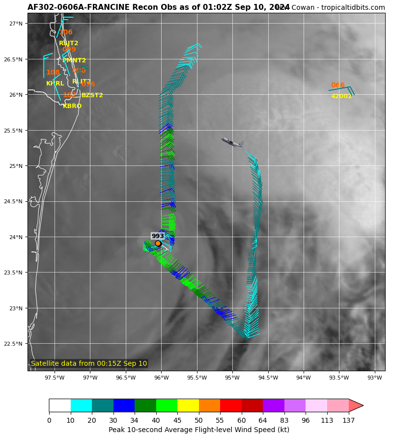
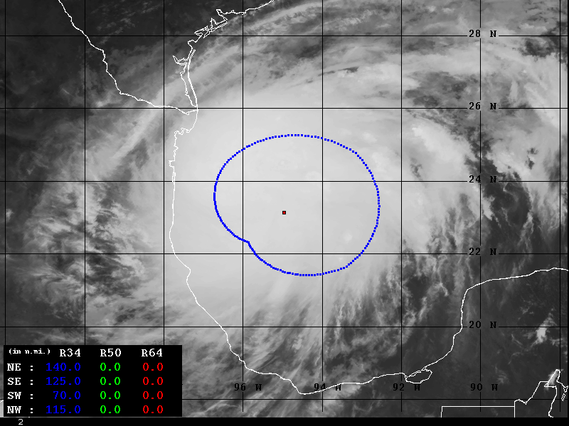
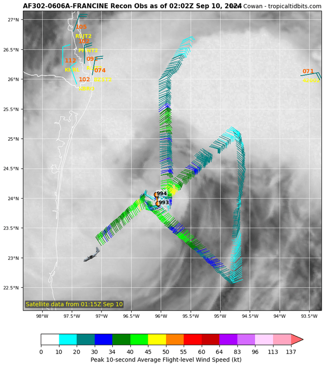
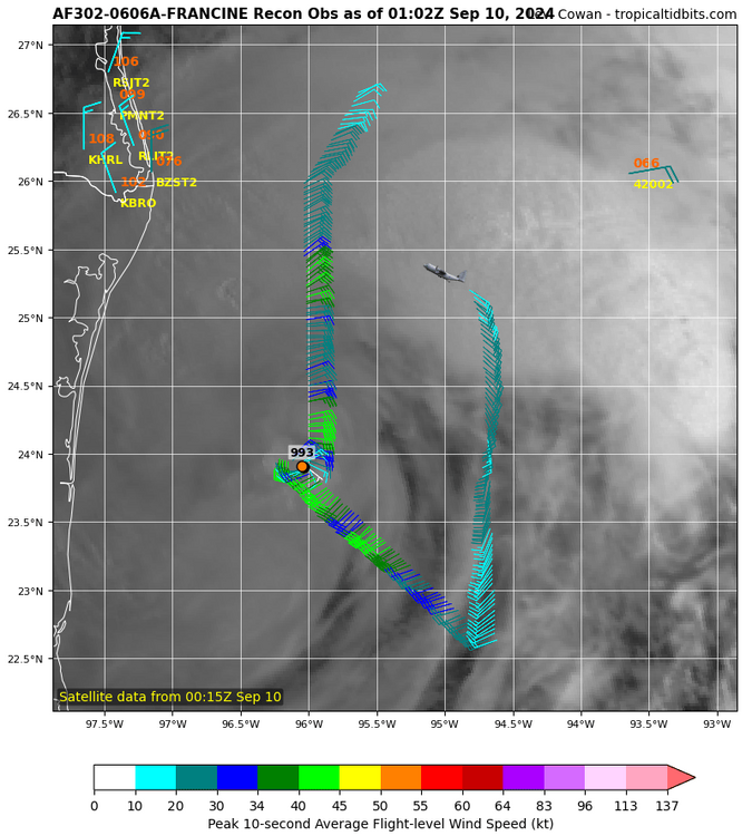
Last pass had best winds closest to center 45-50 knots close to 60 mph.
-
-
-
One planes using SFMR the other isn't. The one using has not seen good winds at all yet.. interesting as of right now, winds measured so far suggest 51 mphs max
-
Max winds found so far about 45knts south east section
-
AS of now winds are piss poor boring
-
Correction recon drops suggest 993-999 pressure so well wait to see
-
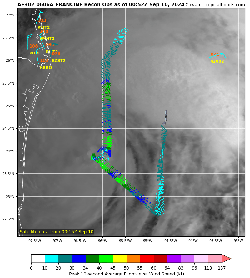
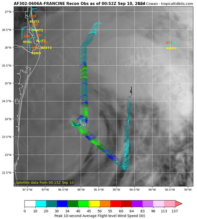
Both planes were in the eye at the exact same time/ location both doing low altitude recon, talk about ballsie!
-
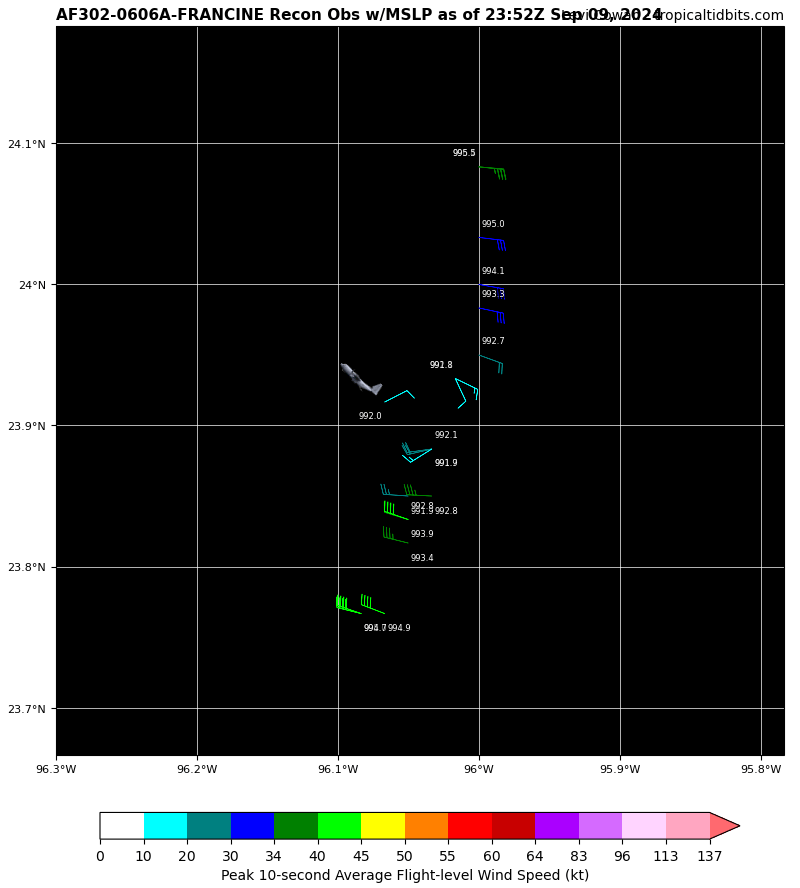
Sat estimate was 988 pressure, plane shows 988 pressure impressive ----- Current Analysis ----- Date : 09 SEP 2024 Time : 234020 UTC Lat : 24:14:55 N Lon : 96:09:58 W CI# /Pressure/ Vmax 3.4 / 988.6mb/ 53.0kt
-
The weather Channel right now.... my gosh makes it sound like it's becoming a hurricane right now really getting it's act together... A weee bit overkill at this moment
-
Barney turn around, you missed the exit!

-
Tno/CI Rules : Constraint Limits : 0.5T/hour Weakening Flag : ON Rapid Dissipation Flag : FLAG
-
997.9 mb so far
-
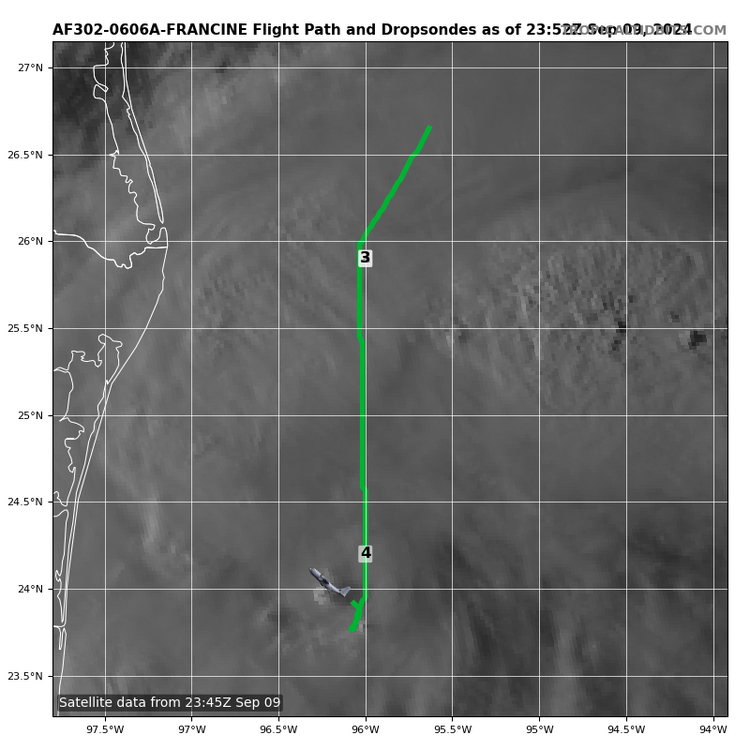
So far nothing exciting on recon but the first planes close now
-
Sat intensities hint/ suggest some weaker winds
-
Is that dry air getting wrapped into it on the bottom right?
-
-
-
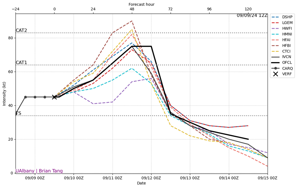
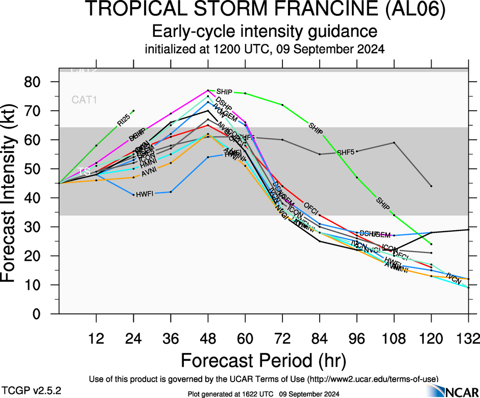
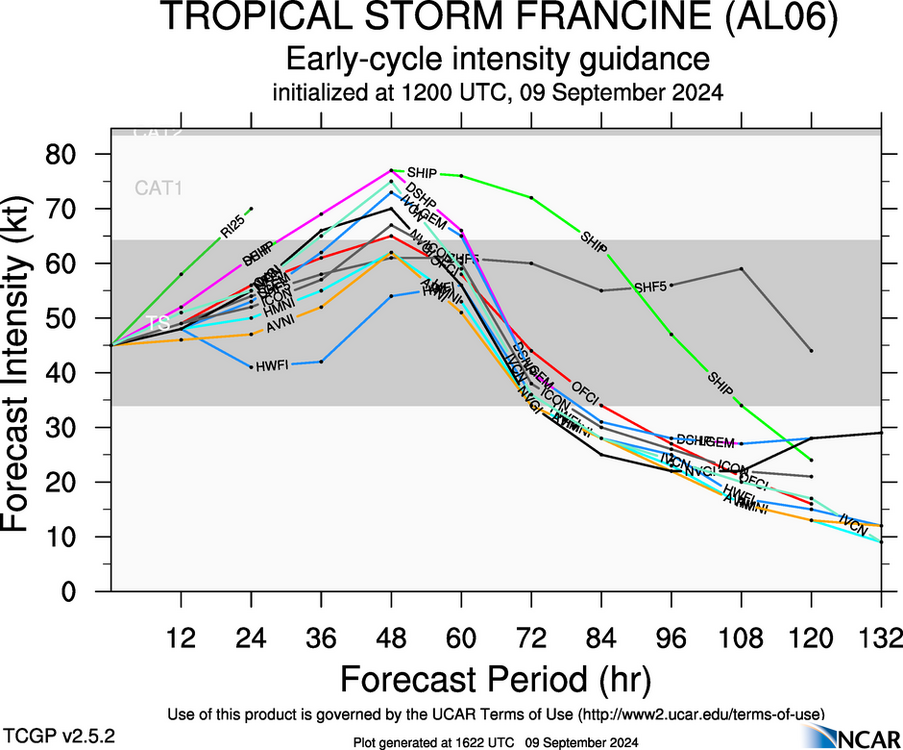
And this is 12z intensity forecast.