wthrmn654
-
Posts
3,069 -
Joined
-
Last visited
Content Type
Profiles
Blogs
Forums
American Weather
Media Demo
Store
Gallery
Everything posted by wthrmn654
-
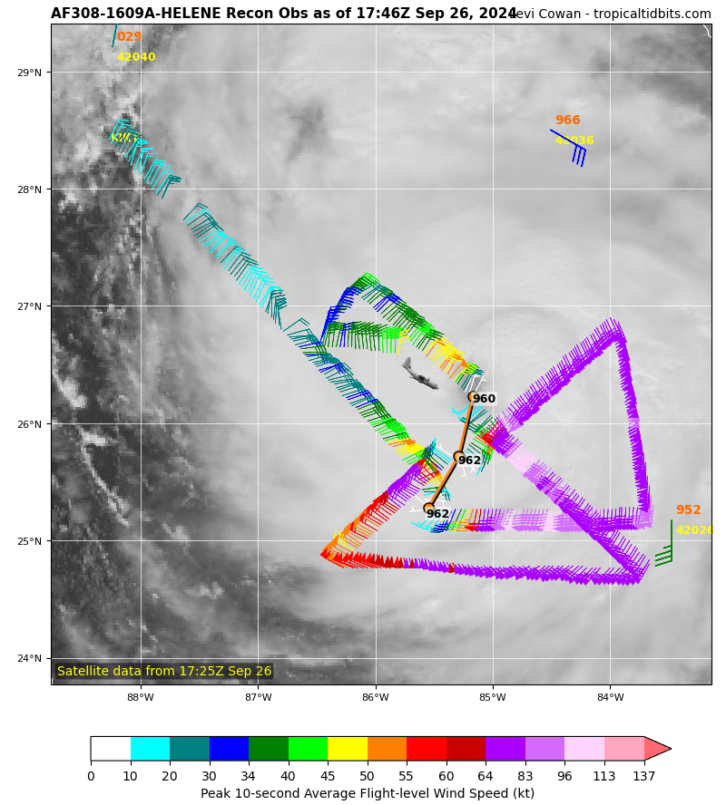
Whoever said recon found that low pressure, drop sonde says 952
-
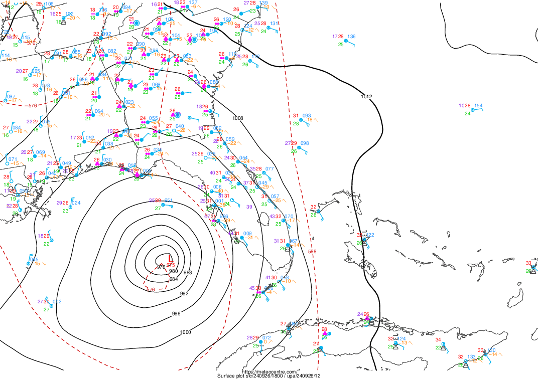
She's getting stronger! Current Analysis ----- Date : 26 SEP 2024 Time : 191020 UTC Lat : 26:49:47 N Lon : 84:44:23 W CI# /Pressure/ Vmax 5.4 / 949.1mb/ 99.6kt Final T# Adj T# Raw T# 5.4 6.3 6.3 Estimated radius of max. wind based on IR :N/A km Center Temp : -8.1C Cloud Region Temp : -70.8C Scene Type : EYE Subtropical Adjustment : OFF Extratropical Adjustment : OFF Positioning Method : ARCHER POSITIONING Ocean Basin : ATLANTIC Dvorak CI > MSLP Conversion Used : CKZ Method Tno/CI Rules : Constraint Limits : NO LIMIT Weakening Flag : OFF Rapid Dissipation Flag : OFF C/K/Z MSLP Estimate Inputs : - Average 34 knot radii : 182nmi - Environmental MSLP : 1007mb Satellite Name : GOES16 Satellite Viewing Angle : 33.0 degrees
-
Things booking now at 20 mph
-
Hurricane Helene Tropical Cyclone Update NWS National Hurricane Center Miami FL AL092024 300 PM EDT Thu Sep 26 2024 ...STORM SURGE AND WINDS INCREASING ALONG THE FLORIDA WEST COAST... ...300 PM EDT POSITION UPDATE... A Weatherflow station at Egmont Channel at the entrance to Tampa Bay recently measured a sustained wind of 50 mph (80 km/h) and a gust to 62 mph (100 km/h). SUMMARY OF 300 PM EDT...1900 UTC...INFORMATION ---------------------------------------------- LOCATION...26.9N 84.8W ABOUT 160 MI...255 KM WSW OF TAMPA FLORIDA ABOUT 195 MI...315 KM S OF APALACHICOLA FLORIDA MAXIMUM SUSTAINED WINDS...120 MPH...195 KM/H PRESENT MOVEMENT...NNE OR 25 DEGREES AT 20 MPH...31 KM/H MINIMUM CENTRAL PRESSURE...959 MB...28.32 INCHES
-
-
About 129nm north waves are at or above 18 feet, winds gusting nearly 65mph. Add insult to injury, high tide is roughly around 100 am , so anyone down there keep in mind that week play a big role in how high tide actually get in all coastal areas
-
Of more shock, if this gets to as strong as several of the hurricane models had showed days ago, and we all were saying there not very good until the system is somewhat more organized, that's impressive for a system that hadn't even gotten a name let alone is core well defined / formed
-
Curious, just was looking at total precipitatable water, that less colored spiral getting wrapped around the western flank, is that anything that would affect weakening/ strengthening at this point? EDIT: just noticed time stamp is a few hours old.
-
This may also go towards what you guys were saying..
-
-
Last thing for a while but, best visual comparison... look at how big that blue wind field line is jeez! https://tidesandcurrents.noaa.gov/inundationdb/?sw=17.49739,-89.05518&ne=34.02535,-78.28857&layers=111111111000
-
16 foot waves already 129NM north at buoy closest to Helene. Pressure already down to 29.40 Current photo of the angry Gulf Link for anyone who wants to track https://www.ndbc.noaa.gov/station_page.php?station=42036
-
As it stands right now, based on the Forcast track, she's going be passing closely 2 buoys out of service in gulf, and since track shifted right, only 1 other station active in the Gulf well be nearby her. If she shifts west, there's able 4 buoys that we can use but it's quite offshore. There's 1 or 2 buoys/ stations at shore that are also or of order. Hopefully there's some noaa/nws stations near the shore that can give us some good pressure/ wind readings.
-

2024 Atlantic Hurricane Season
wthrmn654 replied to Stormchaserchuck1's topic in Tropical Headquarters
2nd sneaky tropical situation? What's that feature on the heels of Helene?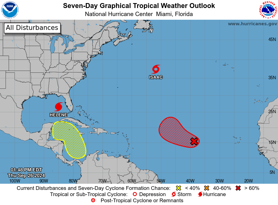
-
Last night, was saying if nothing changed by 8 am, it would be doubtful for big end storm. Recon showing such large area on the eastern side especially 64 knots or even higher That's not the case, she's playing out as models have been hinting, the wind field is ridiculously big, in fact, for comparison, looking at some stats, sandy in 2012 had tropical storm form winds 943 miles wide!.. which is the record holder on the Atlantic side. Helene is about 500ish miles wide, I heard recently but can't confirm. Large storms cause large issues. Fresh water flooding, wind and big storm surge. It's coming so buckle down and stay safe those in the Gulf right now!

-
Translated to 960
-
Idk it kinda looks like the western flank that builds them just vanishes. With that said, it's not near the core/ center so it may not affect it much. And some sort of weird clear blob near bottom right area of the center. I'm guessing some dry air from earlier
-
It was posted already one or 2 times look at a page or 2 before this one
-
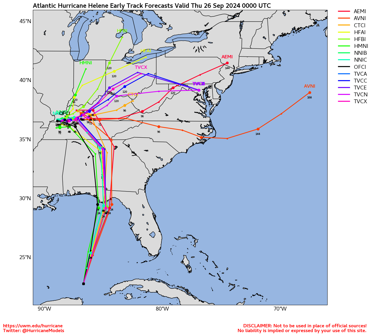
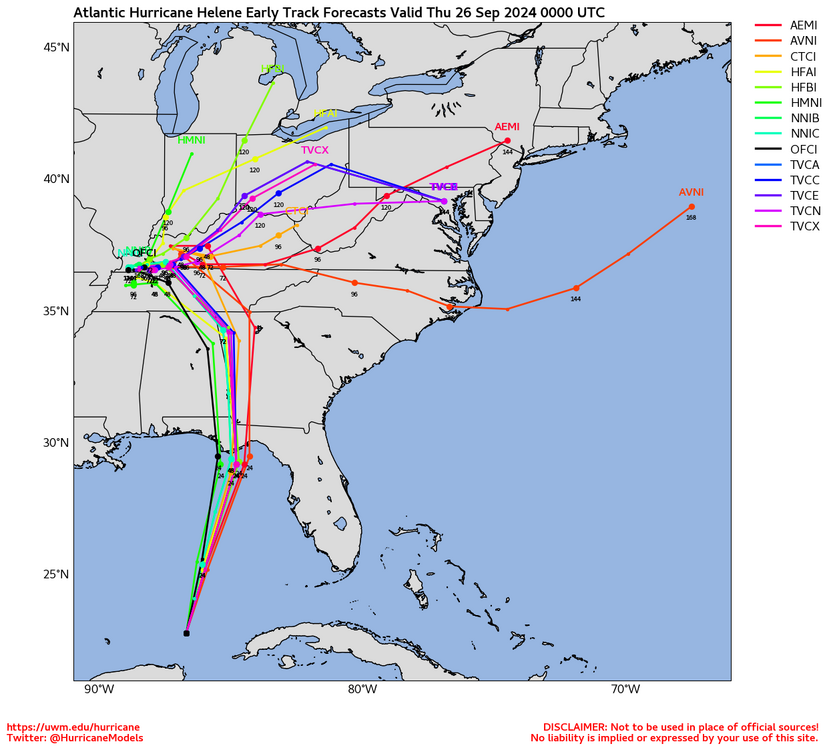
Can't really tell if this shows the newsest nhc track but it gives the idea.
-
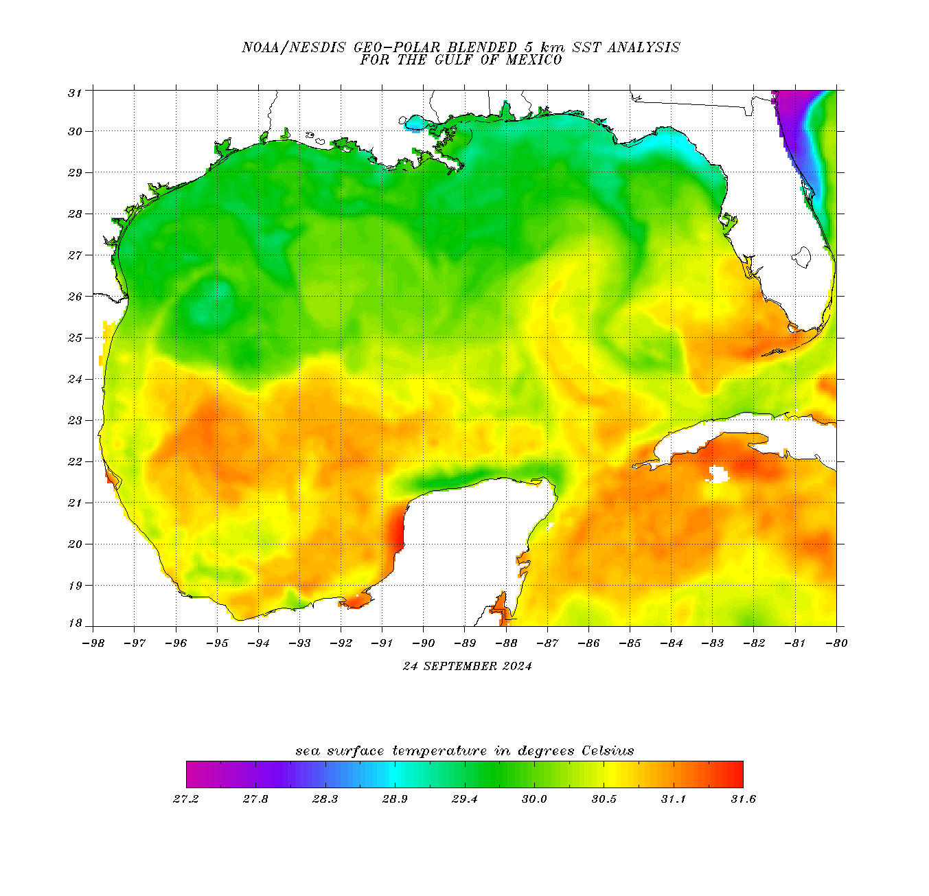
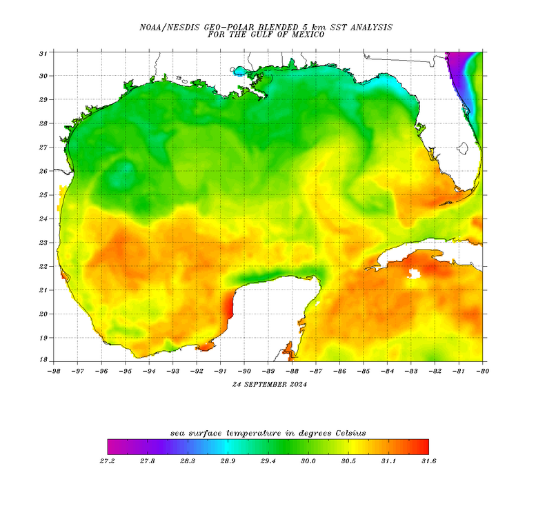
Satellite images show that Helene has a well-organized appearance, with numerous convective banding features. A ragged-looking eye feature is also apparent. However, reports from both Air Force and a NOAA Hurricane Hunter aircraft investigating the system suggest that the it lacks a well-defined inner core with a somewhat broad maximum wind field for now. The central pressure has dropped a little to around 972 mb. Given the slowly falling central pressure, the intensity is maintained at 75 kt for this advisory. Helene's structure and intensity will continue to be closely monitored by Hurricane Hunter aircraft tonight and Thursday. The hurricane continues moving northward with an estimated initial motion of 360/08 kt. For the next couple of days, the steering scenario for this system remains basically unchanged from the earlier advisory. The flow between a mid-tropospheric trough over the east-central United States and a ridge over the western Atlantic should result in Helene accelerating northward to north-northeastward during the next 24 to 36 hours. This motion will bring the center of Helene to the northeastern Gulf of Mexico coast in about 24 hours. The official track forecast through landfall is very similar to the previous NHC prediction and remains close to the corrected consensus guidance. After landfall, the trough to the northwest of the tropical cyclone becomes a cutoff low, and Helene should turn leftward as it rotates around the low. In 3-4 days, the system should become a shallow extratropical cyclone within weaker steering currents. Helene should be in an atmospheric and oceanic environment over the eastern Gulf of Mexico that will be very conducive for strengthening. The system is expected to traverse the Loop Current, which has especially high oceanic heat content. This, along with fairly low vertical wind shear and a moist mid- to lower- tropospheric air mass, should likely result in rapid intensification before landfall. The official forecast continues to call for the hurricane to reach category 4 status tomorrow. It should be noted that the HAFS-A and HAFS-B regional hurricane models show even more intensification than indicated here. Helene is forecast to be a large major hurricane when it reaches the Big Bend coast of Florida. As a result, storm surge, wind, and rainfall impacts will extend well away from the center and outside the forecast cone, particularly on the east side. In addition, the fast forward speed when Helene moves inland will result in a far inland penetration of strong winds over parts of the southeastern United States, including strong gusts over higher terrain of the southern Appalachians. A higher-than-normal gust factor is indicated in the official forecast while Helene is inland.
-
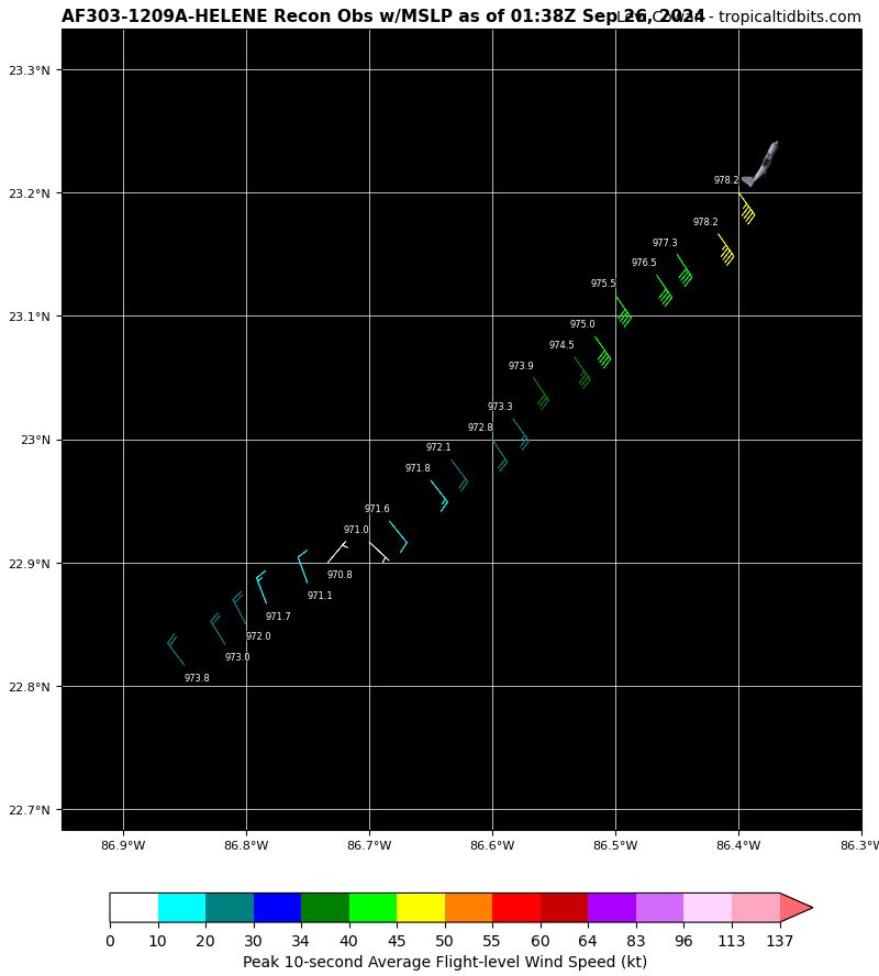
SUMMARY OF 1000 PM CDT...0300 UTC...INFORMATION ----------------------------------------------- LOCATION...23.1N 86.6W ABOUT 425 MI...680 KM SW OF TAMPA FLORIDA ABOUT 465 MI...750 KM SSW OF APALACHICOLA FLORIDA MAXIMUM SUSTAINED WINDS...85 MPH...140 KM/H PRESENT MOVEMENT...N OR 360 DEGREES AT 9 MPH...15 KM/H MINIMUM CENTRAL PRESSURE...972 MB...28.71 INCHES DISCUSSION AND OUTLOOK ---------------------- At 1000 PM CDT (0300 UTC), the center of Hurricane Helene was located near latitude 23.1 North, longitude 86.6 West. Helene is moving toward the north near 9 mph (15 km/h). A northward or north-northeastward motion at a faster forward speed is expected during the next 36 hours. On the forecast track, Helene will move across the eastern Gulf of Mexico tonight and Thursday and cross the Florida Big Bend coast Thursday evening. After landfall, Helene is expected to turn northwestward and slow down over the Tennessee Valley on Friday and Saturday. Maximum sustained winds are near 85 mph (140 km/h) with higher gusts. Strengthening is forecast, and Helene is expected to be a major hurricane when it reaches the Florida Big Bend coast Thursday evening. Weakening is expected after landfall, but Helene's fast forward speed will allow strong, damaging winds, especially in gusts, to penetrate well inland across the southeastern United States, including over the higher terrain of the southern Appalachians. Hurricane-force winds extend outward up to 35 miles (55 km) from the center and tropical-storm-force winds extend outward up to 345 miles (555 km). The minimum central pressure reported by Hurricane Hunter aircraft is 972 mb (28.71 inches).
-
https://www.star.nesdis.noaa.gov/goes/floater.php?stormid=AL092024#homePageLink https://www.ospo.noaa.gov/products/ocean/tropical/floaters/09L/09L_floater.html
-
Nearest buoy last night was 87 or 88, there are 0 buoys in that region of the gulf however so have to rely solely on satellite estimates.
-
Impressive how close it got to cancan area.
-
Last pass of 2nd recon 970mb it looks like.