wthrmn654
-
Posts
3,069 -
Joined
-
Last visited
Content Type
Profiles
Blogs
Forums
American Weather
Media Demo
Store
Gallery
Everything posted by wthrmn654
-
53kft on the enhanced echo tops
-
Effective this Thursday morning and evening from 1140 AM until 800 PM EDT. * Primary threats include... Scattered damaging winds likely with isolated significant gusts to 75 mph possible Isolated large hail events to 1.5 inches in diameter possible
-
SEVERE THUNDERSTORM WATCH OUTLINE UPDATE FOR WS 479 NWS STORM PREDICTION CENTER NORMAN OK 1140 AM EDT THU JUL 21 2022 SEVERE THUNDERSTORM WATCH 479 IS IN EFFECT UNTIL 800 PM EDT FOR THE FOLLOWING LOCATIONS NYC001-019-021-025-027-031-035-039-041-043-057-077-079-083-091- 093-095-111-113-115-220000- /O.NEW.KWNS.SV.A.0479.220721T1540Z-220722T0000Z/ NY . NEW YORK COUNTIES INCLUDED ARE ALBANY CLINTON COLUMBIA DELAWARE DUTCHESS ESSEX FULTON GREENE HAMILTON HERKIMER MONTGOMERY OTSEGO PUTNAM RENSSELAER SARATOGA SCHENECTADY SCHOHARIE ULSTER WARREN WASHINGTON $$ SEVERE THUNDERSTORM WATCH OUTLINE UPDATE FOR WS 479 NWS STORM PREDICTION CENTER NORMAN OK 1140 AM EDT THU JUL 21 2022 SEVERE THUNDERSTORM WATCH 479 IS IN EFFECT UNTIL 800 PM EDT FOR THE FOLLOWING LOCATIONS CTC001-003-005-007-009-011-013-015-220000- /O.NEW.KWNS.SV.A.0479.220721T1540Z-220722T0000Z/ CT . CONNECTICUT COUNTIES INCLUDED ARE FAIRFIELD HARTFORD LITCHFIELD MIDDLESEX NEW HAVEN NEW LONDON TOLLAND WINDHAM $$
-
Temps went to 85.3 down to 83.5 now Dewpoint has been between 70 and 72 overall Heat index of 88.5 but was as high as 91.5 Winds really cranking though with clear skies
-
Temperature-85.3 Humidity- 63% Dewpoint- 71.2 Heat index- 91.5
-
Water 2 times a day, if small use drip irrigation. Water throughly, 60 mintues at least.
-
What, it's directly from Davis Station
-
79.9 With dew 70.9 Humidity 79% Heat index, 79.9 lol
-
Pseg has been doing good, blame the rich and entitled in your area of the island not letting them cut down or trim the trees more aggressively on top of the insane amount of trees per area lol.
-
NYZ072>075-176-178-211015- /O.EXT.KOKX.HT.Y.0002.000000T0000Z-220725T0000Z/ New York (Manhattan)-Bronx-Richmond (Staten Island)- Kings (Brooklyn)-Northern Queens-Southern Queens- 316 PM EDT Wed Jul 20 2022 ...HEAT ADVISORY NOW IN EFFECT UNTIL 8 PM EDT SUNDAY... URGENT - WEATHER MESSAGE National Weather Service New York NY 316 PM EDT Wed Jul 20 2022 NJZ107-108-211015- /O.EXT.KOKX.HT.Y.0002.000000T0000Z-220725T0000Z/ Western Union-Eastern Union- 316 PM EDT Wed Jul 20 2022 ...HEAT ADVISORY NOW IN EFFECT UNTIL 8 PM EDT SUNDAY...
-
NJZ004-006-103>106-211015- /O.EXT.KOKX.HT.Y.0002.000000T0000Z-220725T0000Z/ Eastern Passaic-Hudson-Western Bergen-Eastern Bergen- Western Essex-Eastern Essex- 316 PM EDT Wed Jul 20 2022 ...HEAT ADVISORY NOW IN EFFECT UNTIL 8 PM EDT SUNDAY...
-
Then there gone!
-
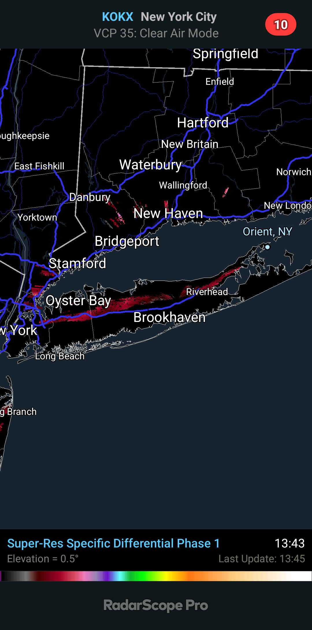
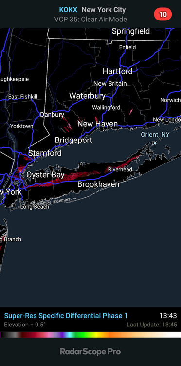
Clouds exploding up near riverhead where the breeze front must be stuck
-
90.9 with a dew of 67 Feels like 93
-
Do the asphalt! Do the asphalt! I should go to the firehouse and get our FLIR gun to see the temps
-
Sea breeze
-
Crazy range in dew points at airports.. breaks 65, Montauk, Grabewski in the 70s, others on the island, nyc area are between 65-69.
-
Finally! Hit 90 since may 31st!
-
Newark Airport equipment looks fairly mint, visible from the turnpike.
-
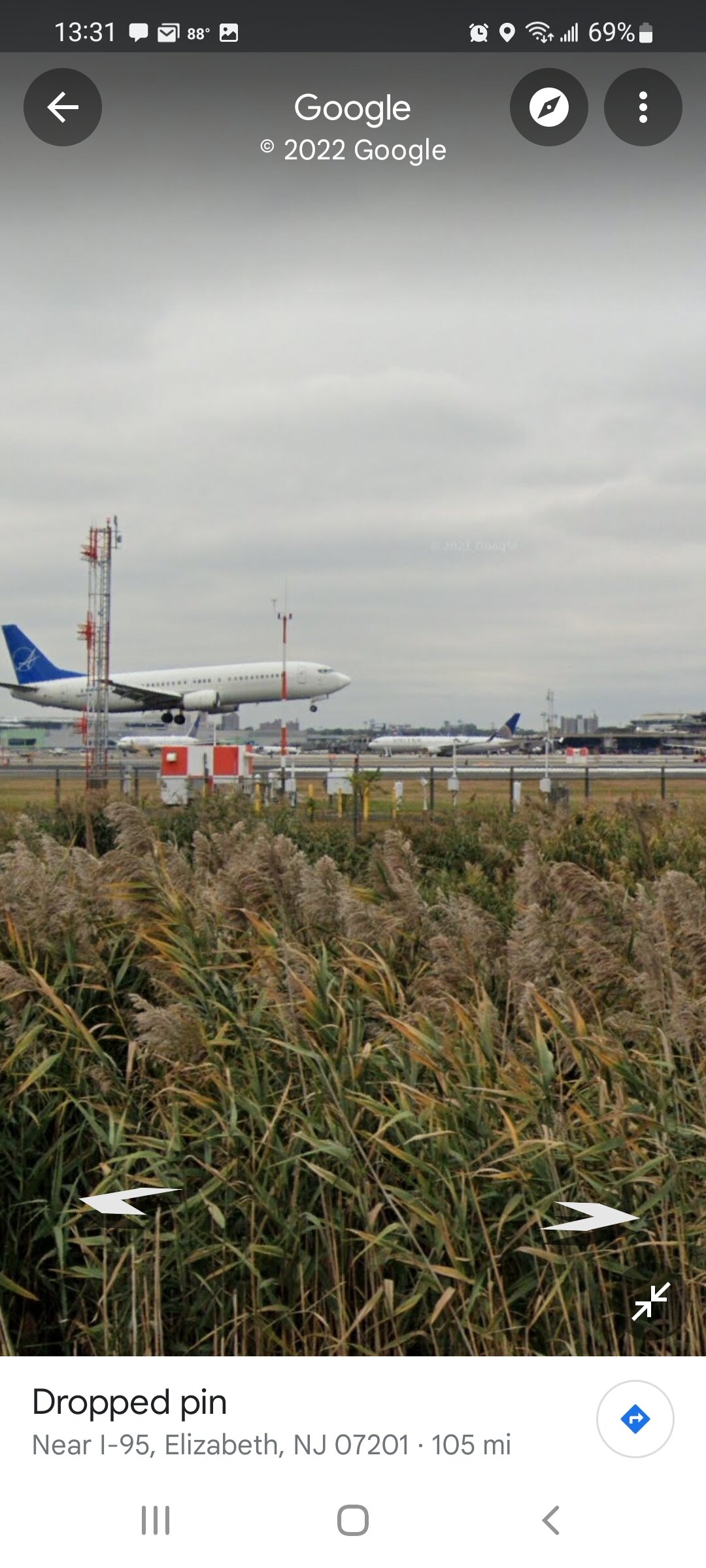
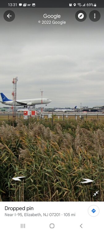
Jfk asos equipment,
-
Found jfk and Newark sensors!
-
Anyone ever try to find the weather stations at any of the area airports with Google maps? I think I found the jfk one but can't tell but at Newark, I didn't see anything remotely possible. What's the standard practice when they locate remote equipment at airports? Edit, found a link with a photo of what jfks equipment looks like, vastly different from say central parks equipment by a big amount.
-
May also be due to style sensor, height etc?