wthrmn654
-
Posts
3,069 -
Joined
-
Last visited
Content Type
Profiles
Blogs
Forums
American Weather
Media Demo
Store
Gallery
Everything posted by wthrmn654
-
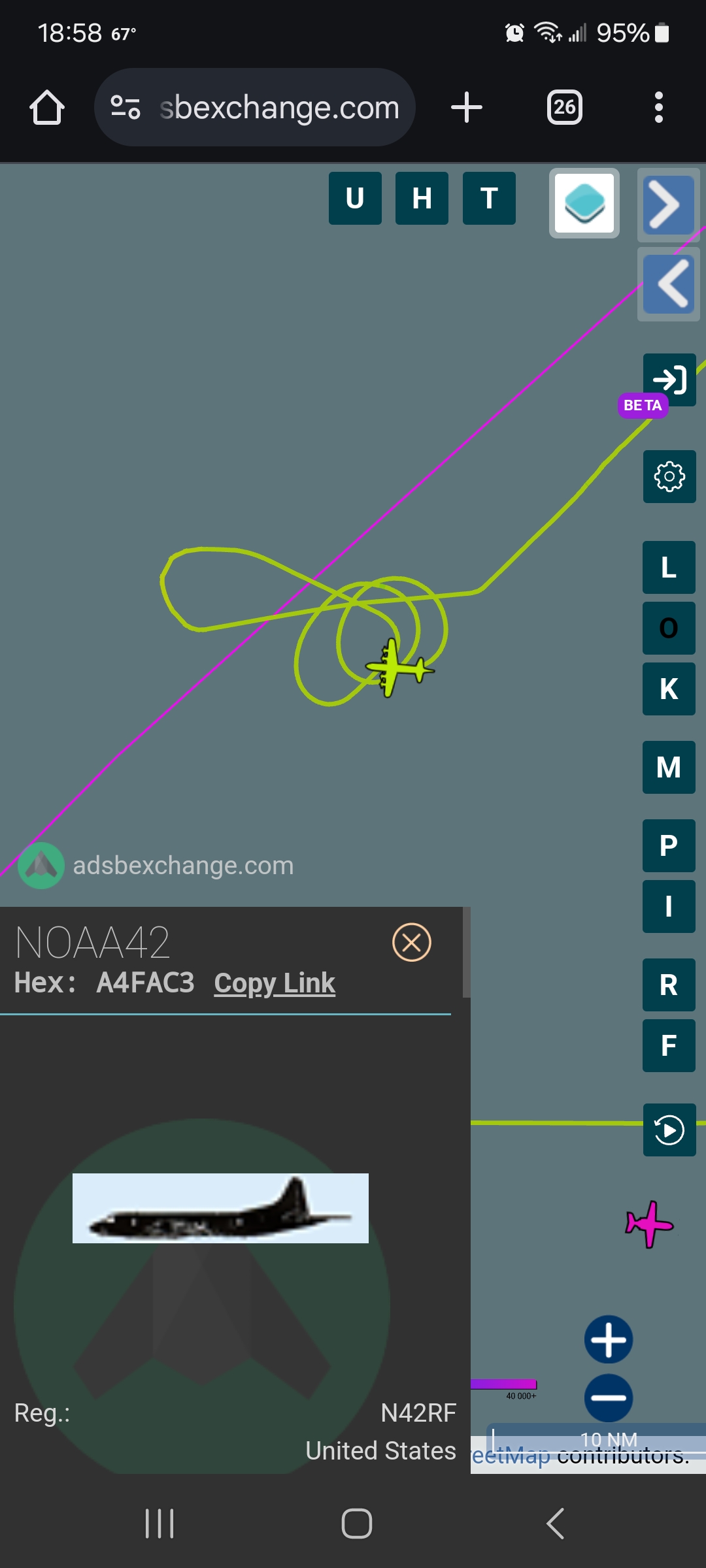
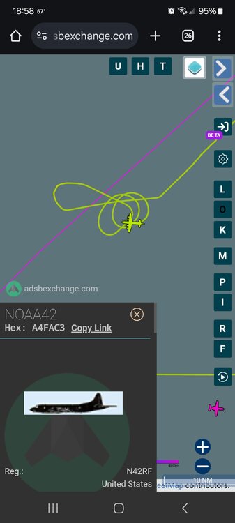
6 loops later at 8 thousand feet and there still sampling the eye...
-
Give them credit for being so determined to find the center
-
Lmao sorry can't help but laugh at this path, 943 lowest plane recorded.


-
Teal heading to storm, noaa doing loop de loops around the "center" looking at plane tracker. Must of missed center.
-
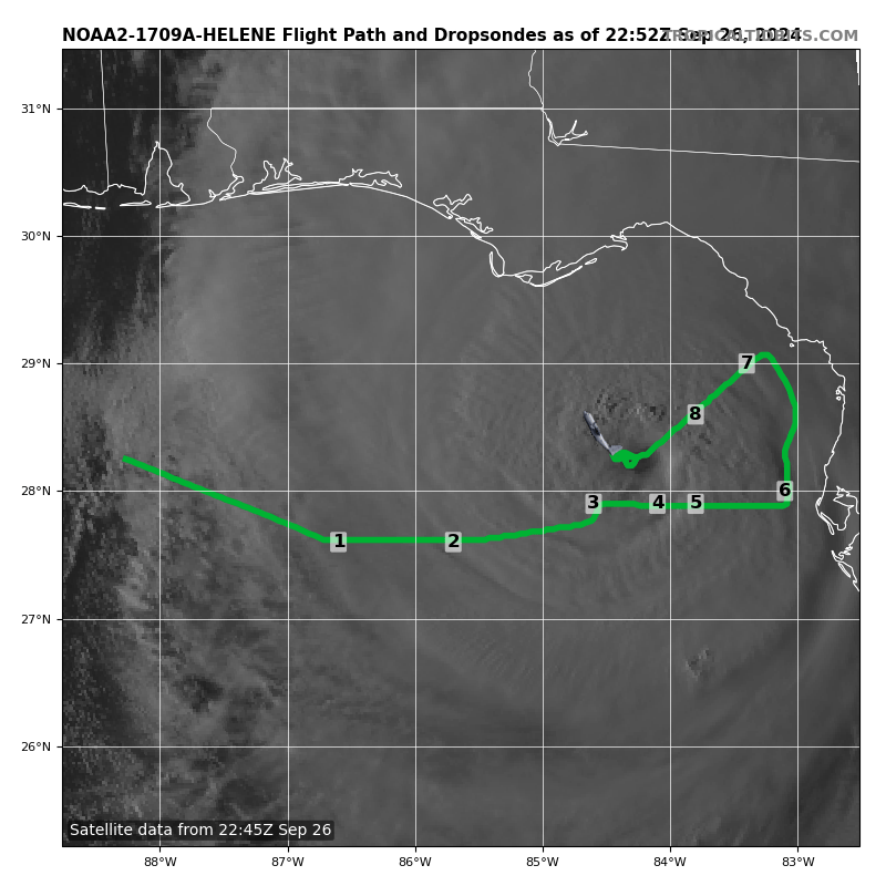
Just updated satellite estimate, let's see how it matches up with next recon pass. Current Analysis ----- Date : 26 SEP 2024 Time : 221020 UTC Lat : 27:54:35 N Lon : 84:18:00 W CI# /Pressure/ Vmax 6.3 / 929.2mb/122.2kt Final T# Adj T# Raw T# 6.3 6.3 6.9 Estimated radius of max. wind based on IR : 16 km Center Temp : +0.7C Cloud Region Temp : -73.3C Scene Type : EYE
-
Looks brutal in the Gulf!

-
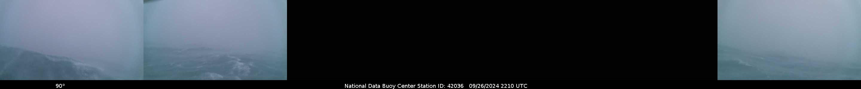
Waves are still updating It appears, nearing 25 feet!
-
We may of lost the buoy...
-
I'm afraid there could be many lives lost, and many trees lost. The timber industry, farmers are going be hurt badly. There's nothing good about this situation at this point.
-
My God, look at far east those crazy winds extend, not sure how much of that mixes down to surface but I hope people run for there lives if they haven't yet! And to note, that is the buoy by the center, looks like it will go just east of it!

-
Nhc 6 pm winds are 125 mph. Was corrected
-
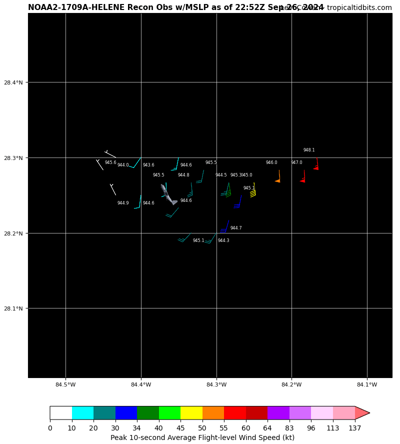
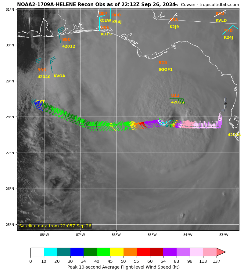
Flight level winds 113-137 knots if I have my colors correct on the recon map?! Jeez And lowest pressure I could see was 946.2mb
-
Wow satellite pressure estimates were 930 or 940 something and I thought they were crazy.. but recon finding 946... matches the recon findings fairly well. Current Analysis ----- Date : 26 SEP 2024 Time : 211020 UTC Lat : 27:33:35 N Lon : 84:25:48 W CI# /Pressure/ Vmax 6.2 / 931.5mb/119.8kt Final T# Adj T# Raw T# 6.2 6.1 6.1 Estimated radius of max. wind based on IR :N/A km Center Temp : -21.9C Cloud Region Temp : -69.7C Scene Type : EYE
-
No worries per buoy site there's no buoys in gulf measuring that high
-
946ish too! It flew east and it was going down
-
As of 09/26/2024 17:00 EDT, water levels along the Florida Gulf Coast are elevated and continuing to rise as Hurricane Helene approaches. Below is a breakdown of water level observations above normal tide levels by region: Pensacola, FL to Apalachicola, FL.... 1.6 to 3.5 feet Apalachicola, FL to Tampa Bay, FL....3.5 to 3.9 feet Tampa Bay, FL to Key West, FL......1.6 to 3.7 feet Winds along the south and southeastern Florida coast from Key West to Lake Worth Pier presently range between 25 and 35 knots with gusts to 40 knots. Winds from Key West to Cedar Key range between 25 and 40 knots with gusts to 50 knots. Winds along the Florida Panhandle from Pensacola to Apalachicola range between 10 and 15 knots with gusts to 20 knots.
-
I assumed that, but I only see 20 foot seas so maybe I'm missing something
-
31? Which buoy is that by chance the one that's less then 31 miles away is showing 20 feet now
-
Buoy nearing the eye pressure is now dropping fast, -0.35 inches currently at 985.4mb sustained windabout 40 knots gusts nearly 60 knots. Wave height close to 20 feet now.
-
Latest ADT satellite estimate shows 115knot max now which translates to 132mph
-

2024 Atlantic Hurricane Season
wthrmn654 replied to Stormchaserchuck1's topic in Tropical Headquarters
Busy times ahead for all you mets! We thank you all for all the schooling and learned knowledge as well as being patient with us average humans of the USA lol -
I was going say looking at the recon positions of the center and the noaa buoys to the north if would seem instead of going to the right of the buoy is going be going to the left of it instead. But as goose pointed out wobbles and such could make it an unknown variable
-
OK , it was a couple of satellite views of different modes and it's not every 15 mintues.
-
-
Kinda looks like an eye is trying to clear out now