wake4est
-
Posts
847 -
Joined
-
Last visited
Content Type
Profiles
Blogs
Forums
American Weather
Media Demo
Store
Gallery
Everything posted by wake4est
-
The NAM is primed to bring a fat juicy storm to the SE when it gets in range...
-
Hey we’re idiots all the time thank you very much
-
Lol Control Run gives 10" + for all of Wake County.
-
NW!
-
FV3 did not
-
And we’re back
-
Canadian does too
-
Not that it is the horse to bet on, but the CMC highlights this possibility. I'm genuinely curious to watch how the ridge will actually stop this thing on a dime like the models show.
-
Interesting the GFS doesn't have such a deep sickle shape as the Euro in its westward movement.
-
-
Big shift south on nhc track
-
Yeah but they do so in a measured fashion, rather than hugging every model run like us internet people like to do.
-
That map they showed was based off the weird south Euro run entirely
-
I guess the NWS doesn’t buy the models weird tracks after the stall.
-
Listen to the NWS.
-
-
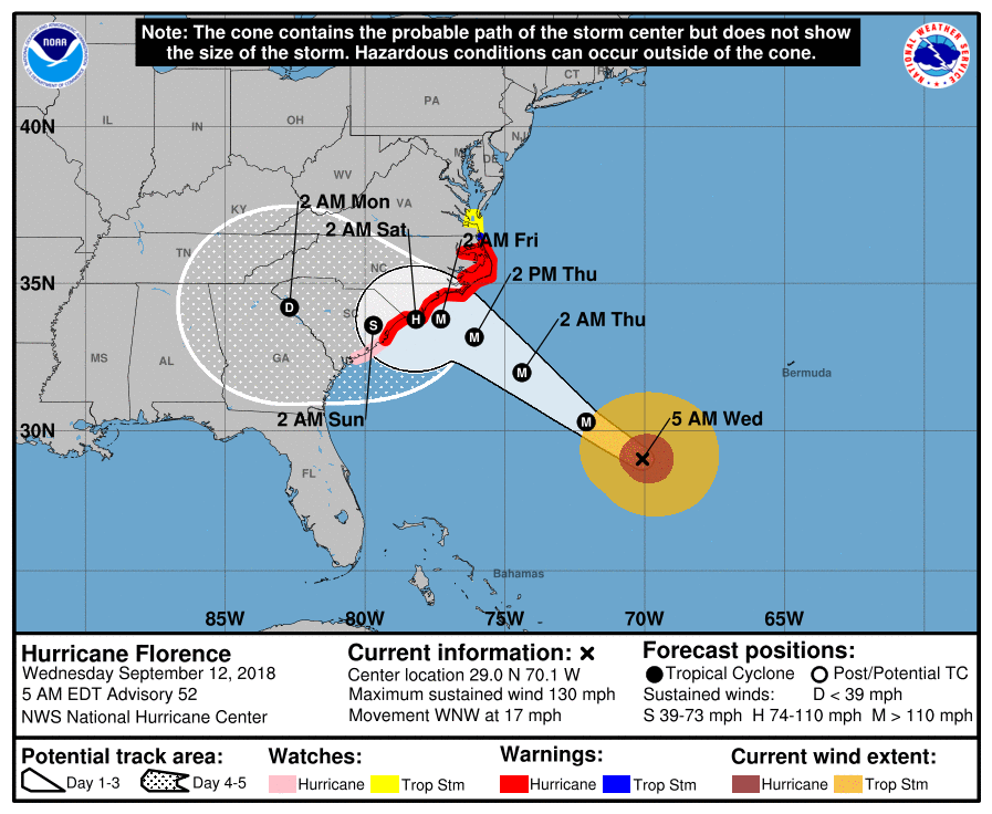
Is there an intermediate advisory at 8pm?
-
The gfs has it redevolping after it leaves land off of nc and aims AGAIN towards SC day 10
-
The new nhc cone seems like the best choice given model data.
-
Can you imagine trying to put out the actual NHC cone this afternoon?
-
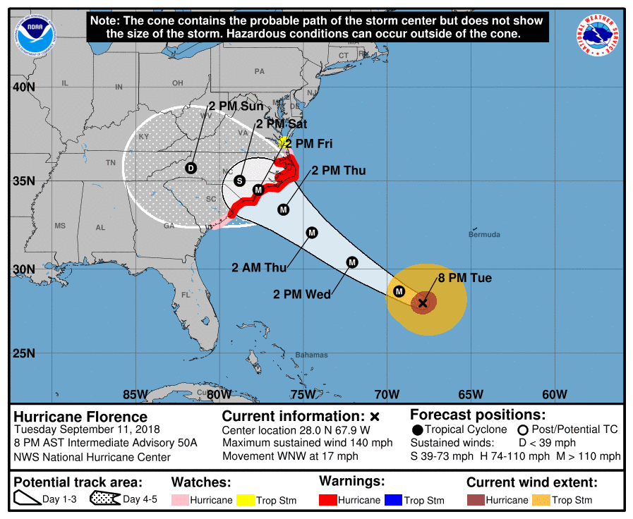
They just posted it, seemingly implying it was the recent run.
-

-
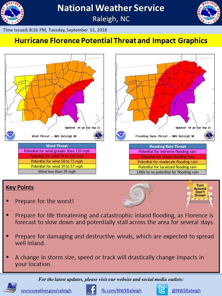
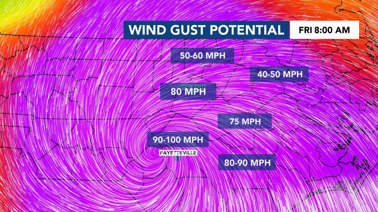
Brick see WRAL Weather’s last 3 FB posts. They are maps of wind gusts during the storm based on Euro. sorry can’t post them at the moment
-
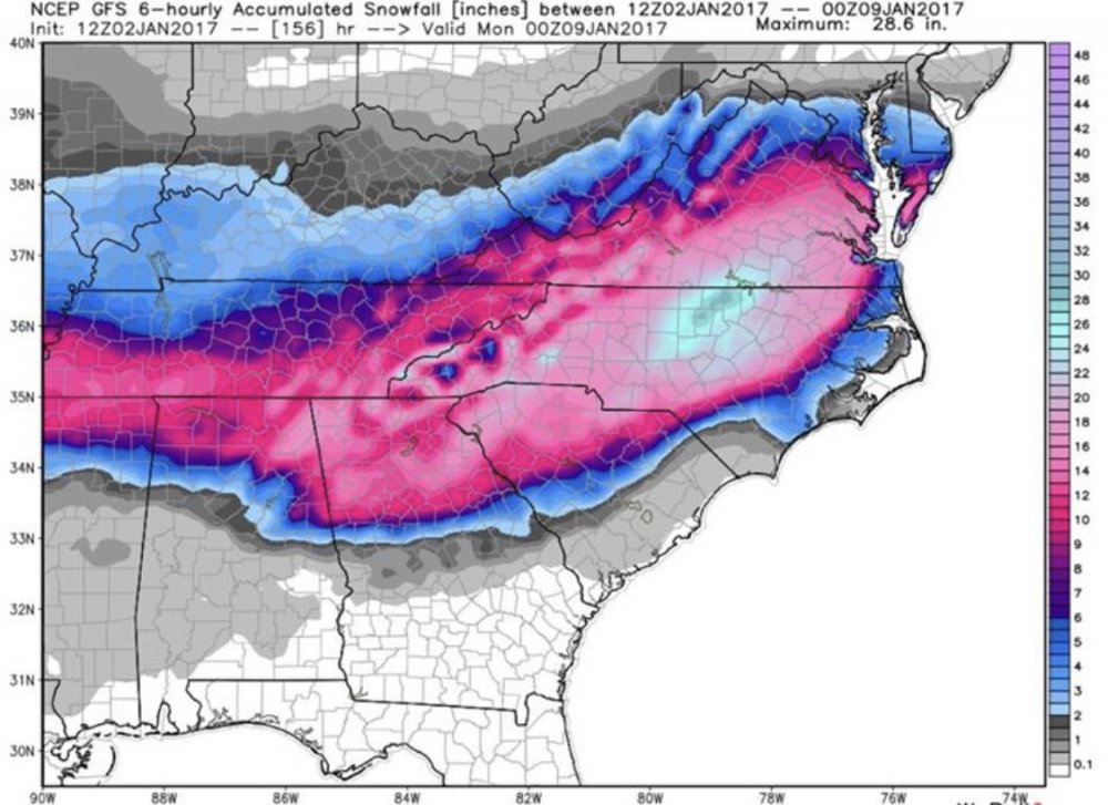
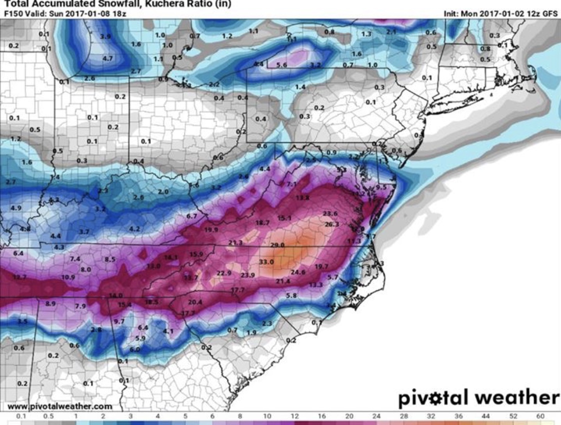
So check out these model runs from exactly 1 year ago today. What a fantasy storm!