wake4est
-
Posts
847 -
Joined
-
Last visited
Content Type
Profiles
Blogs
Forums
American Weather
Media Demo
Store
Gallery
Everything posted by wake4est
-
Looking great at 31
-
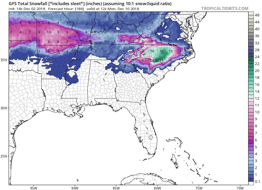
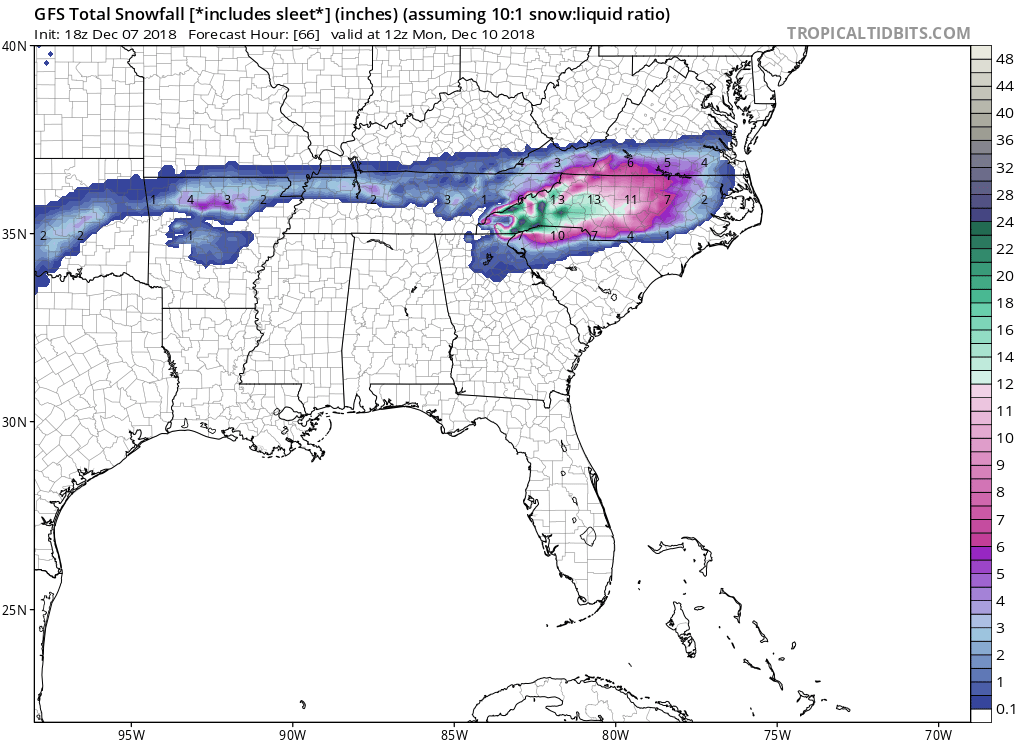
In this brief lull in activity I wanted to point this out. Regardless of what happens, this is remarkable consistency from 12/2 to today

-
https://www.weather.gov/media/rah/briefing/NWSRaleighLatestBriefing.pdf see the link for better resolution
-
They specifically mentioned in the afd that the NAM showed cold mid level layers and minimized a warm nose until later on. They cautioned clearly that things could be very different with minor changes.
-
Rah as of 5:30
-
RAH’s afd should please the Triangle greatly
-
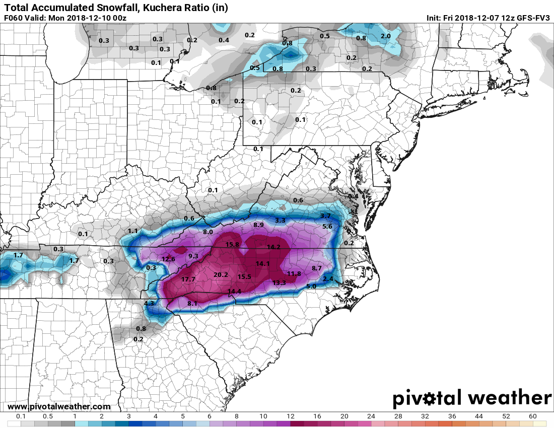
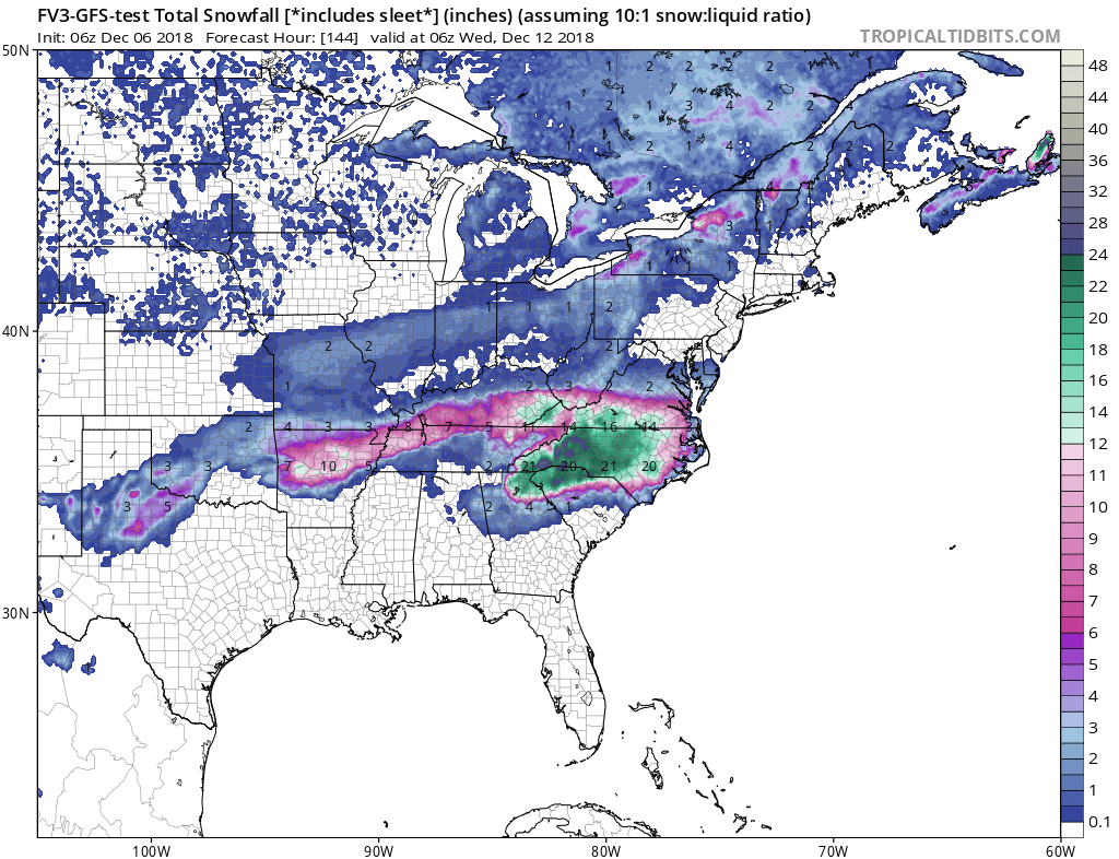
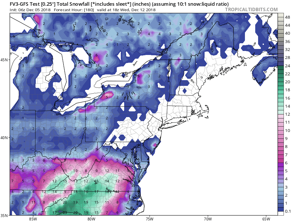
fv3 Kuchera Map through 60 EDIT: thru 66 add an inch to the totals

-
https://www.spc.noaa.gov/exper/sref/srefplumes/
-
It's there on TT. Hasn't finished the run yet.
-
Like I KNOW the non-Kuchera fv3 clown maps are unrealistic but they are just astonishing. Like old-school DGEX snow outputs. They make my eyes happy.
-
Looks eerily like the 6z Euro
-
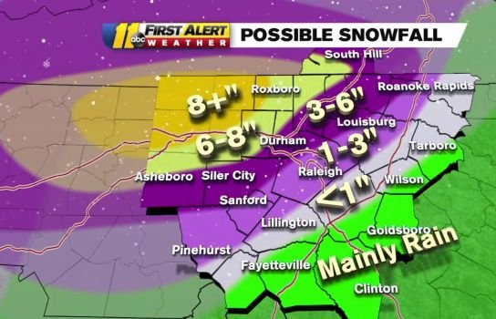
WTVD for comparison
-
Anybody have soundings across NC from the 6z Euro? Precip looks perfect for much of the state if all snow. I wonder how much is sleet.
-
GFS has a finger of precip earlier at 30.
-
NAM could be impressive....
-
Weird I have no functional memory of that. Must have been really terrible for us.
-
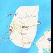
Found this on my laptop from one year ago today. Did anything become of this? I cannot remember what we were chasing.
-
Dang the fv3 is robust with precip into Monday evening
-
It's so juicy.
-
I don’t get why the fv3 just did this
-
LOL what

-
2m temps increased by 1 or 2 on the NAM but the DPs are still way better than the GFS.
-
sure

-
Is the FV3 recognizing a stronger CAD than the old-n-busted GFS? If so that will be a nice upgrade in itself.
-
Boom