superETA
-
Posts
8 -
Joined
-
Last visited
About superETA

-
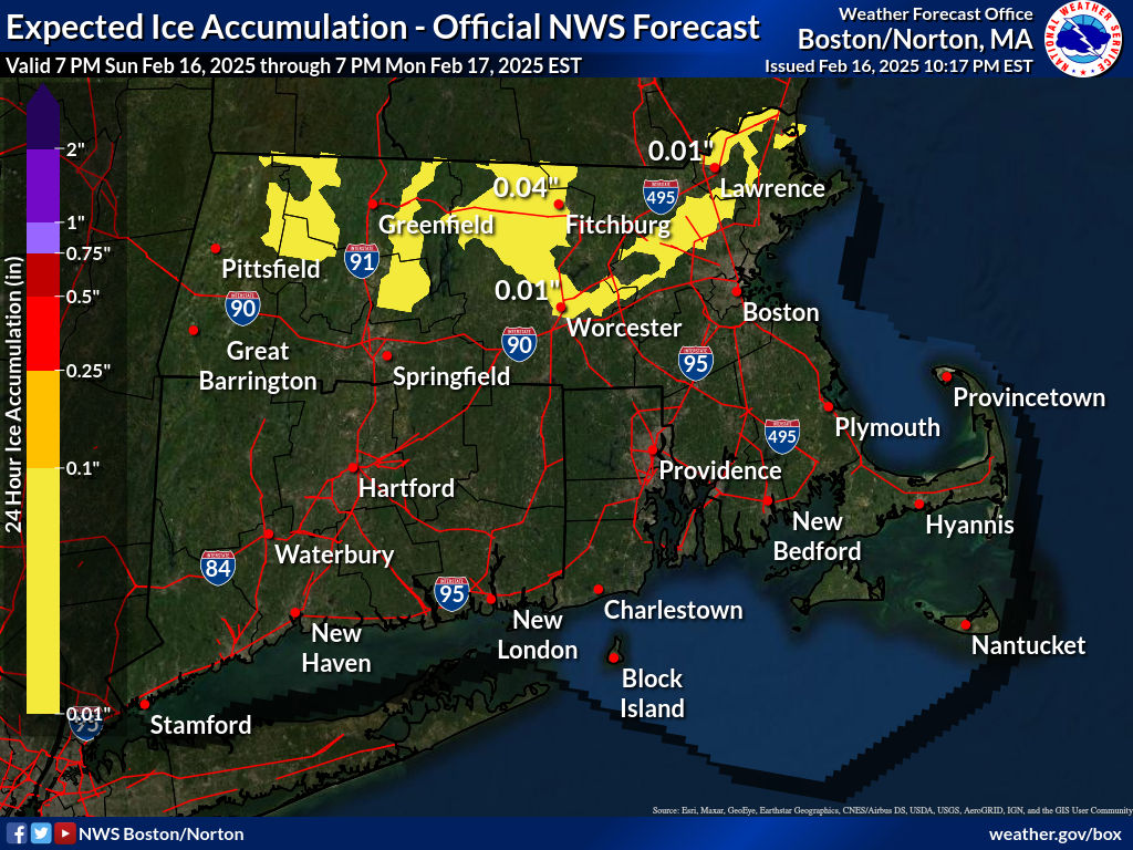
Yeah, I’m driving around Warwick RI tomorrow and I’m concerned about icy road hazards. First, I hear Geoff Bensen from ABC6 describe the roads tomorrow morning as “ice rinks”: https://m.facebook.com/story.php?story_fbid=1345632766472128&id=1345632766472128 That’s a dramatic characterization and can lead to rash decisions like telling my boss I might need to stay home (which I did). I don’t know why he’d use that phrase if there wasn’t a serious concern for safety due to ice. Then I get confused by this graph: Does this mean only the highlighted major roadways will have .25 to .5” of ice? Or that all roadways in the surrounding areas of the highlighted roadways? Sorry everyone still a newbie to this discipline.

-
Hovered in the low 40's today in Warwick RI. All rain.
-
I might be the only one here, not being from a meteorology background, that hopes for LESS precipitation/snow and not more. I do like accurate forecasts though. Those make me fuzzy inside.
-
Very new to meteorology and forecasting, so I could be way off here, but based on the latest NWS Palisades storm discussion (via LOX NWS), I’m not seeing much of a strong western ridge signal that would slow down and organize our storm in the Northeast: So from what I can tell, there’s some ridging out west, but not enough to really change the downstream setup for the NE. That might be why CMC/GFS keep showing the storm getting stretched and ejecting too quickly instead of digging in. The Euro seems to handle the SPV-southern stream interaction better, but with the overall -d(gradient) flow, it still looks like another fast-moving, messy system unless something shifts. Does that sound right? Or is the CA forecast way too far west and early to affect what's going on over here next week? Still trying to get a feel for how these setups evolve. Thanks
-
What are we thinking for an 8-9 AM commute? I’m going west from Rhode Island into Norwich CT. Not sure how good they are over there with clearing their roads.
-
Final update form West Warwick RI reporting- total snow was 4”. Was hoping for some real work this morning!
-
West Warwick RI again - 2 inches as of 2:30 AM (stayed up late watching UFC, which was much more engaging than this snow)
-
West Warwick RI reporting - a little under an inch has accumulated so far.