
bncho
-
Posts
3,737 -
Joined
-
Last visited
Content Type
Profiles
Blogs
Forums
American Weather
Media Demo
Store
Gallery
Everything posted by bncho
-
Outta gas and Outta Time: Early March Winter Storm finale
bncho replied to Ji's topic in Mid Atlantic
If I slant stick and measure on the grass I might be able to eek out 0.7" -
Outta gas and Outta Time: Early March Winter Storm finale
bncho replied to Ji's topic in Mid Atlantic
-
Outta gas and Outta Time: Early March Winter Storm finale
bncho replied to Ji's topic in Mid Atlantic
McLean's at 29.8/25 right now. It's snowing there too. -
Outta gas and Outta Time: Early March Winter Storm finale
bncho replied to Ji's topic in Mid Atlantic
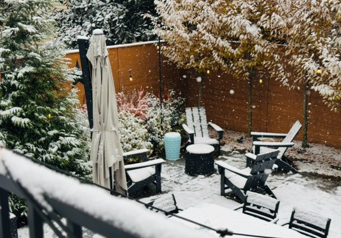
It's starting to dump in Annandale. -
Outta gas and Outta Time: Early March Winter Storm finale
bncho replied to Ji's topic in Mid Atlantic
HOLY SHIT MY DAD JUST TEXTED ME THAT IT WAS SNOWING HARD I'M SAVED HALELUJAH -
Outta gas and Outta Time: Early March Winter Storm finale
bncho replied to Ji's topic in Mid Atlantic
how much snow do you got on the ground Randy? -
Outta gas and Outta Time: Early March Winter Storm finale
bncho replied to Ji's topic in Mid Atlantic
I'm depressed reading Dr. Arlington's posts. I'm cooked -
Outta gas and Outta Time: Early March Winter Storm finale
bncho replied to Ji's topic in Mid Atlantic
Looks like I will NOT be coming back home to 6". This is a disgrace. -
Outta gas and Outta Time: Early March Winter Storm finale
bncho replied to Ji's topic in Mid Atlantic
I better come back home to 6" or I will be very disappointed. -
Outta gas and Outta Time: Early March Winter Storm finale
bncho replied to Ji's topic in Mid Atlantic
Thinking it might be a beautiful bus ride home this afternoon. -
Outta gas and Outta Time: Early March Winter Storm finale
bncho replied to Ji's topic in Mid Atlantic
Happy March, everyone. Happy March. -
Outta gas and Outta Time: Early March Winter Storm finale
bncho replied to Ji's topic in Mid Atlantic
I feel like the snowfall color guide on the bottom changing colors. I didn't get a lot of sleep last night so that might be it -
we're back
-
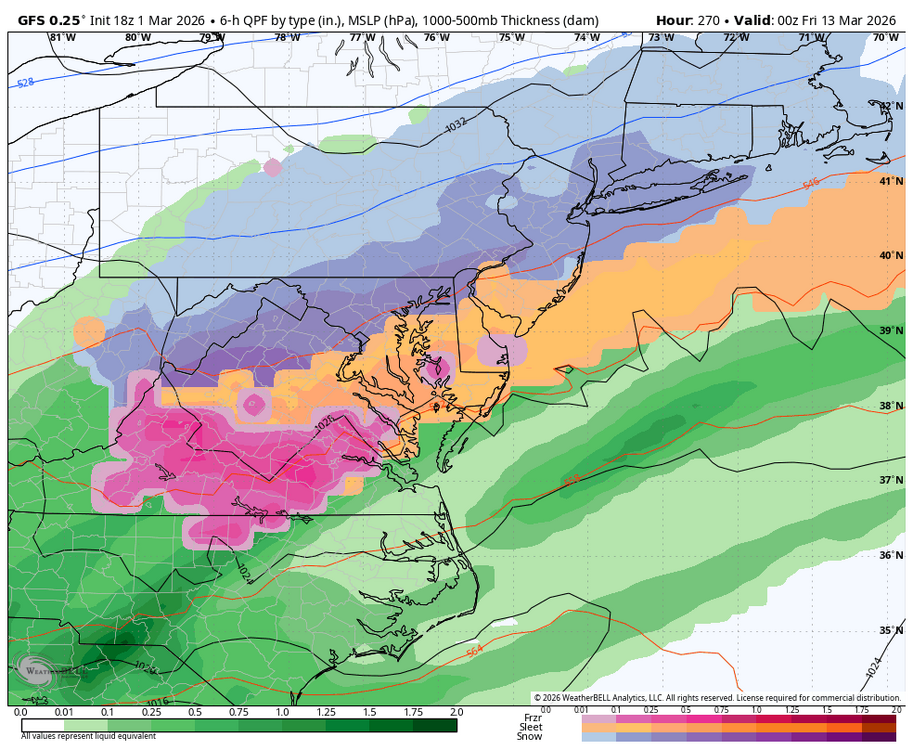
Outta gas and Outta Time: Early March Winter Storm finale
bncho replied to Ji's topic in Mid Atlantic
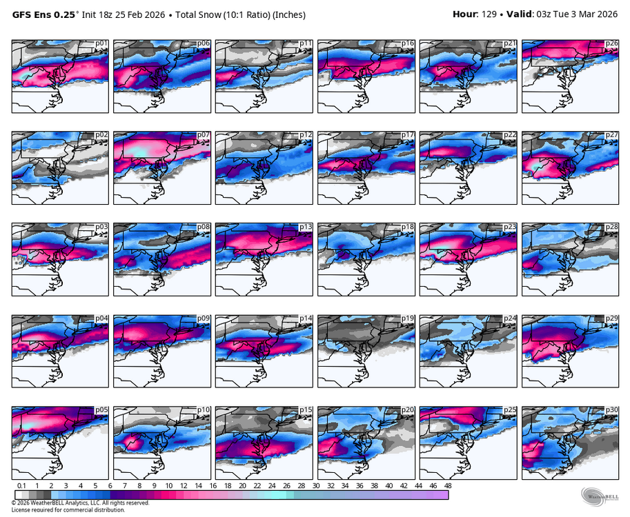
GFS shifted north, and I've just been GFS'd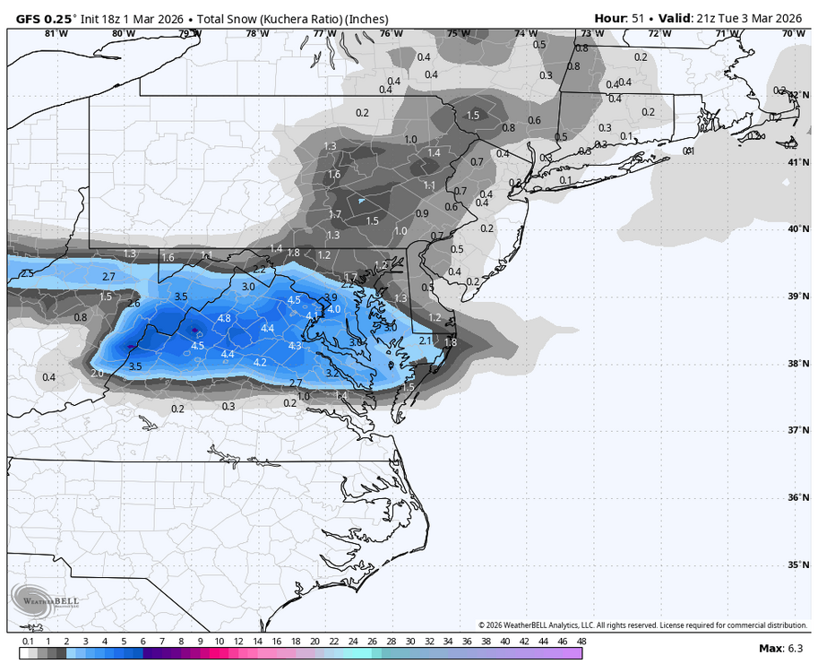
-
@stormtracker did you make some changes to the max file size? It looks like it almost tripled in size
-
This was a super 2010-11-esque winter. Cold but lacking in snow, missed a blockbuster storm due to marginal temps, NYC scored a well above average season while our region gets another below average.
-
man, we really do suck
-
Outta gas and Outta Time: Early March Winter Storm finale
bncho replied to Ji's topic in Mid Atlantic
And we’re worried about suppression in March, but whatever you say -
Verbatim that SSW is putting in its effects surprisingly quick. When was the last time we got a late-March snowstorm? March 2014?
-
Outta gas and Outta Time: Early March Winter Storm finale
bncho replied to Ji's topic in Mid Atlantic
you might have member next to your tag but so do PSU and Bobby Chill. that's kinda how I see you -
Outta gas and Outta Time: Early March Winter Storm finale
bncho replied to Ji's topic in Mid Atlantic
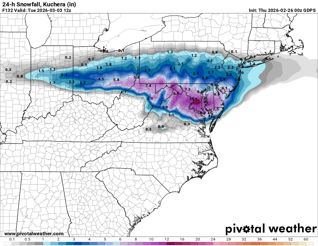
I lost 3" of snow since 0z -
-
Outta gas and Outta Time: Early March Winter Storm finale
bncho replied to Ji's topic in Mid Atlantic
-
Outta gas and Outta Time: Early March Winter Storm finale
bncho replied to Ji's topic in Mid Atlantic
can't wait for rev war to talk about march sun angle and how this event won't happen and how we're tracking a rainstorm, then he'll insult CAPE and when we tell him thats not nice he'll start saying about how we're bullies -
Outta gas and Outta Time: Early March Winter Storm finale
bncho replied to Ji's topic in Mid Atlantic
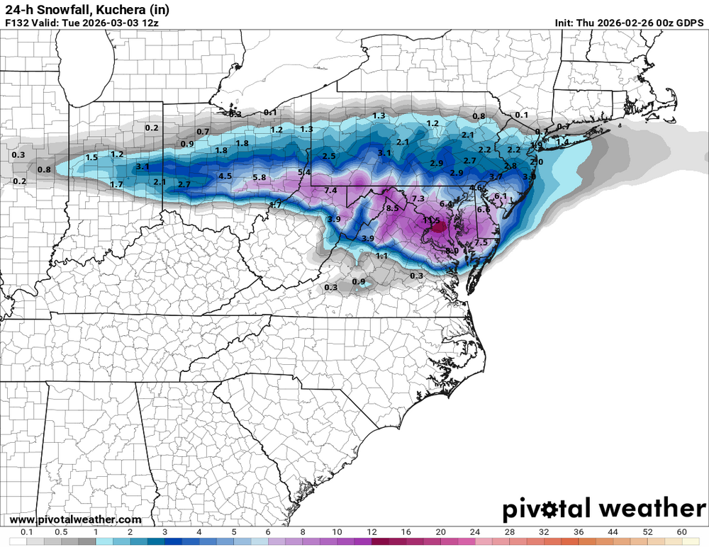
there are a lot of big hits in the individual members. and i think IAD gets at least 1" from all of them.