IrishRob17
-
Posts
11,758 -
Joined
-
Last visited
Content Type
Profiles
Blogs
Forums
American Weather
Media Demo
Store
Gallery
Everything posted by IrishRob17
-
What was your measurement this morning?
-
I’m with ya on this. Sure I’ll pay more for heating this season but we’ve been getting off easy for years. I’ll likely tire of it around the same time you will. I’d like to get some more snow though. As much as I’m enjoying it I’m also looking forward to that first mild calm sunny day to have a pint on the deck, preferably while there’s still a pack out there.
-
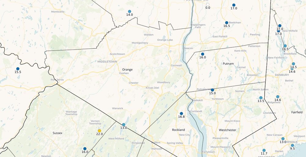
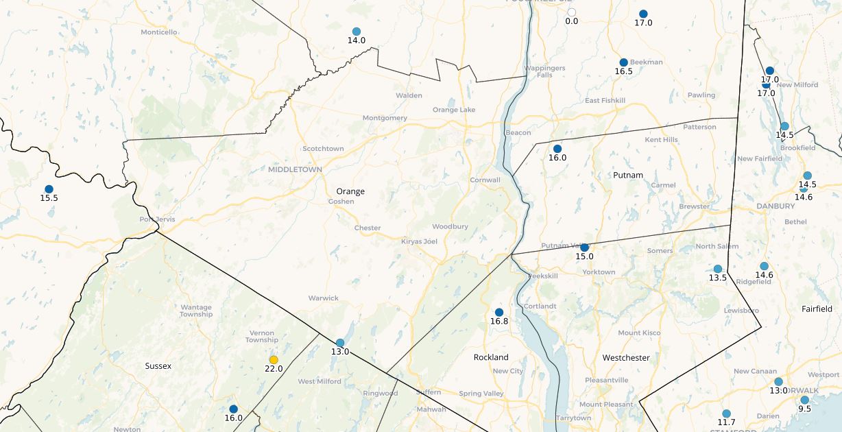
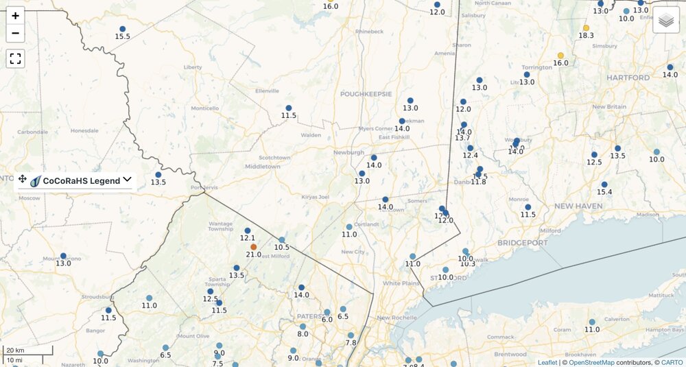
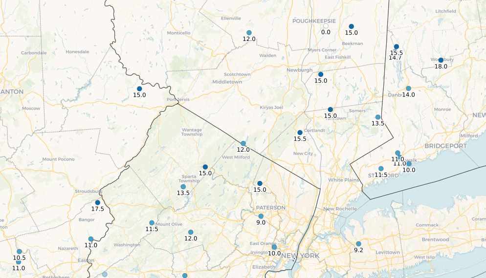
This morning’s snow depth
-
-3 for the low with 12" at both stakes.
-
+1 for the low, big whoop.
-
It wasn't a lock here and I can radiate pretty good, especially with snow on the ground, low of +1 (+.6). I've been dead calm since 3am, clouds must've messed it up. Meh for me when compared to earlier in the week. I did beat KMGJ which appears have only went to +2.
-
Agreed. It's not windy per se but it's too windy here for the temps to really drop, 8/-2.
-
I was watching closely for a bit this morning and every time the temp would start dropping again a slight breeze, like 3mph, would kick up and the temp would rise a degree or two.
-
Low of +2 this morning. Maybe I get a below zero reading right before midnight to keep my streak going but it looks to be too windy for me.
-
The breeze has kept me above zero, sitting at +3, my below zero streak up here may end at four days as a result. Although if it doesn't go below in the next hour or so I could go below before midnight, keeping the streak alive.
-
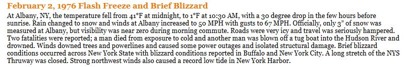
I found the below on the NWS Albany page. This also got me reading again about the Buffalo Blizzard in 1977 when they did record 12" but the bulk of the snow was blown into Buffalo from a frozen Lake Erie. https://en.wikipedia.org/wiki/Blizzard_of_1977#:~:text=The blizzard of 1977 hit,February 1 of that year. https://www.weather.gov/aly/majorwinterstorms
-

Possible coastal storm centered on Feb 1 2026.
IrishRob17 replied to Typhoon Tip's topic in New England
Violenty agree. I woke up at the tail end of the last one I had and still didn't feel a thing but did see up close on the monitor where some people say my head is... -
I've had four below zero mins so far this year, the most I've recorded was 15 in the '14-'15 winter. That winter is also my longest consective streak of below zeros, which was six. I'm currently at six days in a row below 32, the most I've recorded that was 14 days in the '17-'18 winter, and interestingly that winter I recorded a total of 23 days below 32 degrees.
-
The piles and banks are huge and I atribute that to the higher than expeced water content in the snow. Something to keep in mind as we move towards spring.
-
Agreed. My -5.9 goes in the books as -6 and my -8.4 yesterday goes in the books as -8.
-
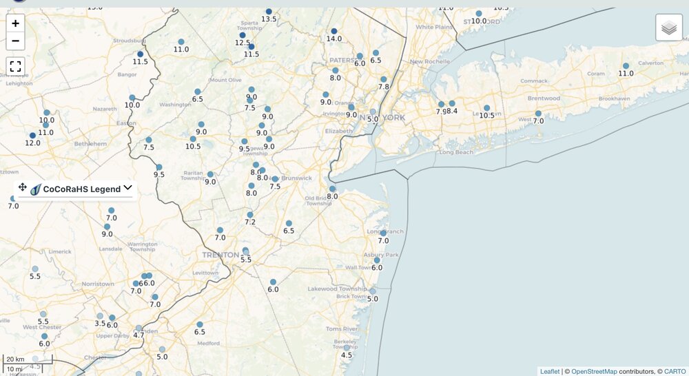
This mornings snow depth from CoCoRaHS.
-
-6 will do it for me, -5 now. Snowpack at both stakes, opposite sides of the yard, are at 13.5" this morning. Sure theres been zero melting but sublimation and settling happens regardless. The storm this weekend ain't happening for us, would like to like see a number of small events, at least, in the next couple weeks to add back to the pack.
-
The 0z has temps briefly sneaking up above freezing on the 7th.
-
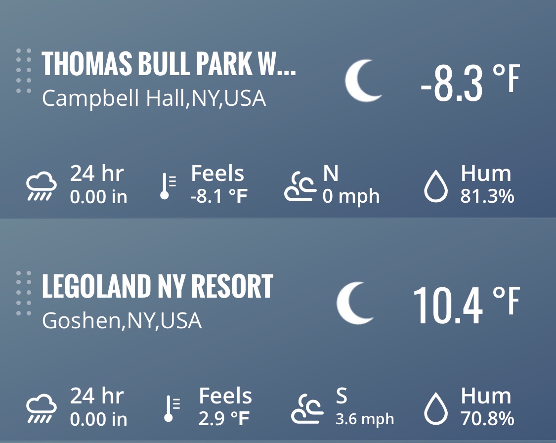
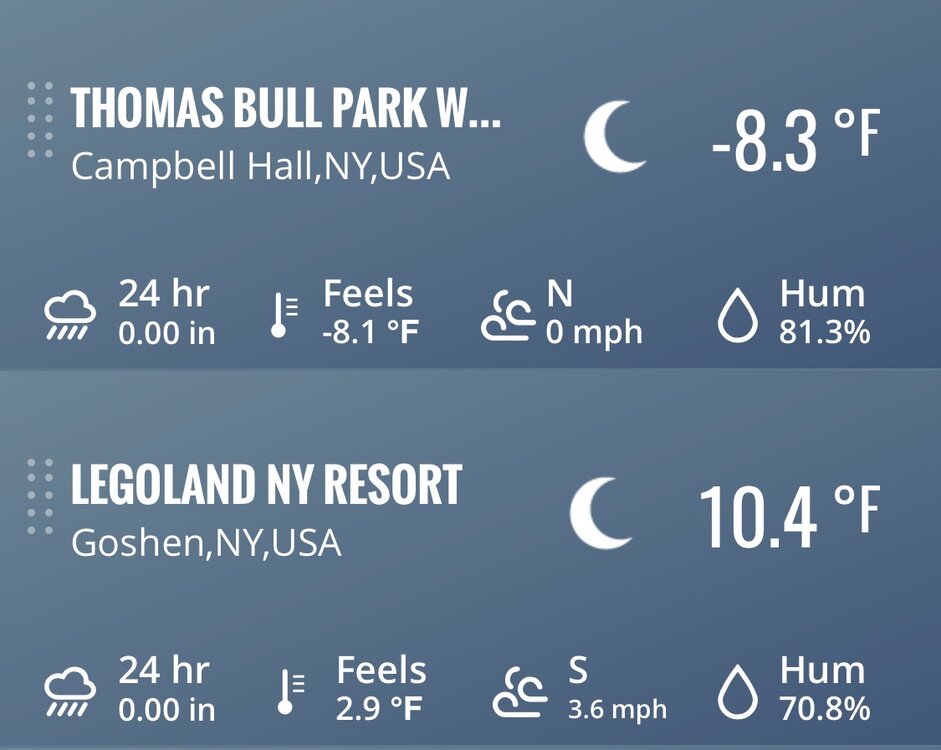
Perfect conditions for it. You'll see in the NW thread I post a screenshot that includes Legoland, 7 miles away as the crow flies, almost 19 degree difference. I thought I might have beat KMGJ for once but they got to -9 in between hours. When I was at -8 KMGJ was around 0. Cool stuff, only 2 miles away.
-
Looks like -8 will do it for the low here, up to -7 currently.
-
My forecasted low was adjusted from 4 to 2 last I checked around 9pm. It's currently -8
-
Today was .2 here. 2.9° currently.
-
Like knowing how to crop a photo?
-
Its legit light snow up here in central Orange County right now.
-
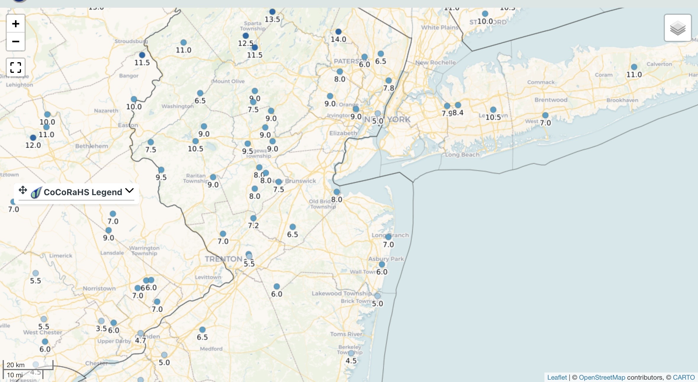
Low of 1 this morning, 15" at the stake. A nice solid pack out there this morning, https://maps.cocorahs.org/