g0ldl10n
-
Posts
13 -
Joined
-
Last visited
About g0ldl10n

-
Updated microwave imaging definitely showing the eye is becoming even more defined. This storm seems impressively resilient! Praying for all in its path! https://tropic.ssec.wisc.edu/real-time/mimtc/2024_14L/web/displayGifsBy12hr_05.html Screen_Recording_20241009_024841_Brave.mp4
-
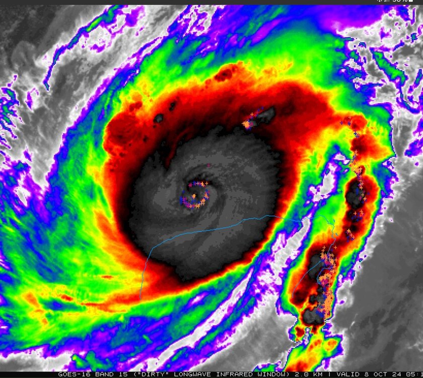
Microwave imaging seems to confirm EWRC is complete. https://tropic.ssec.wisc.edu/real-time/mimtc/2024_14L/web/displayGifsBy12hr_04.html Screen_Recording_20241008_023029_Brave.mp4
-
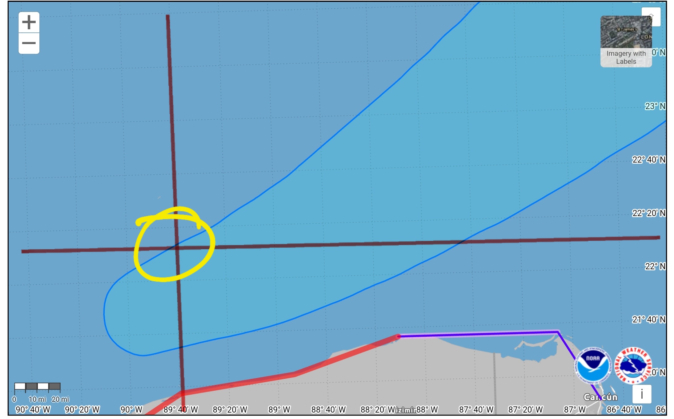
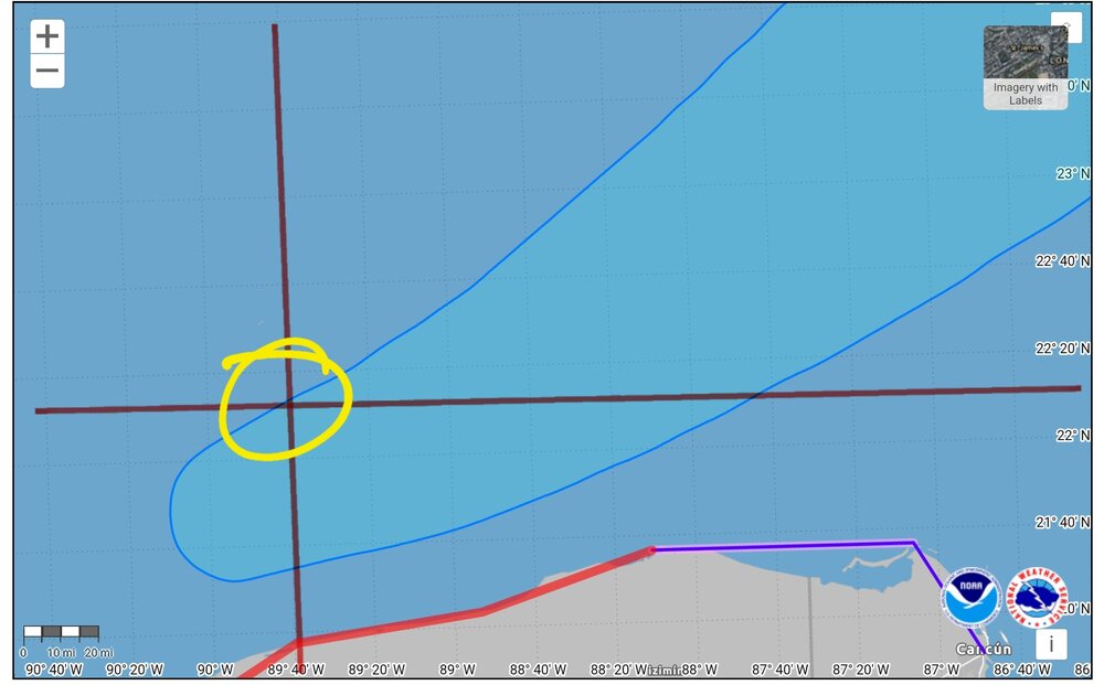
If that is the case, then that seems to have placed it's center now just at the very northern edge of the current NHC cone. Slightly north of 22N and east of 90W, and rough drawing on my part seems to show this. What I am not fully understanding, although, fully understand why the cone from NHC was target further south earlier today, with possible landfall on the peninsula is because of the steering currents. But what I am not quite understanding is what is effecting it's movement that has, and is still keeping it on the northern edge of even updated guidance? Looking at the steering "present" steering currents as well as the same 3 hours ago for sub 940 TC systems, I would have thought it would have made more of a move south. Anyone care to shed any light on why it seemed so resistant to that move despite the steering currents looking so conclusive? Also, how might this effect the overall path moving forward? Looking at the steering currents here. https://tropic.ssec.wisc.edu/real-time/dlmmain.php?&basin=atlantic&sat=wg8&prod=dlm6&zoom=&time=

-
Would we think the newly symmetrical ring of lightning flashes we see here would represent how large the new eye would be assuming it does clear out and complete the EWRC?
-
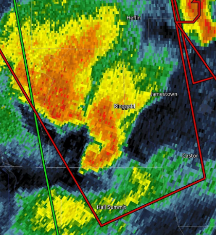
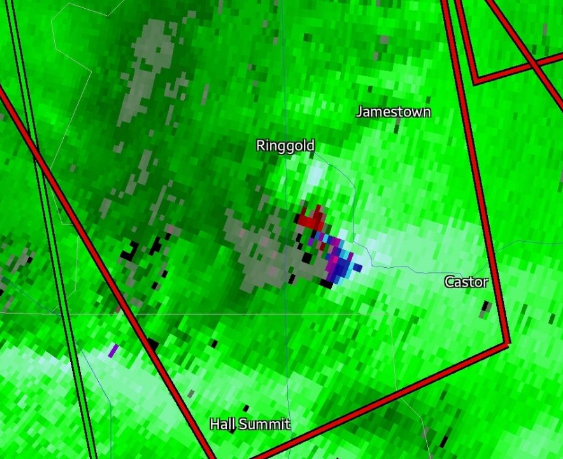
Was this an anticyclonic tornado here? Here is the velocity radar of that hook that appears to be going in the "wrong" direction?
-
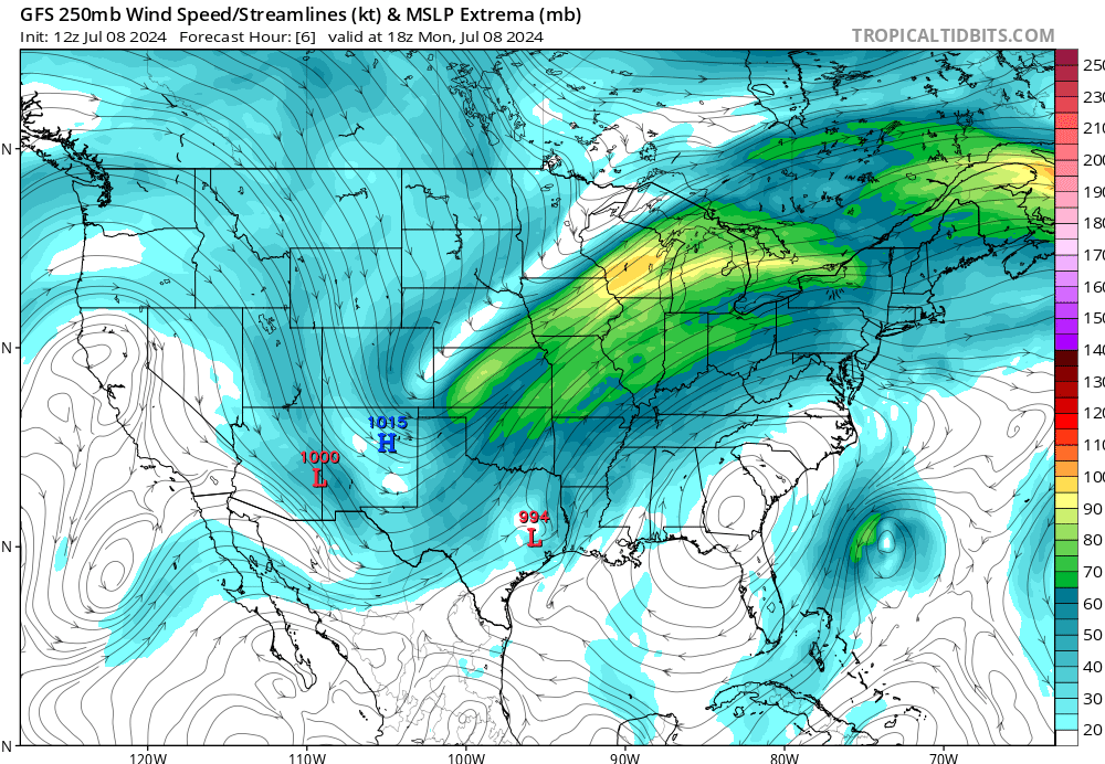
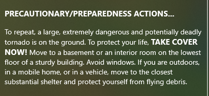
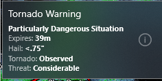
I am trying to learn here - weather my second love, with electronic engineering my first - but is this tornado outbreak being fueled by the high pressure system pushing in the opposite direction of the rotational direction Beryl is spinning? Or, are these winds at 250mb too high up to be causing this? Here, on this satellite feed, we can clearly see the high pressure system pushing directly into Beryl, which I would think is what is helping fuel this outbreak, but am not 100% sure here. https://weather.cod.edu/satrad/?parms=continental-conus-sandwich-96-1-25-1&checked=map&colorbar=undefined Asking because I know in the past when I have monitored hurricanes coming inland, they usually put down smallish and short lived tornadoes, however, a few of these have been confirmed as large with "Considerable" threat levels from NOAA, with the following tags. Also, these seem to be quite long lived - and hook echos are just everywhere - quite scary for the people in the path of this.
-
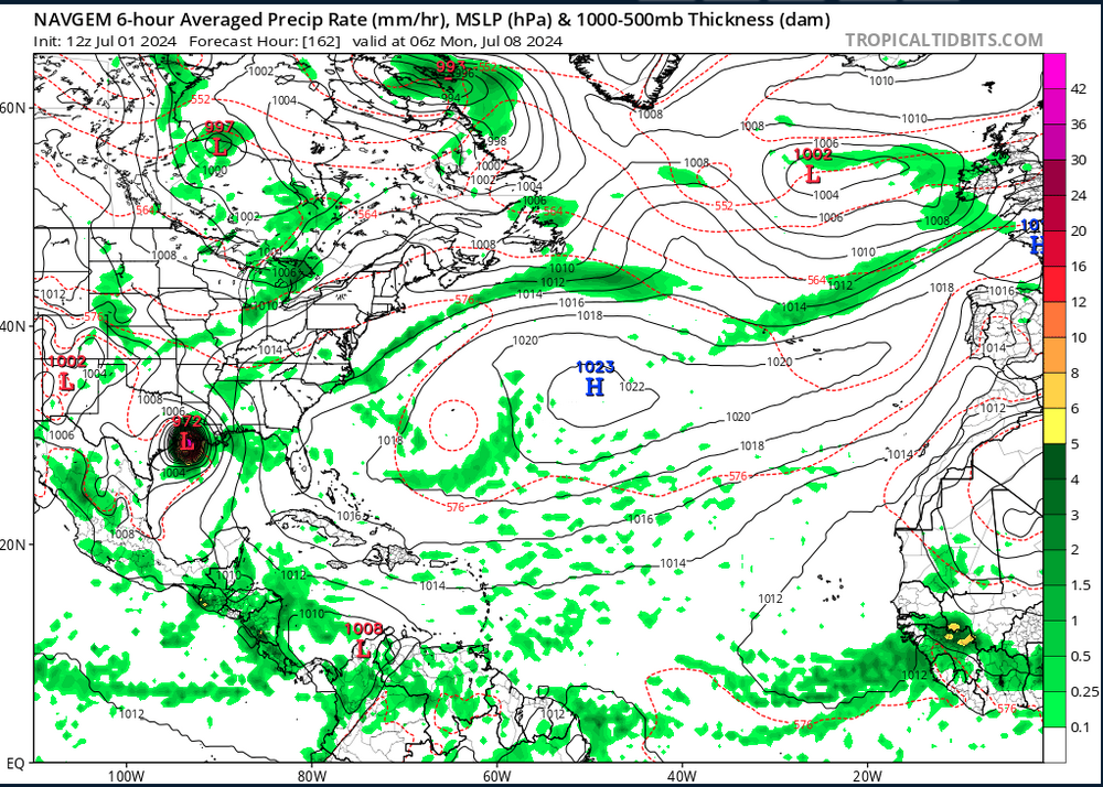
Well dang, this track from July 1 12z run from the NAVGEM is extremely accurate up to this point. Modeled pressure at current location of Beryl and this model is also only off by 5mb of offical NHC pressure right now. Quite interesting. https://www.tropicaltidbits.com/analysis/models/?model=navgem®ion=watl&pkg=mslp_pcpn&runtime=2024070112&fh=108
-
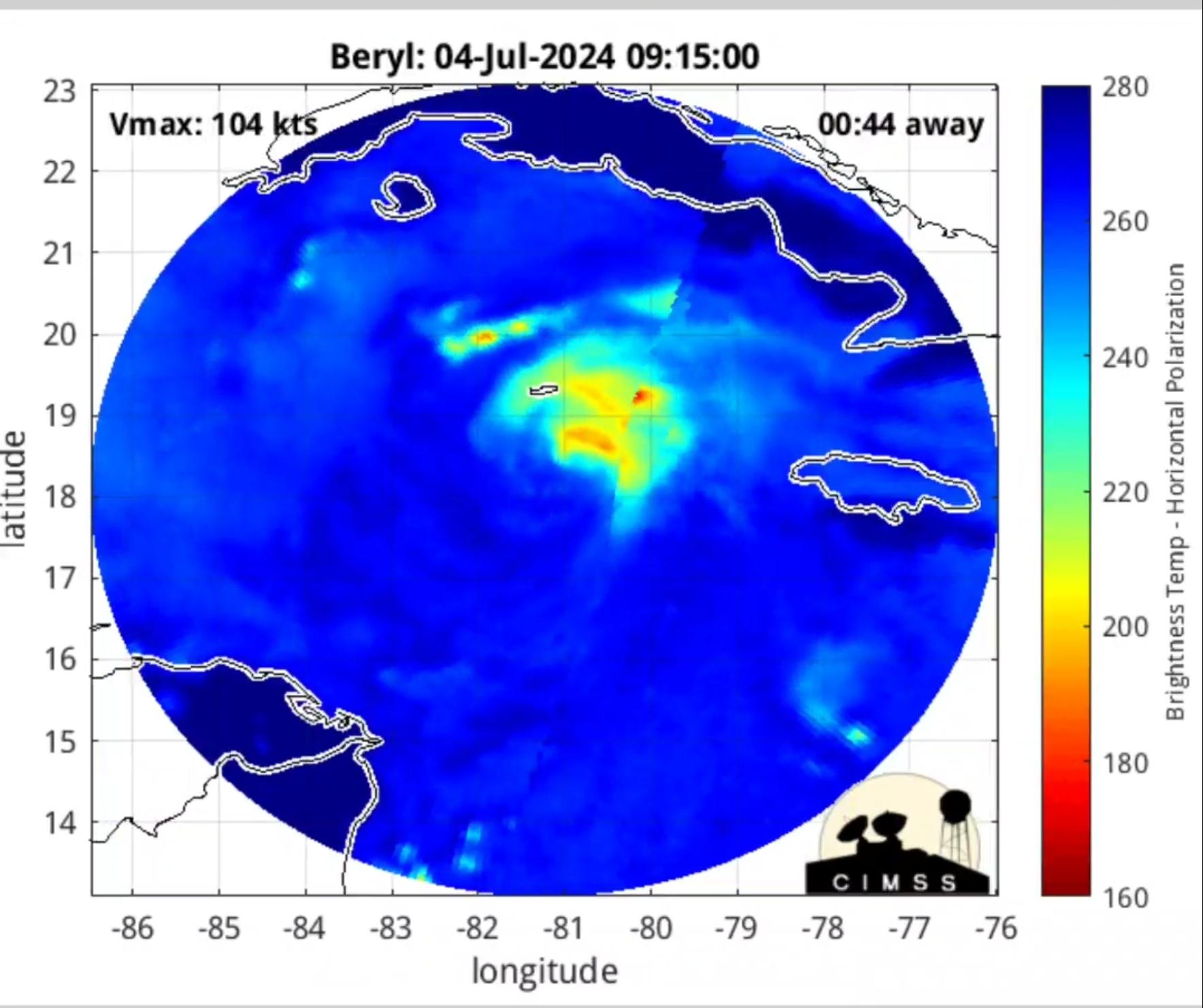
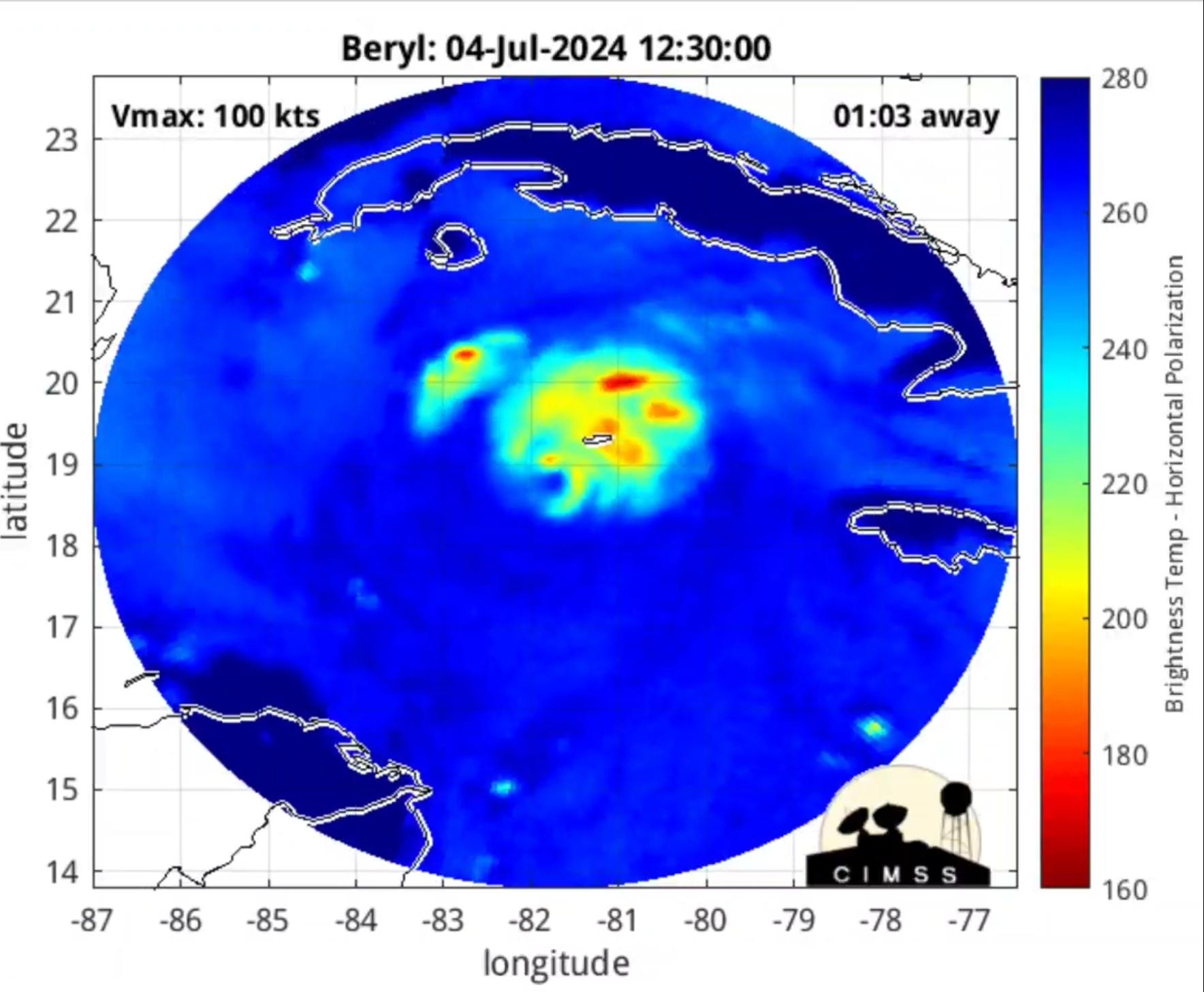
Well, this is looking better on satellite .. curious what recon finds.
-
@40/70 Benchmark here ya go https://tropic.ssec.wisc.edu/real-time/mimtc/2024_02L/web/mainpage.html
-
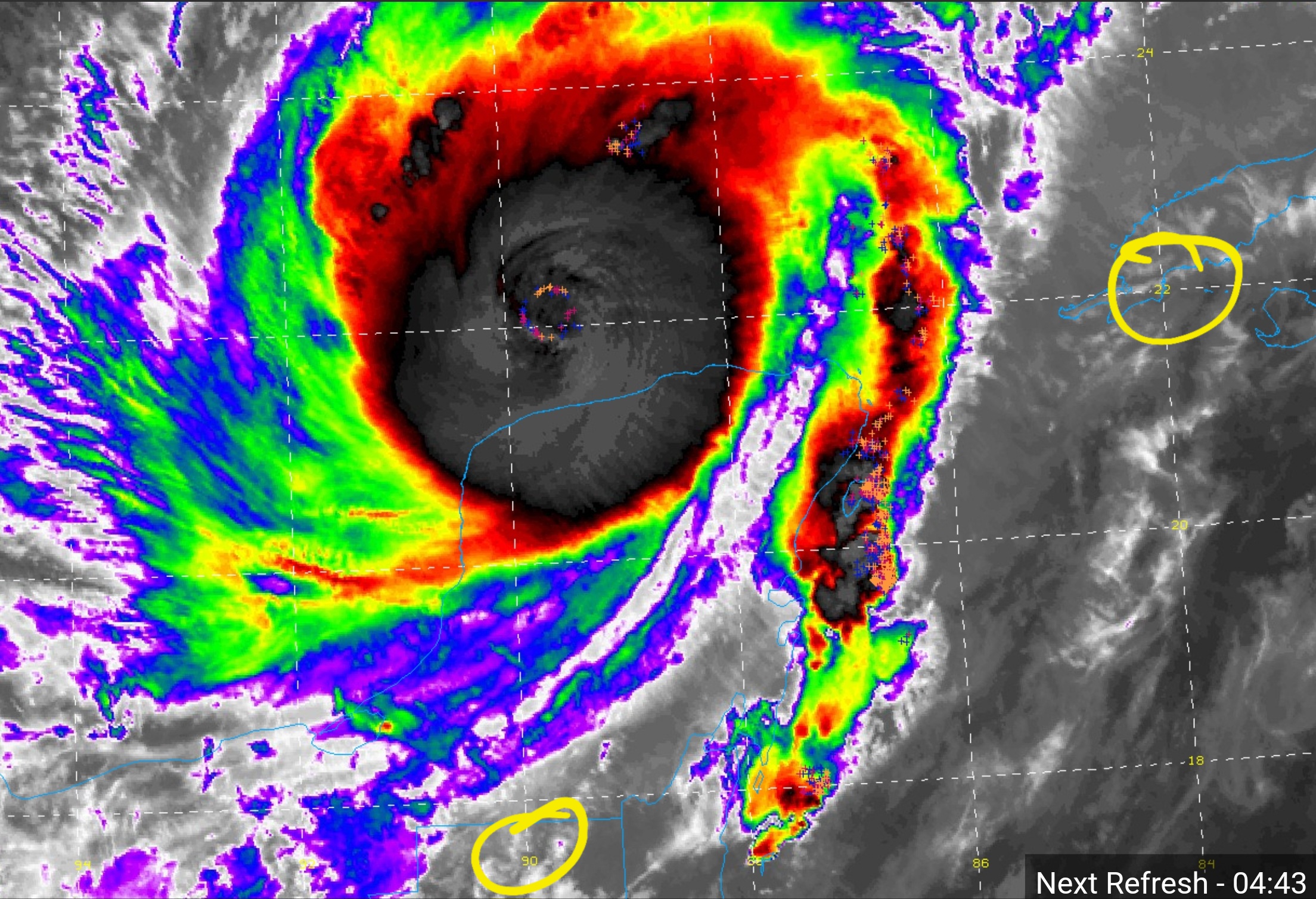
Microwave imaging from the last several hours showed no distinct eye, but in the past hour or so, it seems to be taking shape again.


-
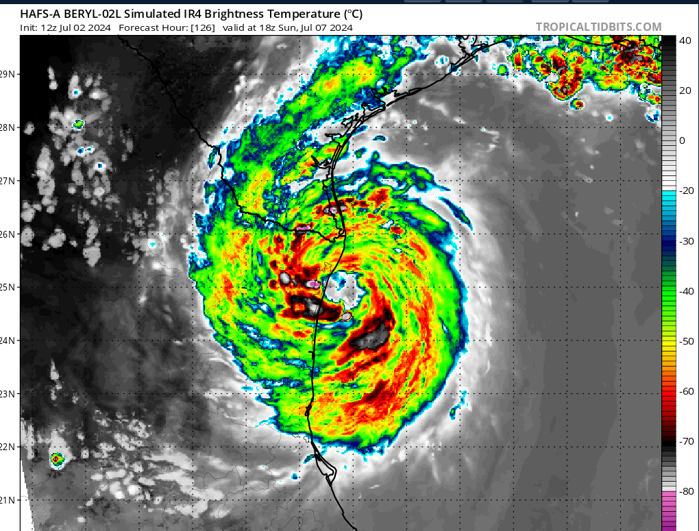
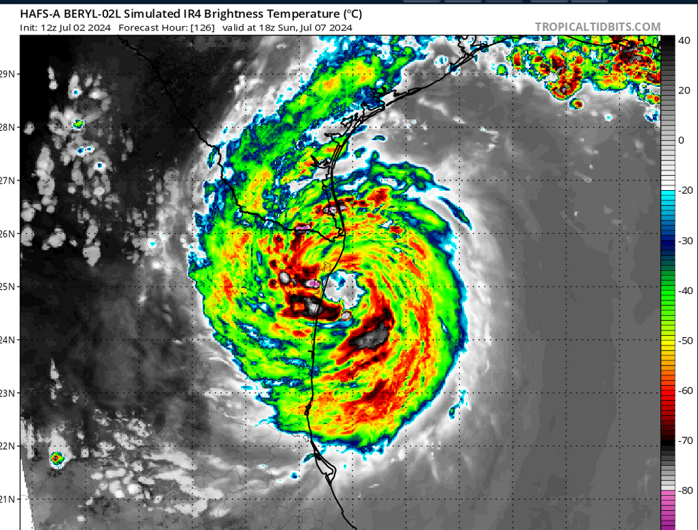
I noticed that too on the HWRF run - HAFS-A isn't far off from that same look, interestingly.
-
Yep, steering currents agree and show the stronger it stays, the more northerly path it will take.
-
How seriously should we take the NAVGEM models forecast.. it's outlook for path making landfall in LA has been pretty consistent over the past few runs.. its forecasted lowest pressure is also right at landfall in these runs.