stormy
-
Posts
2,117 -
Joined
-
Last visited
Content Type
Profiles
Blogs
Forums
American Weather
Media Demo
Store
Gallery
Everything posted by stormy
-
27.9 this morning!
-
28.5 degrees this morning!!! Clear, calm and heavy frost.
-
This likely carries us thorough through November ..........................
-
The CPC through November 8 calls for VERY DRY conditions..................... LA NINA sets in........
-
La Nina cool seasons are dry 84% of the time. More on this with my winter outlook, soon.
-
CAPE, try to understand, when I peruse this site, I'm usually skimming through without looking at or paying attention to nonsense or jokes. If a joke is directed at a post of mine, I pay attention. I very rarely direct a post toward another person unless it is 95% positive and designed to be helpful. People who know me understand how helpful I can be. I sincerely appreciate the tone of PSU's response. Please don't put it down with more nonsense. Nothing would please me more than to be friends with PSU.
-
A balmy 60 at 7 am. Behind the front, 38 degrees at Spruce Knob which should receive around an inch of snow tomorrow.
-
PSU, I do apologize. I already had a short fuse for other reasons. Bill Murray was the straw that broke the camels back. My criticism was ill conceived without properly digesting your other posts before and after Bill Murray. You and I have had an interesting interaction for a few years, sometimes like mixing sae 30 and water. I must say that I am impressed with your lean so far this fall. More on long-range cycles and less on all warm all the time. I have started work on my winter outlook. Yours is amazingly close to mine from 60 years of analogues. Have a good day!!
-
Bob: Thanks for your reasonable assessment. "Some setups more like a Nino than a Nina" , carries intelligence. You by yourself could easily make this board reasonable......................... As usual, PSU is a total failure.............. He has an amazing fan-base with nothing but crap...... Nothing more need be said.................
-
It is easy to see that the rest of October will be very dry. What will November thru March bring?????? This will be crucial to any snowfall probabilities. What are the thoughts of our experts??????
-
31.3 with heavy frost. 14 degrees colder than normal. The tied record for this date was 27 in 1994 and 1964.
-
shootin for 30 at 7 am...........................
-
38 with fog this morning.
-
Many western zones including Augusta will be under a frost threat Thursday night. My low is expected to be 31 - 34.
-
I'm not getting caught up in the futility of any long range models this winter. I remember last February and March all too well for that Nonsense. I totally agree with Bob when he talks about the disappointment of believing long-range stuff. I will soon post 60 years of analogue enso winters and results.
-
The GEFS and CMCE are much more realistic than the EPS with the NHC expectations for Milton in Florida.
-
What is this????????
-
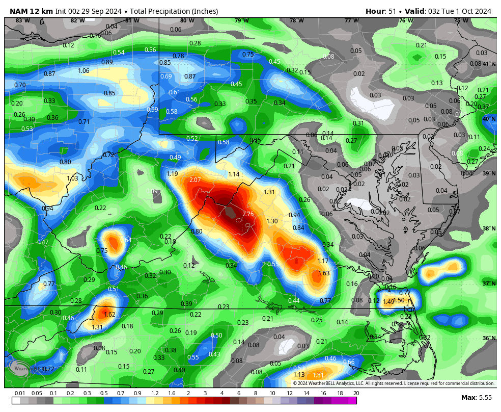
I have received 9.13 during this time. The NAM continues to hammer us since yesterday, run after run!! The latest from 06z - Another 4 - 5 inches??
-
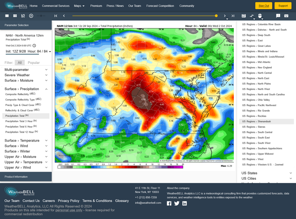
Hot off the press, the 00z NAM hammers Augusta County again!

-
That's amazing!! My high was 73 today.
-
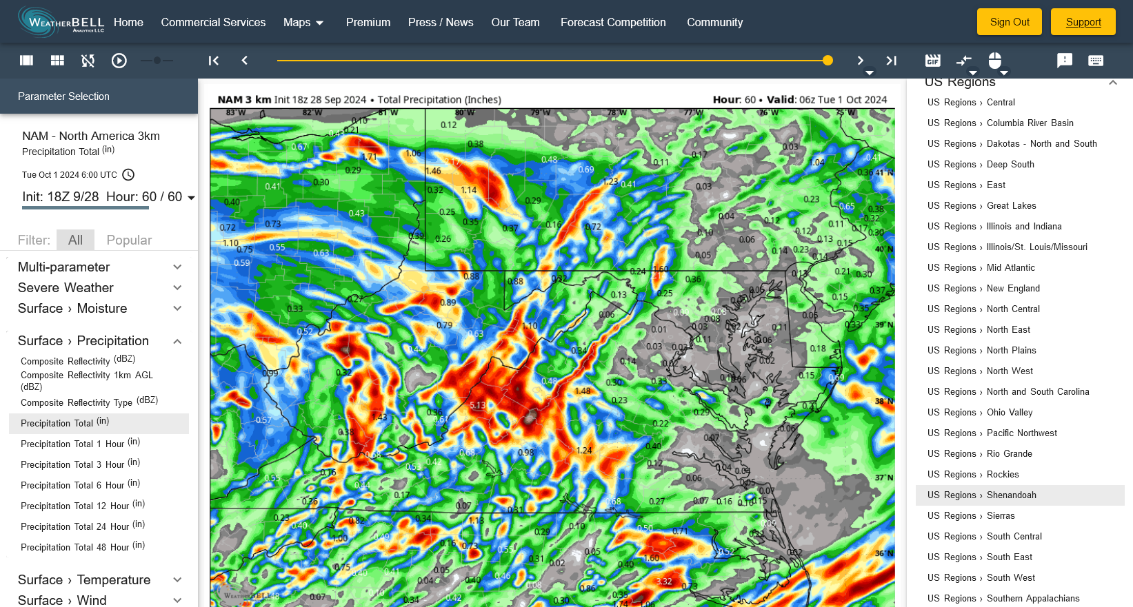
NAM 3k looks even worse thru midnight Monday.

-
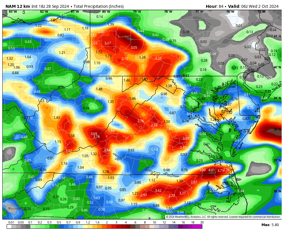
The 18z NAM found it's mind, but D.C. is still on the dry side of the equation.

-
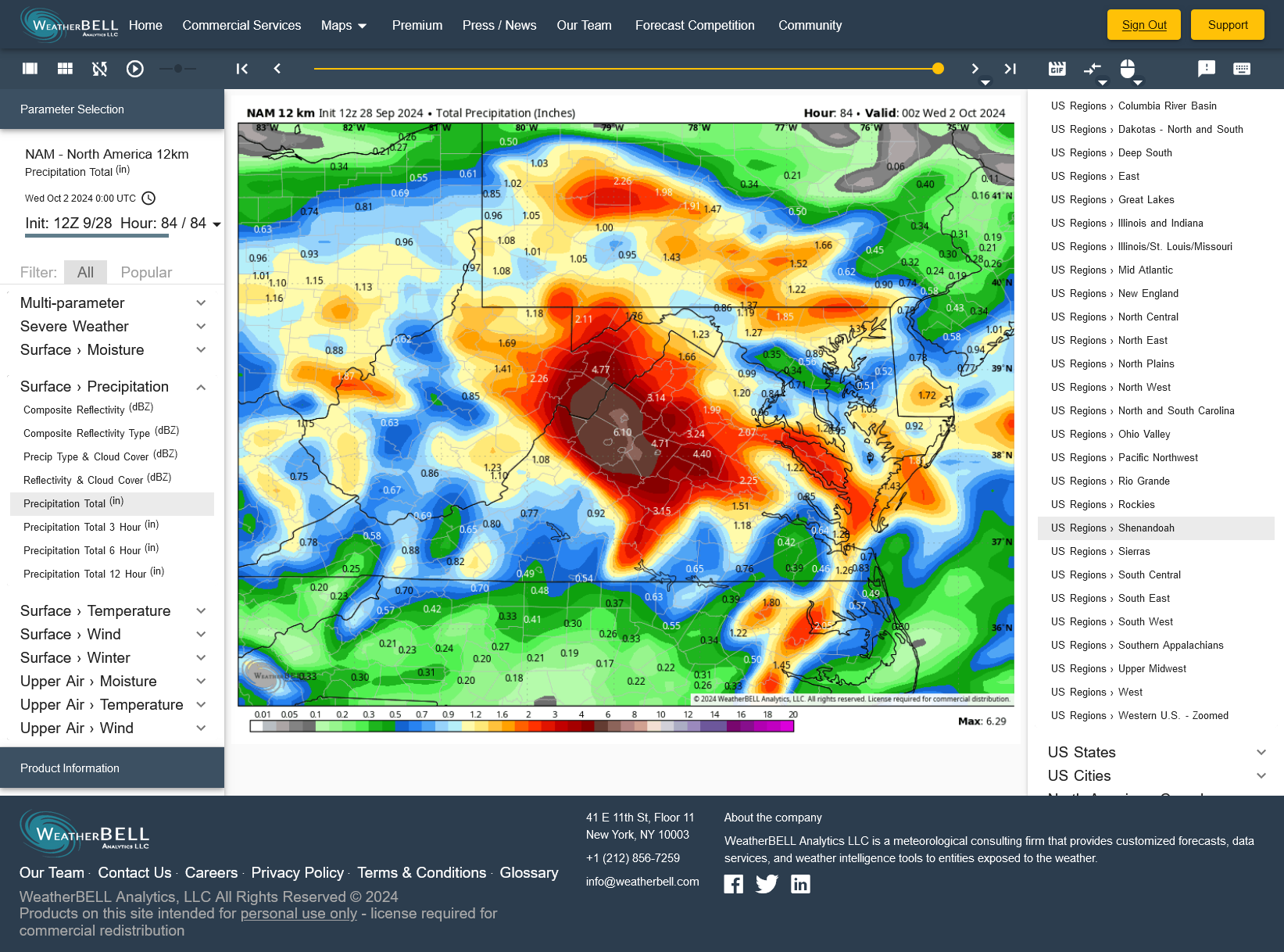
Has the NAM lost its mind??? Did it ever have one??
-
Down in this neck of the woods, we are so lucky! 5.21" during the past week and 3.92" the previous week for a total of 9.13" in 2 weeks!! But, less than 20 miles to my north, only half of that amount!
-
Had an easterly gust to 28 in a moderate squall about 10 minutes ago.