EWR757
-
Posts
94 -
Joined
-
Last visited
Content Type
Profiles
Blogs
Forums
American Weather
Media Demo
Store
Gallery
Everything posted by EWR757
-
 With the post-storm arctic air next week and fresh, significant snow cover the radiational cooling will be at it's maximum. especially Tuesday night into Wednesday morning with calm wind.
 -
Both the Google Graphcast and ECMWF AIFS show about 4" for me Sunday starting mid afternoon. They have both been very good 4 days out this season. The verification data on the ECMWF website is clear, ML models are superior to numerical models in the medium range. Waiting for and looking at each new operational model run is enjoyable (it reminds me of my friends that trade penny stocks or make sports bets), but the practice is obsolete. Ensembles have been around a while, and MLs are just getting started.
-
https://www.9news.com/article/weather/weather-colorado/denver-weather-station-dia-airport/73-860ca63c-4296-4ce8-be84-2e4cb70f2cb6
-
DEN is a weird case. The airport is on a windy plain, it is 6 miles from the SW corner to the NE corner of the airport. I don't know of any houses anywhere near the airport, within miles. Not the best place to measure snow depth.
-
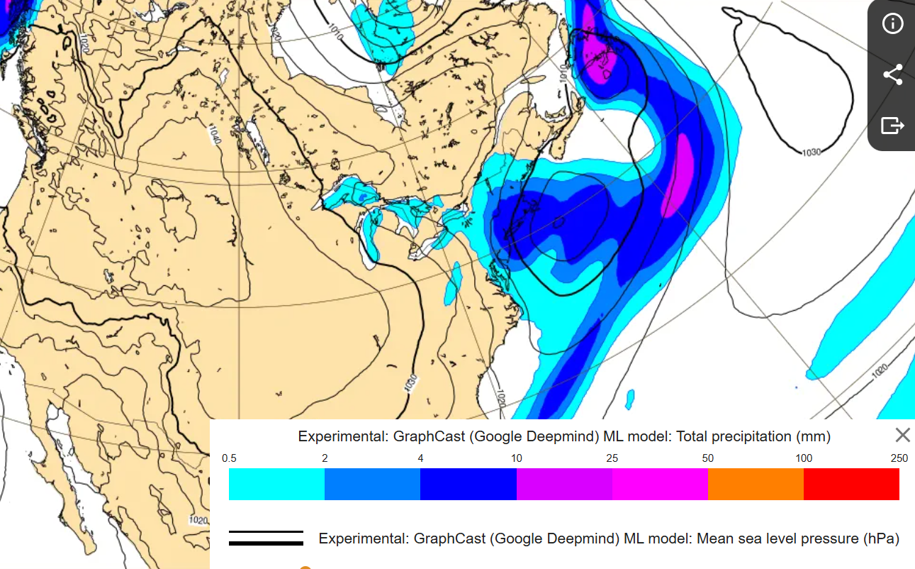
Google Graphcast 12Z Wednesday still shows several inches for most of the area, although along the immediate coast mixed precip/rain is forecast to be an issue.

-
Reminds me of my very dark winters on the east side of Cleveland. I'm grateful for the downsloping on the Eastern seaboard.
-
In reference to the 00Z models... Google Graphcast shows about 5.6" for me (Bridgewater, NJ) during the Sunday evening event, ECMWF AIFS 3" and the operational ECMWF about 2.1". The operational is further south and colder, while the Google Graphcast is north and maybe the precipitation may start off as rain? 850 temperatures are below 0 degrees C for the entire event but the 1000 mb temperature may be a tad warm at the onset, per the Google Graphcast model. All of the models start precipitation mid-afternoon Sunday and it ends around midnight, so about 9 hours of precipitation.
-
Does anyone know where snow is measured at JFK? Before airport reconstruction it was measured on the roof of the International Arrivals Building using a plastic cafeteria tray.
-
A buddy in upstate New York, near the Canadian border has reported precipitation in 54 of the last 57 days. Those lakes sure are warm, and the wind sure has been strong. Though, the western basin of Lake Erie is freezing over.
-
That looks mighty cold. If it verified, what are the surface temperatures?
-
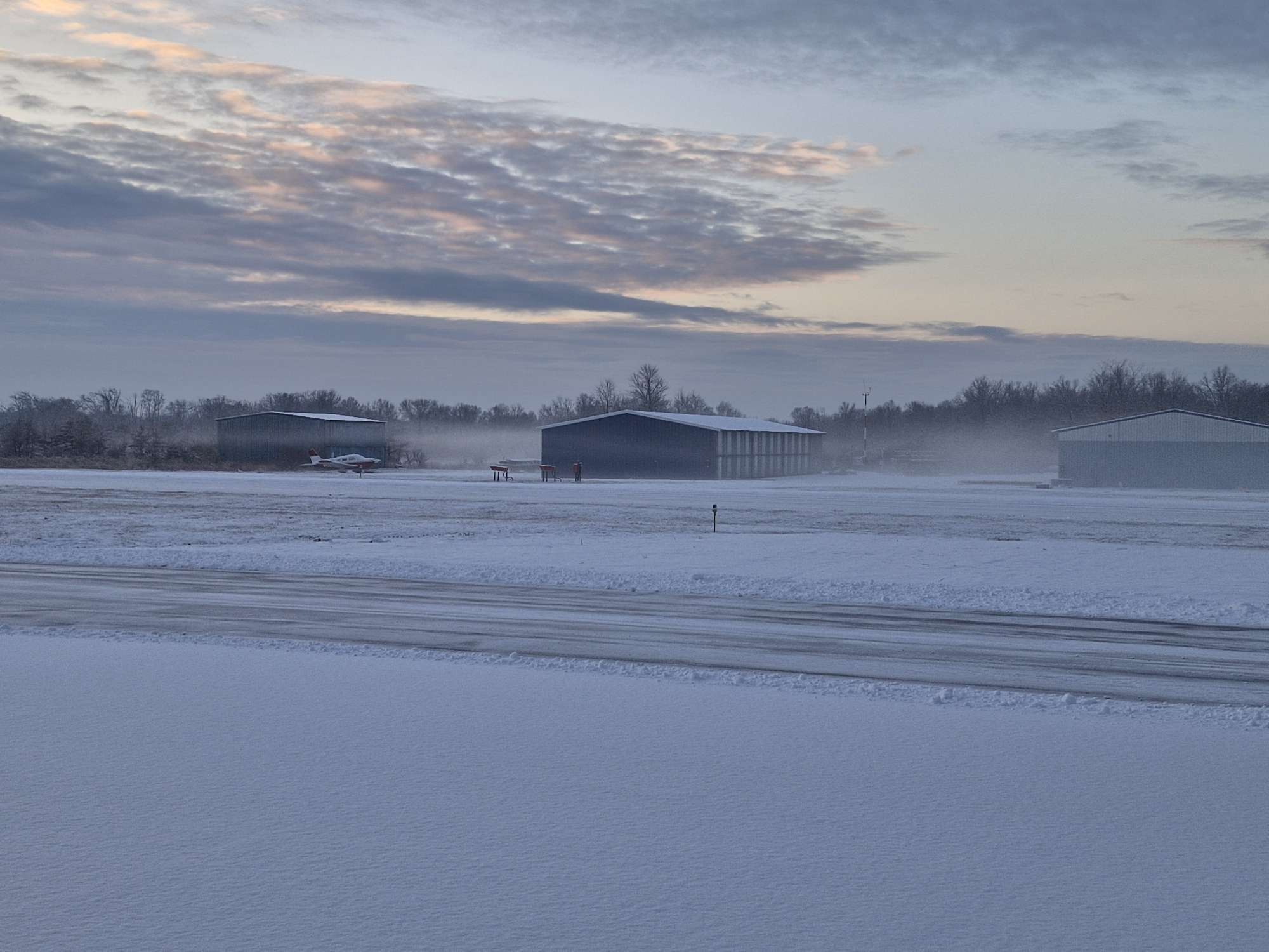
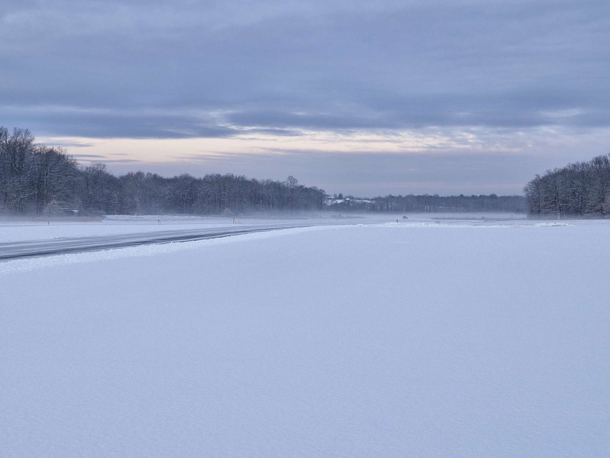
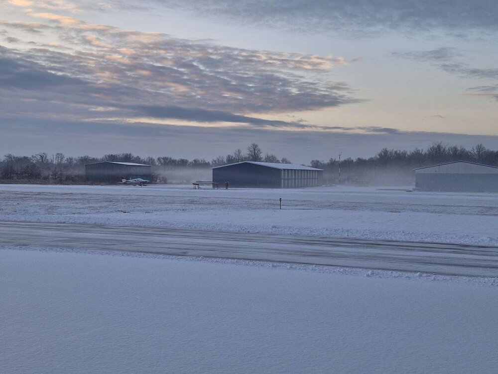
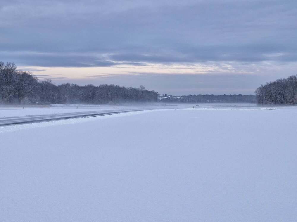
This aged really well. Picked up 1.3". Beautiful ground fog this morning after the snow. It's amazing what models can predict 4 days before an event these days. Rock solid.
- 993 replies
-
- 8
-

-
- metsfan vs snowman
- bomb
- (and 2 more)
-
They are objective. The humans that read them are not. https://thedecisionlab.com/biases/confirmation-bias Expand your toolbox (diversify) and have multiple sources. Give less weight to those sources that tend to be statisitically unreliable (GFS, NAM) and more weight to those that are more reliable (ECMWF, Ensembles, New ML models). “If the only tool you have is a hammer, you tend to see every problem as a nail.”
- 993 replies
-
- 3
-
-
- metsfan vs snowman
- bomb
- (and 2 more)
-
This is pathetic. I live in the Mt. Holly CWA. The GFS shows 1.7 inches of snow, the Graphcast 1.5 inches of snow and the ECMWF looks fairly similar to those two. There is a model consensus but the NWS posts (on social media), they don't know? Nothing favors a significant snow event at this point, not even the long-wave pattern. Hopefully the same meteorologist isn't writing TAFs. Regarding the upstate NY thing, I went to school at SUNYA. Wonderful meteorology school back in the day, but once I graduated I went south on I-87 and never looked back. There are some nice places in upstate New York, and the Hudson Valley in my opinion is magic and unique in the world. But, economic opportunities are few and far between and there is a lot of sadness.
- 993 replies
-
- 3
-
-
- metsfan vs snowman
- bomb
- (and 2 more)
-
Knots.
-
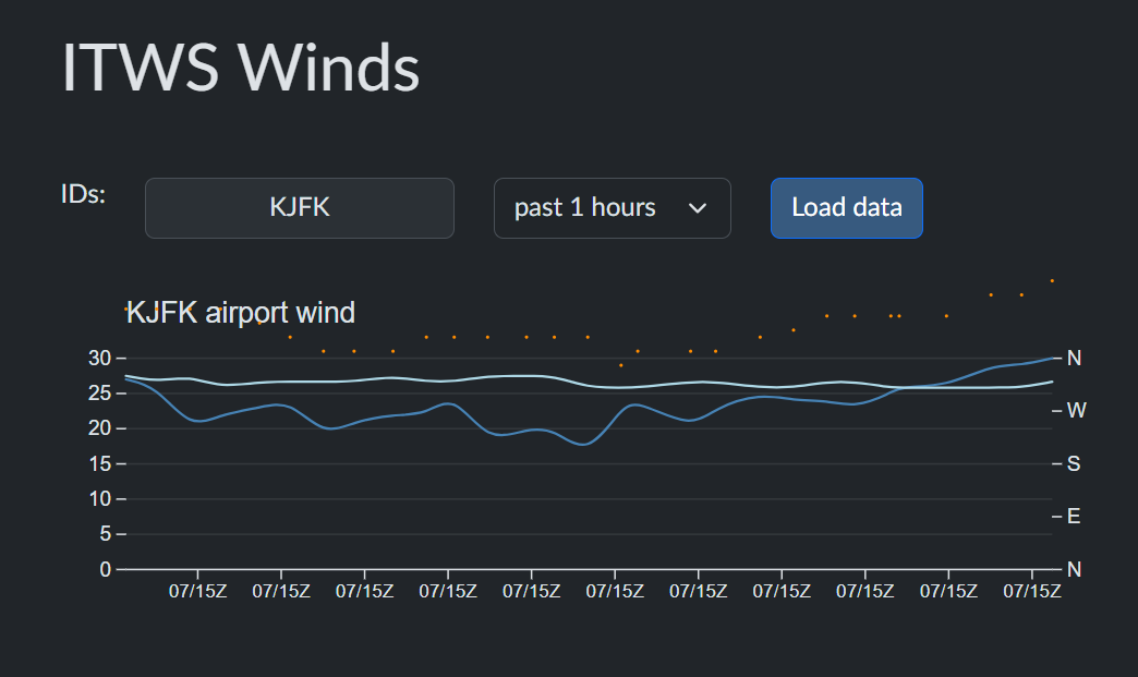
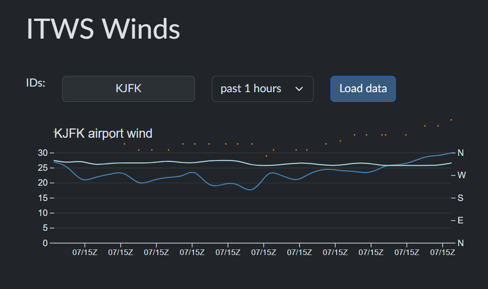
Here is a better link for instant winds: https://runwayweather.com/itws
-
It would be useful if the scale continued beyond 30 knots. The wind gusts at JFK have really increased the last hour. https://www.weather.gov/wrh/timeseries?site=KJFK&hours=72&units=english&chart=on&headers=on&obs=raw&hourly=false&pview=standard
-
I too remember the days of the LFM, NGM, ETA and AVN models. Modelling has come a long way as has the understanding and science of the atmosphere. In addition, various observational networks have increased several fold. Data that we could have only dreamed of 20 years ago is readily available in real-time these days. I assume that machine learning and deep learning will eventually make numerical and deterministic modelling obsolete. The challenges are how humans will interact with the new technology. As with my industry (aviation), the art of the career becomes less and less as more work becomes automated. The need for human intervention will continue to exist (for now), but the job descriptions change. As far as medicine, unfortunately there are a lot of conflicts of interest, lack of oversight and miscommunication. That field has a long way to go, although strides have been made. Fields like meteorology and aviation, for example, are much more matured at this point. Three decades ago, aircraft accidents were frequent. There are many more flights now than at that time, and thankfully accidents are exceedingly rare. Same is true for forecast busts. Now, if only human psychology can mature as quickly as technology. Interesting times ahead...
- 993 replies
-
- 4
-
-
- metsfan vs snowman
- bomb
- (and 2 more)
-
The GFS needs to be decommissioned. I think the LFM was a better model.
- 993 replies
-
- 1
-
-
- metsfan vs snowman
- bomb
- (and 2 more)
-
Yeah, over 40 West longitude.
-
The AI/data-driven models are significantly further south and weaker with the low on January 11-12 than the deterministic/operational GFS and ECMWF. I'm not sure why the AI stuff isn't embraced more, it's difficult to disagree with the superior verification of the technology.
-
For those enthusiasts that love stratocumulus clouds, the next two weeks should be really exciting.
-
Very mean looking altostratus pattern out there again. Is this what Antarctica is like? Dry, cold and windy?
-
It seems the way we measure snowfall these days isn't ideal, either. It's overinflated compared to previous generations measurements, no? Snowfall is already difficult to measure. Using a snowboard, wind, measuring every six hours. If an observer does this by the book the results are likely significantly inflated compared to a maximum daily snow depth. I think it would be good to revisit how we all measure snowfall. There is so much subjectivity and inflation I'm not sure the numbers mean than much. I remember living in the Midwest with a day of lake effect snow. It may have snowed 30" for the event in a day, but the snowdepth at any given time never exceeds 16". Silliness.
-
3.5" snow depth this morning on the north side of Bridgewater, NJ at an elevation of about 400 ft.
-
One nice thing about the stratus and fog on Monday is that the good people of NJ didn't see any space aliens or UFOs, also known as aircraft landing at EWR and TEB. As the weather becomes VFR later today the "UFOs" should be visible again, well at least when said observers aren't looking at their TikTok or SKIMs discount messages.