soadforecasterx
-
Posts
145 -
Joined
-
Last visited
About soadforecasterx

-
E PA/NJ/DE Summer 2026 Obs/Discussion
soadforecasterx replied to PhiEaglesfan712's topic in Philadelphia Region
Ended up with 1.17" last night, hopefully we dont go another 2 week before we get rain again. -
E PA/NJ/DE Spring 2026 Obs/Discussion
soadforecasterx replied to PhiEaglesfan712's topic in Philadelphia Region
Anyone have the storm reports for yesterday? I want to see if I got the worst of things. -
E PA/NJ/DE Spring 2026 Obs/Discussion
soadforecasterx replied to PhiEaglesfan712's topic in Philadelphia Region
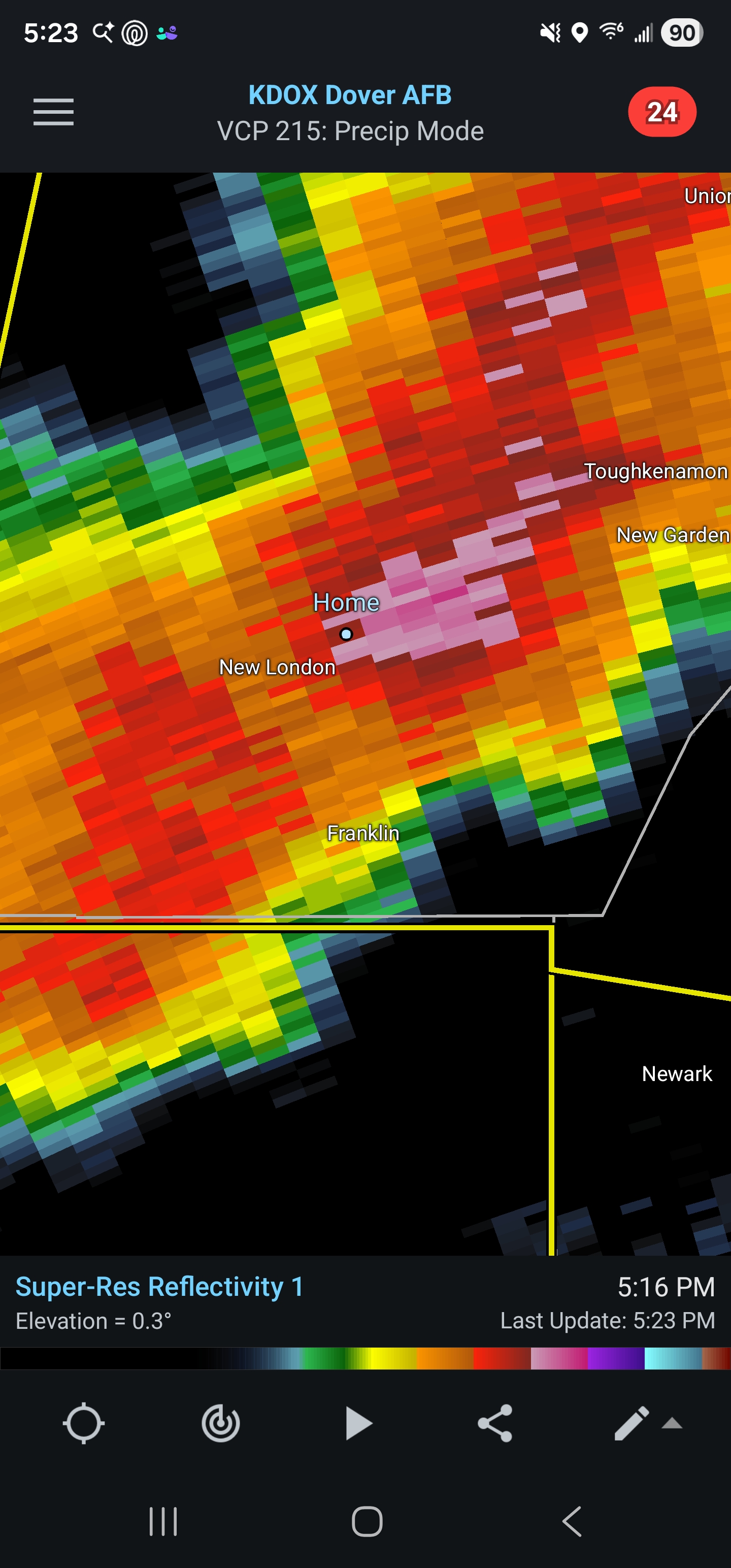
Got crushed here in west grove. dime to nickel sized hail with winds in excess of 60 mph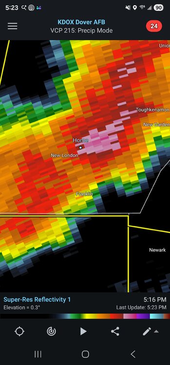
-
Feb 22nd/23rd "There's no way..." Storm Thread
soadforecasterx replied to Maestrobjwa's topic in Mid Atlantic
This is where we need the CRAS model, that was always the marker for an over amped system. -
Feb 22nd/23rd "There's no way..." Storm Thread
soadforecasterx replied to Maestrobjwa's topic in Mid Atlantic
RGEM still showing hope -
Late February/Early March 2026 Mid-Long Range
soadforecasterx replied to WxUSAF's topic in Mid Atlantic
I just want Nam to show a crazy amp'd solution just to show some false hope -
Late February/Early March 2026 Mid-Long Range
soadforecasterx replied to WxUSAF's topic in Mid Atlantic
Now RGEM has my interest -
Late February/Early March 2026 Mid-Long Range
soadforecasterx replied to WxUSAF's topic in Mid Atlantic
Looks like energy doesnt fully catch up in time to capture the low. still would be a good hit but low would move NE from here.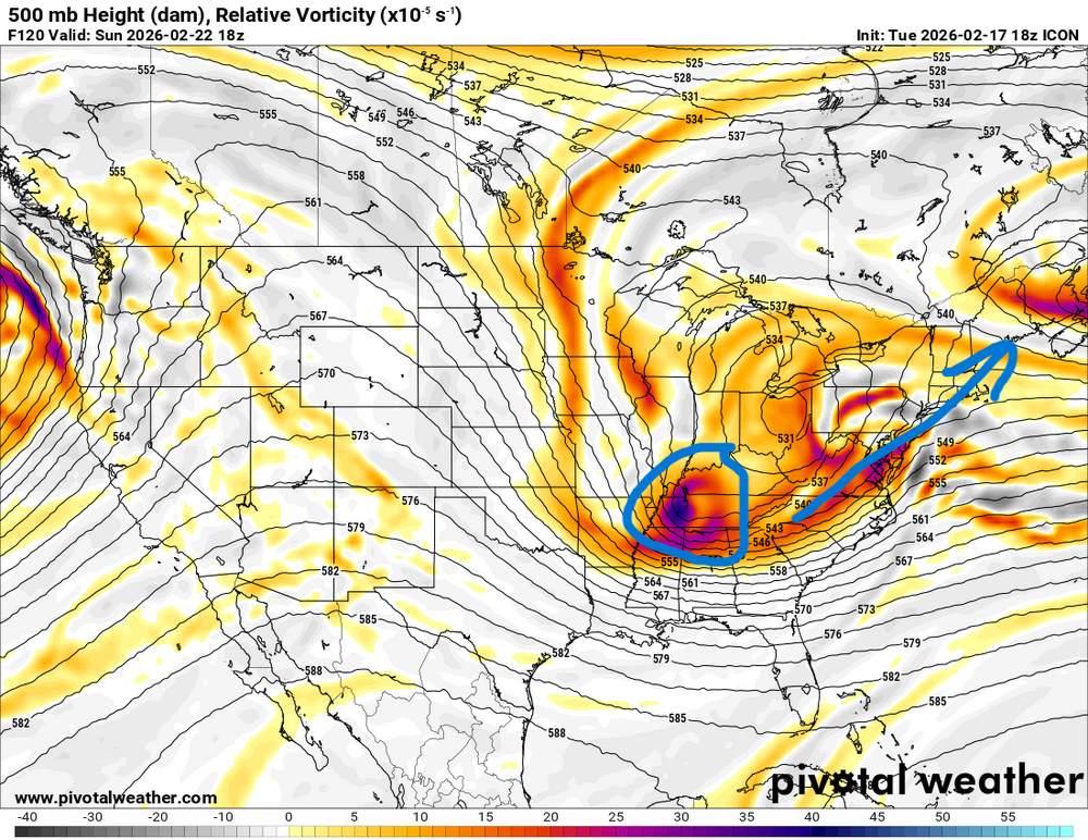
-
Late February/Early March 2026 Mid-Long Range
soadforecasterx replied to WxUSAF's topic in Mid Atlantic
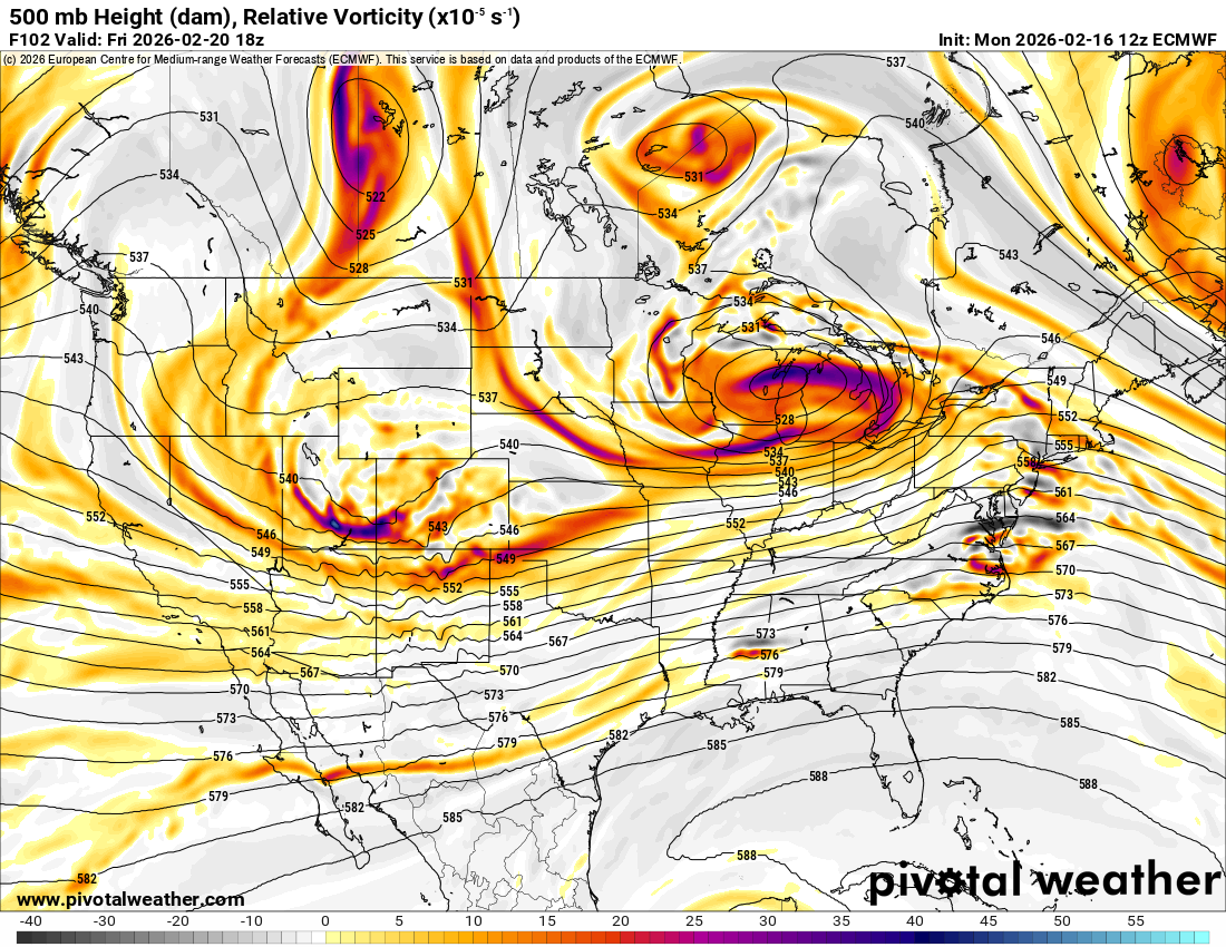
GFS seems to be slowly stepping away from the storm since 00z at 500 -
Late February/Early March 2026 Mid-Long Range
soadforecasterx replied to WxUSAF's topic in Mid Atlantic
well at the 96 hour window you can start to see if there will be a storm or not. Not sure what one is right but atleast gives you a window into the idea of a storm or not.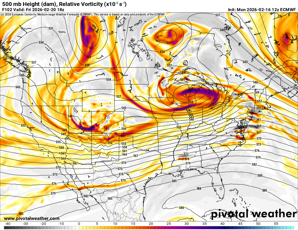
-
Late February/Early March 2026 Mid-Long Range
soadforecasterx replied to WxUSAF's topic in Mid Atlantic
IDK seems like Nam/GFS did a good job for the most part with this part storm.
-
Late February/Early March 2026 Mid-Long Range
soadforecasterx replied to WxUSAF's topic in Mid Atlantic
-
Late February/Early March 2026 Mid-Long Range
soadforecasterx replied to WxUSAF's topic in Mid Atlantic
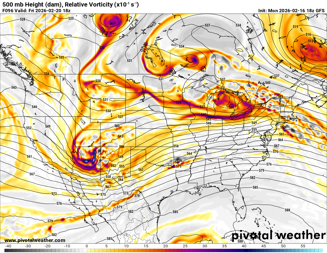
slowly pulling away at 174 -
Late February/Early March 2026 Mid-Long Range
soadforecasterx replied to WxUSAF's topic in Mid Atlantic
stalled and tucked. sign me up please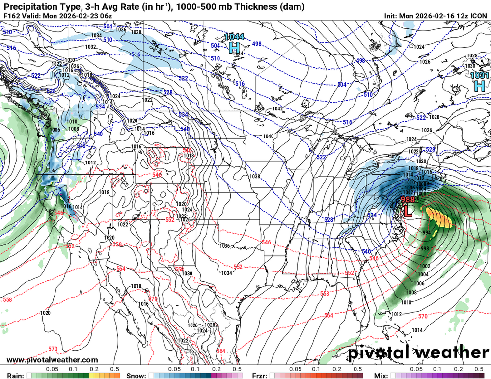
-
Late February/Early March 2026 Mid-Long Range
soadforecasterx replied to WxUSAF's topic in Mid Atlantic
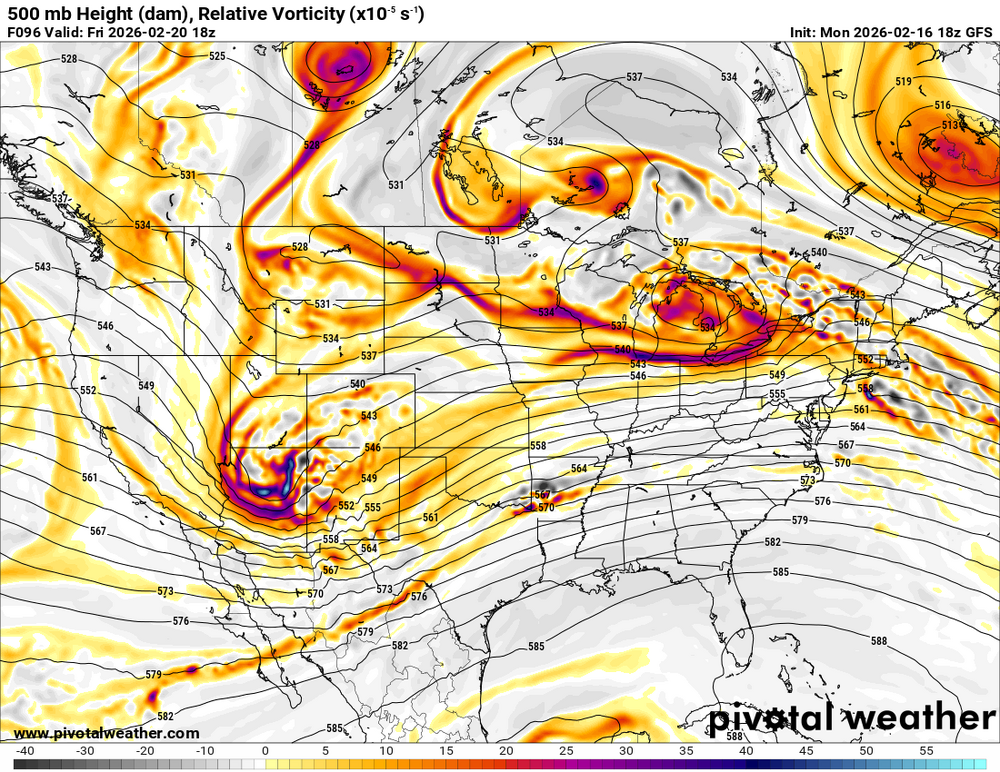
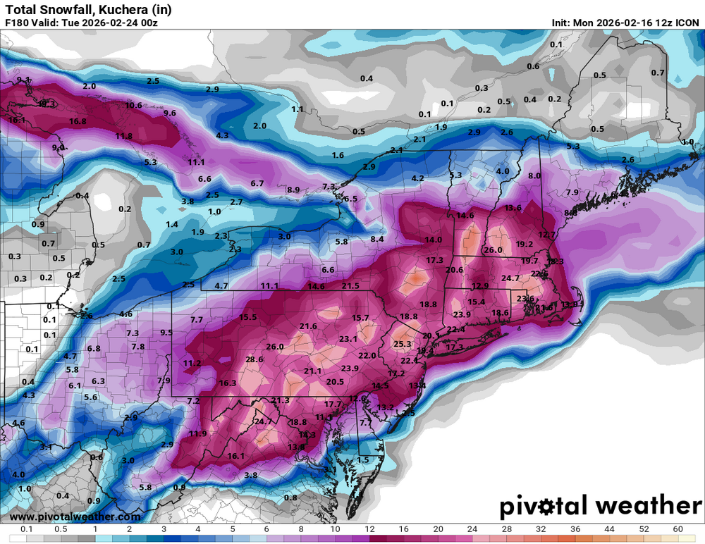
wow icon straight porn