

09-10 analogy
-
Posts
1,209 -
Joined
Content Type
Profiles
Blogs
Forums
American Weather
Media Demo
Store
Gallery
Everything posted by 09-10 analogy
-
Pummeling. LONG duration 40-50+ winds. Been waiting all Summer for this one
-
Now this is a storm
-
We're getting a downpour but, geez, that downburst north of Baltimore meant business, evidently.
-
Not a drop and not much of a puff. At least, not so far. Maybe the fill-in will grace us with its presence. LWX's map looks like a popsicle collection:
-
Seems to be a semblance of a shelf cloud with this cell; haven't seen too many of those recently. Don't have a real good vantage, though, and am too lazy to go up to Fort Reno. Warned in S MOCO; ought to be getting a warning for NW DC at least soon.
-

2023 Mid-Atlantic Severe Wx Thread (General Discussion)
09-10 analogy replied to Kmlwx's topic in Mid Atlantic
Well, immediate DC area, according to SPC meso, we've got 3500-4000 SBCAPE to work with, if I'm reading the squiggly lines right. We had any kind of shear at all, things would be rocking around here.- 2,785 replies
-
- 1
-

-
- severe
- thunderstorms
- (and 3 more)
-
2023 Mid-Atlantic Severe Wx Thread (General Discussion)
09-10 analogy replied to Kmlwx's topic in Mid Atlantic
Hyped days underperform; meh days overperform. Going with that mantra for this afternoon. Nonscientific but, hey, I'm not a scientist.- 2,785 replies
-
- 1
-
-
- severe
- thunderstorms
- (and 3 more)
-
2023 Mid-Atlantic Severe Wx Thread (General Discussion)
09-10 analogy replied to Kmlwx's topic in Mid Atlantic
Yep, wide south. Happens not infrequently in Tenley. Still remember the tornadic storm that went through N Arlington/Foggy Bottom a couple of years ago ... t'wernt much here. At least I (used to) get more snow than they do, but as Joni Mitchell once wrote, it don't snow here, it stays pretty green.- 2,785 replies
-
- 1
-
-
- severe
- thunderstorms
- (and 3 more)
-
2023 Mid-Atlantic Severe Wx Thread (General Discussion)
09-10 analogy replied to Kmlwx's topic in Mid Atlantic
Well whatever we're getting is soon to arrive. The wall of doom grey is a bit ragged along the horizon, it's not a solid block of menacing TSTM+++++ coming in. From NEXRAD, the Rt 7 express stuff I had hopes for seems to be weakening just like everything else. Oh, well, I can always move to Moore or Tanner. -
2023 Mid-Atlantic Severe Wx Thread (General Discussion)
09-10 analogy replied to Kmlwx's topic in Mid Atlantic
Storms seem to be percolating in NVA (e.g. Leesburg) even as they're choking off in C MD. -
2023 Mid-Atlantic Severe Wx Thread (General Discussion)
09-10 analogy replied to Kmlwx's topic in Mid Atlantic
It'll be interesting to see if the powerful storms moving thru MOCO/NVA can lay down any boundaries that may goose (or perpetuate) the storms lining up on I-66 in the Front Royals area, so that (yes, MBY) NW DC can get in on some good stuff a bit later.- 2,785 replies
-
- 1
-
-
- severe
- thunderstorms
- (and 3 more)
-
Oh, yeah, vehicles. They've got sirens too. I'm so dense sometimes.
-
You have severe weather sirens out there? I usually associate that with places like Oklahoma or Kansas. Of course I've never lived in a semi-rural area ... correct me if I'm wrong if you don't ... so maybe that's de rigueur in most places. I remember driving through S/C Oklahoma once, through the town of Frederick. On the SW side of town, every other telephone pole, it seemed, had a speaker. I assume it was for the sirens and that they were located there to warn of storms/tornadoes approaching from the SW. But that's just supposition on my part; maybe there were there just to play selections from a Rogers and Hammerstein musical on Cadillac Day, for all I know. Anyway, the sight of those sirens made me think of tiny vulnerable towns in the Great Plains, which could be suddenly eradicated from existence by a Greensburg/Udall type event, and these little sirens were a brave way of trying to mitigate existential (and usually nighttime) destruction.
-
Clear as a bell directly overhead but I see some cumulus congestus (or something akin) off to the N/W. Must be a hell of a cap in place. And, yeah, muggy and uncomfortable. Seems like today could go either way: little to nothing in the immediate area, or a solid severe wx event? Just read the afternoon AFD. Outflow boundaries, baby! Spawn those storms like mosquito larvae in a swamp.
-
Ryan O'Hearn channeling his inner Steve Pearce this weekend ... and for that matter, all year. Pearce seemed to always get the big hits in 2014. This team is definitely the best O's team since 2014. Picking up Miller at the deadline gave the O's that year three horses in the pen, along with O'Day and Zach; that bullpen was nearly untouchable down the stretch, IIRC. I'd like to see this year's O's get another powerhouse reliever to go with Bautista and, especially, Cano, who I worry will get overworked. (And, no, unfortunately I don't think Fujinami is the second coming of A. Miller.)
-
The hell with Game of Thrones ... Felix is the real "Mountain."
-
I'm all in favor of bolstering the rotation but not at the expense of too much young talent. And the ones I'd be in favor of trading (e.g., Cowser and Stowers) have struggled so far and probably wouldn't get much back that's any better than what we have. (I was surprised to see that Wells is leading the league in WHIP, which is important given how many HRs he gives up.) I can't see Elias parting with Holliday, for instance. Ohtani would be a lot of fun, but he's a rental who's not going to sign in Baltimore for the long term. That said, this is a very balanced lineup. According to Baseball Reference, six of the O's nine starters have OPSs over .800. That's counting Hicks, but Mullins cannot get back too soon since I don't trust a 33-year-old with a lifetime 97 OPS+
-
On the bright side, Hyde saved Yennier and the Mountain for the balance of the series.
-
I think grod was overthrowing in the first inning
-
Santander and Hays have really stepped up this year. For all the hype about Adley and Gunner, the two "leftovers" have been the heart of this offense.
-
Very cool! Looks like a younger version of my daughter when she was Timon in the Lion King in eighth grade. She had some real talent and charisma, more than I did when I acted some, but she never really liked acting that much (or dance, either, like her mom), and they've got to be allowed to do their own thing. Here's to many more theatrical triumphs by your daughter!
-
2023 Mid-Atlantic Severe Wx Thread (General Discussion)
09-10 analogy replied to Kmlwx's topic in Mid Atlantic
Here in up nw ... probably. Kinda sad. -
2023 Mid-Atlantic Severe Wx Thread (General Discussion)
09-10 analogy replied to Kmlwx's topic in Mid Atlantic
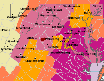
Lotta lightning off to the N&W. According to Ventusky, there's a bit of a surface low (29.9) reflection NW of Germantown, but I don't really see it on the SPC Mesoanalysis. Anyway, DC is now severe warned: Severe Thunderstorm Warning Severe Thunderstorm Warning DCC001-MDC031-033-VAC013-059-142230- /O.NEW.KLWX.SV.W.0135.230714T2138Z-230714T2230Z/ BULLETIN - IMMEDIATE BROADCAST REQUESTED Severe Thunderstorm Warning National Weather Service Baltimore MD/Washington DC 538 PM EDT Fri Jul 14 2023 The National Weather Service in Sterling Virginia has issued a * Severe Thunderstorm Warning for... The District of Columbia... Southeastern Montgomery County in central Maryland... Northern Prince Georges County in central Maryland... Northern Arlington County in northern Virginia... Northeastern Fairfax County in northern Virginia... * Until 630 PM EDT. * At 538 PM EDT, a severe thunderstorm was located over American Legion Bridge, moving east at 35 mph. HAZARD...60 mph wind gusts and quarter size hail. SOURCE...Radar indicated. IMPACT...Damaging winds will cause some trees and large branches to fall. This could injure those outdoors, as well as damage homes and vehicles. Roadways may become blocked by downed trees. Localized power outages are possible. Unsecured light objects may become projectiles. * Locations impacted include... Arlington, Rockville, Bethesda, Bowie, Olney, College Park, Greenbelt, Langley Park, Beltsville, Forestville, Falls Church, Largo, Coral Hills, Bladensburg, Pimmit Hills, Mclean, Fedex Field, Fort Totten, Rosslyn and University of Maryland. ETA: Ugh. Showers out ahead of the storm. Don't like that. -
Time to think cold. What is your favorite snow memory?
09-10 analogy replied to ldub23's topic in Mid Atlantic
Late Friday night, December 18, 2009. Around 10 or so. With an inch or so on the ground, and a LOT more on the way (little did I know then, given the whole winter, how much that would be), I walked into Glover-Archibald Park in NW DC. Had Tom Waits on my headphones (this was before I-Phones, or at least before I had one.). On a slight ridge 100 or so feet a way, six or seven deer were looking at me. I looked back. We stayed there more or less motionless -- I wasn't that cold and, evidently, neither were the deer -- as the snow fell and began to pick up in intensity. I'm far from the most spiritual guy in the world, but that was a truly Zen moment I'll never forget. I've posted this several times here, and for that I apologize, but really ... it was just a moment of perfect peace in a (sometimes) crazy world. But, hell, there are a bunch of memories wound up in snowstorms: 1983, the first one I got drunk in; 1987, Veterans Day, walking to meet a buddy at a bar downtown while looking at people with faces of pure shock that something like that could be happening at that time of year; 1996, planning our wedding with my girlfriend (that wouldn't happen for some years afterwards) at a bar in Takoma Park; 2010 #2 (digging a snow trench in our yard so big my 6 year old daughter and I could both easily fit in); 2016 (that Saturday afternoon, true blizzard conditions, where visibility in Friendship Heights couldn't have been much more than a couple hundred yards and the snow and wind were like being in a great big snow globe shaken by some Titan out of Greek mythology). -
Pretty gusty outflow coming through now. Maybe 30-35 MPH or so. Could go for a quick drenching and some T&L but the 2"/hour stuff I'll pass on. I have better things to do this afternoon than have a dance with my watervac down in the basement.

