-
Posts
1,243 -
Joined
About 09-10 analogy

Profile Information
-
Four Letter Airport Code For Weather Obs (Such as KDCA)
KDCA
-
Gender
Male
-
Location:
tenleytown, dc
-
Interests
irony and black humor, hiking, crossfit, reading history and lit'ry novels, (trying to) match wits with my daughter, playwriting, and storms of all types of course
-
I loved the way he'd pop in and get excited about weather a continent away. A generous spirit, and those are always missed. RIP.
-
Sky is brighter than it's been all day. Destablize!
- 1,093 replies
-
- severe
- thunderstorms
-
(and 1 more)
Tagged with:
-
Torrential rain and a little windy in upper nw
- 1,093 replies
-
- severe
- thunderstorms
-
(and 1 more)
Tagged with:
-
70/50 % on the TOR watch, 80/70 % on wind. Those are pretty robust.
- 1,093 replies
-
- 1
-

-
- severe
- thunderstorms
-
(and 1 more)
Tagged with:
-
Im seeing "HSLC" a lot. Does that stand for "high shear, low CAPE"?
- 1,093 replies
-
- 1
-

-
- severe
- thunderstorms
-
(and 1 more)
Tagged with:
-

2026 Mid-Atlantic Severe Storm General Discussion
09-10 analogy replied to Kmlwx's topic in Mid Atlantic
Yeah he cites the mid-April 2011 NC outbreak, which tends to get overlooked because of what happened later in that month, but it was substantial. I'm pretty sure we got at least TOR watches in the DC area, and of course there was a HIGH risk in NC. I think we were MOD locally.- 312 replies
-
- severe
- thunderstorms
-
(and 7 more)
Tagged with:
-

2026 Mid-Atlantic Severe Storm General Discussion
09-10 analogy replied to Kmlwx's topic in Mid Atlantic
I'm sure I'm totally misreading this, but so often around here the gust front out ahead dampens down the severe potential. But Monday might be different? In that in a dominant shear environment -- if one is realized on Monday -- the gust front is attenuated? Or is my reasoning here too linear or just outright horribly wrong?- 312 replies
-
- severe
- thunderstorms
-
(and 7 more)
Tagged with:
-
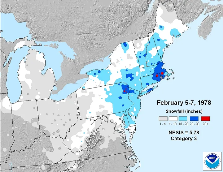
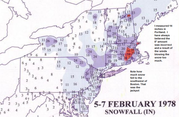
This arguably was a February 1978 redo. That's prolly already been noted, but whatever. I'm ready for thunderstorm season. The screwjobs are more idiosyncratic and less deflating.
-
In honor of the late, great Robert Duvall: "I love the look of a favorable model run in the morning. That HECS look. It looks like ... victory. (Pause) Someday we'll get a snowstorm, son."
-
I've put in some serious time in the OBX, although not recently. Part of the allure was that it was very pet-friendly and we had our two beloved beagles. Before our daughter was born, my wife and I would go there over Xmas occasionally (we saw the Millennium in with a bottle of Dom Perigon -- which someone had given us -- on top of Jockey's Ridge) and experienced a couple of coastal storms, which were wild even though they were wet. I can (or maybe can't) imagine what one would be like that was all snow. Can't get down there, but wish I could.
-

January 24-26: Miracle or Mirage OBS Thread!
09-10 analogy replied to Jebman's topic in Mid Atlantic
Not quite relentless puking pingers, but right next door, since early this morning. I don't remember the rates from Valentine's Day 07, but I doubt they exceeded -- or matched -- what I've been getting this morning. -

January 24-26: Miracle or Mirage OBS Thread!
09-10 analogy replied to Jebman's topic in Mid Atlantic
Pounding pingers. Sounds like an atonal xylophone. -

January 24-26: Miracle or Mirage OBS Thread!
09-10 analogy replied to Jebman's topic in Mid Atlantic
Yeah, the (former) Uptown. Even that rings a snow bell. My wife and I, back in 2002, went there on Xmas Eve (or Day?) to see one of the LOTR trilogy, I forget which one, with a little bit of snow that was either falling or had fallen. So that's three obscure data points. It's a tiny bell with the ringer covered in gauze tape. But I do know it was the Uptown. Pretty heavy in up nw, but I'm not really invested in the storm for some reason. Pre-occupied, maybe, or the fact that we've all this bitter cold, and we're going to get a Burning Man of sleet. Which isn't that bad from the point of view of winter histography, but is a bit of a disappointment because, as others have said, I feel we're wasting a golden opportunity, which don't come around too often around here, for a quasi-HECSnowstorm. -
Love it when the darkest green on the radar is parked directly overhead. I wasn't expecting much out of this. As usual, I was wrong.
-
Some pretty large flakes floating down in up nw


