AccuChris
-
Posts
503 -
Joined
-
Last visited
Content Type
Profiles
Blogs
Forums
American Weather
Media Demo
Store
Gallery
Everything posted by AccuChris
-
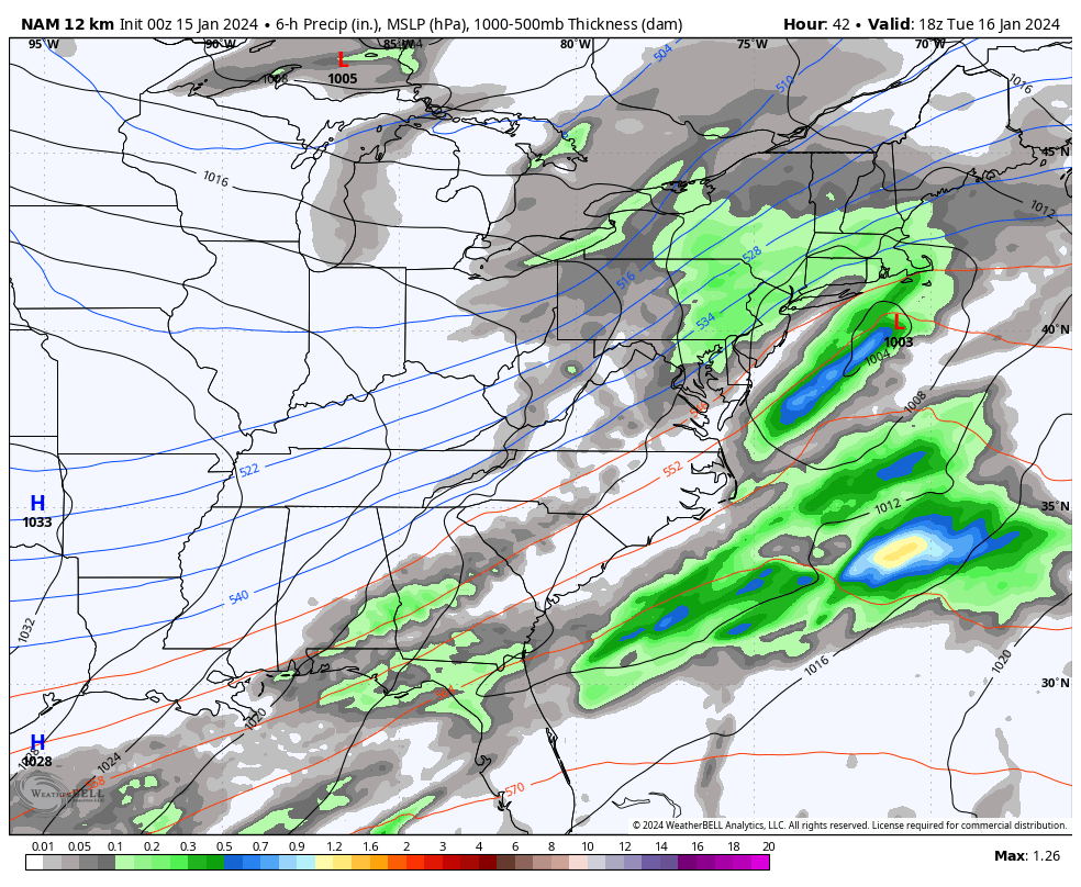
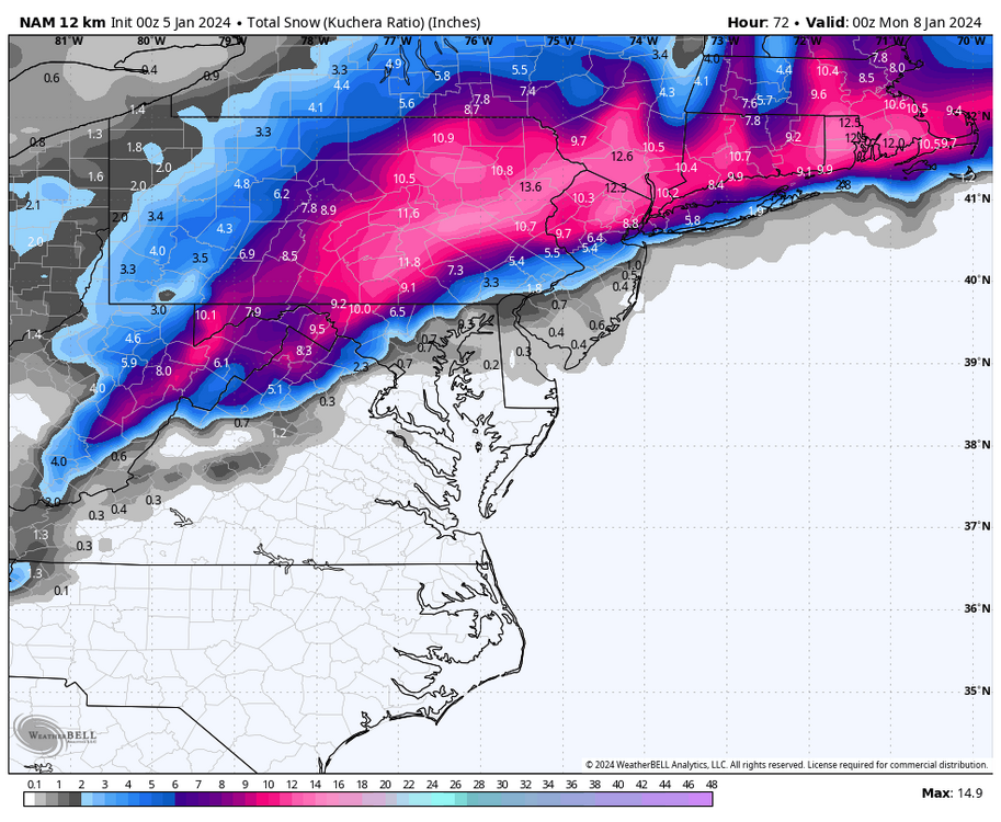
0z NAM trying to keep this juiced up over a large area

-
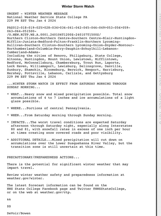
I was down at my alma-mater at the Millersville Meteo Dept about 6 weeks ago seeing some old friends and faces at the weather center and asked about the new radar etc. Long story short, its not even operational yet as some parts were missing/broken and have not been replaced/repaired yet to be even functional. Once it is, the radar will not be available for public viewing/use unless the NWS or other media outlets buy the license rights to broadcast it and use it. Its a private company so everyone who “wants to use it” needs to pay for the access. I would imagine the NWS would want it as they are the only entity who can issues warnings, etc. Hopefully we all will get the ability to see it once its up and running and a deal is worked out. Millersville University is only a location for the radar and for research and not the ones who give the rights/licenses out. Although Millersville did spend a ton of money via a grant to get the radar there and access to it for research. But again, its been 5 months installed now and not functional.
-
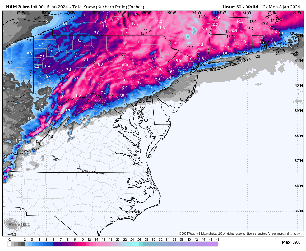
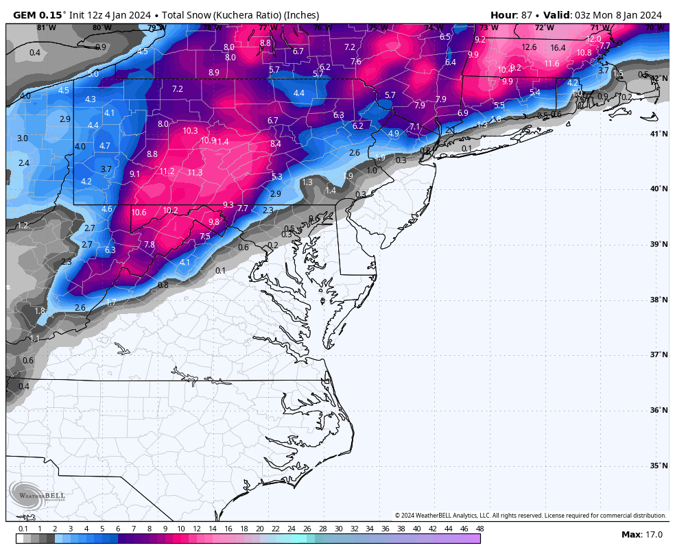
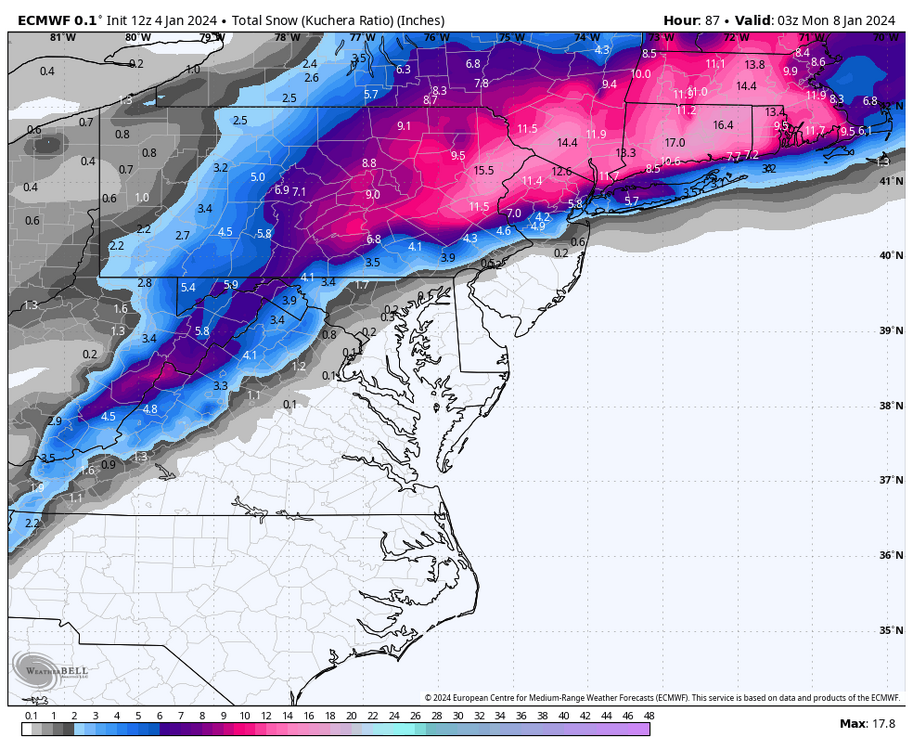
Here is the 12z European 2 day 10:1 snowfall map for next Tuesday
-
Just measured another inch on the snow board in Lebanon making it a storm total of 4” and now it went over to moderate freezing rain. Winds gusty out of the NE at 20MPH and temp 30°
-
Went back to heavy snow for a while in Lebanon and just measured new storm total of 3” now
-
Back to heavy snow in Lebanon now
-
Yes, even over 24 hours ago the long range HRRR was hinting at low end snow amounts in the eastern and southern parts of LSV. Spot on. Im at 29° in Lebanon and only 2” of snow and its heavy sleet now
-
Like a light switch, moderate snow switched to sleet in Lebanon. Warm nose on the eastern areas really screamed northward quickly. Only 2” here in Lebanon at changeover and that likely will be all she wrote as far as snow accumulation here
-
Just measured a half inch since the last check an hour ago. Storm total so far 1.5” in Lebanon. Temp 30°
-
Just measured 1” of snow finally in Lebanon. Moderate snow ongoing
-
First flurries spotted here in Lebanon…28/24
-
28/24 in Lebanon. Nada falling yet
-
The 3km NAM has much more QPF too; had Harrisburg area receiving around 1.2” in liquid equivalent. At one point around 6PM tomorrow it was snowing 2-3”/hr
-
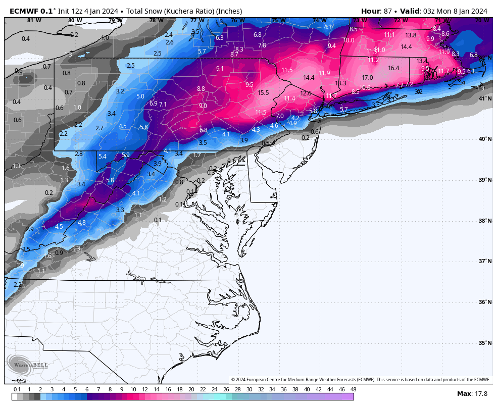
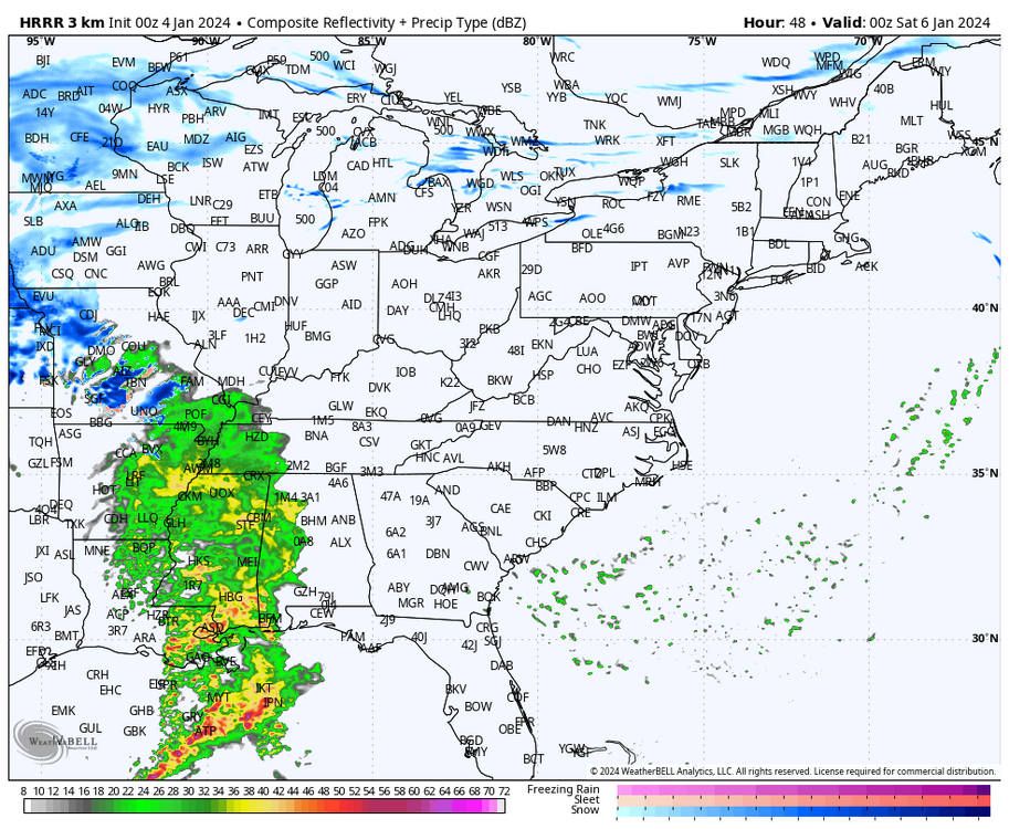
Latest 3km NAM kuchera snow map

-
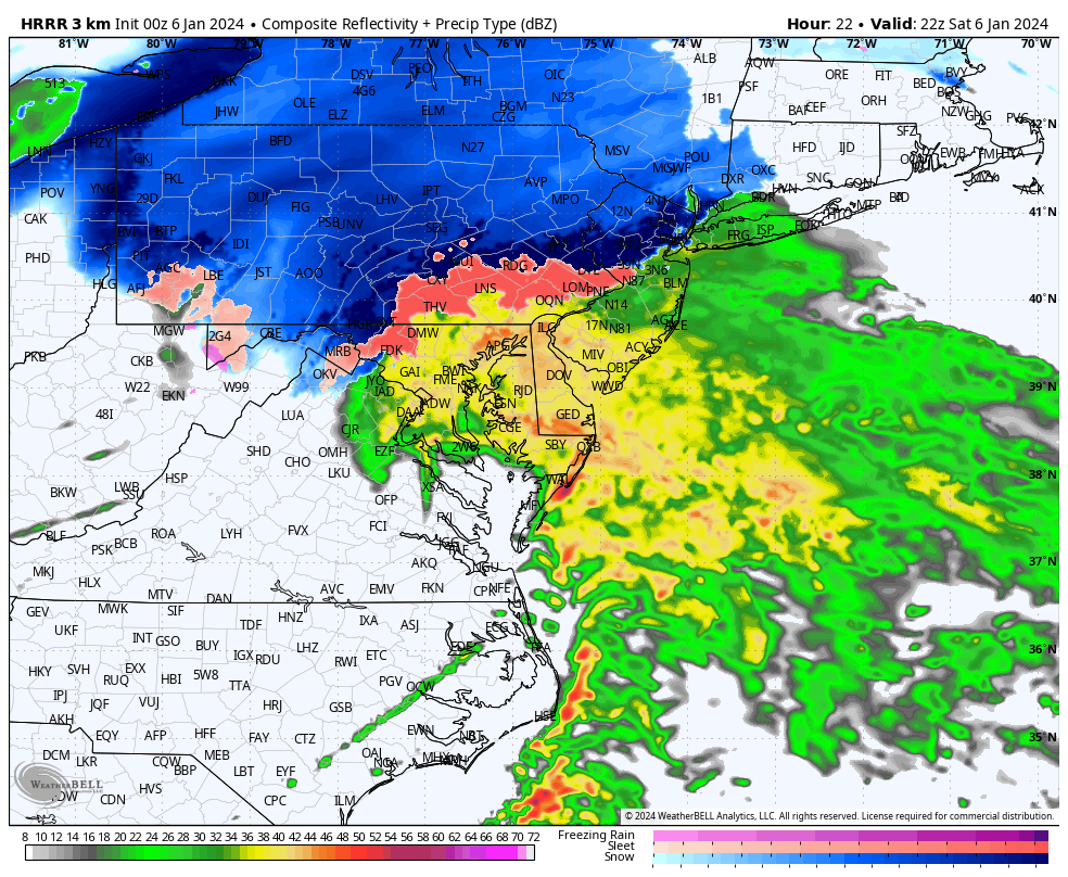
Justin Michaels was set up this PM at the 83/581 interchange near Lemoyne
-
The speed of the system is a problem as well. It is in and out in 9 hours for any one location. If you switch over to a mix halfway through, you are lucky to see 2-3”
-
The latest long range HRRR still wants to shove a warm 850mb warm nose up into the Route 78/81 corridor tomorrow evening. Wants to change anyone south of Route 30 to rain as well.

-
In Lebanon down to 24° and DP is 18…bring it on….anything is better than last winter!
-
Hot off the press:
-
0z NAM definitely got juiced up
-
Here we go…
-
12z Euro kuchera snowmap…overall fairly similar to roughly what the GFS showed
-
12z Canadian trimmed down the southern edges of the snowfall given marginal thermal profiles etc

-
Long range HRRR sure looks juicy at 7pm Friday
-
Definitely! The more the merrier!