AccuChris
-
Posts
502 -
Joined
-
Last visited
Content Type
Profiles
Blogs
Forums
American Weather
Media Demo
Store
Gallery
Everything posted by AccuChris
-
Central PA Autumn 2024
AccuChris replied to Itstrainingtime's topic in Upstate New York/Pennsylvania
Finished with 1.01” in Lebanon with this first part . -
Central PA Autumn 2024
AccuChris replied to Itstrainingtime's topic in Upstate New York/Pennsylvania
18z long range HRRR still very bullish on snowfall . -
Central PA Autumn 2024
AccuChris replied to Itstrainingtime's topic in Upstate New York/Pennsylvania
12z Euro Kuchera is on steroids through the period [emoji15] . -
Central PA Autumn 2024
AccuChris replied to Itstrainingtime's topic in Upstate New York/Pennsylvania
12z NAM holding with the general snow theme . -
Central PA Autumn 2024
AccuChris replied to Itstrainingtime's topic in Upstate New York/Pennsylvania
Latest long range HRRR looking fun and still cranking at hour 48 . -
Central PA Autumn 2024
AccuChris replied to Itstrainingtime's topic in Upstate New York/Pennsylvania
12z NAM kuchera snow map…event still ongoing at hour 84 . -
Central PA Autumn 2024
AccuChris replied to Itstrainingtime's topic in Upstate New York/Pennsylvania
12z GFS still indicating a pattern change to more wintry weather starting this Thursday through the rest of the 2 week period. Kuchera snow map because why not . -
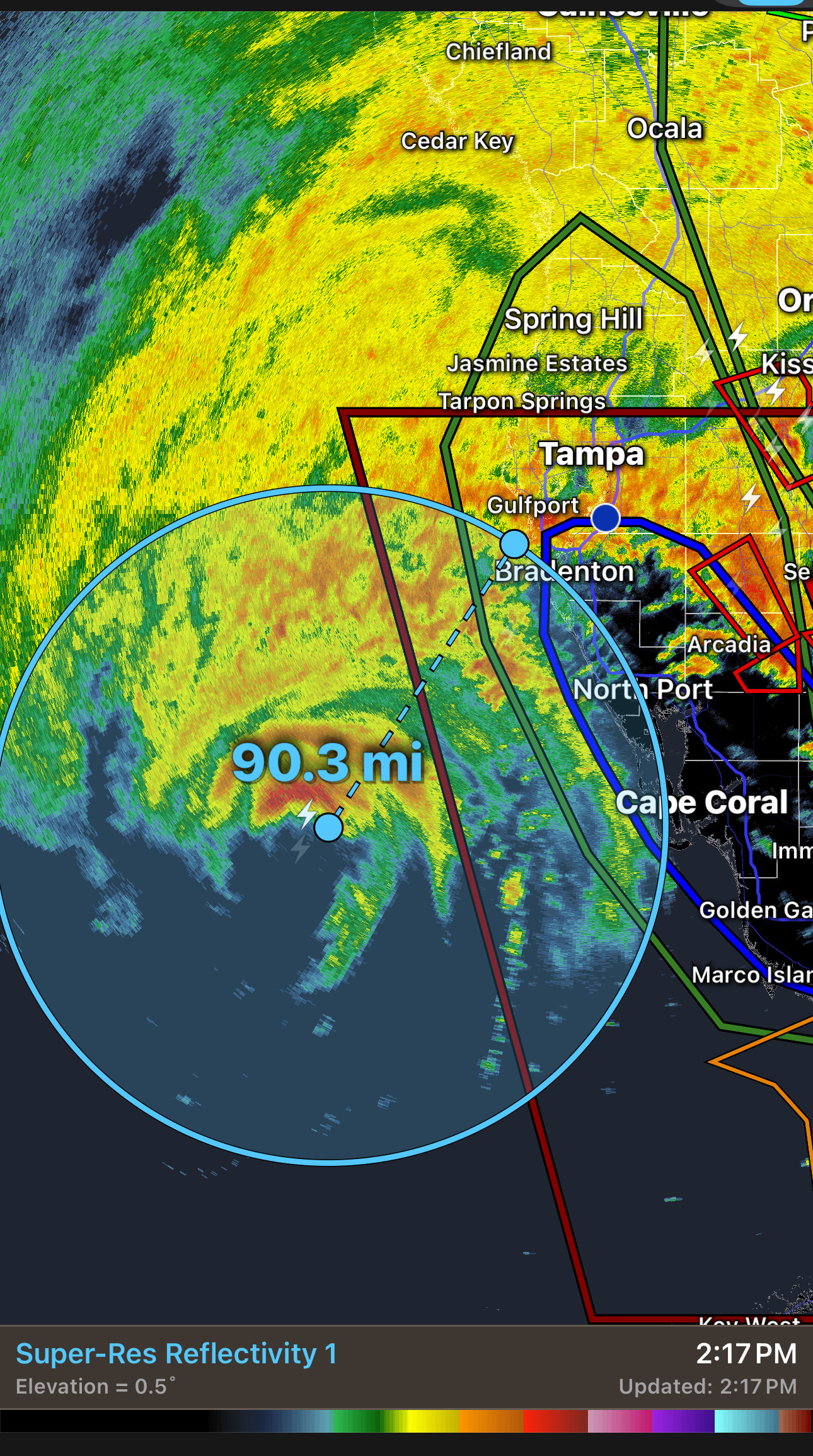
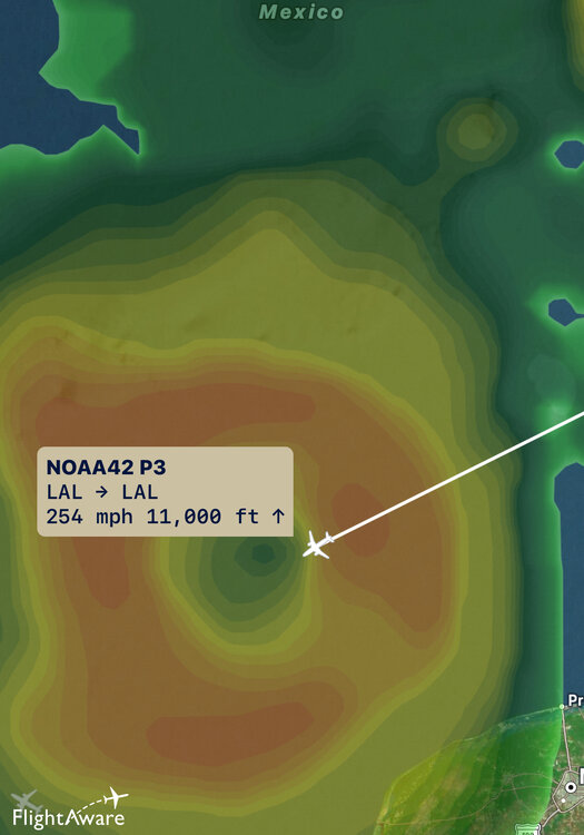
Purely extrapolating current heading and distance it still looks on pace to landfall pretty darn close to Anna Marie Island in about 6 hours…barring any wobbles .

-
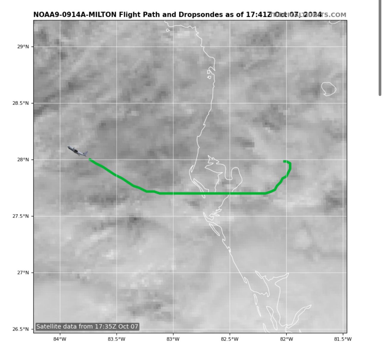
The graphic was not updated to show their latest pass but as someone else just noted, looks like the plane missed the eye by 8-10 miles so that pressure of 941mb was not a true accurate SLP reading in the eye .
-
I was wondering the same as the lowest pressure they found was 941mb. So either they totally missed it or the pressure rose 20mb in an hour .
-
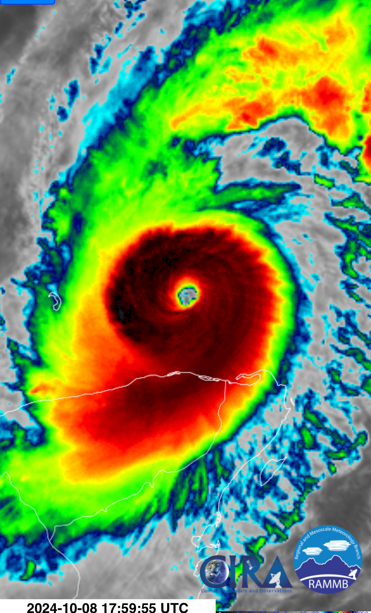
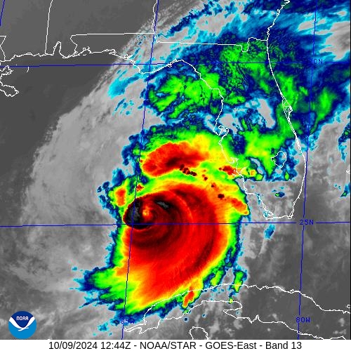
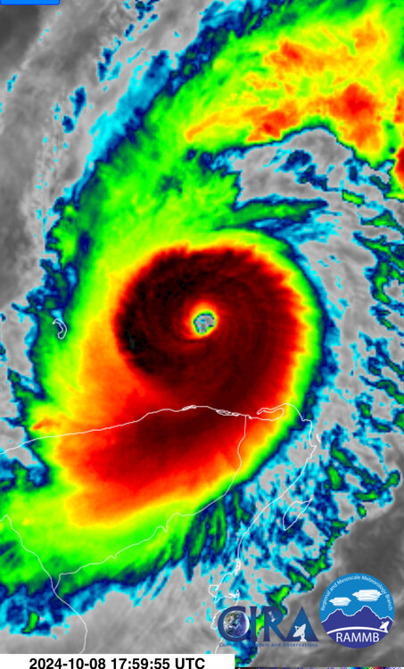
Latest IR shows deep convection really starting to encircle the eye wall again. Will be very curious to see how it responds to a more hostile environment but would no be surprised to see the eye re-appear in the next couple hours .
-
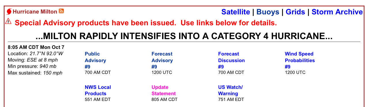
I imagine NHC will be doing a special advisory update increasing the winds and updating for the lower pressure in the near term .
-
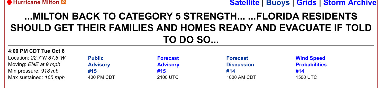
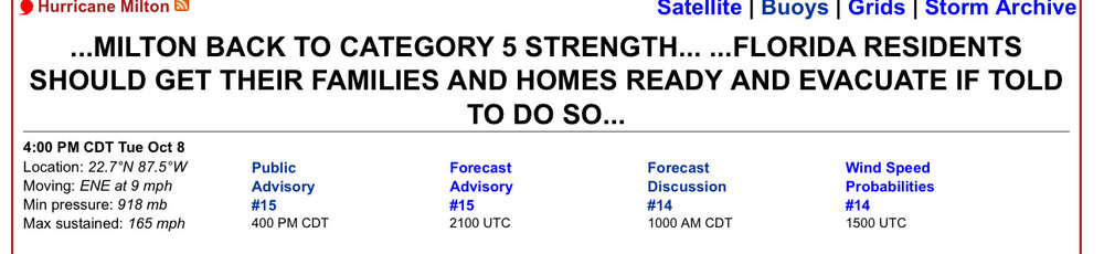
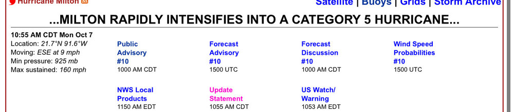
Back to Cat 5 .
-
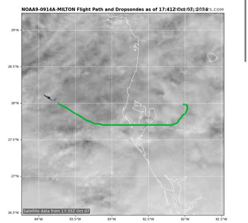
Latest recon just getting into the storm so we should get some up to the minute data on Milton over the next 15-30 mins .
-
Absolutely looking textbook again .
-
Latest recon in the past 30 mins found 925mb .
-
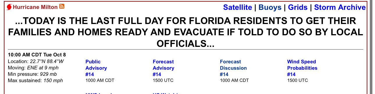
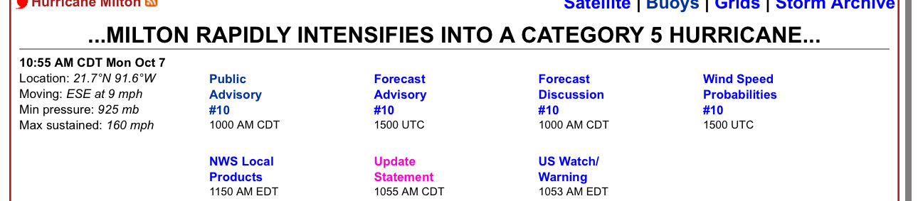
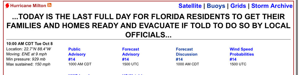
NHC latest 11AM advisory .
-
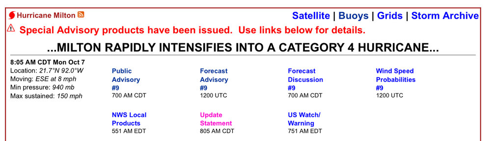
Absolutely incredible….almost 898mb first pass .
-
Recon is punching into the eye now .
-
Looks like they sped up the next recon mission as its already in the Gulf heading to Milton .
-
914mb on recon is just incredible that this has continued to tank so quickly hour-after-hour all day so far .
-
As expected .
-
12z GFS is about 55-60mb too weak right off the bat on this run…if the models cant initialize the intensity correct not sure how much we can trust its intensity forecasts in 48 hours either .
-
Bingo .
-
It will definitely be interesting to see what the 12z runs show later with this “new” info .