Jump to content

BuffaloWeather

Members
  • Posts

    25,664
  • Joined

  • Last visited

Everything posted by BuffaloWeather

  1. Yeah my mom has stage 4 and my grandpa died at 33 of it. I usually participate in the 11 day powerplay in Buffalo that raises millions for Roswell cancer, where my mom goes its one of the best in the world for cancer treatments.
  2. Yeah we would definitely average quite a bit more even though the airport is so far north. If you look at averages through January we are ahead of most spots until the lake freezes. But last year we had a 30-40" LES event with a 80% covered lake, so anything can happen still!
  3. ...Bitterly cold temperatures expected again tonight... Temperatures will fall to 0 to 25 below zero tonight. While winds will be light, wind chills of 10 to 35 below zero will be possible. The cold wind chills could result in frostbite to exposed skin and/or hypothermia if precautions are not taken.
  4. Yes but it stays 250-265 for the longest time period. It kind of stalls over southern Erie county. At least on the RGEM it does.
  5. NWS just raised totals again Saturday Night Snow showers likely before 11pm, then snow between 11pm and 4am, then snow showers likely after 4am. Low around 19. Southwest wind 13 to 15 mph. Chance of precipitation is 90%. New snow accumulation of 4 to 8 inches possible. Sunday Snow showers likely, mainly before 7am. Mostly cloudy, with a high near 22. West wind 8 to 15 mph. Chance of precipitation is 60%. New snow accumulation of 1 to 3 inches possible.
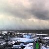
  6. Did you see the Ocean effect today south of Boston. What a band over 6" I think
  7. Looks pretty good for WNY. Another 6-10" across most of the area by middle of week. Light snow will move into western NY by Monday afternoon and spread east across the region Monday night. A widespread few inches of snow is possible across most of the region.
  8. Rates will be stronger than .5-1" per across Buf south with that band, can almost guarantee it.
  9. A cold southwest flow ahead of the front Saturday evening will then set up plumes of lake snow northeast of both lakes. While the cap will initially be in the vcnty of 5kft...it is forecast to rise to between 7 and 10 kft (higher off Lk Ont) by daybreak Sunday. This will include a 4kft deep DGZ...which in a cold airmass will allow for efficient snow making and subsequent accumulations. The les band off Lk Erie should be transitory enough (240 flow at 00z and 280 flow at 12z Sun) to prevent significant snow accumulations Sat night...although can see 4-6" amounts in the vcnty of the BUF Southtowns southward along the Chautauqua ridge with 0.5 to 1 inch rates for a time. Winter weather advisories will likely be needed for these areas as we near the event. Off Lk Ontario...a disorganized band in a 230 flow will initially become established over the northern portion of Jefferson county (north of ART). The band should then settle to just south of Watertown where a 240-250 steering flow will persist for much of the second half of the night into Sunday morning. With 1 inch rates expected...snow accums could exceed 7 inches by daybreak Sunday. Have thus issued a winter storm watch for lake effect snow in this package for Jefferson county only.
  10. Historically Syracuse does much better then Buffalo in synoptic storms because they are closer to the ocean and climo dictates a low along the ocean taking over 90% of the time and "robbing" the primary of moisture. This is a very weird year.
  11. It bombs out so far south I would expect this to be another strong Miller A. GEFS and GEPS had it.
  12. Let me use my reverse psychology again. Euro Tossed, lows don't run up the apps like that.
  13. Southeast ridge in La Nina years favor inland tracks? I'm not sure the reason.
  14. Couple big dogs at end of GEM and on GEFS around hour 240-260. Something to watch.
  15. Hey wolf I told you to stay away. I’d rather they go to giants then dolphins though.
  16. Have you ever been to this place in Ottawa? I went here a few years back it was incredibly beautiful. There was an edm party going on after we bungee jumped. Was nuts
  17. Yeah I was up there definitely got way more snow. That was a rough drive.
  18. Next 2 weeks look active and somewhat cold. Can't ask for much more. Good conditions for all winter activities. Might even hit up some pond hockey.
×
×
  • Create New...