BuffaloWeather
-
Posts
25,686 -
Joined
-
Last visited


-
Im off tomorrow and thinking of making the journey to chase this, worth it you thinking or wait for tonights outlook before leaving?
-
Thinking about heading out early next week out your guys way to chase some Nados. Anyone else going out?
-

Upstate/Eastern NY Spring Discussion/Obs Thread
BuffaloWeather replied to U_Thant's topic in Upstate New York/Pennsylvania
Everyone here left for a discord server we run. Would you be interested in joining? Around 100 members. DM me. -
2025-2026 ENSO
BuffaloWeather replied to 40/70 Benchmark's topic in Weather Forecasting and Discussion
No where to put the snow, Lake Erie is frozen so should slow down accumulations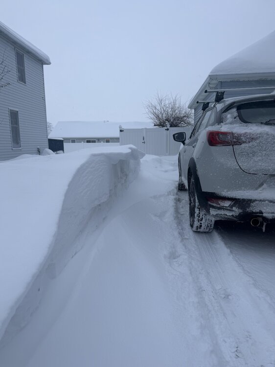
-
2025-2026 ENSO
BuffaloWeather replied to 40/70 Benchmark's topic in Weather Forecasting and Discussion
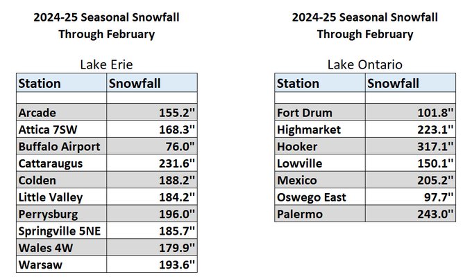
At 118" here, no warmup in sight. Should be an easy 150"+ winter! Just an incredible stretch here in lake effect country. -
2025-2026 ENSO
BuffaloWeather replied to 40/70 Benchmark's topic in Weather Forecasting and Discussion
Some places across the tug are nearing 200" on the year already. Places south of here are 100"+ -
2025-2026 ENSO
BuffaloWeather replied to 40/70 Benchmark's topic in Weather Forecasting and Discussion
Been another great winter around the lakes. December was freezing and snowy. Over 60" already, let’s keep it rolling. -
2025-2026 ENSO
BuffaloWeather replied to 40/70 Benchmark's topic in Weather Forecasting and Discussion
Put out today
-
11/8-11/10 First Snow and Lake Effect Event
BuffaloWeather replied to Geoboy645's topic in Lakes/Ohio Valley
You're about to see a Buffalo band, hope you're still awake for this. -
Major Hurricane Melissa - 892mb - 185mph Jamaica landfall
BuffaloWeather replied to GaWx's topic in Tropical Headquarters
Wind is always the least worry in a landfalling hurricane. Storm surge and flooding are top concerns here. -
So sorry to hear about your dad John. He was an incredible part of this community. RIP.
-
2025-2026 ENSO
BuffaloWeather replied to 40/70 Benchmark's topic in Weather Forecasting and Discussion
Last winter was a historic one for the lakes. Expect this one to be similar with a more active synoptic track. It can't get much worse than last winter for snowstorms. I don't think we had one winter storm watch, despite the chilly temps. -
You can't use Buffalos data before 1940 due to it being literally on the lake. It isn't a good representative of weather across our area, way too marine influenced. If Detroits recording station moved, that data shouldn't be used either. Not really up for debate, moving a recording station eliminates its accuracy and consistency.
-
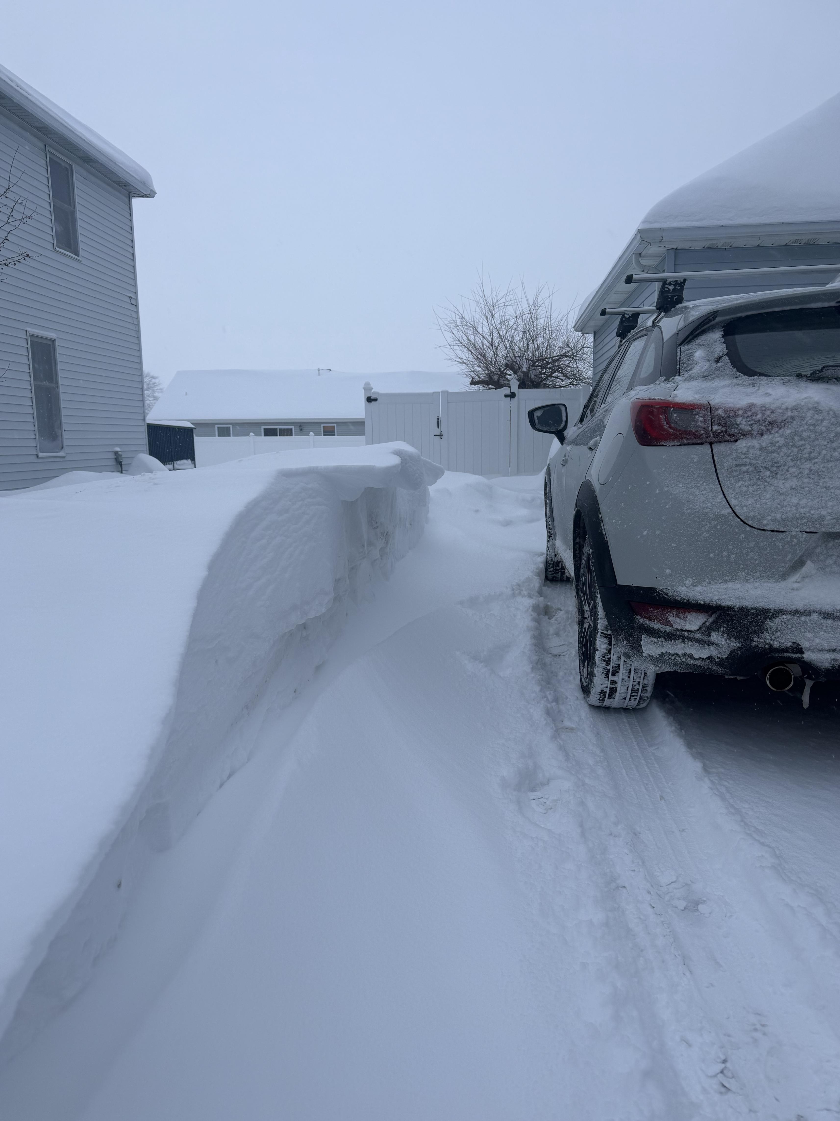
The snowbelts off Erie and Ontario did very well. Had 175" in the southtowns of Buffalo. Crazy the difference between my home to airport. It's about a 20 minute drive from Hamburg to Buffalo airport and 100" difference in snow totals.
-
Just went over 175" on the year, another great winter for those impacted by lake effect snow. Places south of here are well over 200" and places in the tug are well over 300". Gaylord Michigan broke its all time snowfall record this year.