-
Posts
9,634 -
Joined
Content Type
Profiles
Blogs
Forums
American Weather
Media Demo
Store
Gallery
Everything posted by griteater
-
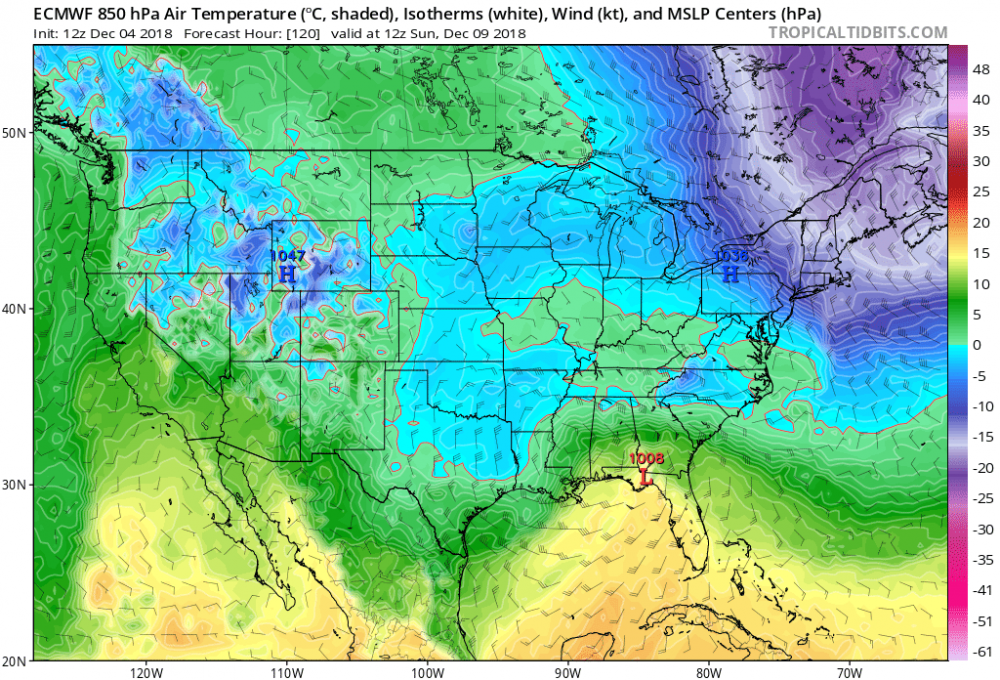
At 120, 850 0 deg says snow from Mack's house in the upstate over to Pinehurst and NW of there
-
Shortwave dropping down from the northern stream will likely phase in late like the UKMet
-
It's definitely a southern slider...let's see what it shows at the sfc
-
Closed contour right over the Red River OK/TX border at 105 at 500mb
-
Still all systems go at 93...it's a touch south of 00z so far
-
The shortwave running thru the great lakes at 81 is a touch stronger again...should help with the NE confluence to keep the system suppressed...all systems go so far
-
The wave thru baja is a tick south again out to 78
-
Euro looks fine so far at 500mb out to 72...heights along the east coast are a tick south...every little bit matters
-
It was a pretty tantalizing run on the UKMet...stout STJ wave tracking west to east with a late phase from the northern stream
-
Gotcha, I was looking broadly at 1000-500mb thickness for temps...it was a small change, but every little bit matters down south
-
FV3 out to 96 it's just a touch colder out ahead...looking at h5 it shouldn't be north of prior run....we'll see
-
Yeah, living on the edge is no good, and there's normally a late north climb. Ideal scenario is for the NE confluence to increase over time, have the wave trek west to east instead of sliding northeast at the end....and throw in some late phasing
-
WPC's morning update
-
FL...it may come off a little north of there, but don't have the specifics with the early maps
-
It's hard to beat the ewall 4 panel...I wish other vendors would go to that with the Euro etc. The 12z UKMet goes big with the phase but still keeps the storm to the south, moving off Jacksonville roughly...similar to GFS really...it's a late, but big phase
-
It's kind of weird, the system is so slow moving that it is thumping heavy front end gulf precip into the cold-ish air....heavy rising motion on the NW side of the Miller A...and by the time the 850 low approaches and it warms, it has snowed a lot
-
This is the big one Elizabeth, I'm coming to join you honey
-
Crushing snow at 114-120 over a big part of west-central NC on the GFS....hawt
-
The Canadian bumped south
-
GFS closes off a contour at h5 right off the Cali coast....ticking a little stronger coming in there
-
Sure. We bang on the NAM a lot, but even at its outer ranges I swear it does as good as any of the other models...it handles southern stream waves well too
-
It's about time for the Canadian model to come in with a southerly adjustment
-
It's usually colder than the global models during cold air damming, and warmer than the global models with its handling of warm nosing moving in from the south - which tends to be correct. It's higher resolution, so it should handle those situations better....but it has to get the big picture right first, and it may struggle to get that right out at its outer range of 72-84 hour.
-
A lifetime of storm failures tends to do that


