Beagles20
-
Posts
36 -
Joined
-
Last visited
About Beagles20

-

Sunday 1/19 Eagles Game Snow and Stuff
Beagles20 replied to Ralph Wiggum's topic in Philadelphia Region
This site should be free if your interested. This will give you access to most of the models. https://home.pivotalweather.com/ -
Sunday 1/19 Eagles Game Snow and Stuff
Beagles20 replied to Ralph Wiggum's topic in Philadelphia Region
The NFL needs to do something with that Luvu or Luvo whatever his name is. I believe he is the one that knocked Hurts out of the game. Took a cheap shot on Goff. The kid is a good player but it seems to me that he is a head hunter. -
January Medium/Long Range: A snowy January ahead?
Beagles20 replied to mappy's topic in Mid Atlantic
I think we have a courtesy L pressure to the north letting the southern L to pass through first. What is causing it to hang out between hours 57 and 81? It basically doesn't move. I am not a meterologist so I am seriously asking. I have never seen that without blocking. Is it because of the system we are watching to the south? -
1/6 snowstorm - nuisance event or something bigger?
Beagles20 replied to LVblizzard's topic in Philadelphia Region
I had to clear my cache. Now its working again. SMH! -
1/6 snowstorm - nuisance event or something bigger?
Beagles20 replied to LVblizzard's topic in Philadelphia Region
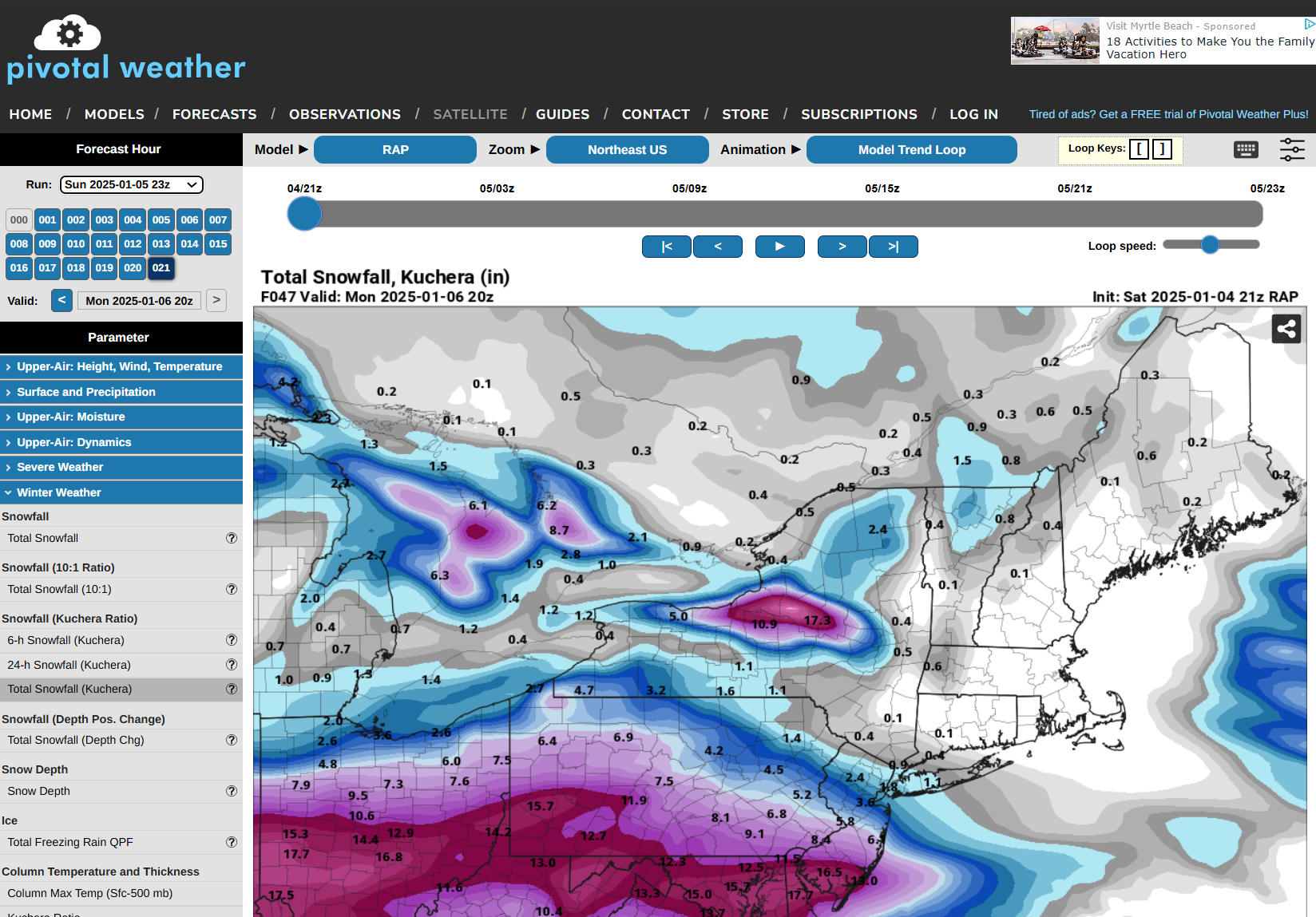
Yeah, I realized that after I posted it. WTH! Here is a screenshot I just took on my computer. The upper left clearly says 1/5/25 23z run but the right hand corner of the map say 1/4. My bad. I apologize for posting the wrong map.

-
I see that on the map now on the upper right hand corner, but I clicked on the 23z in the upper left corner. See the screenshot attached to here. If it is from last night, I apologize for sharing the incorrect map.

-
1/6 snowstorm - nuisance event or something bigger?
Beagles20 replied to LVblizzard's topic in Philadelphia Region
Latest HRRR and RAP models giving us some hope for the northern folks. Who knows if it will pan out, but can give us some hope to get more than 2". -
Here's to an 80 mile shift north over the next couple of days to be in the jackpot or for the storm to stay where its at, whichever comes first! Enjoy this one you southerners in the Mid Atlantic! Hopefully, we can squeeze out a couple of inches and be happy here in PA!
-
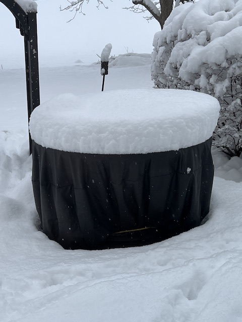
Beagles20 changed their profile photo
-
I did not go out and measure but we ended up with about 12” or so. Light snow currently.
-
-
-
NWS just issued a winter storm warning for an additional 4-6”.
-
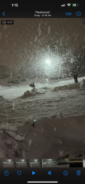
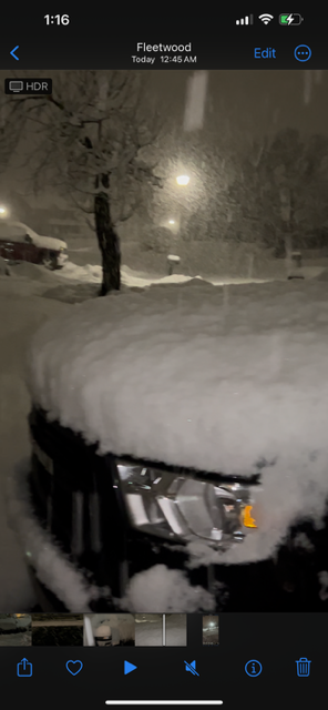
Just got home here and we have been under that heavy band in Berks County. We probably have about 5 or 6” already. Snowing heavily and fairly large flakes.
-
I may be barking up the wrong tree here, but while models are depicting more snow (in most cases) than currently forecasted by local and regional mets, the ground is warmer (not frozen) at least in my area along with the marginal temps at the surface. With that, while most of the storm will be snow (as modeled), the models do not take into account the ground temps and only the air temps at the different levels of the surface. Therefore, until areas get into the heavier snow bands, snow may not accumulate as much as models are depicting, hence the lower snow amounts. Is this accurate when it comes to models?