Maggie Valley Steve
-
Posts
449 -
Joined
-
Last visited
Content Type
Profiles
Blogs
Forums
American Weather
Media Demo
Store
Gallery
Everything posted by Maggie Valley Steve
-

2024-2025 Fall/Winter Mountain Thread
Maggie Valley Steve replied to Buckethead's topic in Southeastern States
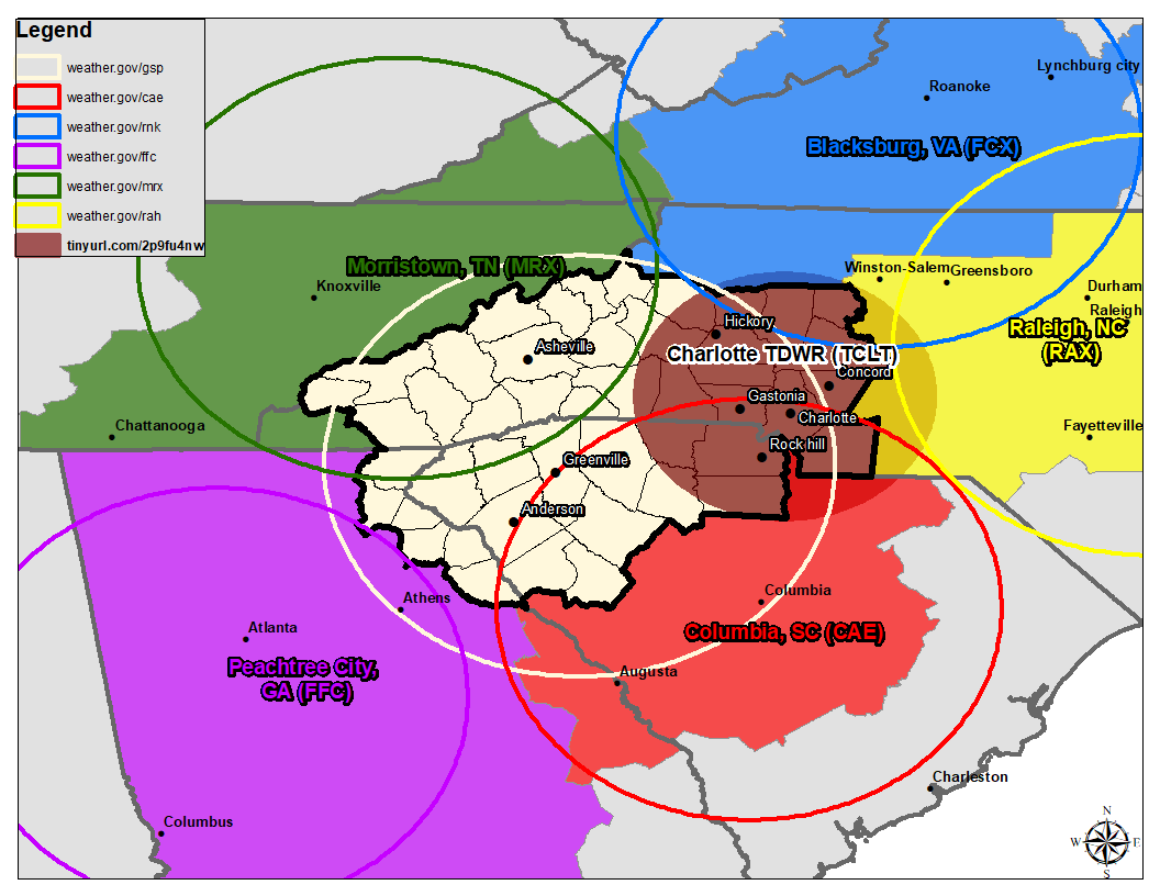
GSP just lost their radar. Statement said it could be out for days waiting on parts. NWS GSP @NWSGSP GSP RADAR OUTAGE (1/19): KGSP is down for unscheduled maintenance, expect multiple days as parts are on the way to fix the issue. Here are links to access imagery from other radars until KGSP returns to service: https://weather.gov/gsp/alternateRadars… #scwx #ncwx #gawx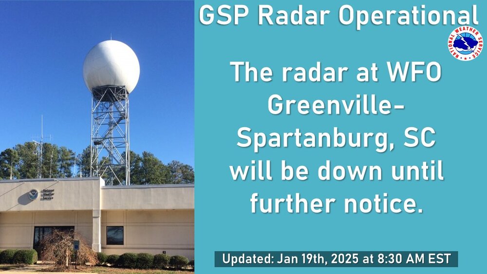

-
2024-2025 Fall/Winter Mountain Thread
Maggie Valley Steve replied to Buckethead's topic in Southeastern States
How about those 20 to 1 ratios that GSP mentioned this morning! It was very foggy when I woke up this morning, but has lifted now. Radar upstream looking good and the Arctic front is nearing Knoxville. -
2024-2025 Fall/Winter Mountain Thread
Maggie Valley Steve replied to Buckethead's topic in Southeastern States
URGENT - WINTER WEATHER MESSAGE National Weather Service Greenville-Spartanburg SC 333 PM EST Sat Jan 18 2025 NCZ051-058-190445- /O.UPG.KGSP.WS.A.0003.250119T1200Z-250120T1200Z/ /O.NEW.KGSP.WW.Y.0005.250119T1200Z-250120T1200Z/ /O.NEW.KGSP.WS.W.0003.250119T1200Z-250120T1200Z/ Swain-Graham- Including the cities of Luada, Wesser, Alarka, Almond, Bryson City, Stecoah, and Robbinsville 333 PM EST Sat Jan 18 2025 ...WINTER STORM WARNING IN EFFECT FROM 7 AM SUNDAY TO 7 AM EST MONDAY ABOVE 3500 FEET... ...WINTER WEATHER ADVISORY IN EFFECT FROM 7 AM SUNDAY TO 7 AM EST MONDAY BELOW 3500 FEET... * WHAT...For the Winter Storm Warning above 3500 feet, heavy snow expected. Total snow accumulations of 3 to 6 inches, with up to 10 inches at elevations above 5000 feet in the Smokies. Winds gusting as high as 40 mph. For the Winter Weather Advisory below 3500 feet, snow expected. Total snow accumulations of 2 to 4 inches. Winds gusting as high as 35 mph. * WHERE...Graham and Swain Counties. * WHEN...From 7 AM Sunday to 7 AM EST Monday. * IMPACTS...The snowfall will create slippery and snow covered roadways. The heavy snow will make many roads impassable and may produce widespread power outages due to the weight of the snow on tree limbs and power lines. The hazardous conditions could impact the Monday morning commute. * ADDITIONAL DETAILS...A dry snow falling into temperatures well below freezing will result in very slippery and treacherous conditions on untreated roads. -
2024-2025 Fall/Winter Mountain Thread
Maggie Valley Steve replied to Buckethead's topic in Southeastern States
The 12Z NAM has us snowing Tuesday afternoon. The meso allowing models will be worth monitoring tomorrow into Monday. Past experience suggests that models struggle with over running moisture when arctic air is in place. -
2024-2025 Fall/Winter Mountain Thread
Maggie Valley Steve replied to Buckethead's topic in Southeastern States
Amazing to see the snow line on the mountains around the Valley. Everything above about 3800 ft is snow covered and still snowing. The valley inversion trapped warmer air at the Valley floor. -
2024-2025 Fall/Winter Mountain Thread
Maggie Valley Steve replied to Buckethead's topic in Southeastern States
Cataloochee is reporting 1.5 inches of snow overnight and it is currently still snowing up there. -
2024-2025 Fall/Winter Mountain Thread
Maggie Valley Steve replied to Buckethead's topic in Southeastern States
39 and rain. Surprised to wake with a Winter Storm Watch this morning! -
2024-2025 Fall/Winter Mountain Thread
Maggie Valley Steve replied to Buckethead's topic in Southeastern States
My temperature has gone up from 38 around 7:30 to 42 currently. Clouds have definitely thickened and the SW winds have increased in the Valley this evening. -
2024-2025 Fall/Winter Mountain Thread
Maggie Valley Steve replied to Buckethead's topic in Southeastern States
It looks like GSP is thinking that possible mixing issues would be some brief and limited in the mountains. 1 to 2 inches of snow tonight into tomorrow morning for areas above 3k, then very light freezing rain and rain flipping back to snow late tomorrow night into Sunday with another 1 to 2 inches of snow. We'll see how that plays out. -
2024-2025 Fall/Winter Mountain Thread
Maggie Valley Steve replied to Buckethead's topic in Southeastern States
So it looks like the 00Z NAM increased abit suggesting 3 inches of snow over the weekend. We'll see if that trend continues tomorrow. My temperature this evening has actually risen a degree or two. It's currently 38. If I do not drop below freezing, it will be the first time since mid December for a morning low. -
2024-2025 Fall/Winter Mountain Thread
Maggie Valley Steve replied to Buckethead's topic in Southeastern States
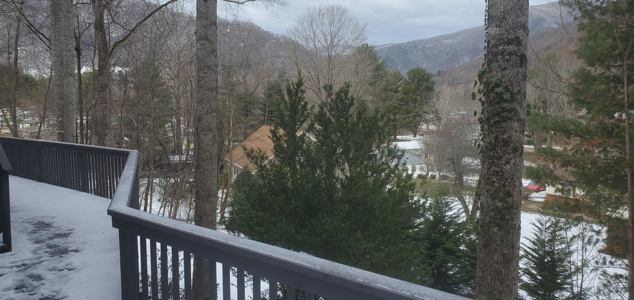
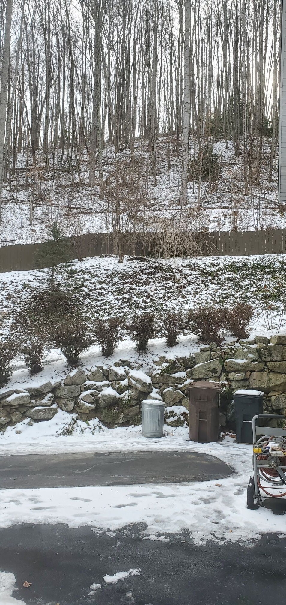
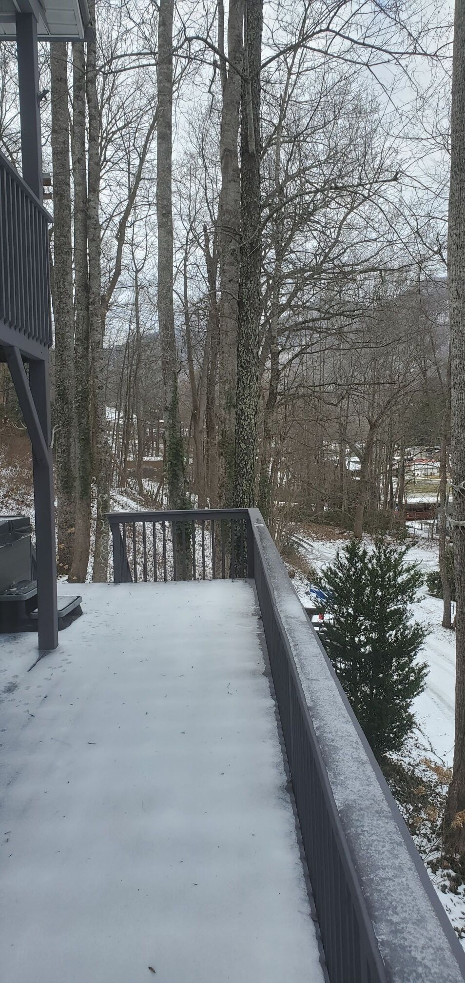
Day 12 with snow on the ground. I've finally managed to get the driveway cleared ahead of the weekend storm.
-
2024-2025 Fall/Winter Mountain Thread
Maggie Valley Steve replied to Buckethead's topic in Southeastern States
If we get the moisture, those very cold temperatures could easily produce 15 to 1 ratios. -
2024-2025 Fall/Winter Mountain Thread
Maggie Valley Steve replied to Buckethead's topic in Southeastern States
Day 11 with snow on the ground here and even at the Valley floor with North facing areas. I see that NWS Houston is mentioning snow for Monday, with even the Coastal Counties seeing a wintry mix. One of my longtime Met friends, Chris Hebert comparing the potential similar to the Christmas Eve snow storm of 2004. I'm also intrigued with Friday into Saturday for the Mountains. Hopefully by Friday we'll have an idea what early next week will bring! -
2024-2025 Fall/Winter Mountain Thread
Maggie Valley Steve replied to Buckethead's topic in Southeastern States
It looks like the meso models ticked up regarding moisture for our upslope tonight into Wednesday. It was 19 this morning, but has warned up to 40 so far. Driveway is melting off and I'll have it cleared by sun set. -
2024-2025 Fall/Winter Mountain Thread
Maggie Valley Steve replied to Buckethead's topic in Southeastern States
Fantastic pictures guys! Thanks for sharing! -
2024-2025 Fall/Winter Mountain Thread
Maggie Valley Steve replied to Buckethead's topic in Southeastern States
Warmed up to 40 for about 15 minutes today. No melting of the snow on my yard and likely won't anytime soon. Driveway is still covered, but drivable. -
2024-2025 Fall/Winter Mountain Thread
Maggie Valley Steve replied to Buckethead's topic in Southeastern States
14 this morning. I've got to tackle the driveway today before it becomes a solid sheet of ice. High temperature today and tomorrow is supposed to reach 40. We'll see about that. -
2024-2025 Fall/Winter Mountain Thread
Maggie Valley Steve replied to Buckethead's topic in Southeastern States
Looks like we have an opportunity for some upslope snow Tuesady night/Wednesday morning behind another shot of Arctic air. -
2024-2025 Fall/Winter Mountain Thread
Maggie Valley Steve replied to Buckethead's topic in Southeastern States
Always great to have you around Don. I'm very optimistic with the pattern we're in up to the last week of January. A lot of potential! -
2024-2025 Fall/Winter Mountain Thread
Maggie Valley Steve replied to Buckethead's topic in Southeastern States
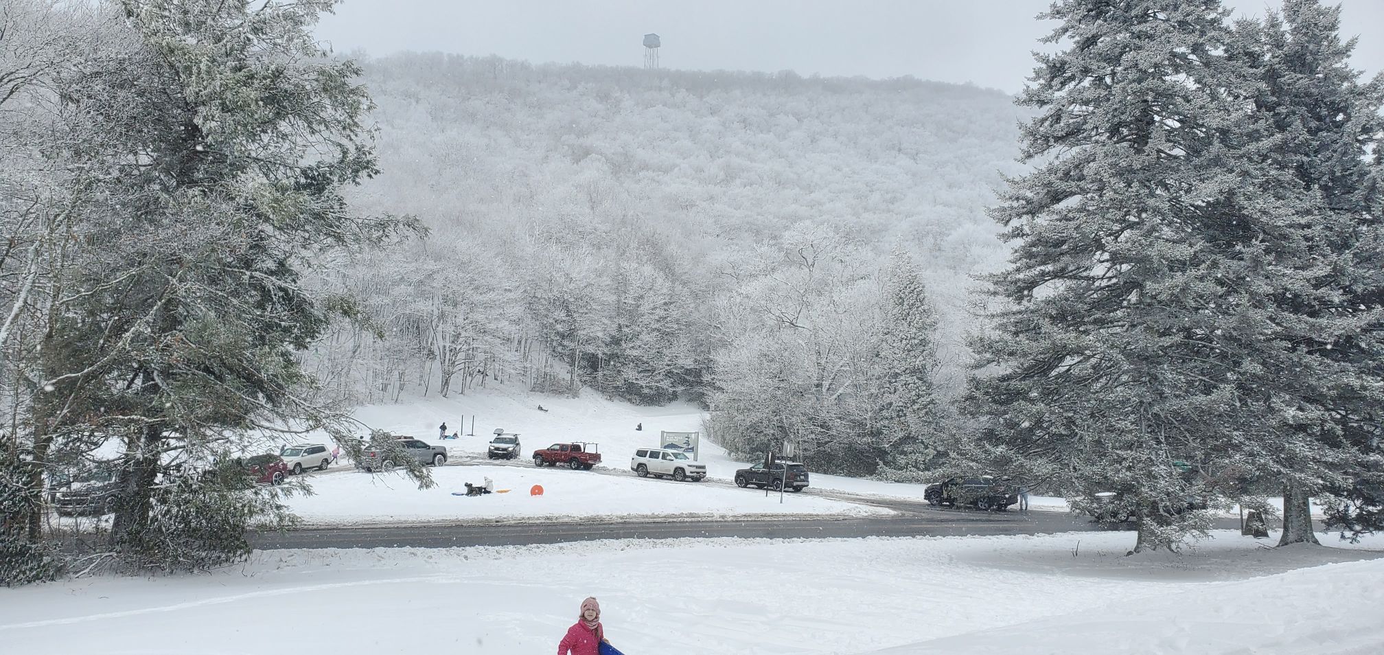
Just got back from the Pkwy at Soco Gap. Still snowing with a little over 14 inches up there.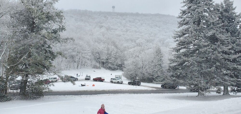
-
2024-2025 Fall/Winter Mountain Thread
Maggie Valley Steve replied to Buckethead's topic in Southeastern States
It's been dropping wintry precipitation for 24 hours now at the house and still lightly snowing. I am overall pleased with the storm and so glad the snow drought ended for many! -
2024-2025 Fall/Winter Mountain Thread
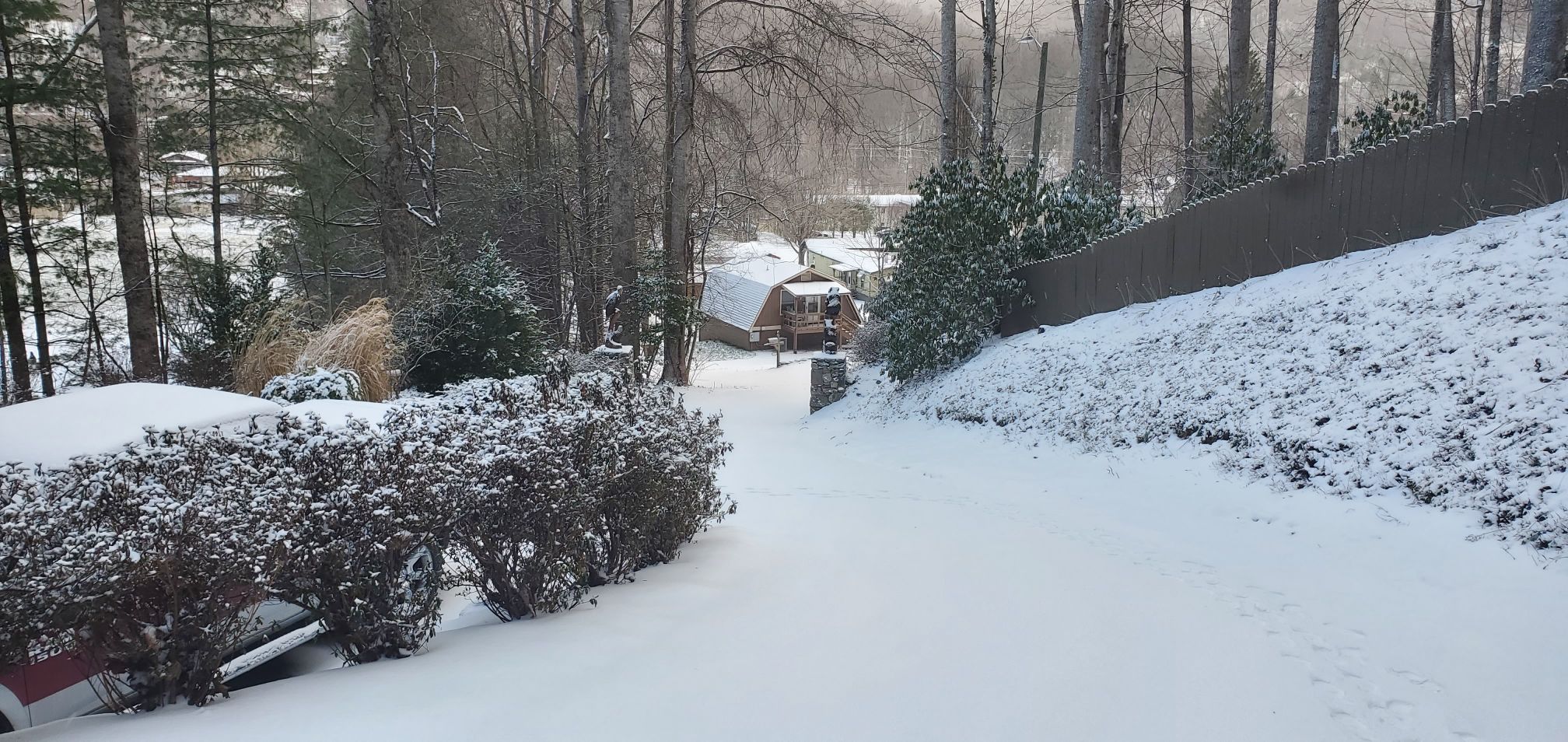
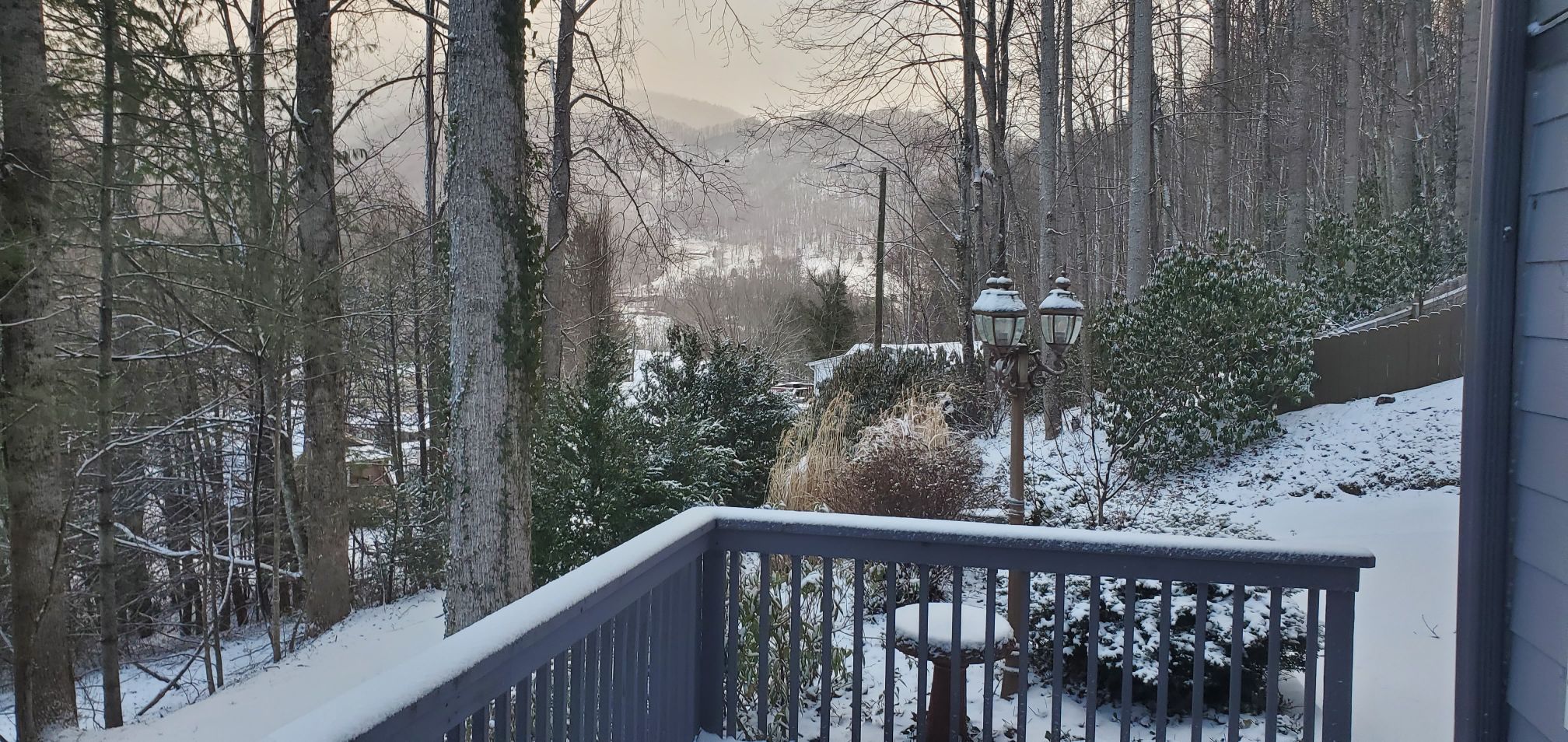
Maggie Valley Steve replied to Buckethead's topic in Southeastern States
Morning pictures.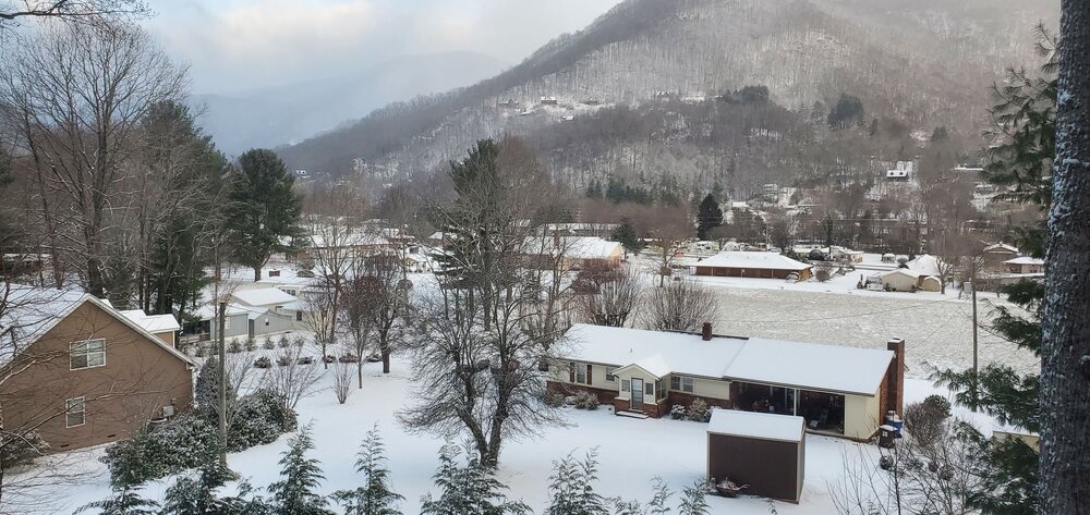


-
2024-2025 Fall/Winter Mountain Thread
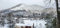
Maggie Valley Steve replied to Buckethead's topic in Southeastern States
Measured 3 inches on the back deck, but I know a lot melted, compacted and a layer of sleet. The driveway is a sheet of ice. Cataloochee is reporting 7 inches at 6:45 this morning. Soco Rd is open in town. -
2024-2025 Fall/Winter Mountain Thread
Maggie Valley Steve replied to Buckethead's topic in Southeastern States
I know they closed it from the Pkwy thru the reservation this morning at 8. Our intention was to turn around at the Pkwy, but unfortunately folks from out of town obviously thought they could make with 2 wheel drive...lol -
2024-2025 Fall/Winter Mountain Thread
Maggie Valley Steve replied to Buckethead's topic in Southeastern States
I know I busted on my call. Wx Knurd has a point though. We tried to get up to Soco Gap this afternoon, but unfortunately there were too many 2 wheel drive folks up ahead of us spinning all over the road, so we turned back. I bet the totals up there are respectable. It will be interesting to see what Cataloochee ends with tomorrow morning. I strongly believe we are not done yet. Next week is looking intriguing and even beyond. The CPC is honking on the cold with moisture continuing for the next couple of weeks. I guess we'll see!