
Maggie Valley Steve
-
Posts
449 -
Joined
-
Last visited
Content Type
Profiles
Blogs
Forums
American Weather
Media Demo
Store
Gallery
Everything posted by Maggie Valley Steve
-

2023-2024 Fall/Winter Mountain Thread
Maggie Valley Steve replied to The Alchemist's topic in Southeastern States
We have pixie dust in Maggie and balmy 25 now. -
2023-2024 Fall/Winter Mountain Thread
Maggie Valley Steve replied to The Alchemist's topic in Southeastern States
My temperature last night at 11 PM was 35. Woke up to 40 at 6:30 and the snow has melted in my yard and driveway. Cataloochee measured 10 inches yesterday and last night and is now 100% open. -
2023-2024 Fall/Winter Mountain Thread
Maggie Valley Steve replied to The Alchemist's topic in Southeastern States
We are going to have concrete tomorrow night into Wednesday morning. My forecast low for Wednesday morning is 1. Looking like we will have snow on the ground throughout the upcoming weekend with more snow possible Thursday night into Friday. -
2023-2024 Fall/Winter Mountain Thread
Maggie Valley Steve replied to The Alchemist's topic in Southeastern States
Looks like Soco Rd/US 19 is closed going to Cherokee. Apparently there are many cars off the road in Jackson County side of the Gap and people are abandoning there cars. That word came from Cherokee Police. -
2023-2024 Fall/Winter Mountain Thread
Maggie Valley Steve replied to The Alchemist's topic in Southeastern States
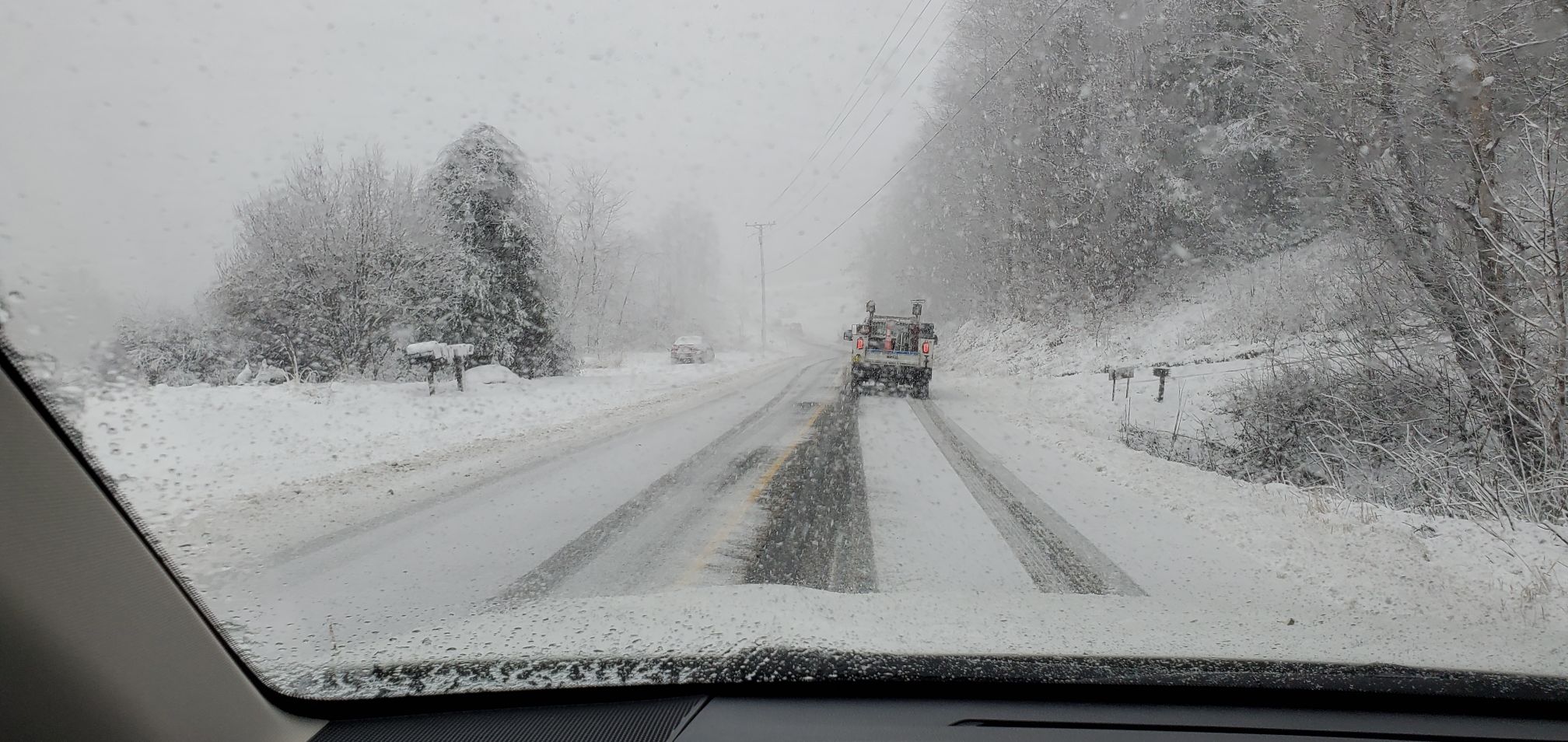
Took another drive up Soco Rd and conditions start deteriorating right at Fie Top rd going up to Cataloochee. The plows are working from Maggie up to the gap, so it's still open for now.
-
2023-2024 Fall/Winter Mountain Thread
Maggie Valley Steve replied to The Alchemist's topic in Southeastern States
They had 4 plows working the gap from both sides of the counties this morning. Drove back up to the tower and the roads were crazy slick with easily a couple of inches covering Soco Rd. -
2023-2024 Fall/Winter Mountain Thread
Maggie Valley Steve replied to The Alchemist's topic in Southeastern States
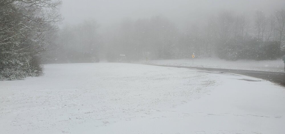
Hang in there. It took a while, but once it flips it seems rates ramp up quickly. Starting to accumulate now on the roads and grassy surfaces. Further up Soco Rd, the trees are plastered with the gusty winds. -
2023-2024 Fall/Winter Mountain Thread
Maggie Valley Steve replied to The Alchemist's topic in Southeastern States
All snow in Maggie now. -
2023-2024 Fall/Winter Mountain Thread
Maggie Valley Steve replied to The Alchemist's topic in Southeastern States
Starting get heavier rates above 3500 and it's dragging down colder air into the Valley. More mangled melting flakes than rain now. 36 at the house and winds are whipping up again. -
2023-2024 Fall/Winter Mountain Thread
Maggie Valley Steve replied to The Alchemist's topic in Southeastern States
Rain and snow mixed in Maggie now. Drove up to Soco Gap and it's snowing light to moderate with a temperature of 32. Maybe a couple of inches at best.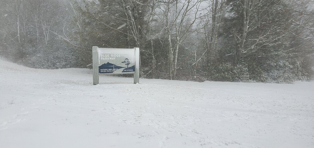
-
2023-2024 Fall/Winter Mountain Thread
Maggie Valley Steve replied to The Alchemist's topic in Southeastern States
Heavy snow up at Cataloochee via Webcam. -
2023-2024 Fall/Winter Mountain Thread
Maggie Valley Steve replied to The Alchemist's topic in Southeastern States
38 and light rain all night in the Valley. -
2023-2024 Fall/Winter Mountain Thread
Maggie Valley Steve replied to The Alchemist's topic in Southeastern States
Snowing at Cataloochee now. -
2023-2024 Fall/Winter Mountain Thread
Maggie Valley Steve replied to The Alchemist's topic in Southeastern States
mPing lighting up with frozen precipitation near the border. Looking like things are a bit ahead of schedule by an hour or two. -
2023-2024 Fall/Winter Mountain Thread
Maggie Valley Steve replied to The Alchemist's topic in Southeastern States
A lot of reports of snow around Huntsville via mPing now. -
2023-2024 Fall/Winter Mountain Thread
Maggie Valley Steve replied to The Alchemist's topic in Southeastern States
Down to 38 and the clouds are rolling in with the wind still gusting to 30 at times. Driveway is salted. Time to relax and watch Hunter on Facebook/YouTube and have some adult beverages! -
2023-2024 Fall/Winter Mountain Thread
Maggie Valley Steve replied to The Alchemist's topic in Southeastern States
mPing reports of frozen precipitation near Huntsville now. -
2023-2024 Fall/Winter Mountain Thread
Maggie Valley Steve replied to The Alchemist's topic in Southeastern States
Interesting to see snow reports coming in the Florence AL area already. -
2023-2024 Fall/Winter Mountain Thread
Maggie Valley Steve replied to The Alchemist's topic in Southeastern States
I appreciate your efforts Hunter and totally understand how you feel. You have a following far beyond WNC now and your website is a huge hit with all the Webcams! -
2023-2024 Fall/Winter Mountain Thread
Maggie Valley Steve replied to The Alchemist's topic in Southeastern States
Down to 40 here and NW winds gusting to 30 at times. The wind makes it feel like 20! -
2023-2024 Fall/Winter Mountain Thread
Maggie Valley Steve replied to The Alchemist's topic in Southeastern States
43 here and the wind is stiff! Made a run to Waynesville to get a few things from the store and overheard several chatting about leaving cars at the bottom of the hill and hooking up plows. Also NCDOT has started brimming the roads. Must be a Winter Storm coming. -
2023-2024 Fall/Winter Mountain Thread
Maggie Valley Steve replied to The Alchemist's topic in Southeastern States
Just thinking about this past week regarding the short-term guidance. Early this past week we had a chance of light snow with no accumulations and no Advisory. Got 2 inches with that one. Rain forecasted for Friday, received sleet and graupel with light accumulations in the Northern Mountains (yeah Buckethead). So we have a cold front crossing the mountains mid day with fresh cold air. I Look back SW to S Central and SE Texas and now there are Advisories down into Houston proper as the first shot of Artic airmass is coming colder and wetter than the models had been indicating. I'll be looking at satalite and radar from this point on and just glancing at the models. Good luck gang and here's to Monday and Tuesday filled with good surprises! -
2023-2024 Fall/Winter Mountain Thread
Maggie Valley Steve replied to The Alchemist's topic in Southeastern States
URGENT - WINTER WEATHER MESSAGE National Weather Service Greenville-Spartanburg SC 341 AM EST Sun Jan 14 2024 NCZ033-048>050-052-059-062-142000- /O.NEW.KGSP.WW.Y.0003.240115T0600Z-240116T1200Z/ Avery-Madison-Yancey-Mitchell-Haywood-Northern Jackson-Macon- Including the cities of Ingalls, Banner Elk, Newland, Faust, Mars Hill, Marshall, Walnut, Allenstand, Hot Springs, Luck, Swiss, Burnsville, Celo, Micaville, Ramseytown, Busick, Spruce Pine, Poplar, Waynesville, Waterville, Canton, Cruso, Cove Creek, Cullowhee, Tuckasegee, Sylva, Franklin, Rainbow Springs, Kyle, and Highlands 341 AM EST Sun Jan 14 2024 ...WINTER WEATHER ADVISORY IN EFFECT FROM 1 AM MONDAY TO 7 AM EST TUESDAY... * WHAT...Snow expected. Total snow accumulations of 1 to 4 inches are expected, and spotty freezing rain could add a light glaze of ice. * WHERE...Portions of the mountains of western North Carolina. * WHEN...From 1 AM Monday to 7 AM EST Tuesday. * IMPACTS...Plan on slippery road conditions. The hazardous conditions could impact the morning and evening commutes. * ADDITIONAL DETAILS...Very cold temperatures and light snow or light freezing drizzle could linger through Tuesday morning. Additional statements may be needed to address this as confidence increases. PRECAUTIONARY/PREPAREDNESS ACTIONS... A Winter Weather Advisory means that periods of snow, sleet, or freezing rain will cause travel difficulties. Be prepared for slippery roads and limited visibilities, and use caution while driving. Please report snow and ice accumulations by calling the National Weather Service toll free at...1...800...2 6 7...8 1 0 1. Leave a message with your observation and the specific location where it occurred. You can also post your report to National Weather Service Greenville Spartanburg Facebook or tweet your report using hashtag nwsgsp. Stay tuned to NOAA Weather Radio or your favorite source of weather information for the latest updates. Additional details can be found at www.weather.gov/gsp. The latest state road conditions can be obtained by calling 5 1 1. -
2023-2024 Fall/Winter Mountain Thread
Maggie Valley Steve replied to The Alchemist's topic in Southeastern States
00Z Euro.thumb.png.d704c8caada523ef32c36dedd28daaaa.png)
-
2023-2024 Fall/Winter Mountain Thread
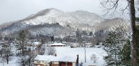
Maggie Valley Steve replied to The Alchemist's topic in Southeastern States
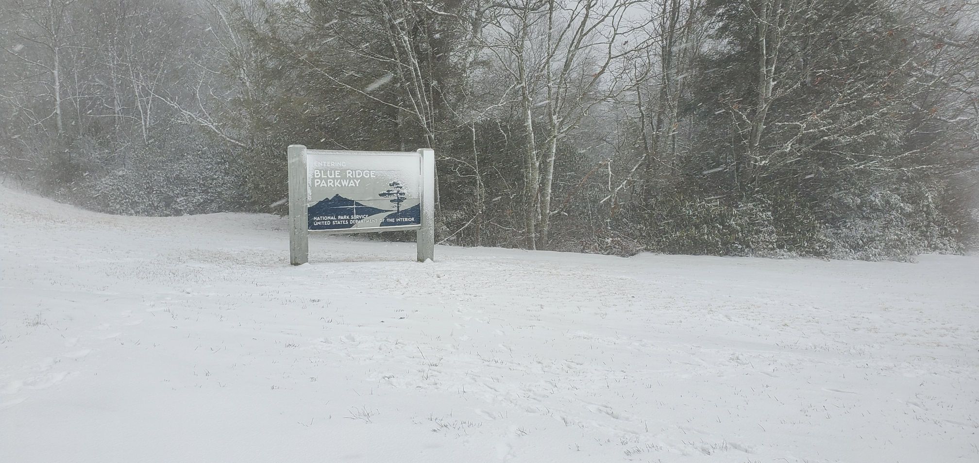
I'll take my 5 inches and call it a day..thumb.png.c8092a6458858bbe5ab543ebd3f55094.png)


.png.0f46403ce5e889a3e0bdaf16d973b404.png)
.png.465095419fe6cdec06744c96bf34cc38.png)