LakePaste25
-
Posts
365 -
Joined
-
Last visited
Content Type
Profiles
Blogs
Forums
American Weather
Media Demo
Store
Gallery
Everything posted by LakePaste25
-
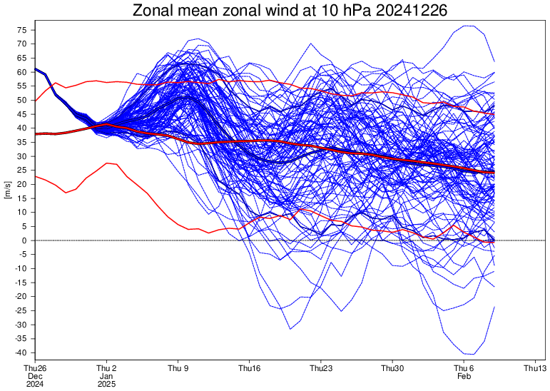
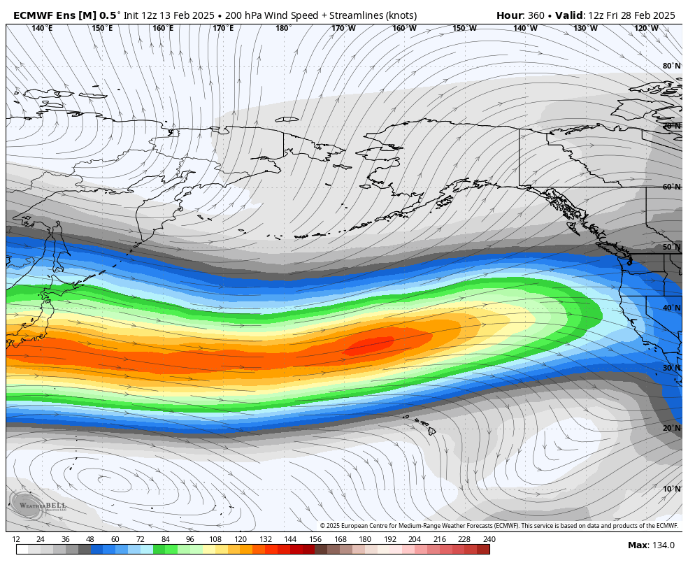
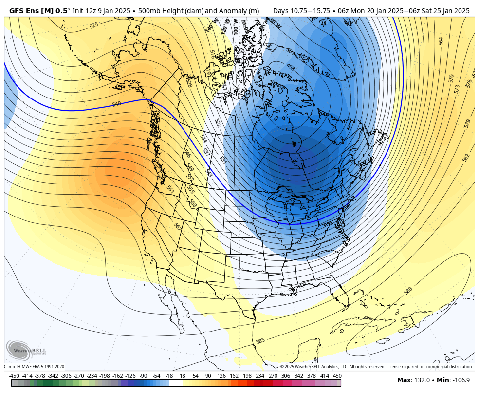
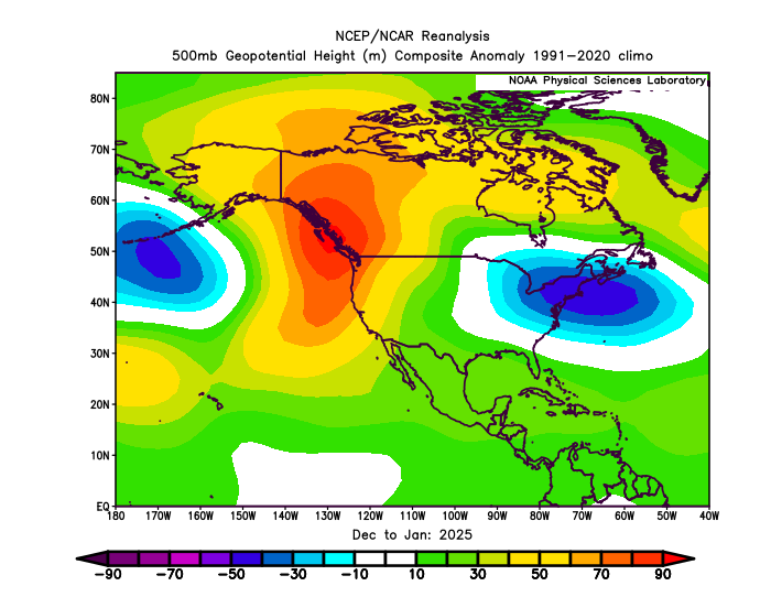
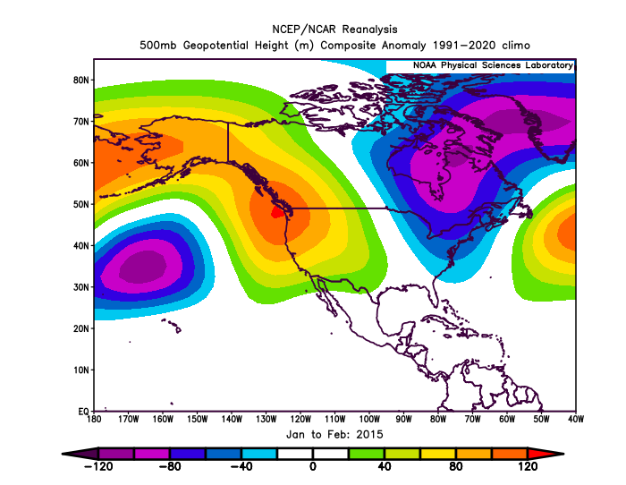
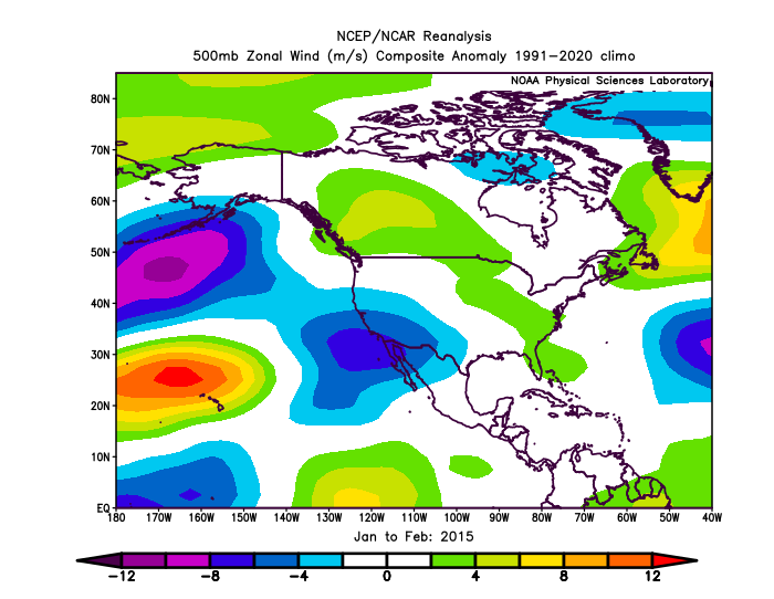
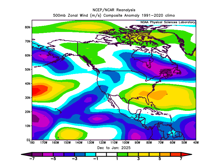
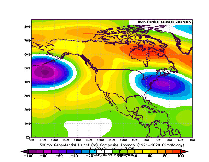
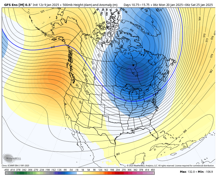
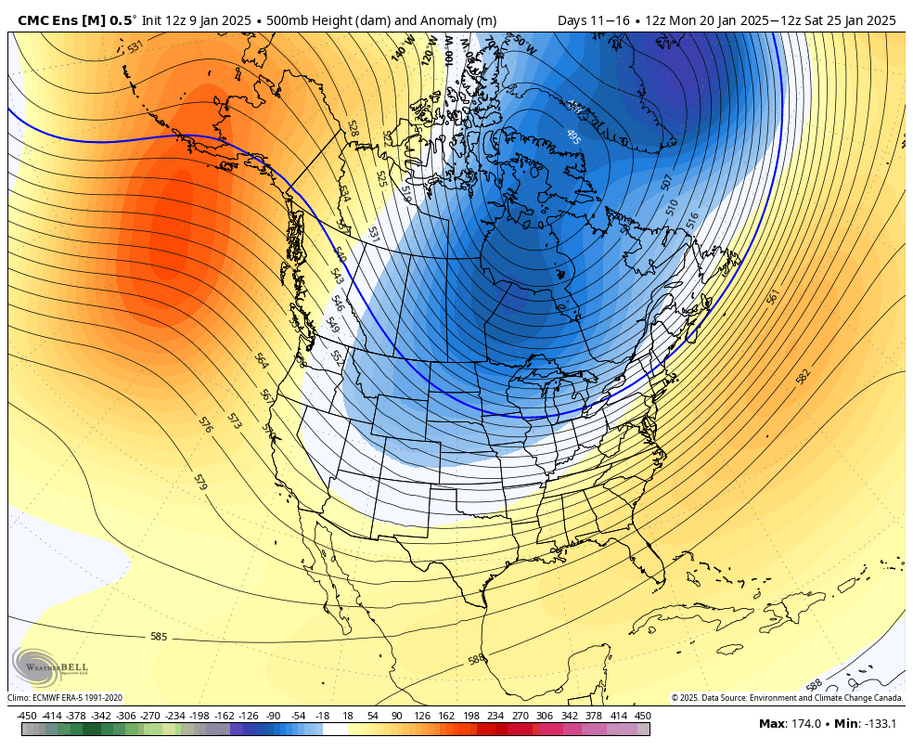
If I were to compare Dec/Jan ‘24-‘25 to Jan/Feb 2015, both patterns look similar at face value (+PNA/-EPO), but late Jan to Feb 2015 was a far snowier pattern for the northeast, with storms constantly bombing out over the benchmark. The thing that really stands out to me is that in 2015, the pacific jet was more equatorward (see that area of blue further south in the eastern pacific, area of orange in zonal wind). A more equatorward pacific jet is more favorable because it allows for more amplified ridging out west, allowing storms to dig.
-
The lake effect snow here and the record warm lakes earlier in the season is the only reason we did well here. Most of the clippers went north of here, which is fairly unusual in this type of +PNA/-EPO pattern. While that was cold enough for snow here, it did not allow much redevelopment east of the mountains, so the precip of these light to moderate clippers mostly fell apart by the time they reached the coastal plain. The further north track can probably be attributed to the stronger pacific jet as mentioned.
-
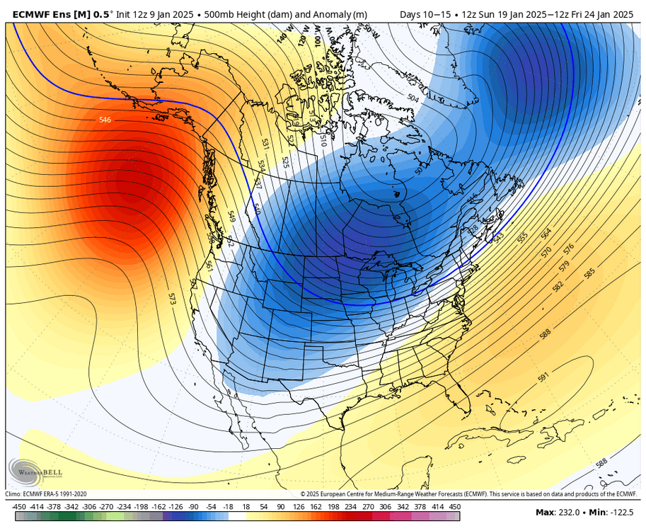
The end of run EPS are showing signs of a Nino-like pacific jet extension, bringing the risk of mild temperatures across North America. Depending on how this shakes out, it could bring our first shot of spring-like temperatures, particularly the interior/areas not subject to CAD. If it verifies less extended (stops short of the west coast), then we likely continue to see colder than normal temperatures. There are currently mixed and competing ensemble signals in regards to this.
-
Yeah exactly. The longer the fetch across water the better. Of course you still generally need cyclonic flow, but a weak clipper or a storm passing offshore over the atlantic would probably be enough to do that. A developing 50/50 low lodged under a block would produce it for several days.
-
In Japan, it’s usually cold air advection driven ocean effect snow, similar to lake effect snow off the great lakes. Far easier to get that when you’re east of a large body of water as opposed to the Atlantic where you need the southern and northern stream to phase and a favorable storm track, otherwise it’s mostly cold and dry.
-
The second half of February has some potential with signs of blocking showing up. We will need to see how the pacific pattern evolves.
-
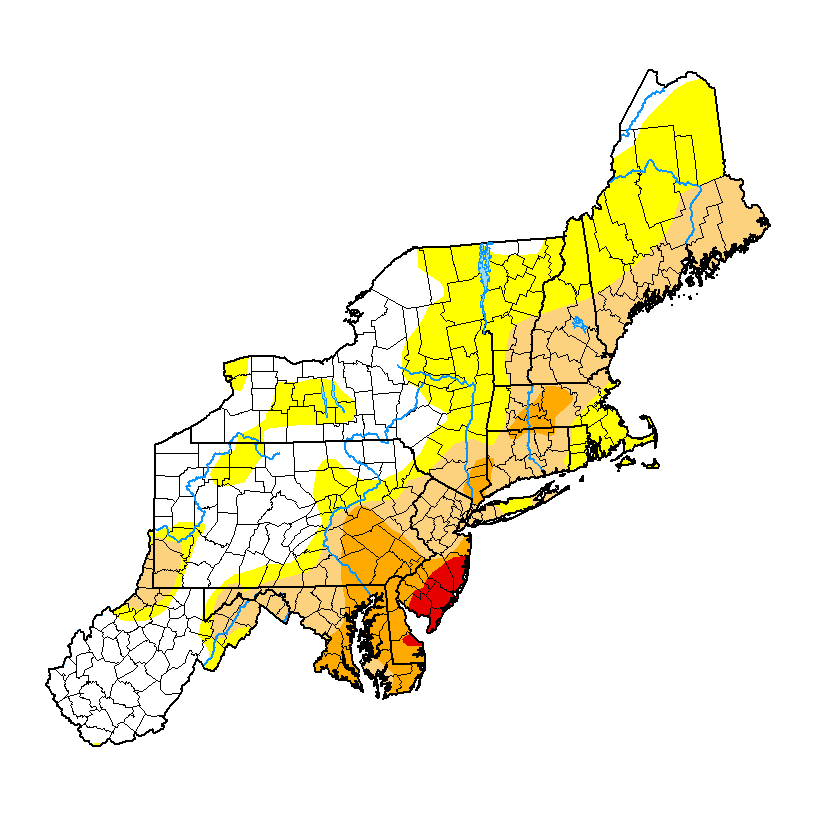
On a positive note, the upcoming pattern will provide potential relief to the drought-stricken portions of the region.

-
Yeah if we lose that -EPO/western AO ridging by mid month, we will have our first legit torch period.
-
There should be continued snow chances in the Northeast as long as every vort that drops in from the Pacific is not getting buried in the southwest. Whether they cut, go inland or go coastal depends on individual tracks and wave spacing.
-
Probably not until mid Feb when we see a more sustained SE ridge torch pattern. Prior, I would go with up/down thermals.
-
I wonder if they see something that other’s don’t. This year made sense because we almost always swing to Nina after a strong Nino. But next year seems less certain until we cross the spring predictability barrier.
-
While I happen to be doing fine with lake effect, 135” on the season (well above normal), and snow cover since thanksgiving weekend, others in this region that do not receive much lake effect snow have felt that they have been stuck in the freezer with few synoptic snow opportunities other than dry clippers that bring some light accumulations. A warmer and wetter pattern, even if it runs the risk of rain, seems to be what is wanted. Also, Lake Erie is freezing over, so I would not mind an active pattern myself.
-
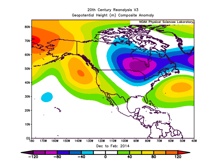
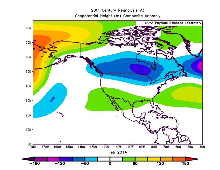
One of the reasons I’d argue why this winter is less snowier outside of the lake effect and upslope mountain regions is the H5 pattern. Compared to 13-14, the mean long wave trough axis is further east.
-
While certainly it’s on the table, a ridge south of the aleutians (mild pattern in the northeast) is not set in stone or guaranteed at this point.
-
I also feel the same way. Also, aren’t canonical Nina’s usually dry for Cali? People had snow up to their roof out there in 22-23. I view a canonical Nina as a GOA (not Aleutian) ridge. This is why I would rarely forecast a deep -PNA/SE ridge all winter long just because it’s a Nina. Also, I should mention that 22-23 would have had a cold January in the east, if not for a strong/super Nino-like pacific jet extension lasting until week 2 that extended all the way to the west coast and required several variables to line up for that to occur, and nobody could have reasonably predicted that to occur on a seasonal or subseasonal scale.
-

Occasional Thoughts on Climate Change
LakePaste25 replied to donsutherland1's topic in Climate Change
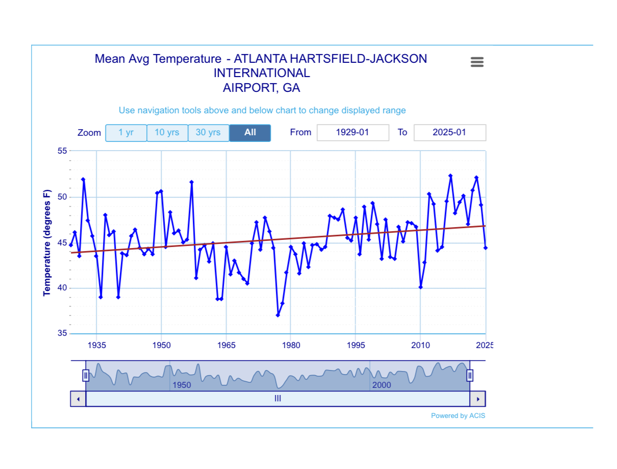
A prominent climate change denial account is using the historic winter storm in GA to downplay the effects or impact of climate change. Winters at ATL have been rapidly warming: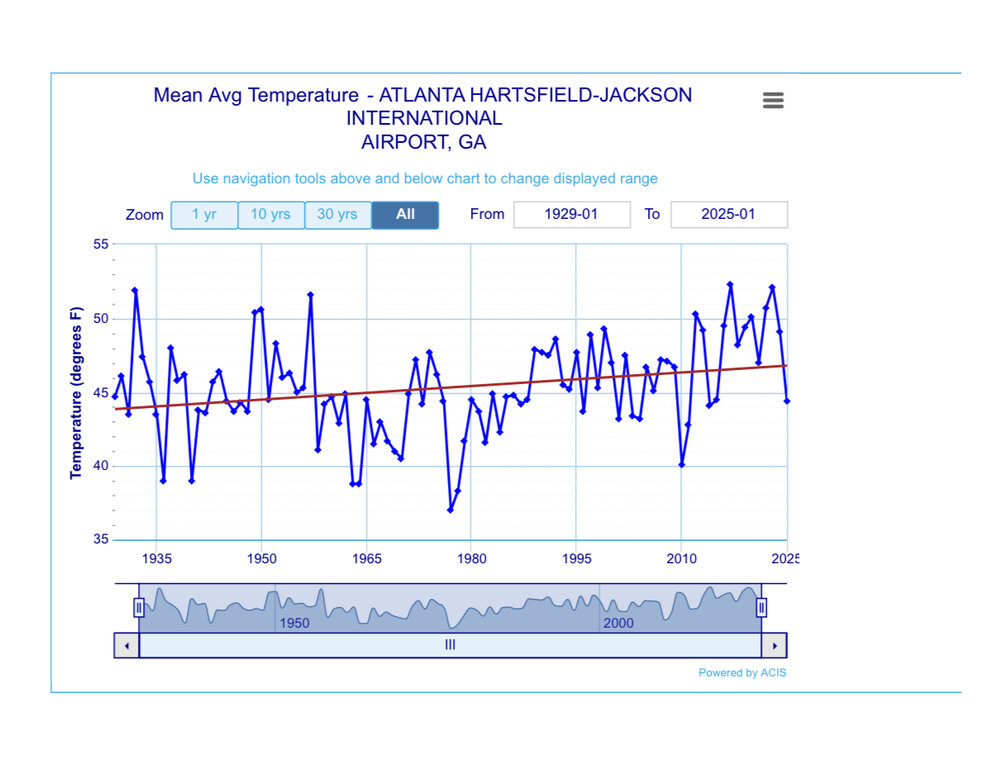
-
Sure it will get cold, but storms can cut with a -EPO if there’s no +PNA. Remember that historic blizzard in Buffalo in December 2022? That started with a huge cutter and -EPO. For the coast, it was a cutter followed by cold and dry.
-
I still recorded 10”+ of snow here in february 2018, but the latter part of the month was a torch here. I had 2 days over 70, which is over a +30 departure.
-
Ensembles are split post-MLK day. The GEFS continues with a full eastern trough, while the EPS and GEPS have more of an overrunning setup that favors the interior, potentially with snow/sleet/ice profiles.
-
I think going forward, the main question is what type of SE ridge pattern we see in Feb. Do we see an amplified SE ridge torch like we saw in Feb 2018, or do we see a more muted, -EPO driven SE ridge with a gradient pattern such as Feb 2022? I am obviously rooting for the latter as it is better for snow chances here.
-
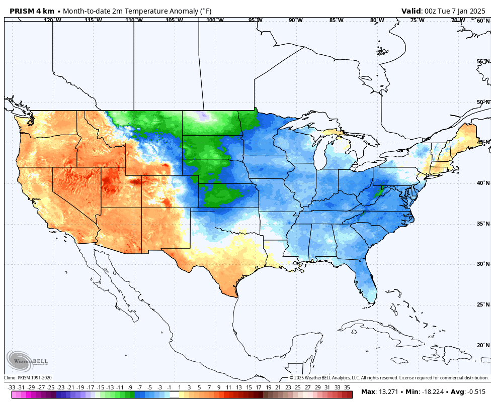
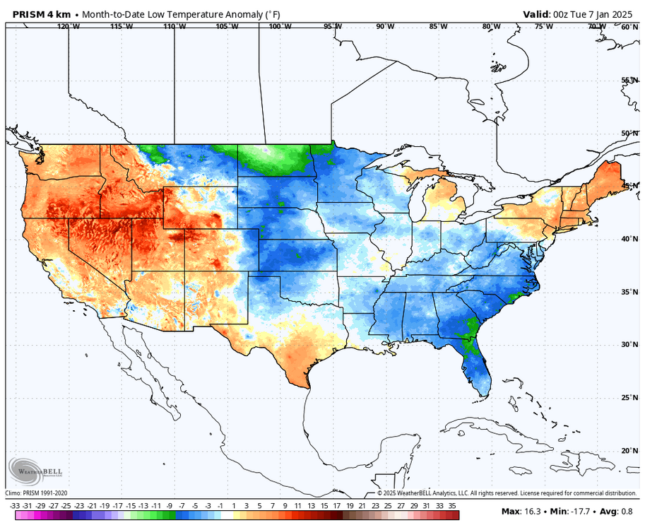
Although persistent, the cold pattern that began the New Year has not been that impressive for the northeast. The cold temperature anomalies have been more impressive further west in the plains and in the deep south. Persistent cloudy conditions north of the turnpike has kept a lid on temperature departures, even resulting in the min temps being above normal.

-
If we can maintain some Baja ridging, we can hope for a more February 2014 look, as opposed to recent february’s.
-
That 12z euro run spelled trouble for good snow storm chances as it buries vort after vort in the southwest. It is probably the more extreme scenario, however.
-
Yep, this is progressing as expected. Hopefully the -PNA doesn’t dig to Baja and we get some blocking.
-
They might just be referring to a sudden weakening of the PV. For an official SSW, these winds need to drop below 0 m/s which only has a few ensemble members doing so near the end of January into February.