.jpeg.302c67143ea75c332053973bc310ec90.jpeg)
kazimirkai
-
Posts
123 -
Joined
-
Last visited
Content Type
Profiles
Blogs
Forums
American Weather
Media Demo
Store
Gallery
Everything posted by kazimirkai
-
Lol i'd be fine with zero snow for the rest of winter if the GFS 0z validated
-
.thumb.jpeg.406ecda2eec9e267302c22b9f128fe3c.jpeg) I mean yeah these are all over the place. Some show a foot of snow in places while others have almost nothing anywhere
I mean yeah these are all over the place. Some show a foot of snow in places while others have almost nothing anywhere -
lol I don't think that should be too tough at this point. I stopped hoping for 12-18 2 days ago
-
Its at least an interesting event, even if disappointing at the moment.
-
How have the ensembles been trending with that one?
-
Is that the case with the 6z/18z ensembles? It seems like the gefs has been trending weaker for a few runs now.
-
Just another fun map to look at. They're definitely seeing the dreaded Hudson river valley effect. Hopefully I'm far enough west to avoid that but the EPS sees it as a big factor in this storm too
-
Interesting how the 12z euro has the same lingering snowfall across SNE after the storm moves through as the 6z gfs. I wonder what will become of that feature
-
Ig I was looking at hour 114 on the 12z and comparing. At that point (just off the coast) the storm is at virtually the same latitude but as it moves east it goes farther north on the 12z. The north trend much more evident looking at the snowfall distribution
-
Really? It looks like a similar track to me, just weaker and less moisture
-
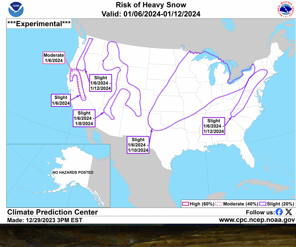
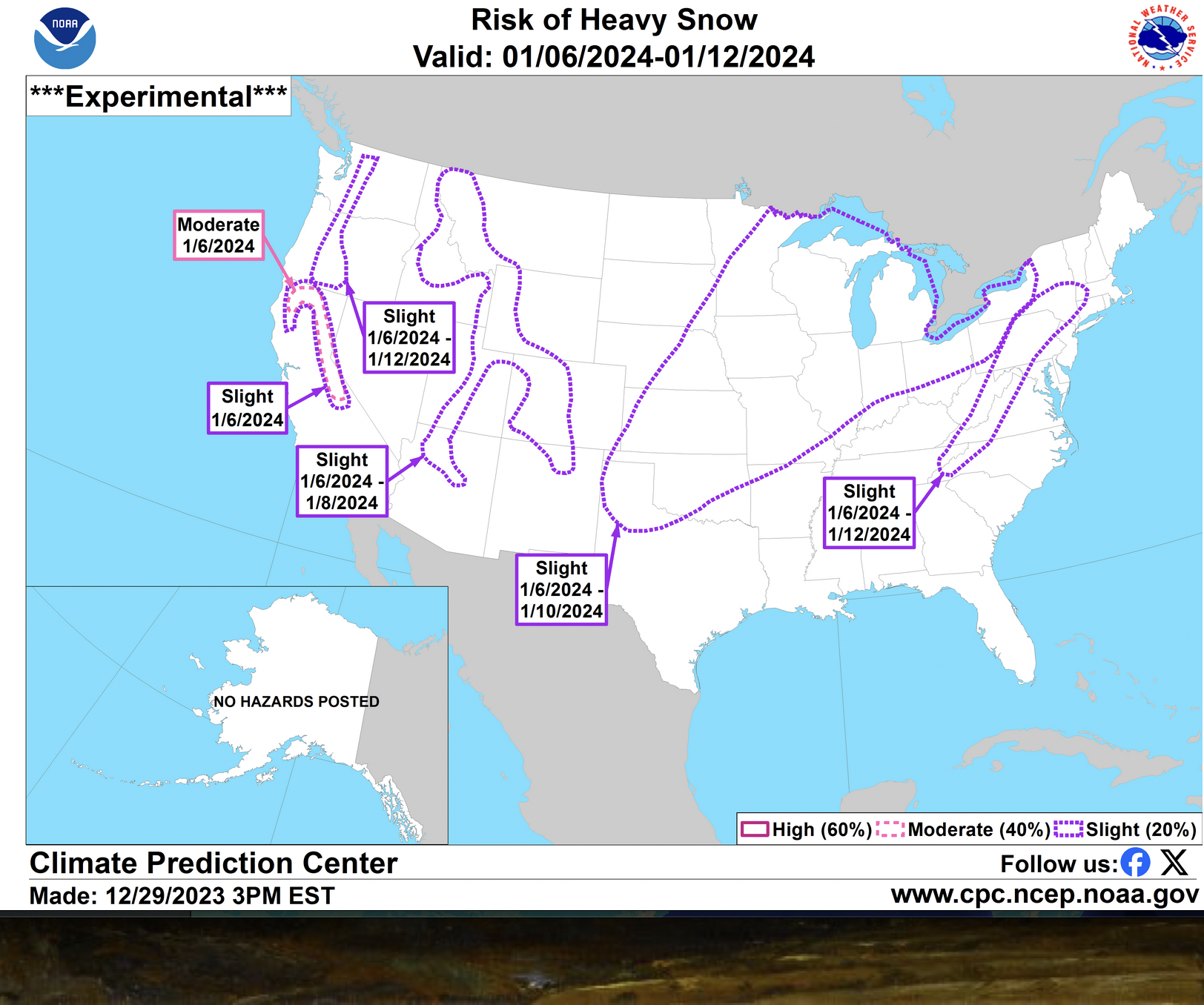
CPC thoughts on the 10th storm
-
Can somebody explain the extreme forecast index please? What is a shift of tails?
-
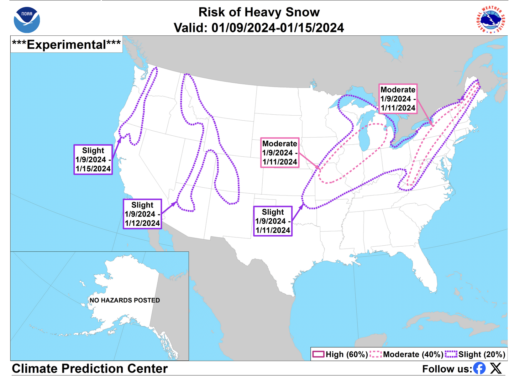
I'm in the 60% on this map. Hope it validates
-
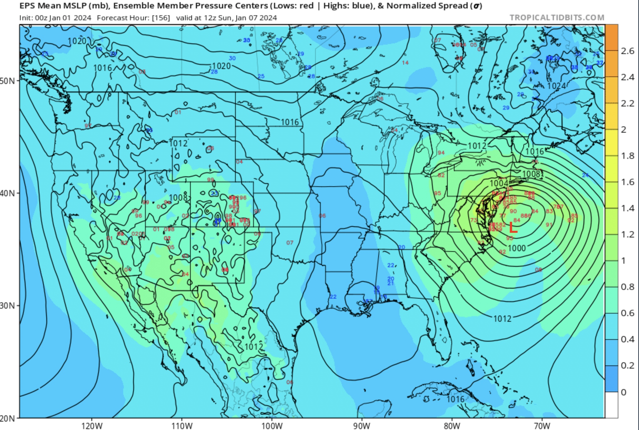
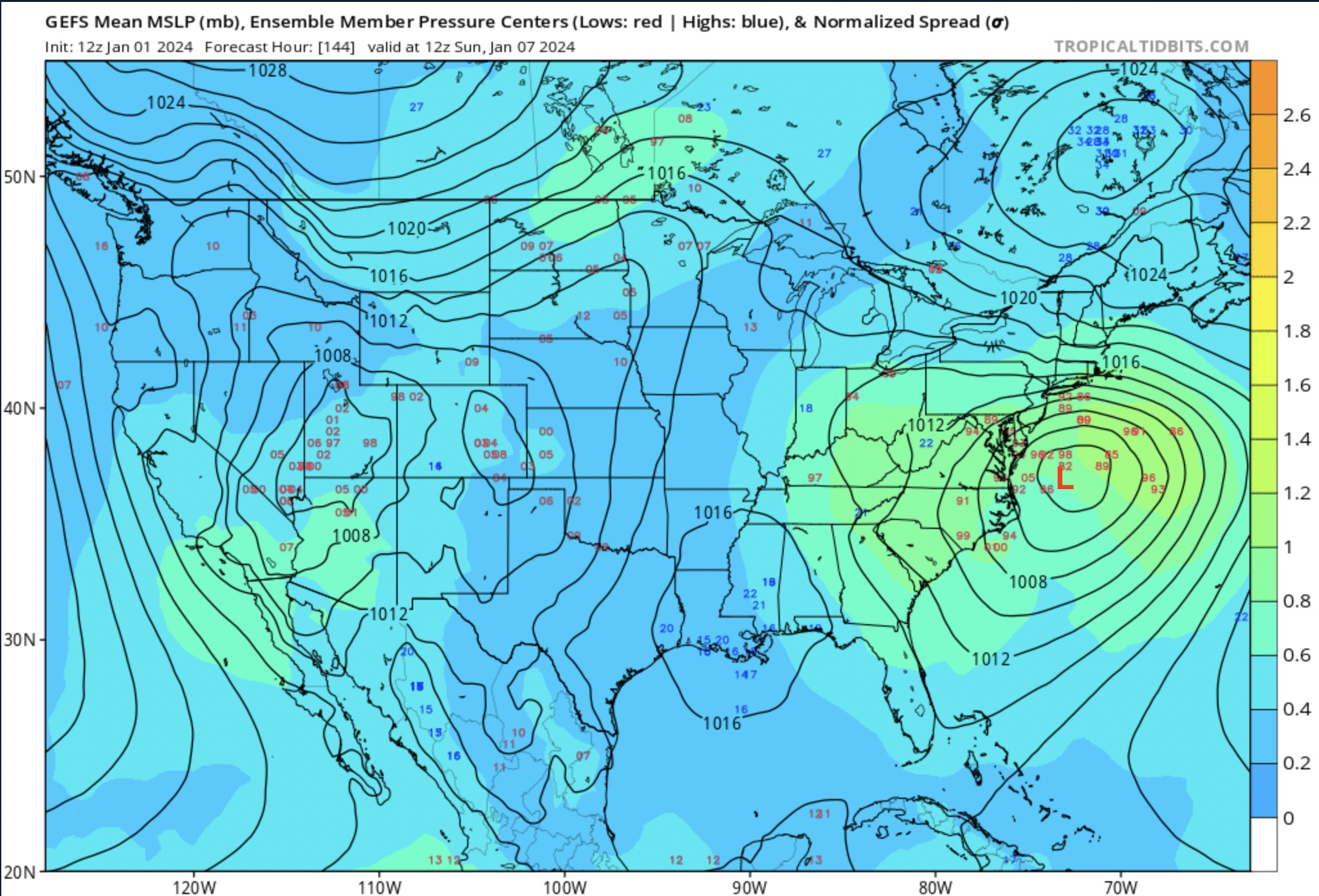
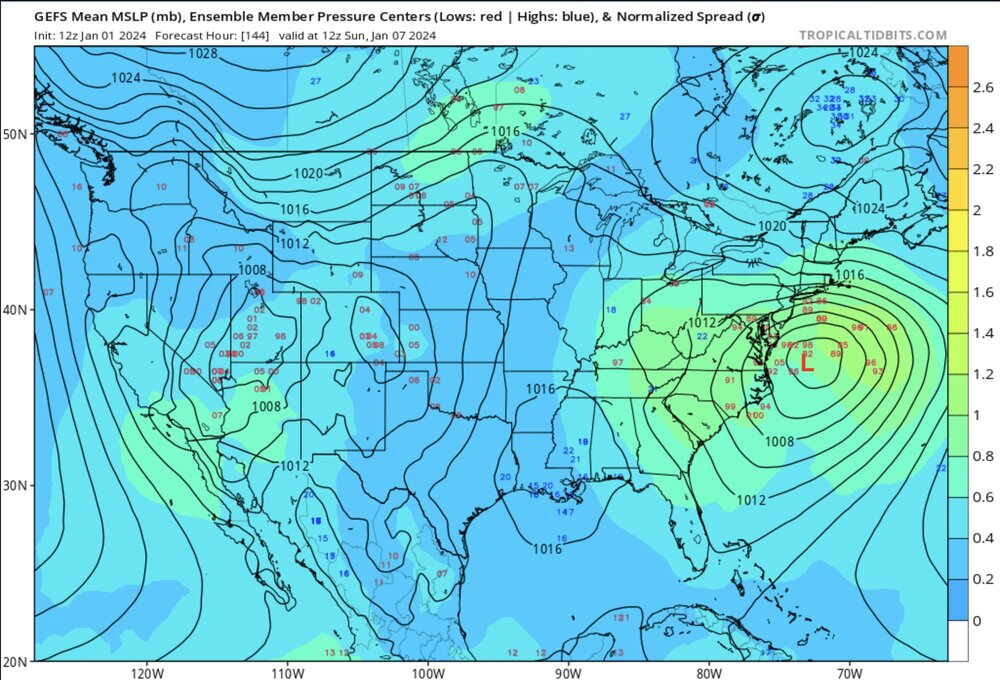
12z GFS OP low compared to GEFS 12z and EPS 0z with storm timing lined up (EPS has it abt 12 hrs slower than GEFS).

-
I wonder what this map would look like in kuchera
-
same
-
The two ensembles appear to be nearing a consensus about the general idea of the 7th storm which is comforting at least.
-
Same boat here: 3" with the gfs, 17" with the euro. Id honestly even be happy with 3 though I'm starving for snow
-
Well I guess I just would have assumed the operational run would always be one of those roughly in the middle of all the ensemble members as opposed to one of the those skirting the edge of the distribution.
-
Well I was referring explicitly to the 5th storm. The majority of the high snowfall amounts on some of these members result from the 7th storm which I figure is the better one anyways.
-
It seems like the latest ensemble runs don't have hardly any members close enough to the coast to provide any sizeable precipitation even if it was in the form of snow. The best chance for anything around that time is probably some lingering inland snow from a weak low pressure near the st Lawrence valley before the energy transfers to the coastal low.
-
It is interesting though how on the 7ths storm neither the 12z euro deterministic or the 18z gfs deterministic are anywhere near their the center of their respective ensemble mean counterparts. Why doesn't the model default to deterministics that are more representative of the ensemble mean? I'm looking at hr 204 btw.
-
Yeah fr. I get a piece of every storm and cutter on that run and end up with 13". Oh what a dream that would be
-
You said it man. A lot of people around me are saying things like "why doesn't it snow anymore?" or "remember when it used to snow before global warming?" I don't really know what to say because I don't honestly know how much this snow drought over the past 5 years has to due with climate change compared to a regular period of variation. What do you guys think?
-
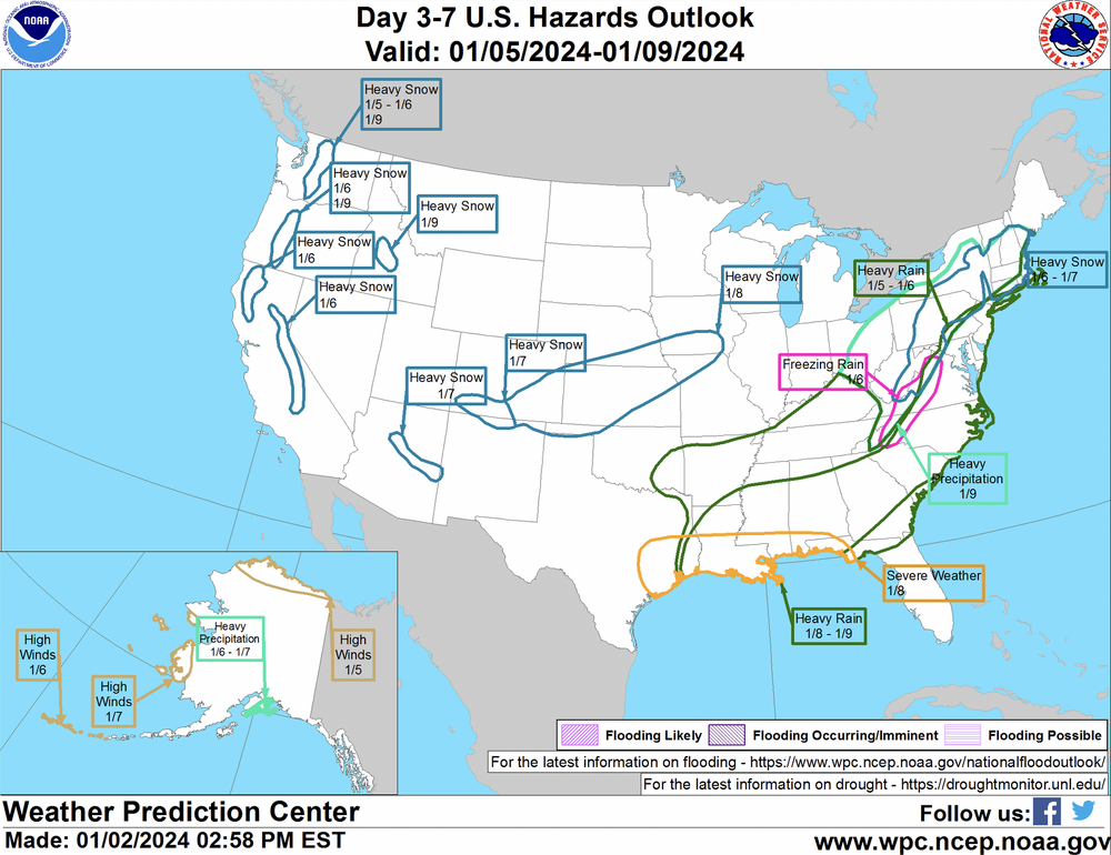
Thoughts on this map? I assume the slight risk over the Appalachians is regarding the 7th storm since the 5th isn't within the specified range.