.jpeg.302c67143ea75c332053973bc310ec90.jpeg)
kazimirkai
-
Posts
123 -
Joined
-
Last visited
Content Type
Profiles
Blogs
Forums
American Weather
Media Demo
Store
Gallery
Everything posted by kazimirkai
-
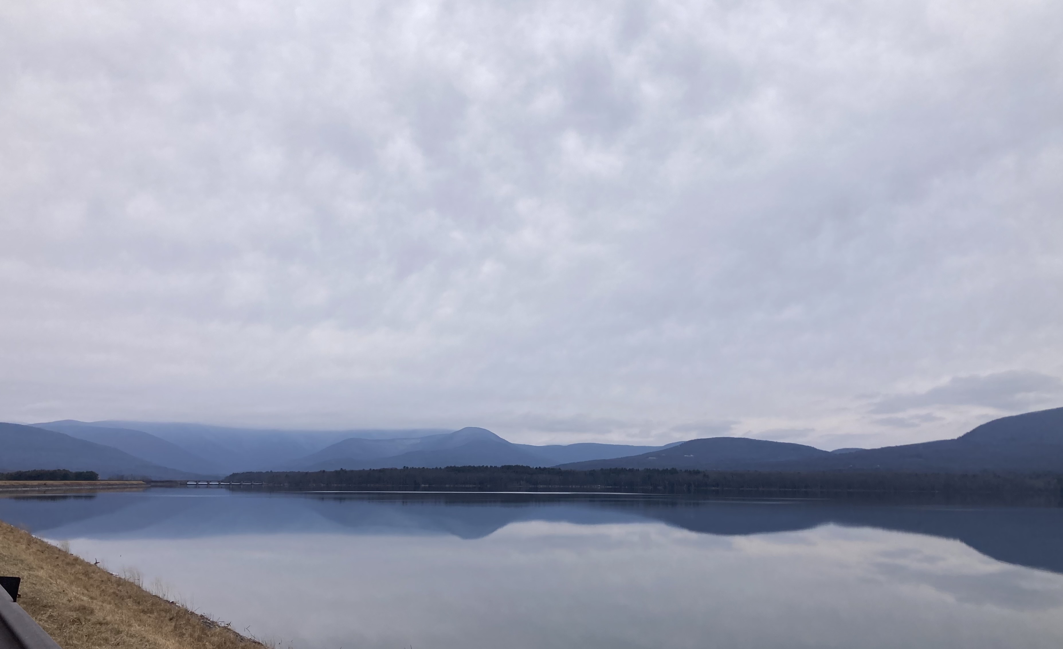
.thumb.jpeg.406ecda2eec9e267302c22b9f128fe3c.jpeg) Catskills about an hour ago
Catskills about an hour ago
-
Is there some page or website that compiles the snowfall forecasts of each weather office in into one map?
-
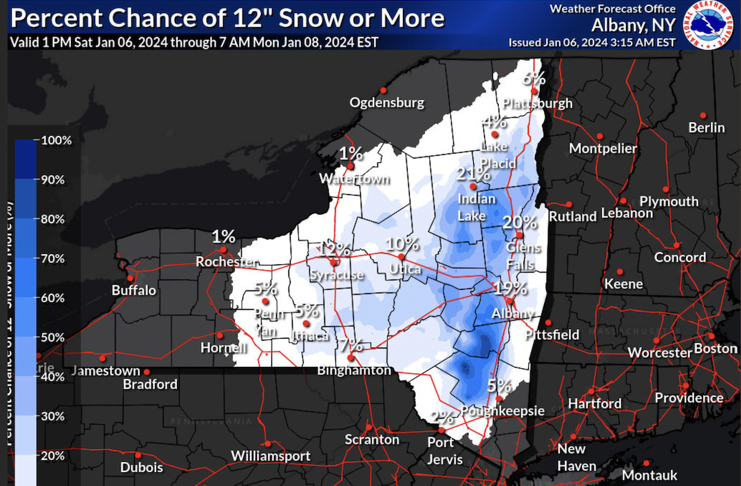
I live about 10 miles southwest of Kingston and at least half of the models have shown 12"+ since about noon yesterday so it seems reasonable for where I am at least to be in the 12-18 shade. Other areas, not so much. Looking at the probabilistic snowfall forecast, there are plenty of spots in the 12-18 region that have a probability less than 50 of getting it which leads me to believe this map is indeed generally overdone.

-
Youch not liking this run. Hopefully the short ranges have a better idea
-
I mean it doesn't look much like any of the other 0z models, most of which are hi-res, so I'm not putting much weight on it unless I see more support for this type of solution.
-
I am. Just joined in November. Trying to learn as much as I can before I start working in the field
-
The low moved further west since 18z but weirdly the heavy banding shifted southeast
-
I mean its been varied within a range of two inches for my area since the 6z run. Maybe S NY is just easier to forecast for than S NE with this storm? Idk ig I can see where the inconsistency complaints come from in places farther east.
-
Which shortrange model usually is right in a snowstorm?
-
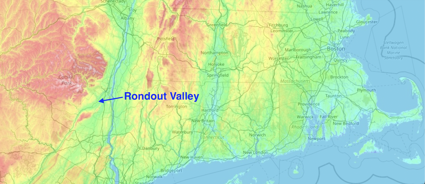
Does the orientation of the valleys matter? I figured the biggest reduction in snowfall amounts on the Hudson and Connecticut had to do with down-sloping off of the eastern-side ridges. I'm in the roughly east-west oriented Rondout River Valley and models haven't seemed to pick up much of a decreased snowfall outside of simple lower elevation.

-
Wow just got back from my hike to find most all of the models outside the euro, rgem, and canadian giving me around 12". Nice sight to see
-
I don't personally mind all my snow melting by next week. I'm used to winters where most of the ground is barren most of the time. Ill be disappointed if we don't get another good storm by the 20th though
-
Well I'm in the Hudson Valley. A large portion of the snowfall in these forecasts are dependent on a solid band coming through near the first half of the storm that could easily shift south or east, leaving the brunt of the totals on the light to moderate accumulations through Sunday when the temperatures are higher and the snow liquid ratios aren't as favorable, but that's just my area. I'm not too concerned about an overall change in the character of the storm reducing totals for everyone
-
GFS cuts down alot on the whole western half of the impact region. For whatever reason I have a bad feeling about this storm under-performing in my area.
-
At what point are short range models more important to look at than the GFS and EURO?
-
One thing I notice about the nam comparing the models at 48hrs (which includes 3km, rdps etc.) is that compared too all other 18z models and 12z ones that came out earlier, the 12km has the weakest low pressure. Maybe that lends credence to the idea of it being somewhat of an outlier?
-
Ohhhh yeah I remember making these in my atmospheric structure class two semesters ago
-
What are WAA and CCB?
-
I mean I guess you could just look at qpf and temperature throughout the event and estimate
-
I'm about 65 miles from the coast in S upstate NY and I seem to be right in where the 10:1 line is. Every time I check the kuchera it tends to be about the same amount with an increase north of me and a decrease south. Of course that probably changes as you go east but that's where the 10:1 line is on the western side of the impact zone
-
You know the 12z had a very similar looking feature in southern upstate New York. It seems like both this dry slot along with the heaviest stuff near E Mass shifted about 80 miles eastward while the western extent of snow remained largely the same. Interesting
-
Much better handle than the 12z. Maybe the new sounding input influencing?
-
Interesting the gfs is stronger at 18z Sunday though. Idk how to interpret what that means for the system. Did the trailing area of low pressure link up better in this run?
-
The new Canadian is great for the 10th. Nice to think that's a possibility
-
The EPC low did trend south and weaker but the track of the OP was amid the northwest cluster so I wouldn't say it was much of an outlier track-wise. Idk what most members' intensities were so It would've been an anomaly in that respect.