
Stx_Thunder
-
Posts
301 -
Joined
Content Type
Profiles
Blogs
Forums
American Weather
Media Demo
Store
Gallery
Everything posted by Stx_Thunder
-

Severe Weather 3-13 through 3-16-24
Stx_Thunder replied to cheese007's topic in Central/Western States
Lots of CG positive strikes in that healthy supercell south of Houston, but nothing actually powerful on lightning analysis (all less than 150 kiloamps). -
Severe Weather 3-13 through 3-16-24
Stx_Thunder replied to cheese007's topic in Central/Western States
https://www.spc.noaa.gov/products/md/md0263.html -
Severe Weather 3-13 through 3-16-24
Stx_Thunder replied to cheese007's topic in Central/Western States
Must’ve been very prolific severe hail coming down in that same supercell when I saw Base reflectivity color max out on imagery over 80 DBZ (may have neared 90 DBZ seeing that tiny, light yellow speckle in right side blue strip area of 80 DBZ range), a short time ago. -
Severe Weather 3-13 through 3-16-24
Stx_Thunder replied to cheese007's topic in Central/Western States
https://www.spc.noaa.gov/products/watch/ww0054.html https://www.spc.noaa.gov/products/md/md0259.html -
Severe Weather 3-13 through 3-16-24
Stx_Thunder replied to cheese007's topic in Central/Western States
Seeing new cells developing between San Antonio and Houston TX, and a struggling cell near the Mexican border close to Del Rio. But they seem to be mostly heating/surface boundary induced as 500mb heights have slightly risen in South TX (above 580dm) this morning behind the departing shortwave causing the MCC in Dallas/Fort Worth area right now. The cells closer to Houston are showing some intensification/organization. But not sure if I can agree with SPC’s decision to upgrade to Enhanced risk on today’s outlook. Though they have upgraded to Slight risk now on midday D2 update (as I had also suspected yesterday for Saturday with the sufficient DL shear that had already been forecast in GFS & Euro runs all this week). - Deep 500mb Low is also still a bit too far out west over the California/Arizona/northern Mexico border. And shear parameters on this morning’s 12Z CRP observed sounding is not really conducive for a sustained supercell or mature MCS risk. But moreover cell clustering or MCCs (as been seen over northern half of TX today). It’s looking more like Saturday timeframe would be better for a more pronounced severe hail/wind potential over southern half of TX when the Low gets closer with better dynamics and cooling aloft coming in. Will see how 0Z sounding looks this evening, for tonight. -
Severe Weather 3-13 through 3-16-24
Stx_Thunder replied to cheese007's topic in Central/Western States
Day 1 Convective Outlook NWS Storm Prediction Center Norman OK 1232 AM CDT Fri Mar 15 2024 Valid 151200Z - 161200Z ...THERE IS A SLIGHT RISK OF SEVERE THUNDERSTORMS ACROSS PARTS OF SOUTH-CENTRAL TEXAS AND THE MISSISSIPPI/ALABAMA REGION... ...SUMMARY... Scattered strong to severe thunderstorms are possible across portions of south-central Texas and over parts of Mississippi/Alabama region. ...South-central TX... Confluent high-level flow over the middle of the CONUS will encourage surface anticyclone to settle south across the Plains today, though some weakening is expected across the southern Plains late in the period. Latest water-vapor imagery suggests a weak midlevel short-wave trough is approaching south TX early this morning. This feature is forecast to advance into the lower MS by 18z as associated 500mb speed max translates downstream into the central Gulf States. As a result, neutral-weak height rises are expected across south-central TX by afternoon. As this low-latitude short wave approaches higher-quality moisture, there is some concern that early-day elevated convection may develop. Several HREF members suggest isolated supercells initiate ahead of this feature. However, forecast soundings are quite capped so any activity should remain isolated. Of more concern is the strong surface heating anticipated across northeast Mexico into portions of south TX ahead of the synoptic front. Forecast soundings ahead of the boundary suggest convective temperatures will be breached as readings warm into the lower 80s. NAM sounding for DRT at 22z exhibits negligible CINH with SBCAPE on the order of 2500 J/kg with a temp/dew point of 83/62F. Strong surface-6km bulk shear and weak frontal convergence favor thunderstorm development and supercells appear possible. Large hail, some of it potentially bigger than 2 inches, is the primary risk with these storms. While convection should initiate due to strong heating, thunderstorms will likely linger well into the overnight hours as an increase in the LLJ is expected during the latter half of the period into this portion of TX. ..Darrow/Wendt.. 03/15/2024 -
Texas 2024 Discussion/Observations
Stx_Thunder replied to Stx_Thunder's topic in Central/Western States
Seeing new, fairly strong thunder development with the dry line/front closer to Abilene area right now with one embedded supercell near Coleman that was apparently producing 2” hail just a short time ago. The more reliable ARW2 and NSSL convective models are showing things organizing into some sort of linear MCS around DFW area (seeing some cells trying to initiate just north of there now also), and propagating south through ETX and toward Houston this morning (Friday) like the globals had been indicating the past days. Models are also insistent on some actual thunder cells (possible supercell or two) firing along the Rio Grande near Laredo overnite and moving east/northeast but that seems to be very conditional for tonight. Though I’m seeing one little thunder cell popping up not too far southwest of Brownsville right now also. There’ll likely be a significant outflow generated with N/ETX activity if it does organize and that would serve for renewed convective development later in the afternoon or evening closer to Del Rio - San Antonio - Houston area. Which still looks interesting for some severe potential into this evening. Then again Saturday and into STX also. -
Severe Weather 3-13 through 3-16-24
Stx_Thunder replied to cheese007's topic in Central/Western States
That 12Z Dallas/Fort Worth sounding has wet bulb zero (WBZ) height inside the large hail zone. But Effective shear at 36 Kts is much more meager for supercells than further north in OK at 67. BRN shear value at 40 is barely in the supercell range also. -
Severe Weather 3-13 through 3-16-24
Stx_Thunder replied to cheese007's topic in Central/Western States
The last time I had a similarly projected (severe) convective/MCS scenario happening around here in Southern TX in mid March (and at night) was back in 2016. Before that, on March 13, 2007. Even though the 2016 one had significant damaging winds in the region, I didn’t lose power. But the 2007 one I did. Though I don’t think the 2016 one had a Cutoff Low involved. 2016 one: https://www.weather.gov/crp/031816_highwind_hail https://www.spc.noaa.gov/exper/archive/event.php?date=20070313 The 2007 one had a non-severe (but restrengthened near coast) MCS, two nights prior and closer to sunrise. Tuesday evening March 13th, discrete supercells popped up around Laredo and Rio Grande plains area then gradually consolidated into a fairly linear but powerful MCS. Propagating east and came right through and off the mid TX coast, fully intact around midnight. I even got to see hail come down which is hard to come by here around the mid-lower TX coast. Very frequent lightning also of course. But there was more of a southwesterly 850mb flow and a thick stratus inversion deck in the low-levels that formed later that evening so I couldn’t see zip lightning out west outside until it got close. That very following morning behind the MCS on 14th (Wednesday), a few elevated supercells popped up near Victoria and headed toward Houston in the mid day. -
Severe Weather 3-13 through 3-16-24
Stx_Thunder replied to cheese007's topic in Central/Western States
SPC is likely going to expand that current D2 Slight Risk south-east going into tomorrow. GFS & Euro showing sufficient DL & effective shear around 50 Kts over southern half of TX Friday afternoon/evening (Del Rio - Houston line, south), with an unusually backed south-easterly 850mb flow happening right ahead of a slowing/stalling front. Because of a cutoff 500mb Low out west that’ll be edging a little closer by then with stronger shortwaves aloft in the SS obviously trailing in from it. But even through Friday night over STX, latest runs are showing CIN weakening more through the night with more storms popping up over the Rio Grande plains around Laredo overnite, going east. And with all that projected positive 850mb theta advection going on beneath steep ML lapse rates and sufficient shear, could still have some pretty powerful storms & supercells going on overnite into Saturday. Even if a little elevated. I see they also have a D3 marginal risk outlined over Laredo area toward San Antonio. But that’ll probably also be upgraded to a slight risk or at least in Deep STX if the front is still hanging around here until early Sunday. Can be earlier frontal push if mature MCS happens Saturday morning (which is good possibility seeing these things in the past around here). But this whole setup with a cutoff Low out west ahead a very modified warm sector in mid March (already 70F+ DPs on TX coast this morning), is unusual to say the least. There’s definitely going to be a lot of built-up instability that storms can tap into over southern half of TX (with enough lift), Friday afternoon/night. -
Texas 2024 Discussion/Observations
Stx_Thunder replied to Stx_Thunder's topic in Central/Western States
Good multi early season MCS/MCC with lots-o-lightning potential (cutoff Low out west & projected steep mid-level lapse rates esp. on Euro), eastern to southern half Thursday nite - Sunday: -
Texas 2024 Discussion/Observations
Stx_Thunder replied to Stx_Thunder's topic in Central/Western States
* Taken at 10am (regarding high-based cells in my previous post today). Could be another round later tonite - Wednesday.
-
Texas 2024 Discussion/Observations
Stx_Thunder replied to Stx_Thunder's topic in Central/Western States
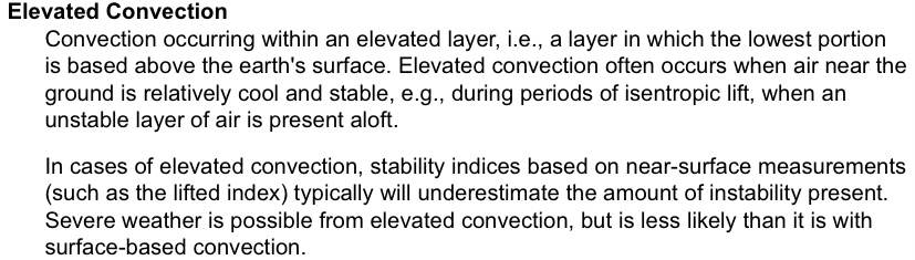
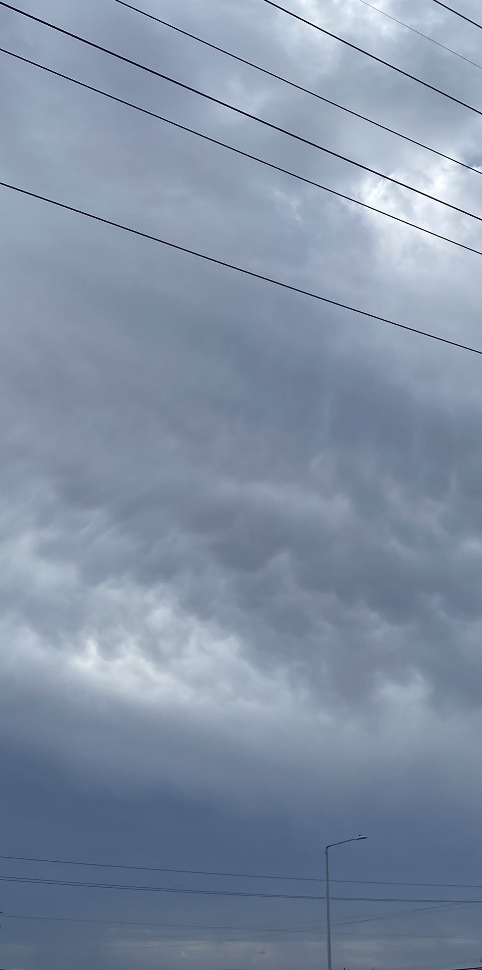
Seeing a few high-based thunder cells popping up from an incoming ML shortwave across deep south since before sunrise this morning. BRO/CRP NWS offices did not forecast anything for today until they saw it now but already had somewhat steep ML lapse rates on Brownsville 0Z sounding yesterday evening. Already a good sign a more convectively active pattern is starting to return as later this week/weekend should be pretty fun with a parade of shortwaves coming in a more active southern stream. Potentially even part of next week seeing latest Euro runs as it got this morning’s sporadic high-based thunder activity around here right. Euro has been doing pretty well thunder-wise over TX since the beginning of the year. ‘Was not seeing very good reasoning with SPC’s D 4-8 severe risk highlights over the northeastern half (DFW region) as shear values were already projected to be modest there (consistently around 40 kts on both GFS & Euro the past couple days). And trending even more modest now on very latest runs on both models last night, for Thursday afternoon/evening. Though not too surprising on SPC’s part as they’ve been overforecasting the risks in the state lately. There may be a couple of supercells initially, but not seeing any kind of sustained/significant severe risk. Except for frequent lightning, smaller hail & heavier rainfall/flash flooding moreover. Might be a better severe risk in the southern half this weekend with higher shear values. -
March 7th-9th, 2024 Severe Weather
Stx_Thunder replied to cheese007's topic in Central/Western States
GFS, Euro, and all CAMs holding onto eroded sfc-based CIN over SETX midday - late afternoon today (Friday).- - - Wouldn’t hope for a dry spring too soon especially coming out of a fairly wet EN winter and active MJO pattern since the beginning of the year. GFS/Euro and their ensembles starting to latch onto a potentially more convectively active pattern later next week into next weekend over TX (and potentially through the early half of Spring). Looking at CFS longer range depictions also, it may not be useful in temp forecasting for a month out, but that is not necessarily the case regarding precip looking at its spring depictions since the past few years over TX. Keep in mind for later spring that May is typically spring MCS guarantee month also. Over the years, it rarely fails to have at least one or two good thunder systems impacting much of the state (especially eastern/southern half) during that month. MJO activity was relatively inactive the past weeks. But is also forecast to ramp up again out over the tropical Pacific in the coming weeks with a new activity wave progressing eastward. So that will likely have an impact on convective activity (potential severe) over the state due to enhanced subtropical jet influence as well in the coming weeks. The afternoon heat + orographically induced storms or discrete supercells out over the Mexican terrain (west of Laredo/Rio Grande) usually startup in March most years. The Euro is showing that could be happening mid-late next week as some more shortwave energy starts to come in from the west aloft in the southern stream, with hotter afternoon temps happening out there closer to or around 100 F on both GFS & Euro. - - - - - By the way, those bats you mentioned are called ‘Mexican free-tailed bats’ if I remember correctly. I do remember reading an article Austin/San Antonio NWS (as they’re very common in that region of TX) wrote about them back in the 2000s. Especially how they cause the donut-looking ground clutter depictions right around the radar site location on DFX & EWX radars like you referenced when the bats come out in huge numbers together at sunset during spring season. * Found detailed info on those bats: https://en.wikipedia.org/wiki/Mexican_free-tailed_bat
-
Texas 2024 Discussion/Observations
Stx_Thunder replied to Stx_Thunder's topic in Central/Western States
Been seeing some persistent thunder clustering (likely elevated, seeing tops no more than about 30 Kft on ET radar) going on around DFW the past couple hours. Things seem to be winding down for now, (especially with not much CAPE in place on 12 Z observed sounding this morning). But there was some pretty powerful CG strikes around the area on lightning data earlier this afternoon with this one being the strongest I saw on analysis: -
March 7th-9th, 2024 Severe Weather
Stx_Thunder replied to cheese007's topic in Central/Western States
12 Z runs yesterday and today on both GFS & Euro are starting to show a forecast trend in less convective CIN in S-SETX (including Houston area), Friday morning ahead of the initial Pacific front/dryline (dry, modest polar reinforcing front Friday night). But even though moisture, and DL shear is looking good (generally 60 kts) on both globals, forecast ML Lapse Rates aren’t (< 7) and seems to be trending lower. CAPE modest also (but sufficient). So that’s likely going to tamper atmospheric instability and severe hail, lightning threat a bit if storms happen. SRH values aren’t great also. Timing of frontal passage and 700 MB Low track over the TX Panhandle on those 12 Z runs comparison seems to be slowing down a little too. That could allow for a little better dynamics aloft. And instability on Friday in the lower levels and surface if frontal passage is indeed later midday. Will be interesting to see what CAMs (especially HRRR & ARW-2 as those have been doing the best lately), show when the time period comes into window tomorrow night. But since it is a positive-tilt (but formidable) incoming mid-upper trough being shown, I still wouldn’t be surprised if timing of shortwave energy ends up being somewhat out of sync with frontal passage in SETX. Though that’s usually a bigger problem with fronts further southwest in STX even if environment is favorable for storms. Especially this time of year. -
I’ve seen those weird flat-looking kind of hailstones with cratered edges before. They’ve got that foggy white nuclei, so they were indeed supercooled higher up in those storms with more updraft strength.
-
How long did all the hail last?
-
The more recent CFS runs seem to be hinting at that for late March cold snap in the Central US also. Time will tell in the weeks after March begins. But I’m just not convinced winter is actually done. Even down here in TX. Especially if the -AO phase verifies and has longer duration or more pronounced.
-
Nice. Though I might question if it’s actually real (though I see the timestamp in the stream). But if it’s legit, definitely supercooled hail stones (foggy or white nuclei). I’m assuming the “cracked” area on top happened when it hit the ground before it was picked up. It kind of looks like the shaved ice that’s made or packed for snow cones. I wonder if anyone on here has seen spiked hail stones. I saw that in real life from my own eyes once back in May 2005 from an HP supercell that was about 2” diameter and picked it up. The hailstone was almost literally ‘spiked’ that it could make your hand or fingers bleed if you weren’t careful handling it, basically.
-
Evidently seeing more multicellular clustering on radar like the low BRN shear values on the late afternoon DVN & ILX soundings were indicating (rather than truly discrete supercells). I’m sure this will have a somewhat negative impact on tornado production in the risk area unless things get more discrete. - - - - - I’ve seen that a handful of times before on lightning data or radar over the years. It probably is a “false” lightning strike. But what it likely really means is that the atmosphere is electrically charged (favorable for lightning production) in that area when you see that and nothing on precip radar.
-
Number of multicell clusters literally exploded just in the past 30 minutes, just east/south of Davenport IA area. Couple of severe thunderstorm, and tornado warnings now also.
-
Not surprised as I just checked the SPC 22Z DVN (Davenport IA) observed sounding. Again similar to a few weeks ago in eastern TX, Low CAPE (282 MU), but both steep low & mid-level lapse rates. Surface temp at 72 F which I guess pretty warm for this time of year up there. WBZ height isn’t ideal for large hail, but FZL height is definitely low for more hail production. PW only at 0.57 BRN shear parameter is low at 24 which doesn’t support supercells though at least in the immediate Davenport area (mainly multicells). Gonna try to watch how this evolves as that environment aloft around there is definitely still interesting. *Edit: 22 Z or utc DVN sounding. ILX sounding just off to the southeast in central IL showing much more CAPE around 1000 & better shear parameters.
-
Texas 2024 Discussion/Observations
Stx_Thunder replied to Stx_Thunder's topic in Central/Western States
By the way, I’m assuming that was a typo for ‘South Padre Island’. But the way you wrote it is legit pretty much what it is anyway there in deep STX lol -
Just to reference for everyone on here in case some aren’t as informed, NWS defines ‘Elevated Convection’ on their meteorological discussion glossary as this: https://forecast.weather.gov/glossary.php - - - And I never wrote that ‘elevated’ and ‘high-based’ storms were indeed the same and I already explained what high-based normally, or better yet, logically means. ’High-based’ though, can be interpreted differently because it is not an existing term in the NWS glossary. But, SPC also uses both terms in their convective discussions (and it’s been like that for a lot of years now as I’ve seen & read). Each forecaster may very well have a different interpretation of what's actually ‘High-based’ to them. But they could also just be meaning ‘Elevated’ at the same time too because there doesn’t seem to be an actual top layer criteria that strictly defines an elevated storm, looking at that NWS definition. ’Surface-based’ is indeed in their glossary as well. But it obviously has no room for individual interpretation because it inevitably means storms that are based within the surface layer (very near the ground), as written on there.