AstronomyEnjoyer
-
Posts
967 -
Joined
-
Last visited
Content Type
Profiles
Blogs
Forums
American Weather
Media Demo
Store
Gallery
Everything posted by AstronomyEnjoyer
-
Lol, this is somehow turning out to be one of the best events of the season.
-
Egg prices drop yet?
-
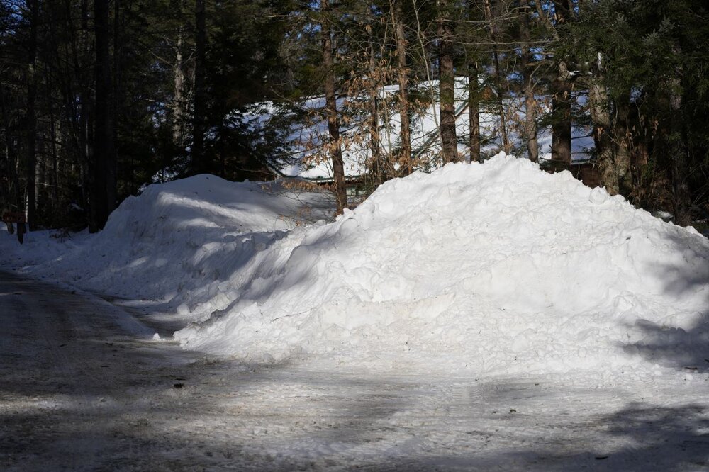
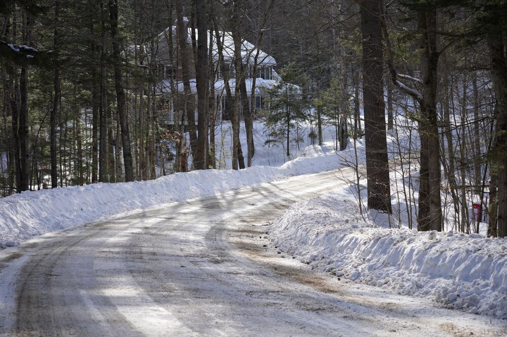
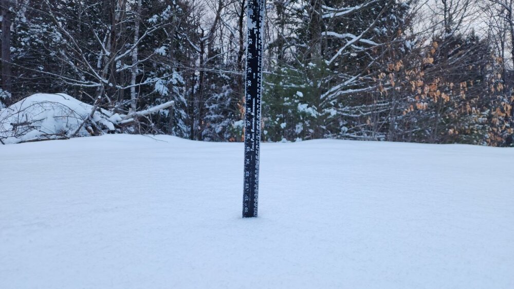
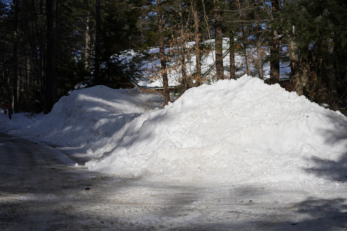
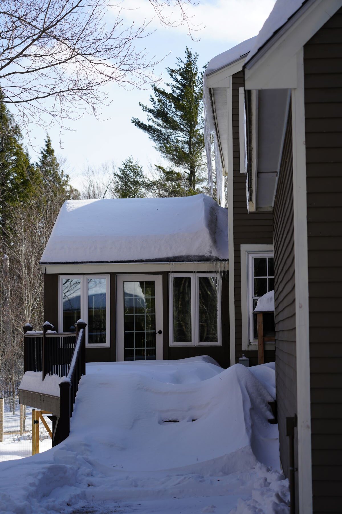
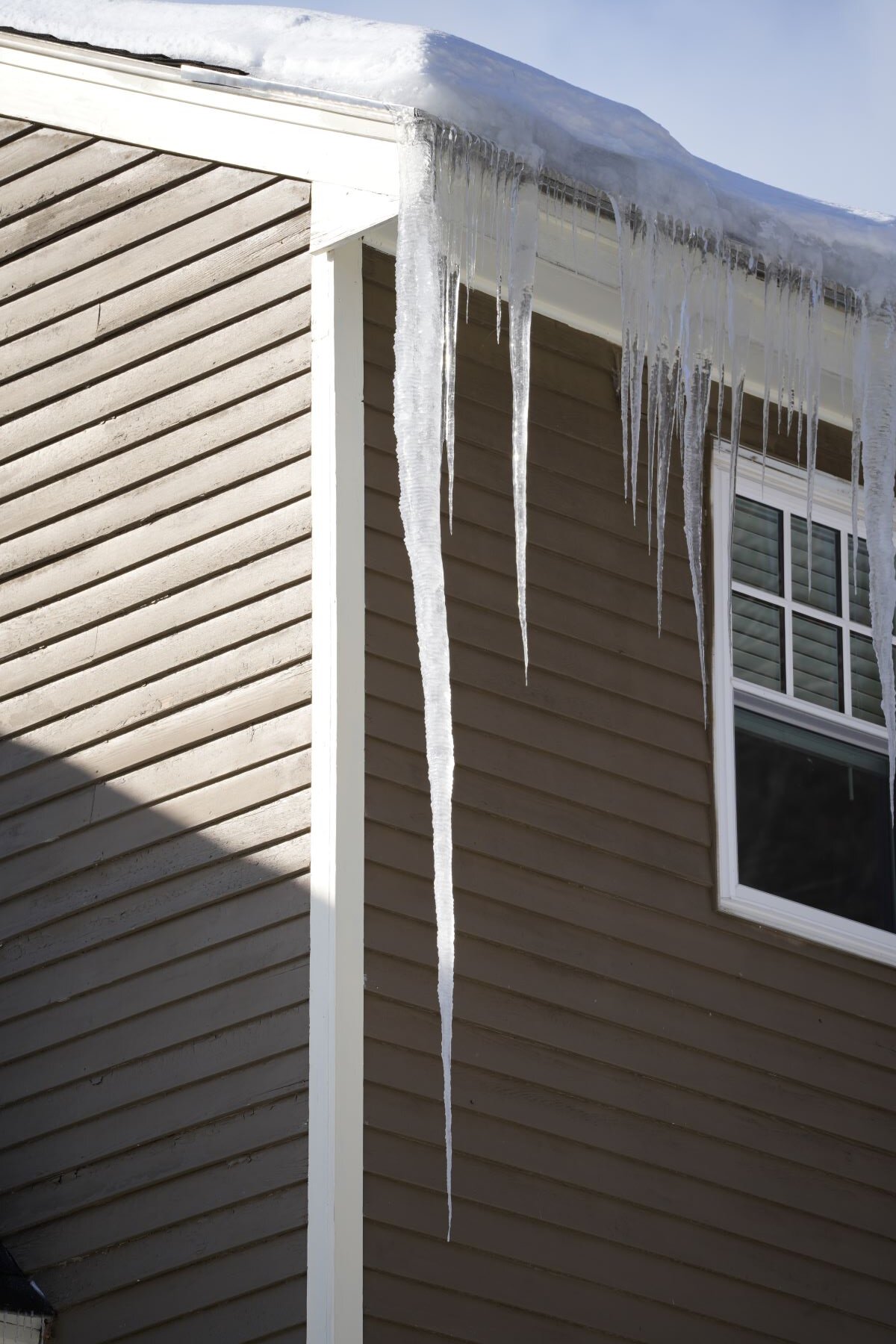
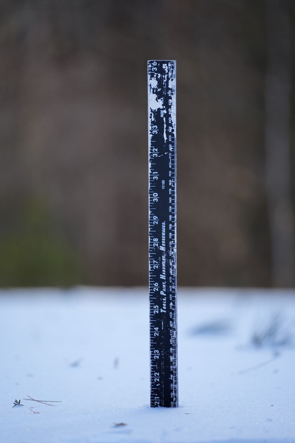
Some pics from this afternoon. Big icicles, and good snow depth. Around 21" in the flat part of the yard.


-
Absolutely puking snow right now.
-
My word, the mythical backend snow is happening... I didn't think it was really possible.
-
Yup, a little past two feetsies here in Dendriteland.
-
Oh good lawd, sleeting something fierce here right now.
-
Well, I suppose the nice thing about 12/12 roofs (rooves?) is that all the sleet is rolling off.
-
Dendrites large enough to concuss right now.
-
Looks like a gorgeous space, but good lord, what is up with the insistence of sticking TV's up in the stratosphere? I don't want to crane my neck like I'm watching the shuttle lift off from Cape Canaveral.
-
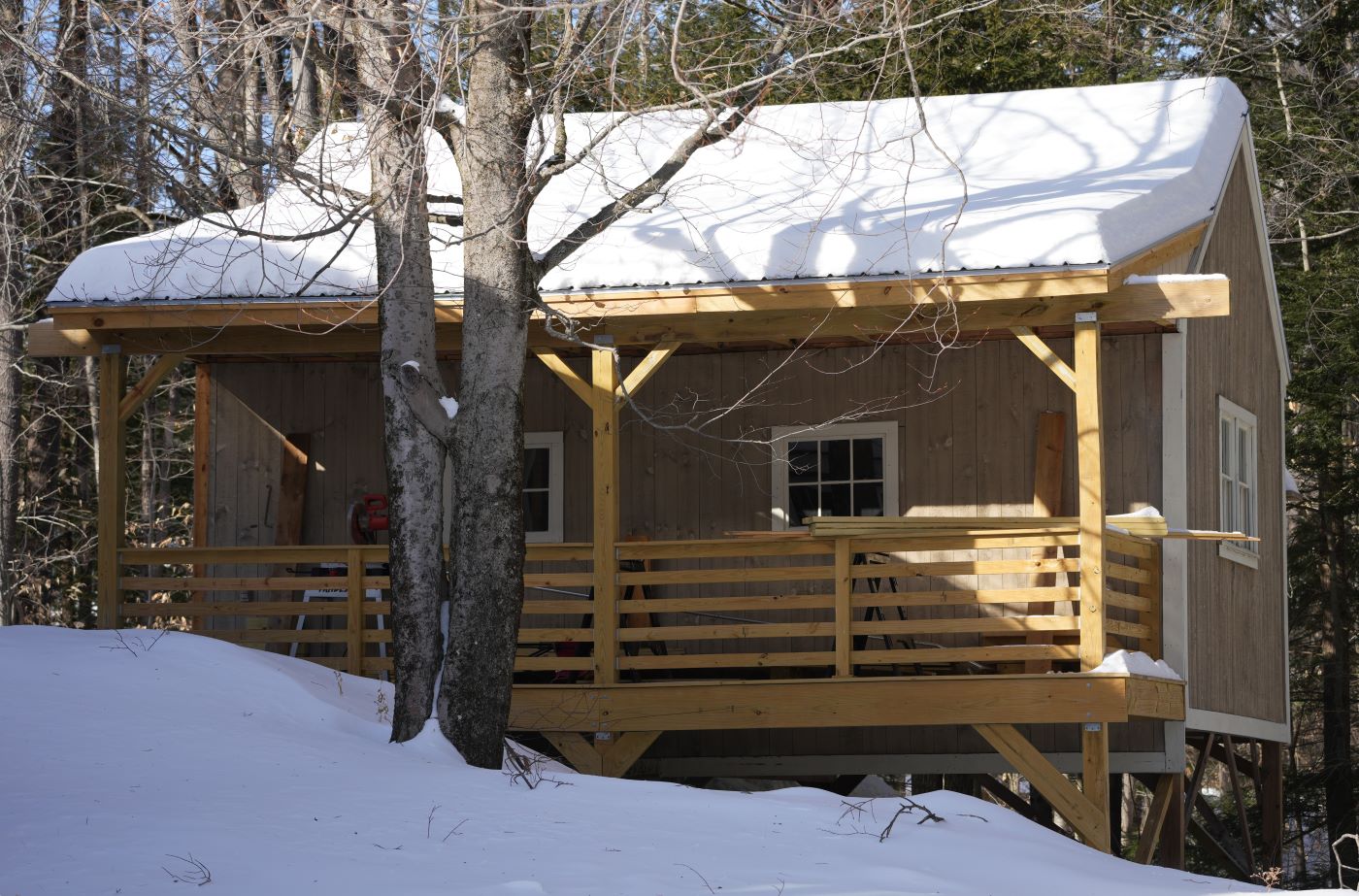
Pack is going to be good IMBY. I've got direct access to sled trails from the house. Tempted to buy a snowmobile, lol.
-
With what's already on the roof and 1.5" of frozen QPF on the way, it might be time to dig out the roof rake.
-
18z HRRR is, uh, rather optimistic for CNE.
.thumb.png.d49f4a75fed6fce44327332a61d6fe2d.png)
-
For this event I imagine much of the displayed accumulation on the pos depth change is from sleet that has been counted as snowfall. I don't think I should expect the 14" of snow it's showing for my location.
-
Not really in the HRRR's range, but the 12z run has a really solid initial thump for CNE.
-
Per Pivotal, copy and pasted below. Apparently the foreign models output directly usable data regarding p-type. "ECMWF, UKMET, and Environment Canada models keep track of precipitation type in a precise way as the model integrates, so we know how exactly much precipitation falls in the form of snow (at least, based on the model’s internal diagnostics). This eliminates any concern about including sleet, graupel, or rain when we compute snowfall for those models. For NCEP models, the bookkeeping for precipitation types is less precise, so mis-categorizing some of the precipitation that fell between data output times is always a risk during mixed precipitation or precipitation that is rapidly changing type. We have adopted an approach that usually avoids erroneously treating sleet as snow for NCEP models, so you should not see a shield of "fake snow" extending well equatorward of the actual snow-sleet line in a large mid-latitude cyclone, for example. Still, it is inevitable that we will sometimes overestimate the fraction of mixed precipitation falling as snow in borderline and transitional environments (usually small in area)."
-
24 hour Kuchie. Always room to adjust upwards if needed.
.thumb.png.bda4b686e0549be923cf6318ba005622.png)
-
What a lovely little monster.
-
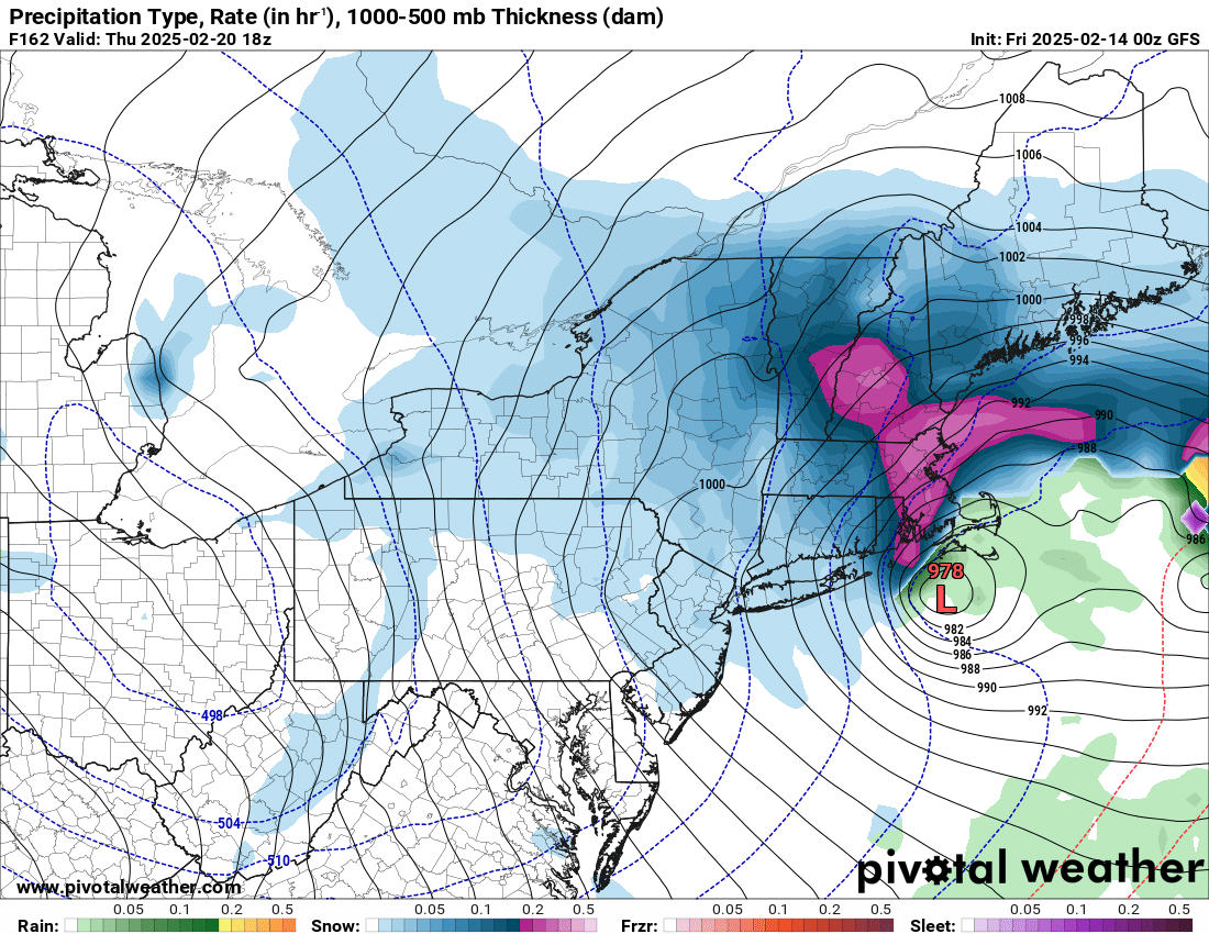
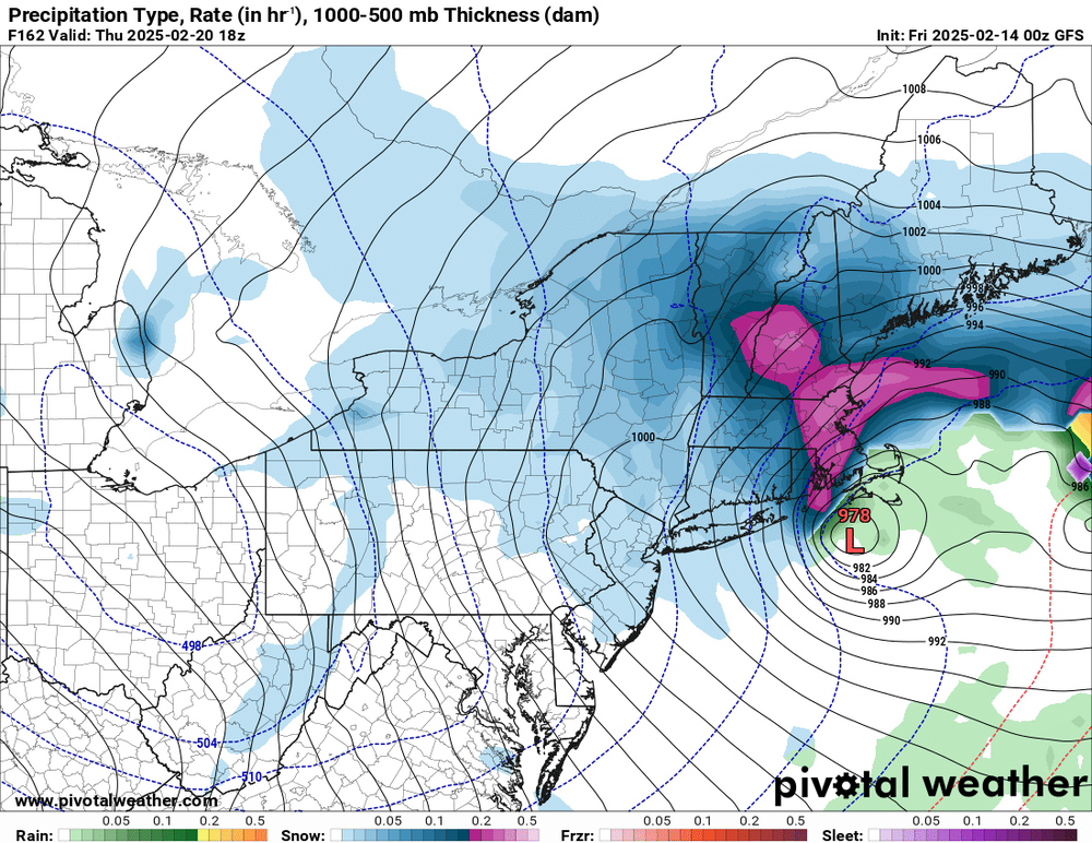
00z GFS says yes to the 20th.
-
The American models need to step up their game and actually assign p-types to QPF. The way vendors are forced to essentially guess what was falling based off of frames that are spaced 3 hours apart is silly. You get that ridiculous tiger striping artifact as a result.
-
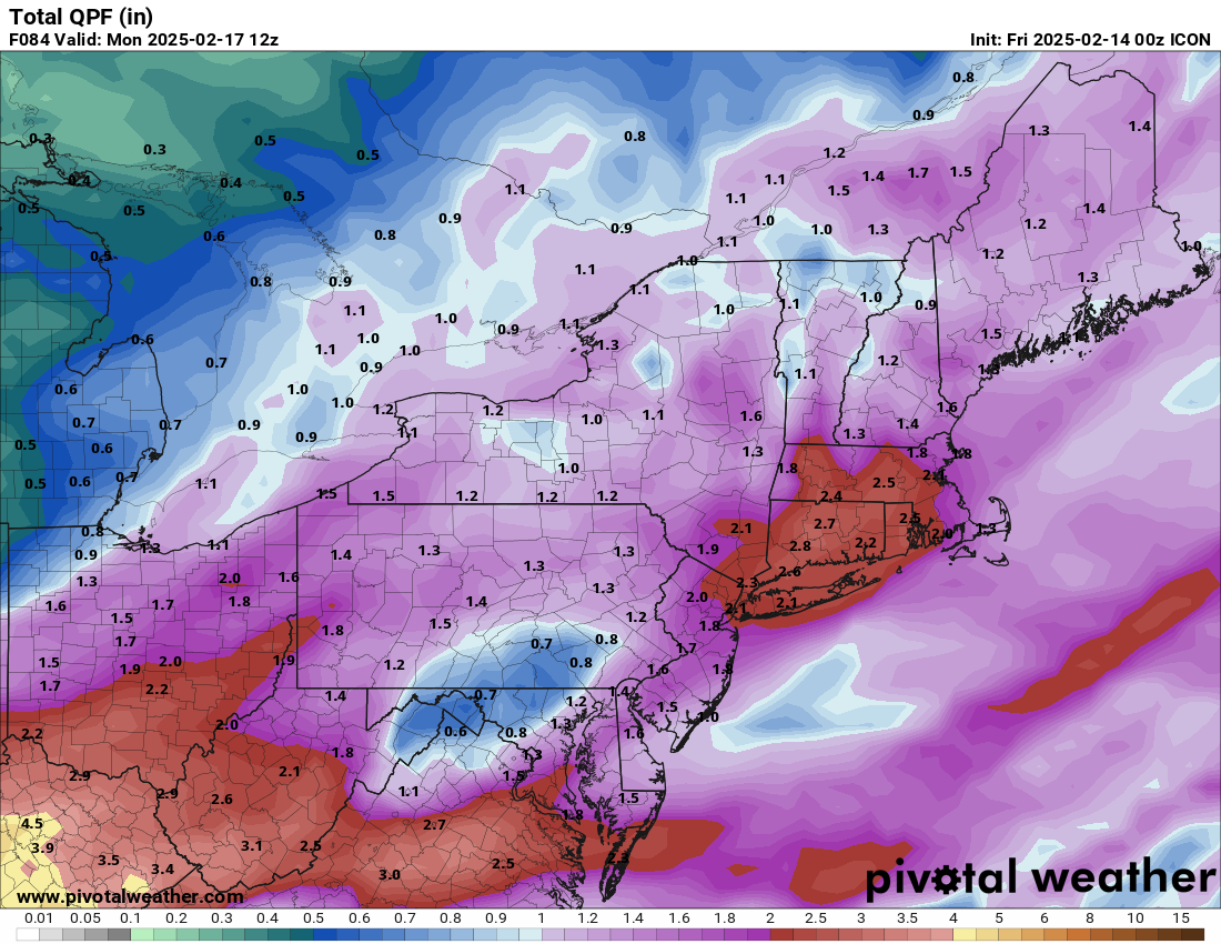
Germans bringing the juice.

-
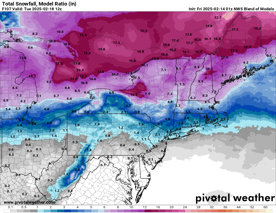
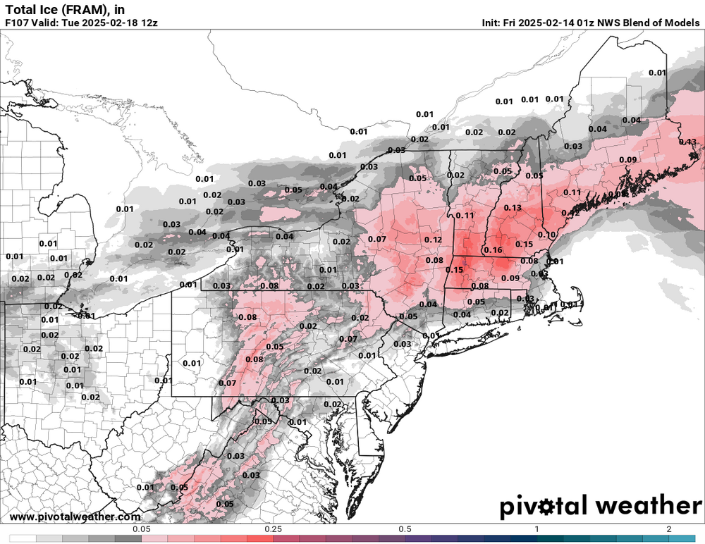
NWS 01z blend. Nice pack builder up here.

-
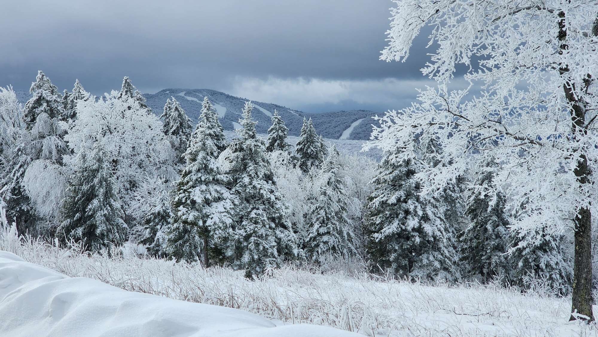
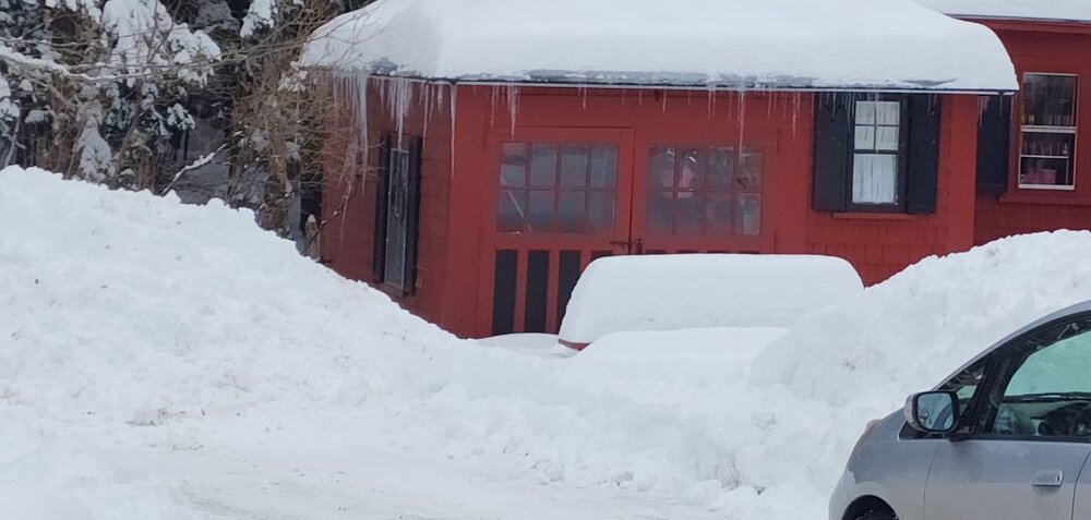
Pics from two days ago. Between 18"-20" in the yard, and as a bonus, my neighbor's mystical weenie picnic table that somehow holds snow better than anything else in existence. That thing might have 30" on it after this weekend.
-
28.4°, and sleeting here in Bradford.
-
For pictures I take on my phone, what I do is share them to my google drive. From there, I can download them onto my Windows desktop and use the resize function.


.png.7baba383ff23aa1de640c90b14a64ae7.png)
.png.623fbbbcc1db5d3c7c1c8ce824a64259.png)