Summit Snow
-
Posts
99 -
Joined
-
Last visited
Content Type
Profiles
Blogs
Forums
American Weather
Media Demo
Store
Gallery
Everything posted by Summit Snow
-
Funny. I am at 1400' and drove down to Scranton at 3PM for the 1st half and it was light rain and 36. Nothing south of Scranton and very little in the Poconos south of Tobyhanna
-
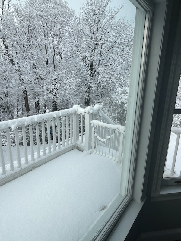
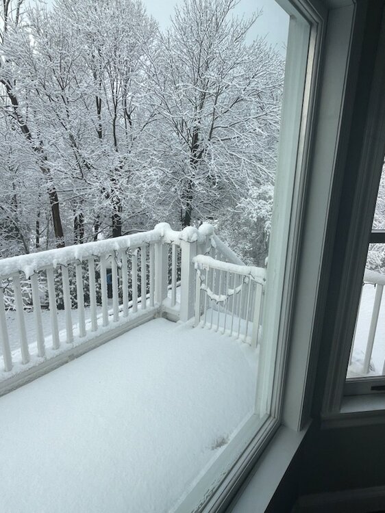
Still snowing moderately. +2" on the ground and think we can squeeze out another before midnight. 31 degrees currently.
-
Moderate to Heavy Snow up here right now and 33. NWS BGM is saying a couple of quick inches.
-
Love this forum. You guys are great. Living in NEPA close to BGM I am split between discussions but the insight and feedback here is awesome. Still think the northern mid-atlantic interior has a lot more to bitch about than many on here. The difference in "winter" over the Catskills and Poconos in the past 30 years is crazy. I was in snow and cold for 120 days when I first moved up here but now winter is from January 20th- through March 20th. I have seen 2 white christmases in the past 10 years but 8 white St.Patricks Day.
-
It's beginning to look a lot like Christmas.....
-
Yes-Waverly/Clarks Green just under 1500'. WWA just issued by BGM for 3-6" for elevations around Scranton. You might be looking at 7"+ based on trends of faster changeover.
-
Feel real good for a pasting up here sitting at 1400' feet north of Scranton. BGM really hitting elevation. ELK Mountain in the crosshairs!
-
Today Snow, mainly before 1pm, then a chance of snow showers after 3pm. High near 34. Southwest wind 6 to 9 mph. Chance of precipitation is 90%. Total daytime snow accumulation of less than one inch possible. Light Snow falling currently and 25.
-
Central PA Autumn 2023
Summit Snow replied to Itstrainingtime's topic in Upstate New York/Pennsylvania
24 with snow showers currently up here. Forecasted high of 30. -
Central PA Autumn 2023
Summit Snow replied to Itstrainingtime's topic in Upstate New York/Pennsylvania
22 up here. Snow showers yesterday. Bring it! -
Central PA Autumn 2023
Summit Snow replied to Itstrainingtime's topic in Upstate New York/Pennsylvania
Can it continue this winter?! LOL-hope it is more widespread. -
Central PA Autumn 2023
Summit Snow replied to Itstrainingtime's topic in Upstate New York/Pennsylvania
After under 1" of rain in May we have had the following with another .63 today: June- 5.46 July- 9.27" August- 8.57" September- 10.65" October - 5.49" -
Central PA Autumn 2023
Summit Snow replied to Itstrainingtime's topic in Upstate New York/Pennsylvania
Wednesday 11/01 Clarks Green, PA 40% / 0.1 in Moderating temperatures will change morning snow showers to rain showers by late day. High 42F. Winds NNW at 5 to 10 mph. Chance of rain 40%. -
Central PA Autumn 2023
Summit Snow replied to Itstrainingtime's topic in Upstate New York/Pennsylvania
Rain to Snow on 11/1 on my 7-day up here! 41/28 for the temp spead. -
Central PA Autumn 2023
Summit Snow replied to Itstrainingtime's topic in Upstate New York/Pennsylvania
49 degrees currently and another .30 in the bucket today. Brutal three days up here. 1.50 of rain and in the 40s Sat-Mon. -
Central PA Autumn 2023
Summit Snow replied to Itstrainingtime's topic in Upstate New York/Pennsylvania
2.43" for the event. We are at 8.82" for the month. -
Hope it stays for winter!
-
Another .94 up here in NEPA. At 7.08 for the month with July at 9.77 and August at 8.57. Sitting at 45.47 YTD with close to 30" since June 1st.
-
Crazy up here. Closed 6&11 through Clarks Summit because it was underwater and closed Exit 194 off of 81. I ended the night at 4.69 which fell between 7-10PM. The WBRE Site has crazy video.
-
.
-
* Flash Flood Warning for... Northwestern Lackawanna County in northeastern Pennsylvania... * Until 1045 PM EDT. * At 833 PM EDT, Doppler radar indicated thunderstorms producing heavy rain across the warned area. Up to 4 inches of rain have fallen. Additional rainfall amounts up to 1 inch are possible in the warned area. Flash flooding is already occurring.
-
Wow. Never saw what I saw tonight. 4.35" so far and most of that since 6:00PM. Roads are close and it continues to pour with more incoming. Not good in the Northern Tier.
-
51 for the low. 54 currently. A few hot days next week and then summers over up here. Climo always wins. 70s and 40s in my future.
-
1.22" last night and 8.57" for the month. BGM closing in on 32" for the year and I am closing in on 35".
-
1.76" of rain last night up here. 7.27" for the month. Best my lawn has looked in a decade.