TradeWinds
-
Posts
539 -
Joined
-
Last visited
Content Type
Profiles
Blogs
Forums
American Weather
Media Demo
Store
Gallery
Everything posted by TradeWinds
-
Noticeable change N and E thru 60
-
Land had no bearing on the hurricane direction. There was an unseasonable trough that came in stronger than forecasted.
-
2022 Atlantic Hurricane season
TradeWinds replied to StormchaserChuck!'s topic in Tropical Headquarters
I keep looking at 1950. Florida has been hot, dry this summer especially on the eastern side of the peninsula. I've have about 5" of rain since mid-June. 1950 had a very similar set up in the 850 winds and Andy posted about it earlier. It all changed mid to late Aug into Oct when the pattern became wet. Just throwing that out there. -
Could be a wobble. I also remember a few 12z members showed a jump towards land approaching Sarasota then a jog back W before N. I thought it was odd but might be realized.
-
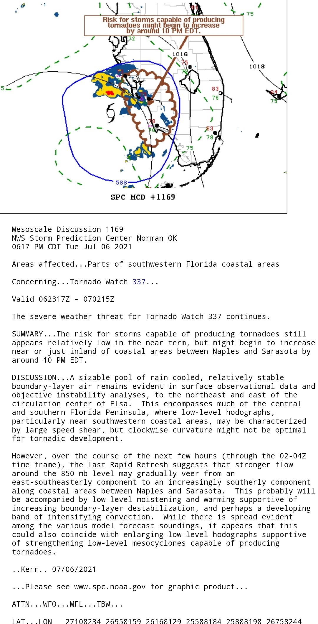
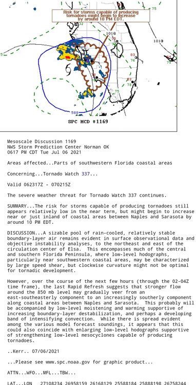
Risk of tornadoes expected to increase Naples to Sarasota around 10 PM per SPC
-
Came together nicely. I see those dark reds just popping up. Extrapolated, it has deviated from the pink line. Maybe a wobble, maybe from consolidation, or maybe an early N-NE trend.

-
Are any rainfall totals verifying? Seems like a lot of dry air is mixing in this storm.
-
NWS Melbourne midday analysis confused me a bit. They talked about Elsa's more westward track than anticipated and new guidance suggesting a slightly more west track. It looks to be verifying slightly east. Who knows.
-
Agree but the Euro had it over water up past Cedar Key. Any track east would minimize time to strengthen. NHC did nudge their track slightly east. Will be interesting to see how it unfolds. Sometimes there is a surprise.
-
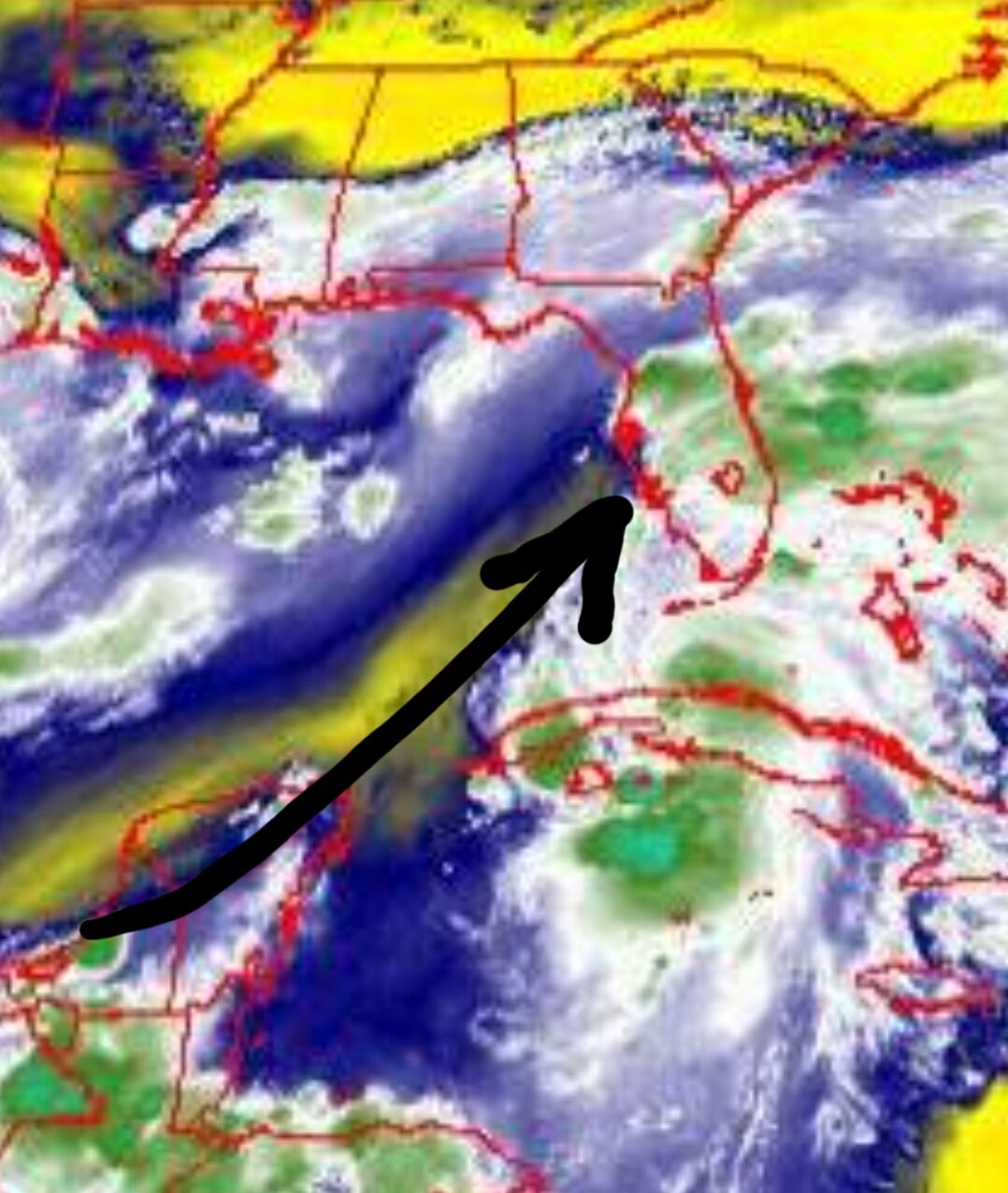
It just seems that SW shear is acting like a wall. That flow on water vapor seems to be like a wall. Might be reason for the NNW jog.

-
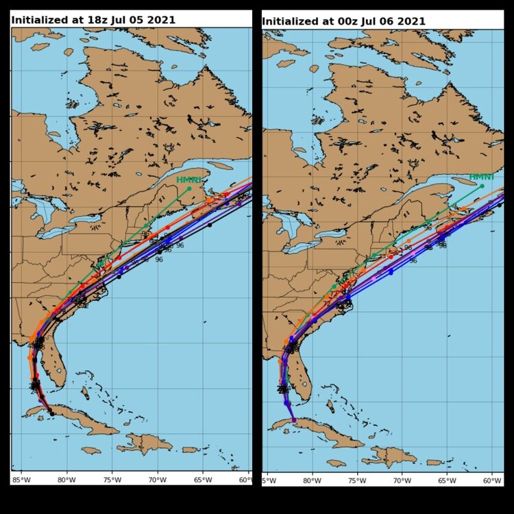
Looks east FL thru SC but still exits by VA Beach. Edit: the difference seems to be favoring a more NNW track rather than NW exiting Cuba.
-
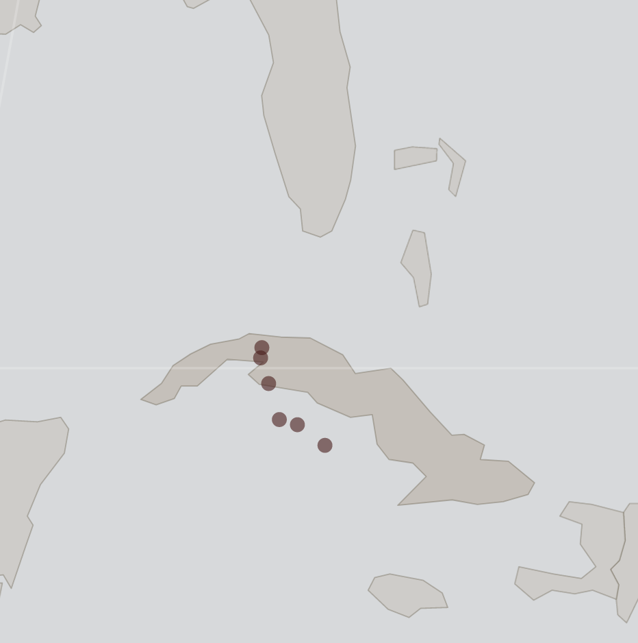
I plotted all estimated center locations by the NHC since 5 AM today. The movement certainly looks like it shifted from NW to NNW. I suspect they'll get better coordinates when the plane flies in but it will look odd to see any jump to the W. The trend favors the east cone track but time will tell.

-
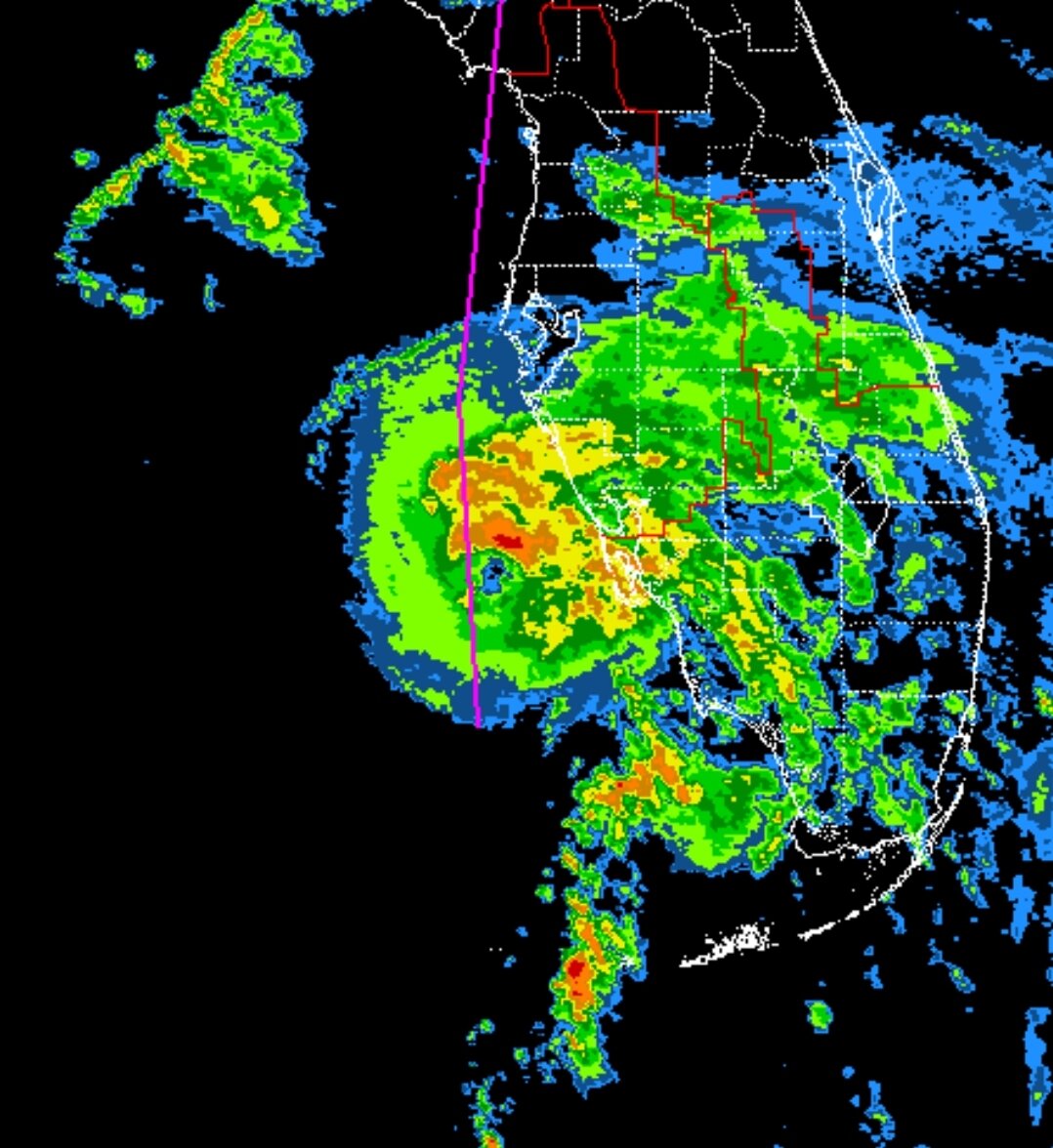
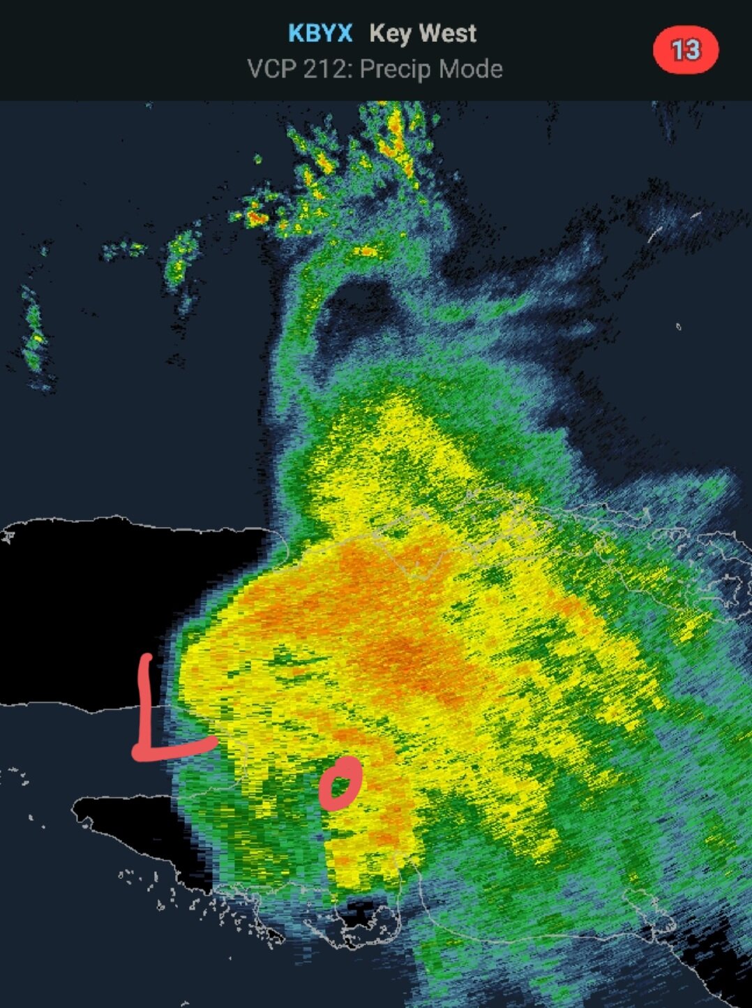
You can see some rotation on the Key West radar. Maybe mid level circ? I guess the LLC is at the point of the yellow.

-
No kidding. My backyard is registering 90 with dewpoint of 78 (heat index 104) in Orlando.
-
It's out of the NHC cone. I'd trust them over the NAM.
-
It's just an impressive tower right now tho. I read local radars are not showing any wrapping.
-
I think it's been that way since last night.
-
NHC talked about weakening in the next 48 hrs but potential for some strengthening after Cuba due to interaction with an ULL in the Gulf.
-
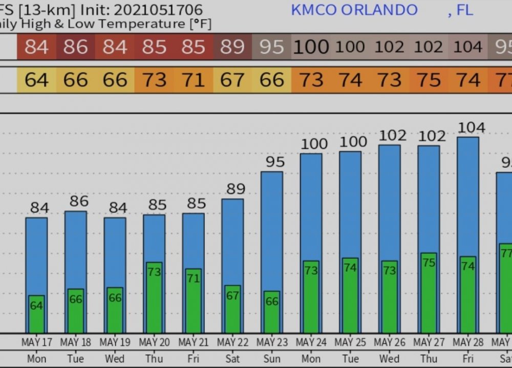
Models continue to bring record heat into FL next week. Both Euro and GFS have Orlando near 100 next week. GFS likely overdone but all time high in Orlando is 103.
-
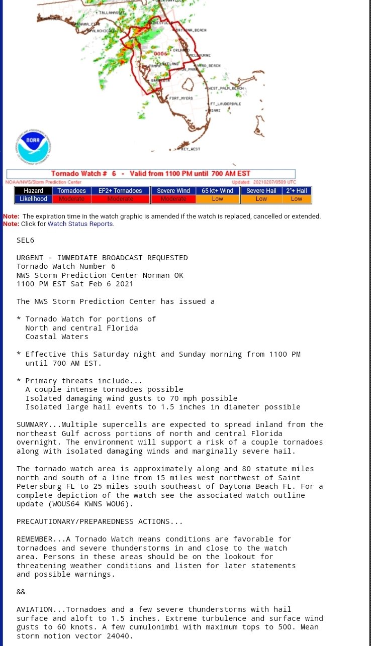
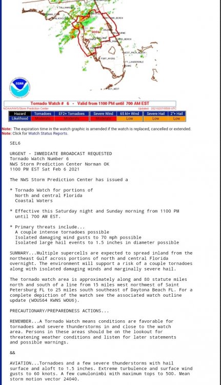
Tornado watch for Central FL extended until 7 AM. I was surprised by the moderate risk for EF2+ and words of a few intense tornadoes. Atmosphere must be ripe.
-
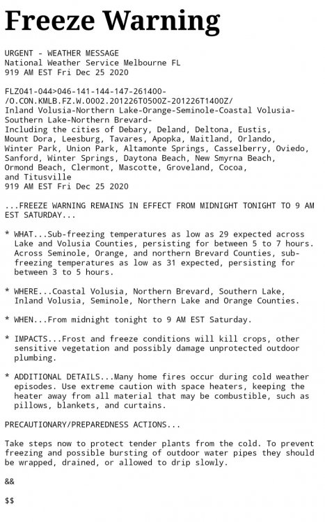
Freeze warnings being issues for Orlando area. If this is radiational cooling I like my chances as I'm on the SE of side of a large lake. I maxed at 54.1F today. I do not plan on protecting my coconut tree as it already has Christmas lights wrapped around the base. Dewpoint is currently rising. At 38F.
-
Live report from Orlando. We have a gust to 10 mph and about 0.02" of rain today. Sure does sound like Tampa got some big rains today. I hear some places are up to 6 or 7".
-
Dundee is surprising. Well inland. Almost 20 miles E of Lakeland.
-
69 confirmed? Thats pretty impressive.
-
Not surprising. Schools close now for a light breeze. I remember in my day... lol