TradeWinds
-
Posts
539 -
Joined
-
Last visited
Content Type
Profiles
Blogs
Forums
American Weather
Media Demo
Store
Gallery
Everything posted by TradeWinds
-
Basically going according to plan
-
The wipers are on high on this vehicle. Still time to go more east or back west.
-
GFS position later this afternoon is still S of the current position. I'd be surprised if the GFS doesn't have further corrections in later runs.
-
ECMWF ensembles 18z, 00z, 6z. Clusters tightening and noticeably weaker in the Gulf.

-
Big difference in ICON 12z yesterday (top) vs 12z today (bottom) is a faster Ian and a slightly sharper trough. Wonder if new data ingested yesterday caused the shift to the east. Will be curious what other 12z models show.
-
People are just following real time obs and trends. It's called weather forecasting. And the cluster has moved east, probably because models are trending faster. Might not pan out but something to watch.

-
Euro drops below 1000 mb about the latitude of Jamaica. GFS is 985 at that point. I hadn't seen intensity on UK or ICON. Seems GFS continues to underperform on short term intensity forecasts.
-
-
00z ICON Sarasota landfall then rides due N over TPA.
-
Big jump east. Faster movement probably feels the effect of the trough more. Landfall at 12z was Destin to just N of Cedar key at 00z.
-
GFS at 60 about 6 hrs faster than 18z and a little weaker as it crosses near Cuba. Slightly more east but not much.
-
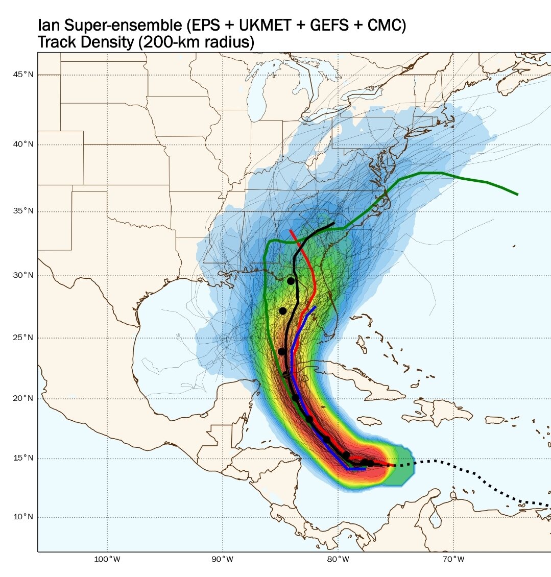
Winning by 40 km without a defined center on one storm over 2 days falls into the margin of luck. Lol
-
I thought Levi said stronger earlier was the GFS solution. Euro was stronger later.
-
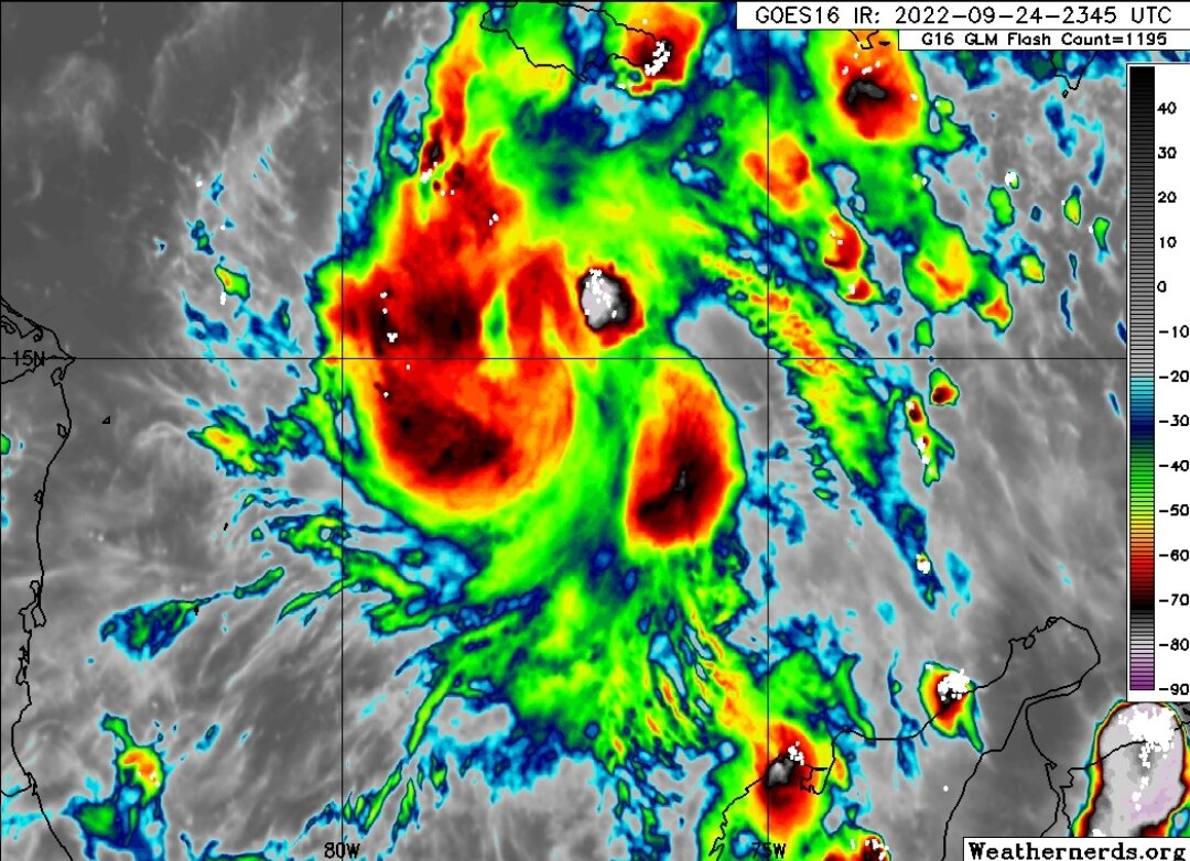
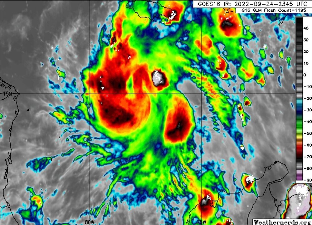
Sure is looking like it is consolidating. Pinwheel at those hot towers?
-
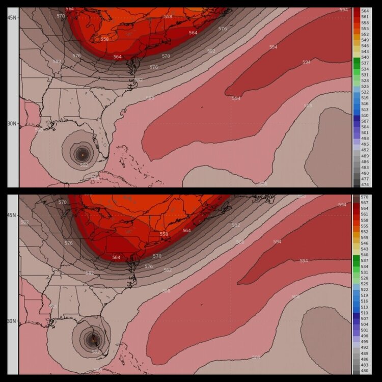
You can see on the 18z ICON 500 heights it holds back the trough in the Ohio Valley as Ian comes off the tip of Cuba like the Euro. At 12z it was more progressive like GFS. Flip flop.
-
Lows in Northern Florida are near 60F early this week. The dry air is real up there.
-
So you want them to fake a forecast?
-
I was laughing at a lady yesterday at Costco in Orlando. She bought enough water to fill a swimming pool. And you could see panic in her almost running with her cart. Smh.
-
Through what hr? I'm seeing 1.4" through hr 192 (Thurs).
-
This forecast track is an I-4 special
-
Charlie turned quicker because the trough came in stronger than forecasted. It was an unseasonably strong trough.
-
I moved here from the DMV a decade ago. My advice is please don't panic or panic buy. DMV was the worst in weather situations with clearing shelves from stores. Download a hurricane checklist and use that as a guide. Listen to local authorities.
-
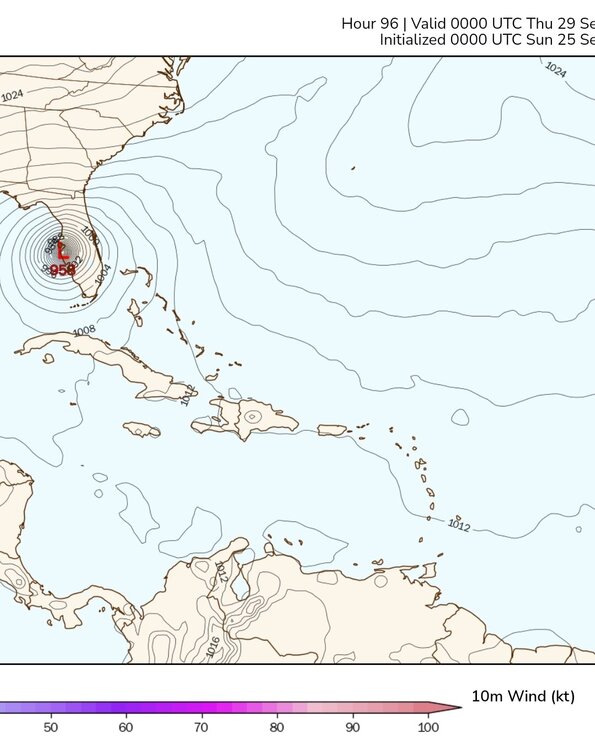
That would make more sense but my map says 953 MB at that position.
-
GFS 18z vs 12z a little east at hr 108. Closer to the tip of Cuba. But 33 MB stronger if I'm reading that right??
-
A lot keep talking about how chilly it's been. Florida must not be participating. 93 with heat index of 105 IMBY. But I looked at temps tonight across the East and was surprised.