
nvck
-
Posts
180 -
Joined
-
Last visited
Content Type
Profiles
Blogs
Forums
American Weather
Media Demo
Store
Gallery
Everything posted by nvck
-
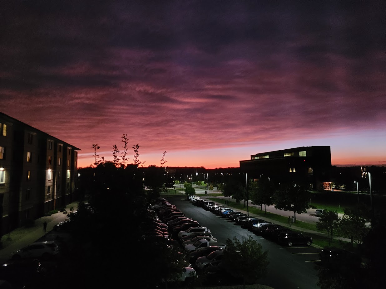
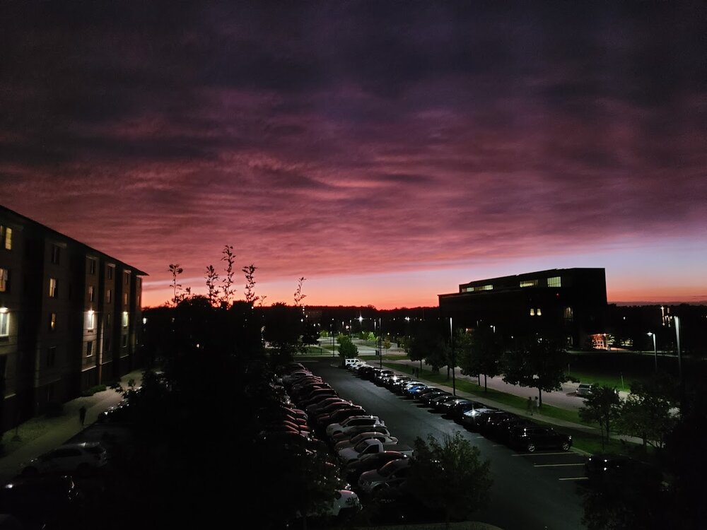
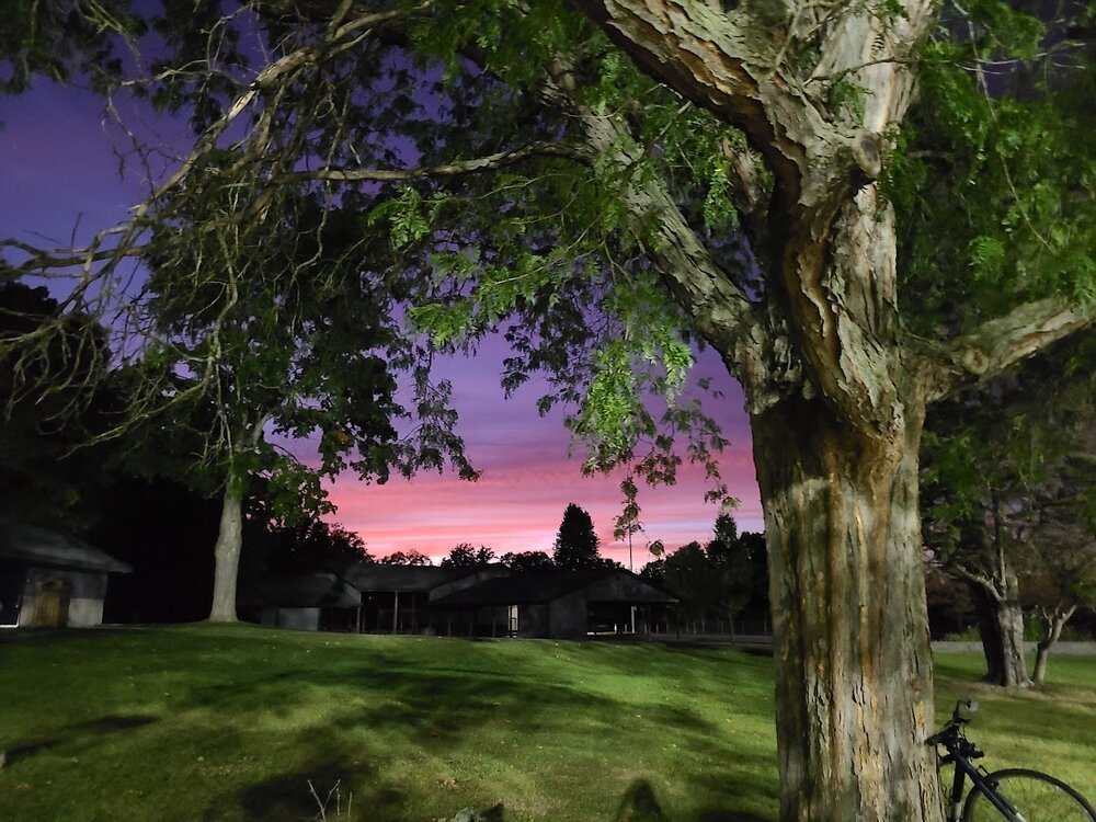
And, of course, beautiful sunsets the past 2 nights as well.
-
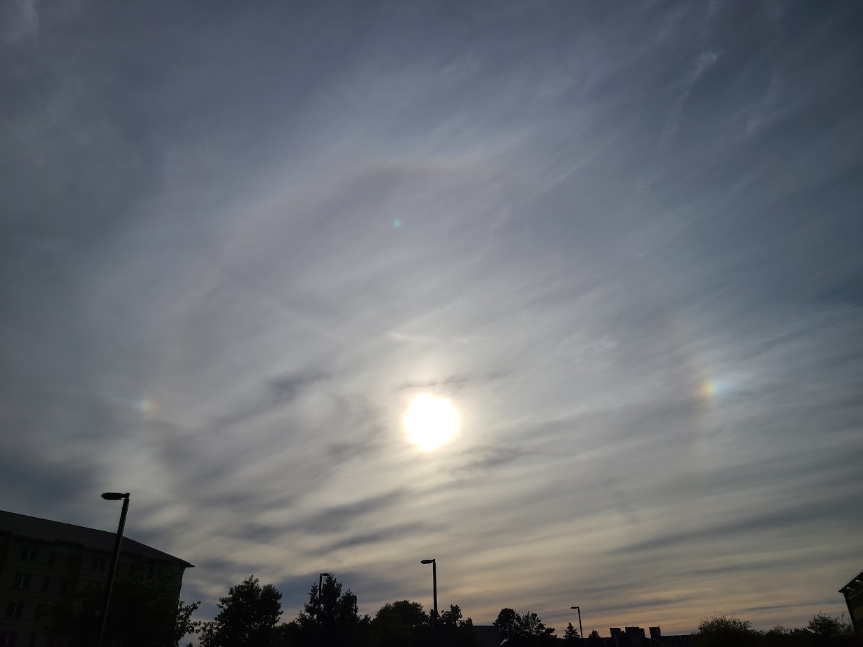
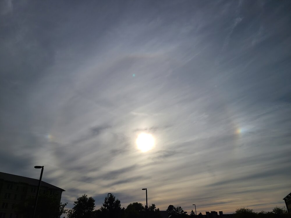
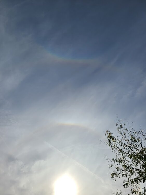
Caught a "circum-zenithical arc" yesterday afternoon here in MI, as well as 2 sundogs thanks to those high hurricane clouds making their way north.
-
You can really see the shape of the eyewall on the lightning map from blitzortung

-
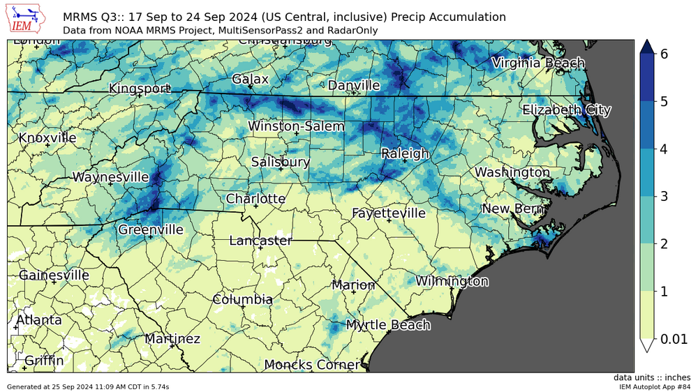
Up to 6 Inches over the past week in some of the mountains of NC (over past 7 days, but same idea)
-
Saw that, I won't talk too much about it on this thread, but yeah, another homebrew 'cane that the GFS (keep in mind at 240+ hrs) has landfalling on the FL panhandle around 950mb. Safe to say this likely won't verify, but worth keeping an eye on
-
looks like the core of it should miss land, although it'll certainly be close
-
Correct me if I'm wrong, but if the storm post-landfall does take a looping track like that highlighted in some of the models, wouldn't that lead to some pretty intense inland flooding, especially over S Appalachia and the Ozarks?
-
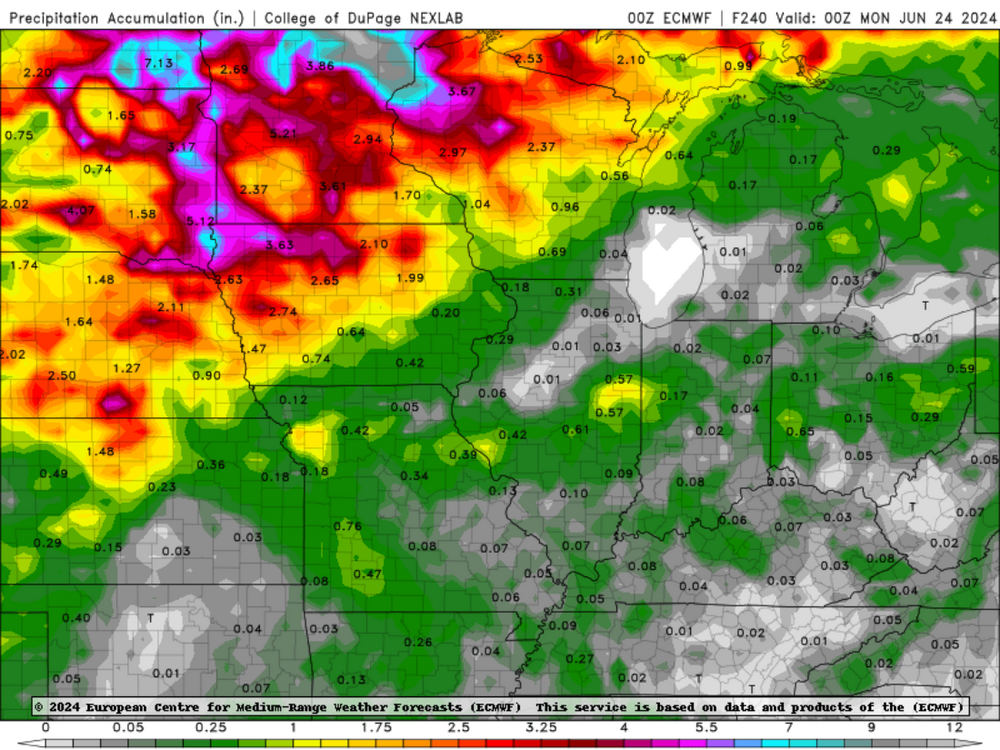
obviously just one model run, but wow... 935 only 4.5 days out is nothing to sneeze at...
-
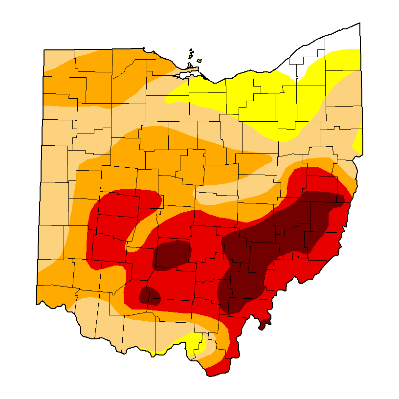
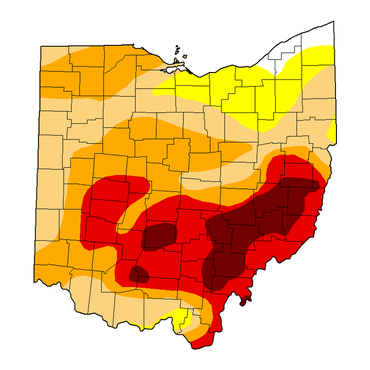
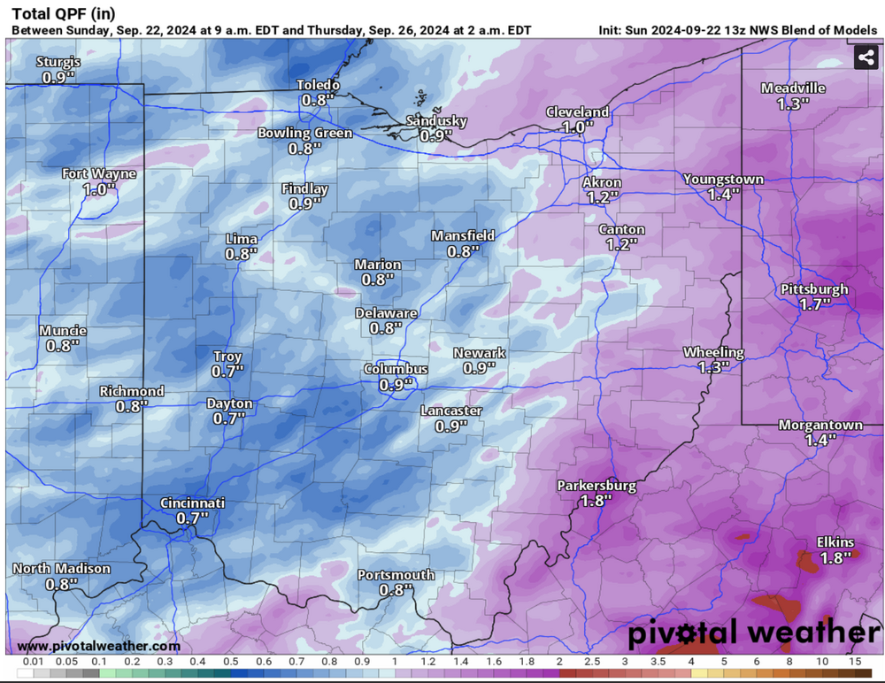
Meanwhile, drought back home continues to worsen, with much of Appalachian Ohio in D4 conditions. Thankfully, rain looks to be coming sometime through the week, which should hopefully alleviate much of the dryness.
-
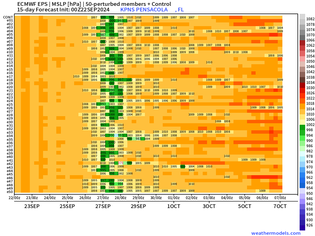
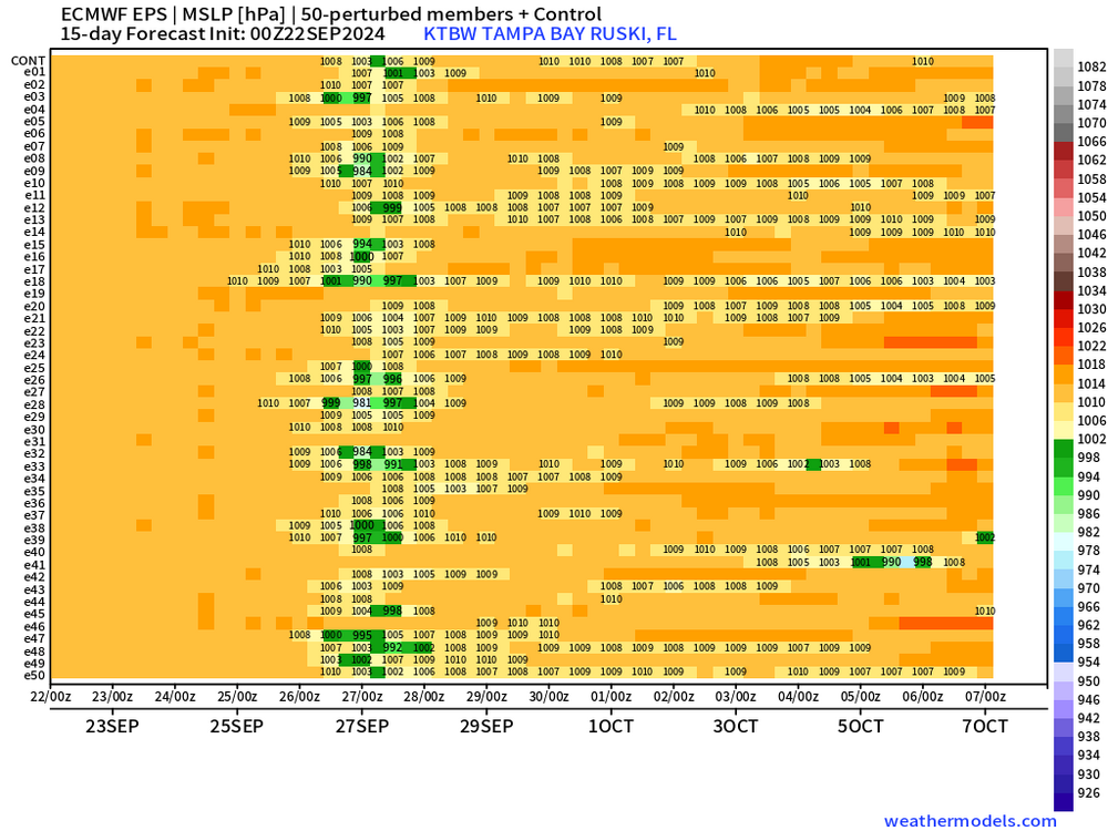
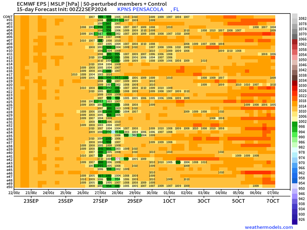
Euro ensemble pressure matrices for Tampa and Pensacola, off the 00z run (not available on 06z). Looks to be angling at more of a panhandle/ big bend area landfall, although not super strong.
-
https://x.com/realStarInBox/status/1820273147058303099?t=GQXJBgvzQRmDf372rwqpwQ&s=19
-
 You gotta be like hella online either tiktok or 4chan or maybe twitter to fully comprehend
 -
Not even noon and it's already 91/74/103
-
Extended Euro looks pretty dire for about half of the forum, between hardly any rain over the next 10 days and possibly triple-degree heat, flash drought seems pretty likely
-
Would only need an ~2 degree overperfomance here to hit that, probably sometime between monday and Friday next week
-
really hope this verifies! love the nice cool days throughout the summer
-
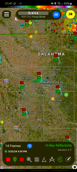
any idea why this cell, among others, are dying as soon as they get into the OKC area?
-
2024 Hurricane season forecast contest -- results now posted
nvck replied to Roger Smith's topic in Tropical Headquarters
lets go with 29/15/5 -
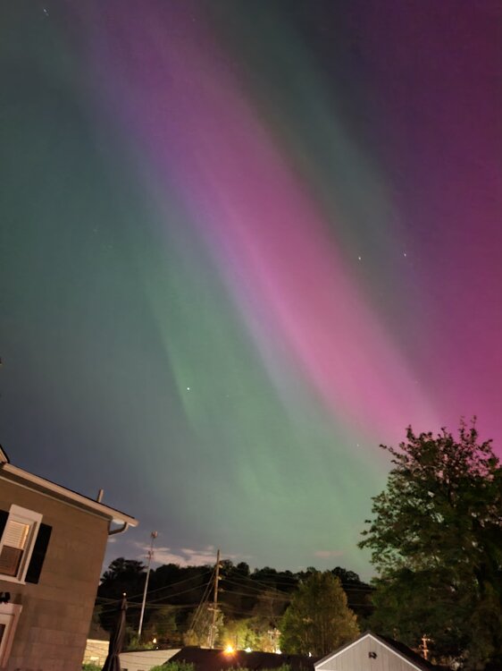
absolutely insane... I just happened to look up on my walk home from work last night, and saw the brightest of the night for me!
-
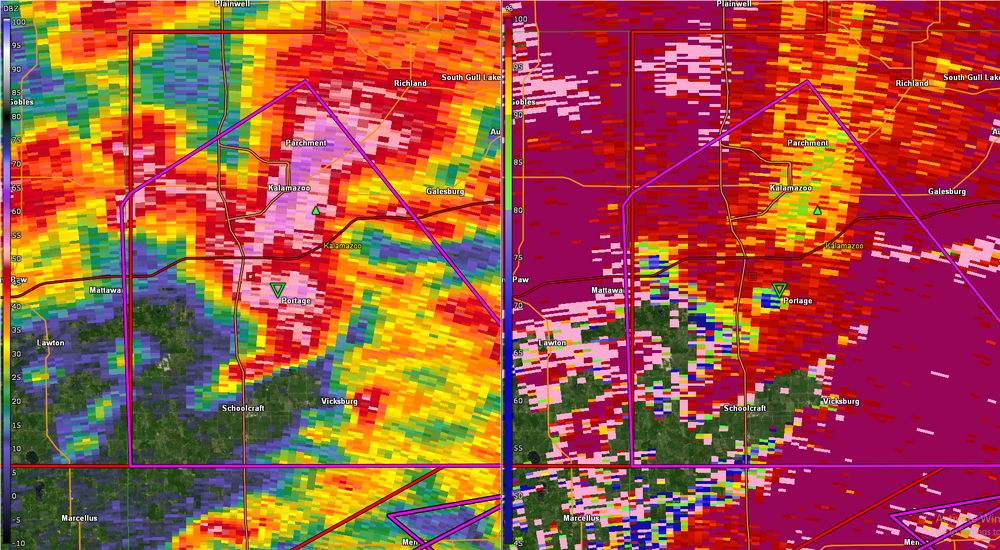
Brandon Copic has a TOG in New Salem, IN
-
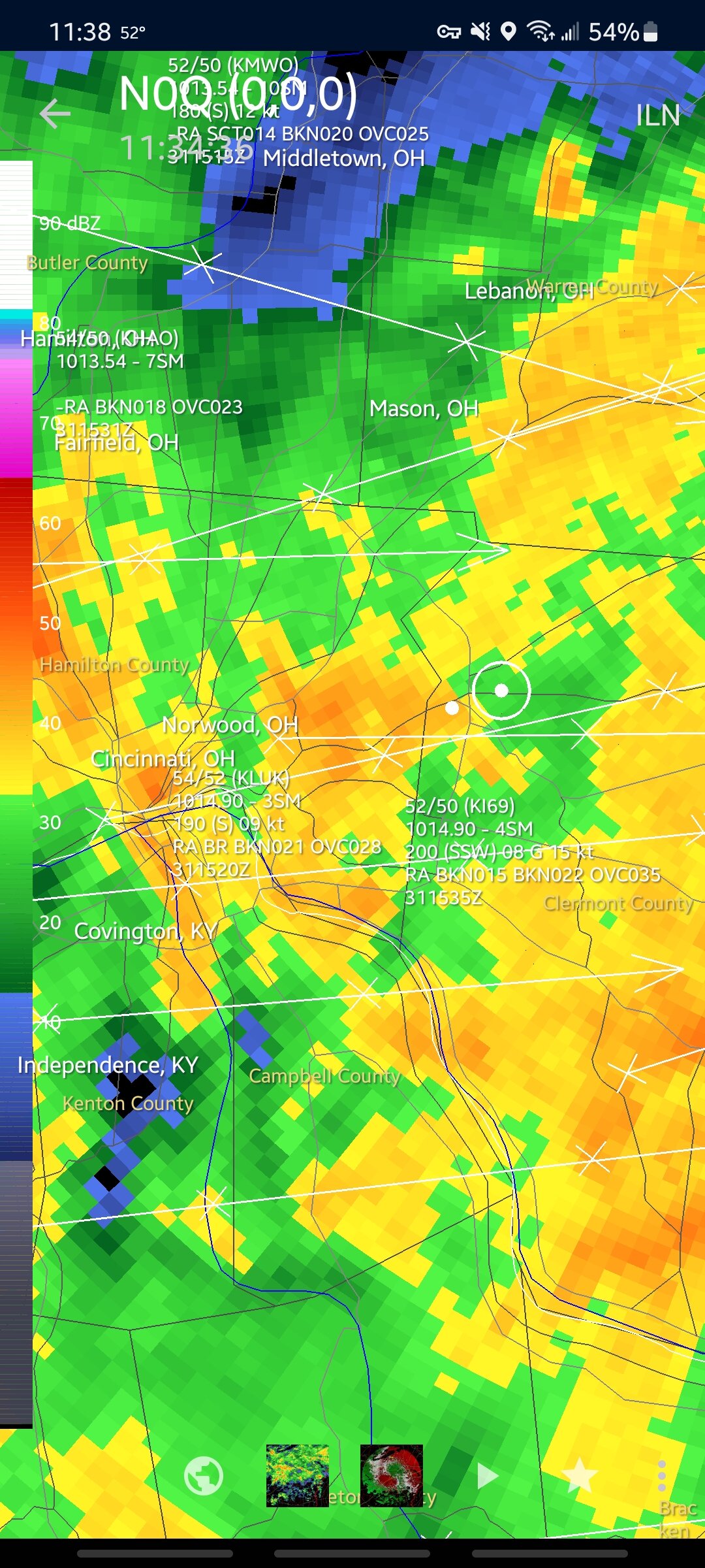
not looking good on radar
-
how much precedent is there for upgrading risks while the event is going on/ just before it starts in an area?
-
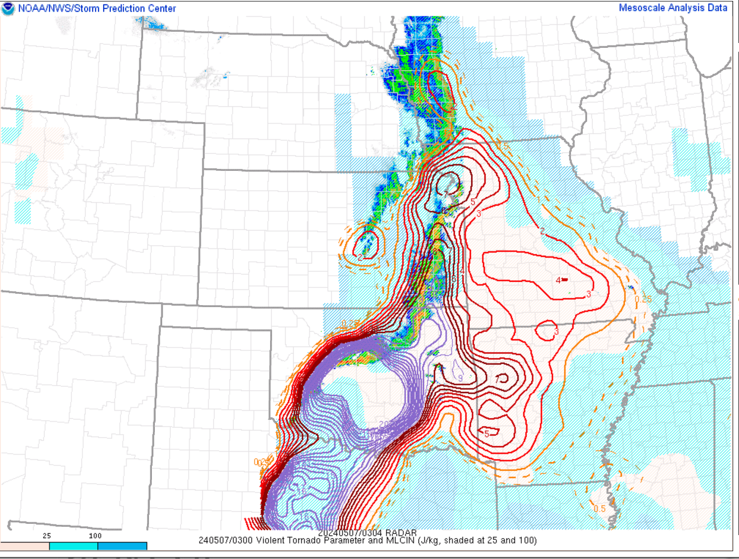
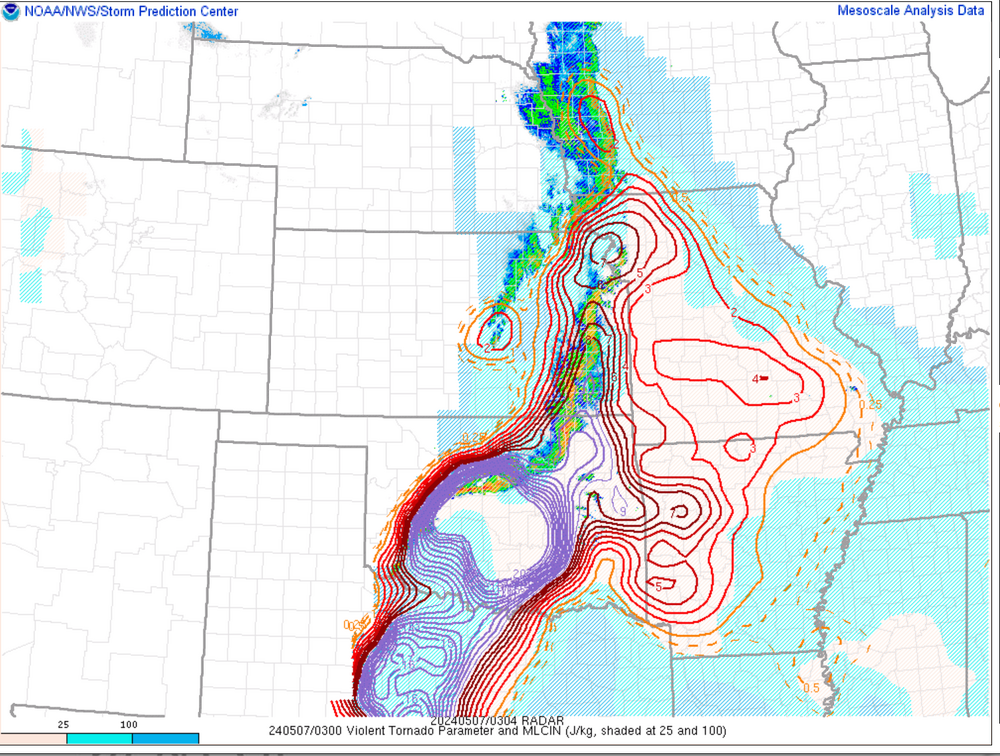
shit... violent tornado parameter ahead of the blossoming storms in W OK might be "maxed out", per spc mesoanalysis
-
cameron nixon had a twitter post recently about how some mergers between lines of storms and discrete storms w/ a strong meso can result in a boost to the discrete cell
-
to all the dumbasses screaming "bust!!" ... it only takes one storm...