
nvck
-
Posts
180 -
Joined
-
Last visited
Content Type
Profiles
Blogs
Forums
American Weather
Media Demo
Store
Gallery
Everything posted by nvck
-
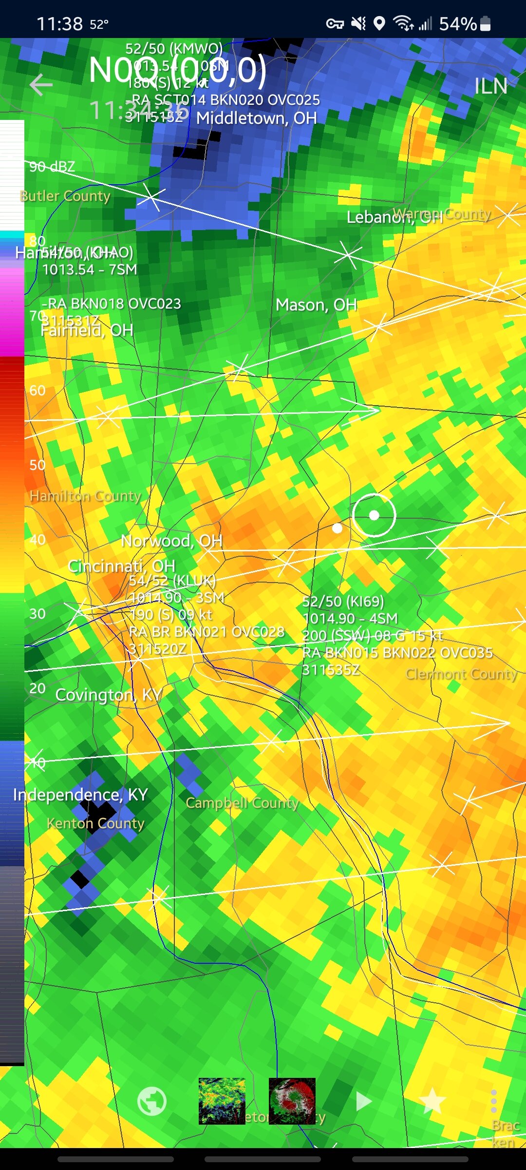
18z hrrr goes crazy on the tri-state area, keeping the sleet/snow line well in kentucky
-
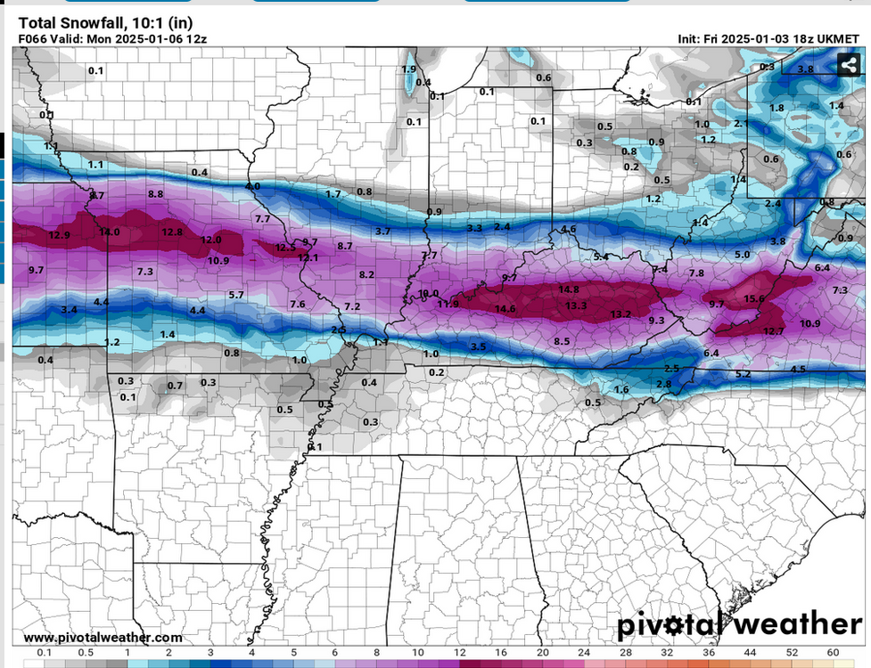
the ukmet, OTOH, would be very dissapointing...
-
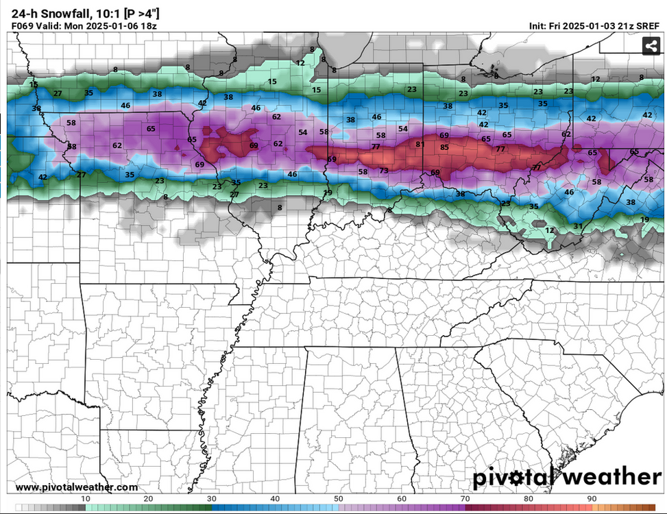
some of us may need to chill on the dooming, lol. sref (not sure how it does for winter wx) still has the most significant accumulations farther north, especially compared to the euro
-
18z euro ticked backed north...
-
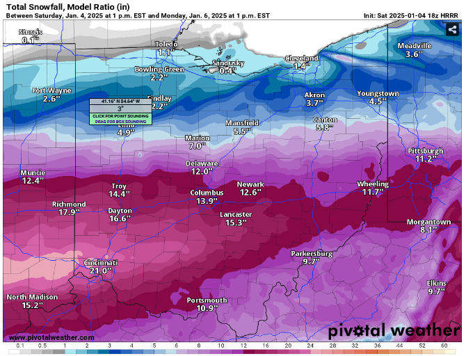
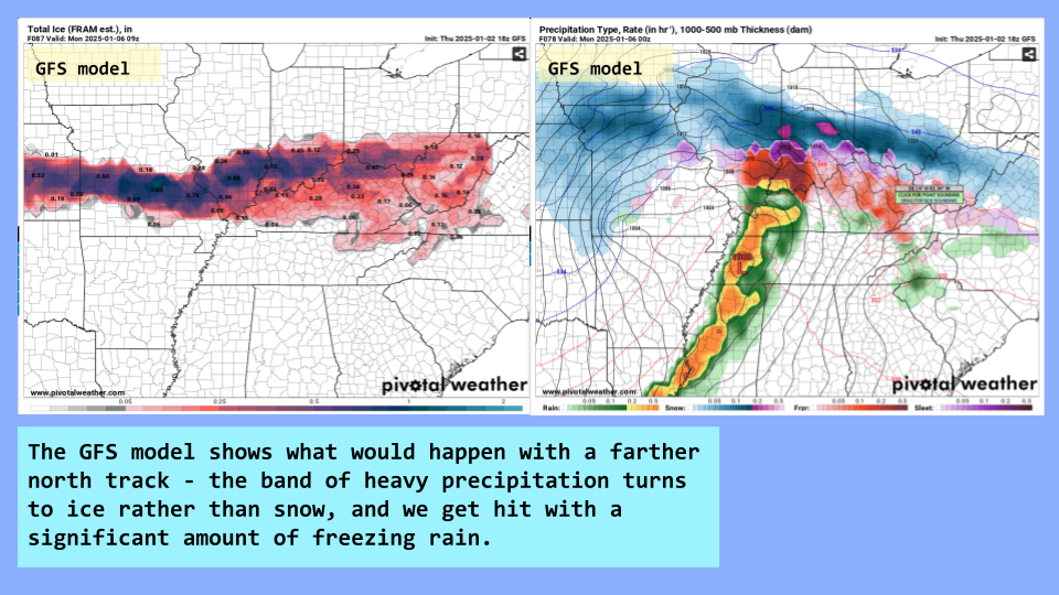
not loving the look that the gfs has with regards to ice / diminished snow potential. gonna be a tight gradient down here
-
Neat visualization from the 12z GFS, really would like to see more snow in the more intense precip bands than freezing rain, but maybe it'll come back around Also, freezing rain at 24° ground temps means that there's got to be one hell of a warm nose at like 850mb, right?
-
Maybe the more southwest Ohio people on here, the more we can pull this thing back south
-
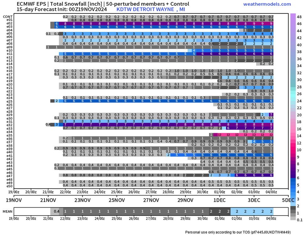
Pretty big uptrend for my area on the 12z EPS, also included a couple other stations around the region for everyone's viewing pleasure (or displeasure)
-
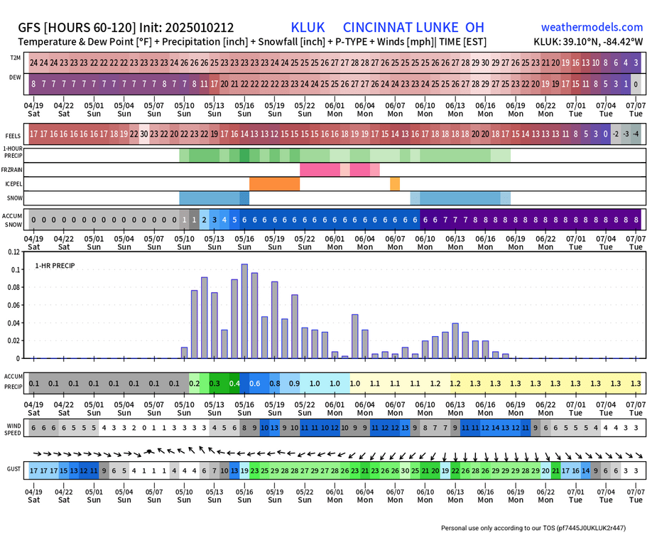
Snow-total wise, this is for cincy - lmk if you want to see any other stations
-

Winter 2024-25 Medium/Long Range Discussion
nvck replied to michsnowfreak's topic in Lakes/Ohio Valley
I'll have what the 06z euro is cooking, please.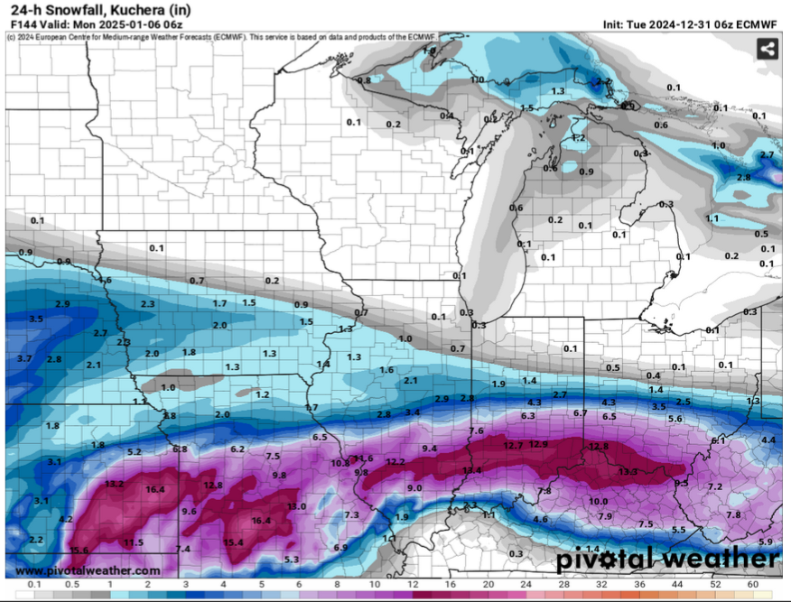
-
Winter 2024-25 Medium/Long Range Discussion
nvck replied to michsnowfreak's topic in Lakes/Ohio Valley
18z gfs is well south of previous 2 runs -
Winter 2024-25 Medium/Long Range Discussion
nvck replied to michsnowfreak's topic in Lakes/Ohio Valley
Here ya go... If this just came 50 or 60 miles south, I'd be in heaven -
Winter 2024-25 Medium/Long Range Discussion
nvck replied to michsnowfreak's topic in Lakes/Ohio Valley
I mean, this is just ridiculous. Yeah, this is a couple weeks out, but temps down into the negative teens in Tennessee is crazy. Obviously, I don't think that this will come anywhere near verifying, but wow... -
Winter 2024-25 Medium/Long Range Discussion
nvck replied to michsnowfreak's topic in Lakes/Ohio Valley
That 12 inches over cincy is more than we got in total last year, I believe. -
Decent rates here for about 30 or 40 minutes, enough to about half cover the grass. Just flurries now, but hoping for another inch or two tonight, maybe like last Wednesday?
-
Winter 2024-25 Medium/Long Range Discussion
nvck replied to michsnowfreak's topic in Lakes/Ohio Valley
i'll be back in sw ohio atp, and would definitely take 50s consistently over the mid-30s and no snow up here. -
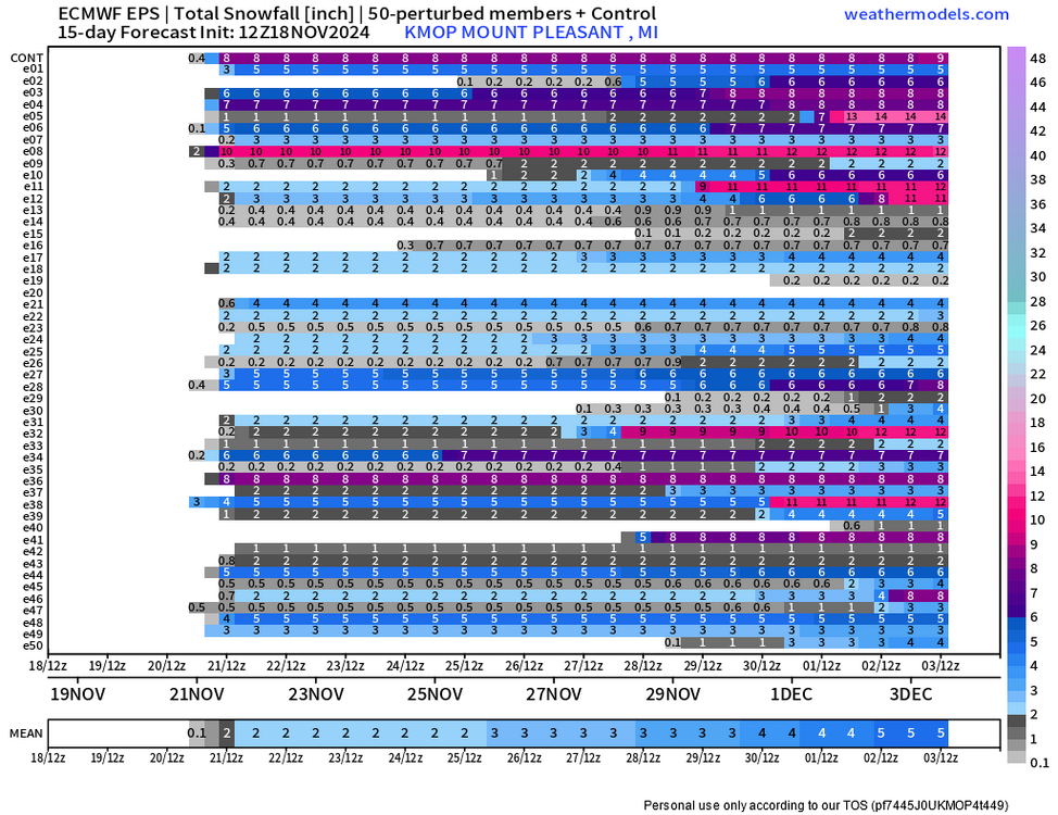
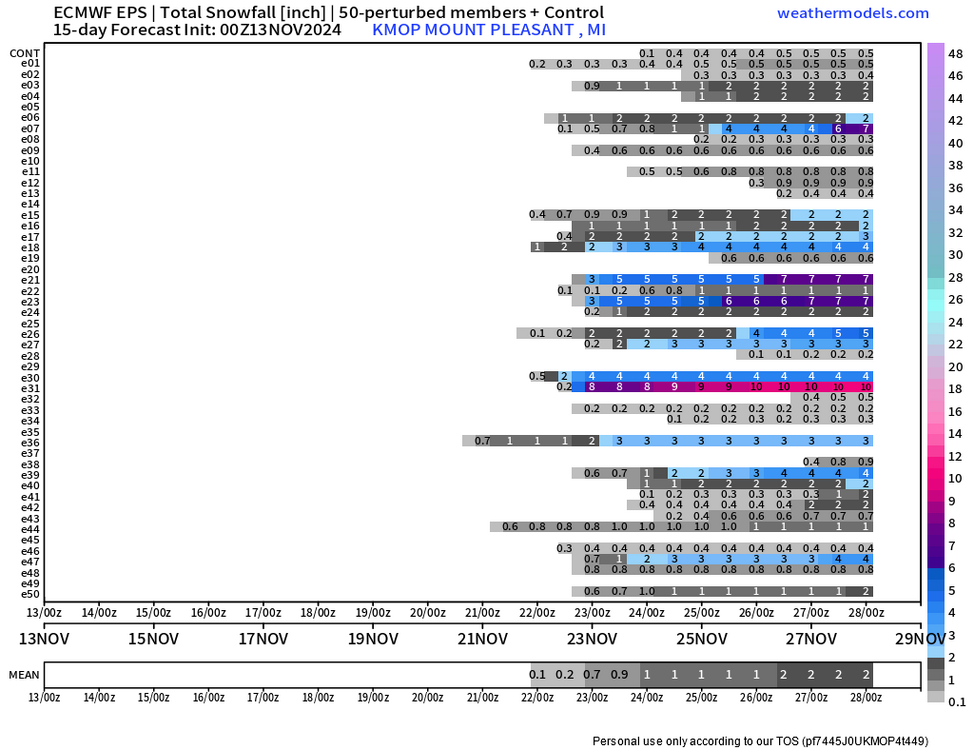
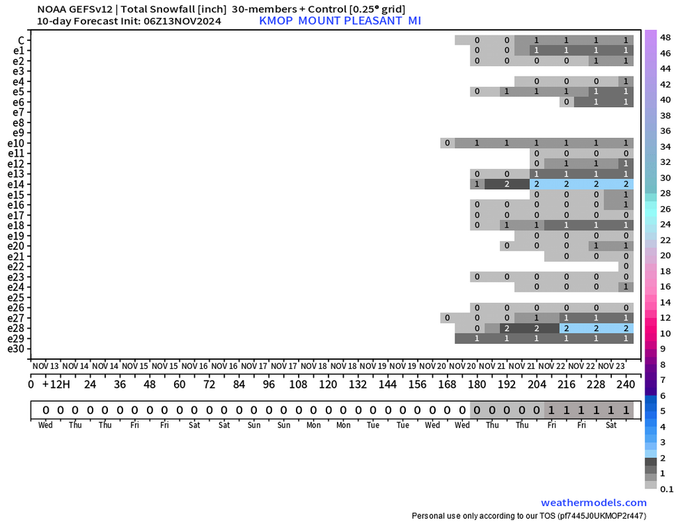
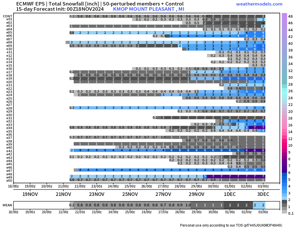
KGRR - Precipitation Depiction, 10_52~2.mp4 Little LES band with Mt. Pleasant perfectly in the middle... glad to see the wealth be spread inland finally!
-
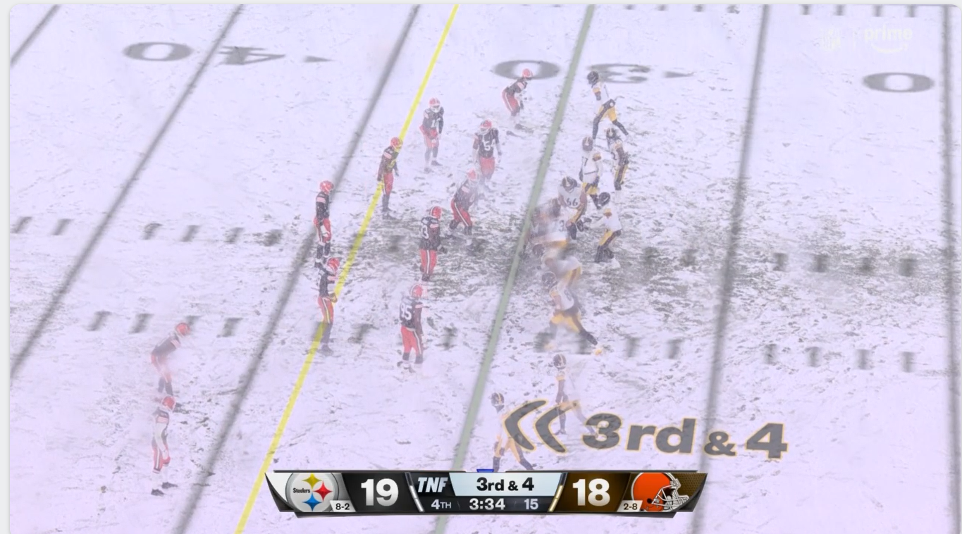
Snow really coming down now in Cleveland! Football weather...

-
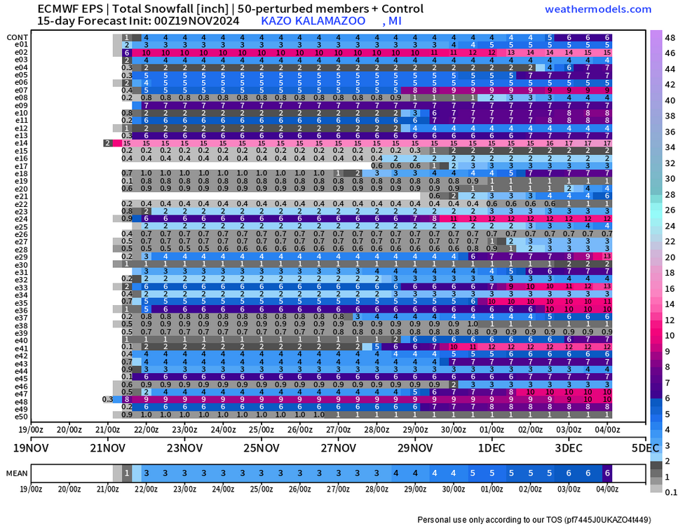
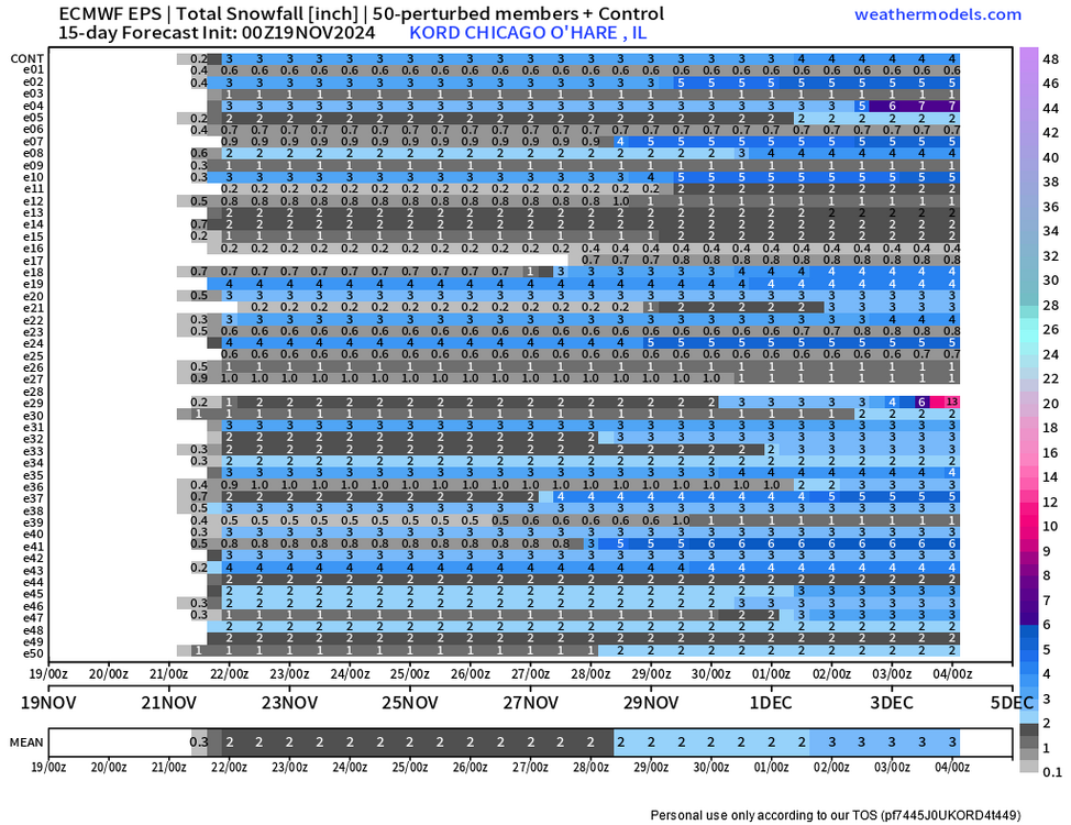
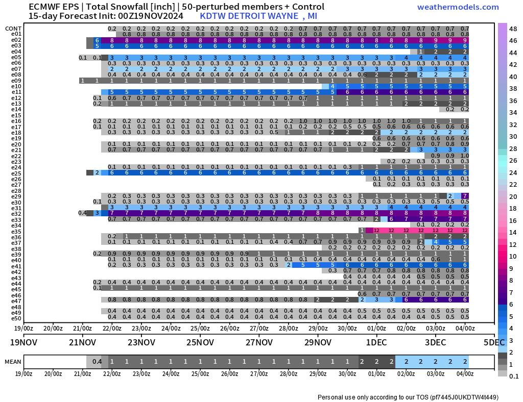
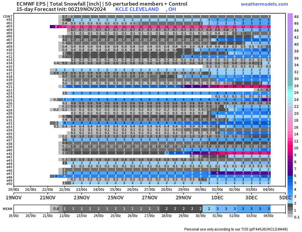
Yep lol, been pretty focused on mid-michigan, but heres a couple more charts I pulled from the 00z run for other cities DTW: Kalamazoo: Chicago/O'Hare: Cleveland: Let me know if anyone wants any other graphics from this site, they've got some good visualizations, but it needs a subscription which I've got thru school.

-
Haven't been paying too much attention to ensembles, but this is a pretty big run-to-run change off the EPS, and somewhat surprising to see so close to the event?

-
What a complex forecast for this mid-week... Rain chance basically everyday, and didn't end up including any snow in my "official" 7-day, but wouldn't be surprised if we got even up to 3inches through the week.
-
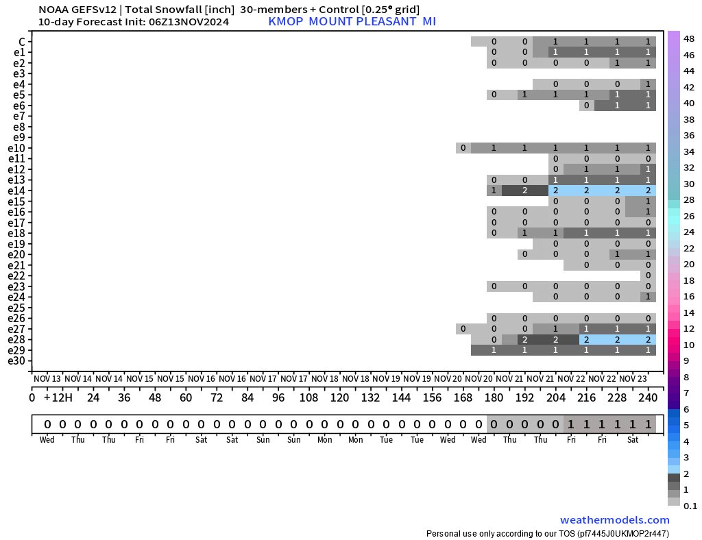
Euro ensemble with a decent signal for something to happen on or around the 23rd, at least in my area. GEFS doesn't go out quite as far, but seems to be picking up on the same system.
-
yep, freshman in the met program!
-
Pretty good show just north of Mt Pleasant, MI. Crazy sight with the wind farms surrounding you as well
.thumb.png.a5c38131c9bbe7abbdd0cdeffc7d1ed0.png)
-
Massive CC drop directly over Lakewood Park on FL's east coast


.png.0f7bcedb10a378c9bb907a85a4d0af90.png)
