
nvck
-
Posts
213 -
Joined
-
Last visited
Content Type
Profiles
Blogs
Forums
American Weather
Media Demo
Store
Gallery
Everything posted by nvck
-
Same areas that saw snow last week?
-
lets come back to this in a couple months
-
no snow here last night, but a mid-30s, overcast, drizzly day, on par with most of spring so far. clouds did clear some a little bit ago and we're in the low 40s, but I can't wait for some 50s!
-
Yeah I'm super excited! was a fairly competitive selection process here, so i'm glad i got in, and it'll be cool to do legit fieldwork
-
may 15- the end of june. If the weather's looking dead then we might leave a week or so early, but the scheduled end date is june 28 i believe
-
not sure how many of you know about the ICECHIP hail research project this summer - a hail study led by CMU & NIU, with like 20 other orgs involved. I'll be going out to the front range/central plains for like 6 weeks this summer working on it. There's this website: http://icechip.niu.edu if you want to learn more, or feel free to ask me any questions, super excited about it
-
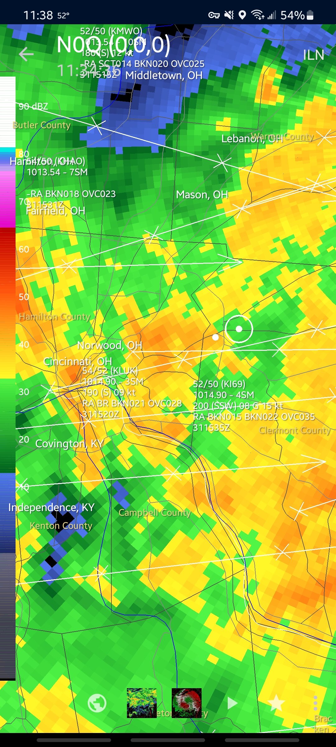
what a long night, insane wind gusts in IN/OH, with a 100mph report from the Muncie area. was posting warnings until like 2am for all the little 3 frame spin-ups in the wilmington area
-
lol yeah, I'm looking forward to some 50s and 60s later this month, before I head back south for the summer (I know, the wrong direction )
-
Heavy sleet with some thunder and gusty winds on my walk to class this morning. Why the hell did I come here?
-
tor-driven, and I was surprised that they didn't go 45% for wind.
-
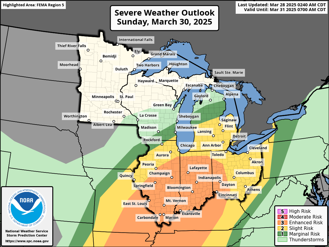
Moderate issued for Evansville - Little Rock area along the Ohio & Mississippi Rivers
-
Would be exactly 1 year from this:
-
Big swath of 75kt+ winds at 850mb early thursday AM on the latest HRRR, over western ohio. I'm thinking a moderate is coming at 1:30, probably for both wind and tor potential.
-
Pretty sunny and 73 on the southwest side of lansing
-
Charlotte, mi, sorry, SW of Lansing. I think there is a Charlotte near circleville tho
-
Heading down to Charlotte area to chase
-
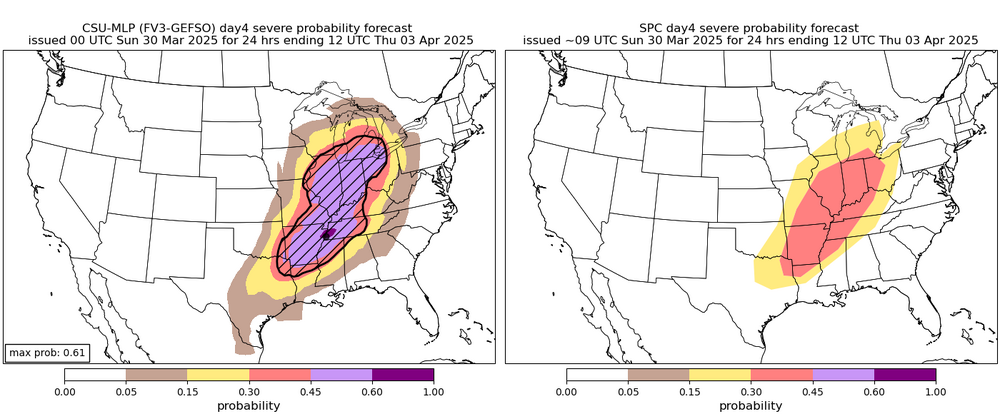
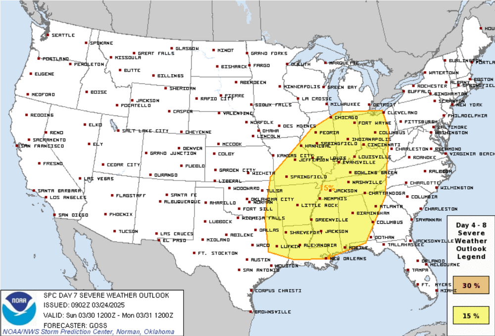
From the day4 portion of the days 4-8 outlook
-
keep in mind that this is a composite of all hazards but still, looking like another big day in the area.
-
Not so sure about this one...
-
At a glance, 00z hrrr looks like an uptrend in terms of morning convection decreasing around the IN/KY/OH area and a little bit more destabilization
-
Probably thread worthy given the huge d3 enhanced covering a lot of the southern sub, and the slight risk all the way into MI. Interesting that the SPC keeps mentioning the significant hail probs as almost the primary risk with this event. Just rare to see this far east I feel.

-

2025 Short Range Severe Weather Discussion
nvck replied to Chicago Storm's topic in Lakes/Ohio Valley
I can start a thread for Sunday tomorrow if it looks to continue the uptrend around the area. Saw a gif of the GFS actually trending towards the ukmet solution which is concerning -
It's the chatbot on Twitter ("x"), https://x.com/i/grok. Not sure if it's accessible without an account, but in my experience it's pretty similar skillwise to deepseek/chatgpt, although I haven't used it to do analysis on data like that.
-
Something to watch for next weekend
-
Incredible amount of lightning with these storms as well