
Bob Chill
-
Posts
36,385 -
Joined
Content Type
Profiles
Blogs
Forums
American Weather
Media Demo
Store
Gallery
Everything posted by Bob Chill
-

January Medium/Long Range: A snowy January ahead?
Bob Chill replied to mappy's topic in Mid Atlantic
Gfs reminds me of Feb/Mar 2015. West track but coooold in front. Maybe we get our second 6+" storm all snow below freezing start to finish with HP closer to Bermuda than Maine lol. I was thinking when this pattern was showing long range that the CAD acronym will start becoming common on the board. It's not a pretty nor classic way to snow but my picky days are long gone Eta: not saying a mixed CAD solution is the most likely. Just that if it happens it will produce anyway -
Seems like a multidecadal cycle there too. Such a hot and cold streak area over longer timescales. We suffered 7 years after 2016 but think about the 7 years prior to that.... maybe, just maybe, we back on a multi year streak. Why? Beats me lol
-
Idk man, seems waaay to advanced to me. I was thinking more like this but I can see a case for commodore 64 level stuff.
-
Richmond Metro/Hampton Roads Area Discussion
Bob Chill replied to RIC Airport's topic in Mid Atlantic
There's been an underlying trend for nearly a month now for mid/long range models to underestimate the pushback of confluence or suppressive flow. This weekend looked more like rain than snow out in time but the speed/depth of the acrtic front trended favorably. Atmosphere seems to want to buck the trend of the much more typical "north trend" or "slow cold". The way I look at things, the atmosphere has spoken and typical model trends that we expect aren't happening as expected. Each event is unique but until I see anything other than what has been repeating, I'll continue to hedge colder/snowier on all threats mid range or longer until I'm told to stop doing that... lolol Dies RIC end up with more snow than DC? It might just do that. Fun winter! -
January Medium/Long Range: A snowy January ahead?
Bob Chill replied to mappy's topic in Mid Atlantic
Appreciate you dropping model snapshot analysis. I really don't have a lot of free time until late in the day and by then.... buddy I'm tired lol Train tracks in my brain are either seasonal door to door or these weird "hot streaks" that oddly repeat even when mid/long range models never really shows it but short term we're "Again?!" (For better or worse lol). 2013-14 was a year of seasonal train tracks in a good way and some more recent winters have been the same but in a VERY bad NOT good kinda way lol. 2014-15 is the starkest example I can think of where it was chapters of tracks in the seasonal book. Jan 2015 was probably the most nerve grating month I've been thru. It was the birth of the "Scumstonian River" lololol... lookin at you Jebman! Hahaha. But when the tracks FINALLY shifted it was game fookin on. So far this year feels more seasonal than chapters. A bit muddy because the hemispheric pattern is quite different than the last month but the end result is still pretty good. I was getting the seasonal feel during Dec but Dec is curveball city. Now we can kinda see into Feb and the MA is solidly in the game. How long it holds is anyone's guess at this point but there has been zero tendency for things to become all ridgy or rainy. Steady as she goes.... -
January Medium/Long Range: A snowy January ahead?
Bob Chill replied to mappy's topic in Mid Atlantic
On the contrary, this is an absolutely exquisite map and if it's right, I'll post lots of pics to make up for the discrepancy in our yards -
January Medium/Long Range: A snowy January ahead?
Bob Chill replied to mappy's topic in Mid Atlantic
Yessir, agree completely. It's why I haven't done much looking other than ops. When run over run and model against model shows wide swings with every run, you can be VERY confident in not have ANY confidence in a specific solution. Ops are spread wide and ensembles are shotguns I always keep it simple. Spread is large but on the balance, the solutions are quite snowy and not rainy except for the initial front. So that tells me there are multiple chances at snowfall thru the end of the month. Our area almost requires multiple chances. My thought algorithm keeps landing on there's a high probability of accum snow or winter wx thru the end of Jan. I'll jump back in when ops and ensembles agree on something discrete for more than one suite and a range less than 5-6 days. -
January Medium/Long Range: A snowy January ahead?
Bob Chill replied to mappy's topic in Mid Atlantic
After some very shallow analysis it appears that every wave that may or may not affect us over the next 2 weeks has equal chances of rain, snow, sleet, zr or a combination of all. Wiggly progressive fire hoses have somewhere around a zero percent chance of being modeled correctly by ops beyond 4 days or so and even then. Ensembles are 12 guage shotgun blasts of all solutions. Good luck guessing right lol. -
And this picture is too much lol. I mean how freekin ironic. The universe has a sense of humor and life is a dam trip
-
Had to run to Quincy OH Sunday and drove back today. All 470 miles were 100% snowcovered the whole way out. Trip through the VA apps and WV turnpike was pure eye candy. Blue sky powder day. Flattop area reminded me of the CO foothills lol.
-
Sounds pretty fun and I could use the tips. It's a big deep cold lake. Not my forte.... yet lol. Sent ya a DM
-
That's a nice spot. Dead center of the best part of the lake. Napolis is decent too. Love to fish. I'll have a boat b4 it warms up. Haven't fished smith much yet. Interested in stripers. Looks like a blast and reminds me of the bay when they feed on top. Wife and I have caught typical stuff in leesville and kayaking the Staunton. Got a big walleye in the fall. Delish!
-
January Medium/Long Range: A snowy January ahead?
Bob Chill replied to mappy's topic in Mid Atlantic
MJO = Maybe it's Just Over? SSW = Stupid Shitty Winter! -
Yea lol, it's an awesome place. New owners took over when Wayne lumpkin passed 3 years ago and they're investing in upgrades. Wife and I are only temporarily here until we build our place on the leesville lake side of smith. We'll prob keep the place here. It's a little gem in a cool spot. Few and far between on this lake without costing a literal fortune lol
-
I'm feelin pretty blessed down here this year. 5.25" total and some ice isn't impressive at all but the way it happened was deep winter appeal. Feels quite lucky to be sharing full snowcover with my long time MA digital friends lol. Told myself to get used to being on the outside looking in when I moved. This winter is already a big win in some ways
-
January Medium/Long Range: A snowy January ahead?
Bob Chill replied to mappy's topic in Mid Atlantic
I'm keeping it simple going forward. Epo patterns are frustrating to figure out beyond 5 days and even then.... I'm not getting married to anything until it's inside of that range. Think of an epo driven pattern as one dude holding an open firehouse. Yea, you can kinda aim it where you want but it sprays all over anyway. That spray with flow is make or break. Expect nothing to lock in and hold mid range and beyond. It's a game of windows and not events. -
January Medium/Long Range: A snowy January ahead?
Bob Chill replied to mappy's topic in Mid Atlantic
It will have to reshuffle if a big -ao/-nao is coming back. Mod/strong EPO ridges generally feature a neutral or + ao/nao because it's awful hard to fill the entire arctic circle with high pressure. Blocking slows things down and spreads out shortwaves which is good when they have their eyes on you but terrible when your on the outside looking in. I'd prefer blocking but there are advantages to progressive epos when it comes to precip events. They are spaced tighter and more frequent. Pick your poison because it NEVER comes easy here lol -
Lake shots didn't come out well but this is the scene
- 957 replies
-
- 16
-

-
Cold powder scene with this one. Crazy satisfying and a long wait lol
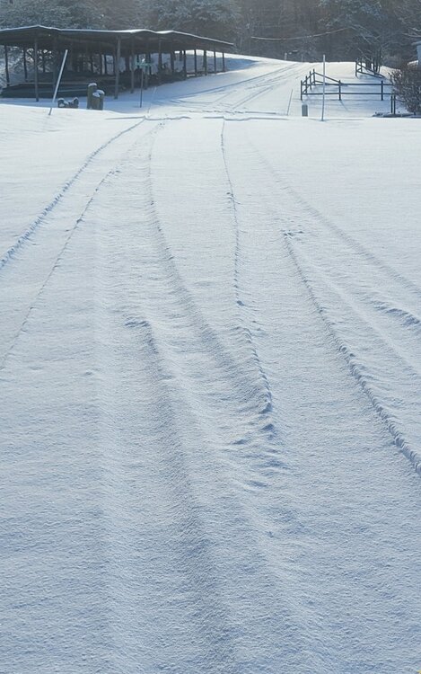
- 957 replies
-
- 30
-
-
January Medium/Long Range: A snowy January ahead?
Bob Chill replied to mappy's topic in Mid Atlantic
Last 3-4+ years has taught us that long range models almost exclusively overdo the depth of progressive cold invasions. I don't think it's different this time. Doesn't mean easy snow. Just won't be nearly as easy for GA than current progs show lol -
I want to slantstick so bad... but I can't lol..... 3.75" total.
- 957 replies
-
- 12
-
-
Getting close to 3" and best dendrites/rates of the event falling now. I don't think I'll hit 4" but radar looks half decent for another hour or 2.
- 957 replies
-
- 11
-
-
27 and moderate snow with decent dendrites. A smidge over an inch. Gonna walk around in a few and see if decent pics are possible.
- 957 replies
-
- 20
-
-
There wasn't much virga here. First round of fake greens faded then it filled back in an hour later and was snowing. I've seen far worse. Prob because it's a southern stream wave
-
A distant second is a VERY kind gesture in this sport. I'll always root for the hoco-moco deathband... as long as the Roanoke-lynchburg nuke stripe is twice as big


