Picard
-
Posts
291 -
Joined
-
Last visited
Content Type
Profiles
Blogs
Forums
American Weather
Media Demo
Store
Gallery
Everything posted by Picard
-
 Looks like more vehicles will be available soon at your local shady used car lot.
- 527 replies
-
- 3
-

-
- flash flooding
- river flooding
- (and 2 more)
-
We are/were heading to the finger lakes Wednesday - Sunday. I'm in the process of communicating with the B & B owner to try to change the dates to Saturday - Tuesday of next week. I'm hoping they are flexible and understanding. Not only do I not want to vacation in the rain if I can help it, I also would need to keep an eye on our basement if this comes to fruition.
- 1,764 replies
-
- 1
-

-
- hurricanes
- tropics
- (and 5 more)
-
Some serious business for people now with these training red radar returns. I've passed an inch on the afternoon and it's currently pouring again. Meanwhile, others do still remain dry. Amazing how this has been working out for some. Feast or famine.
-
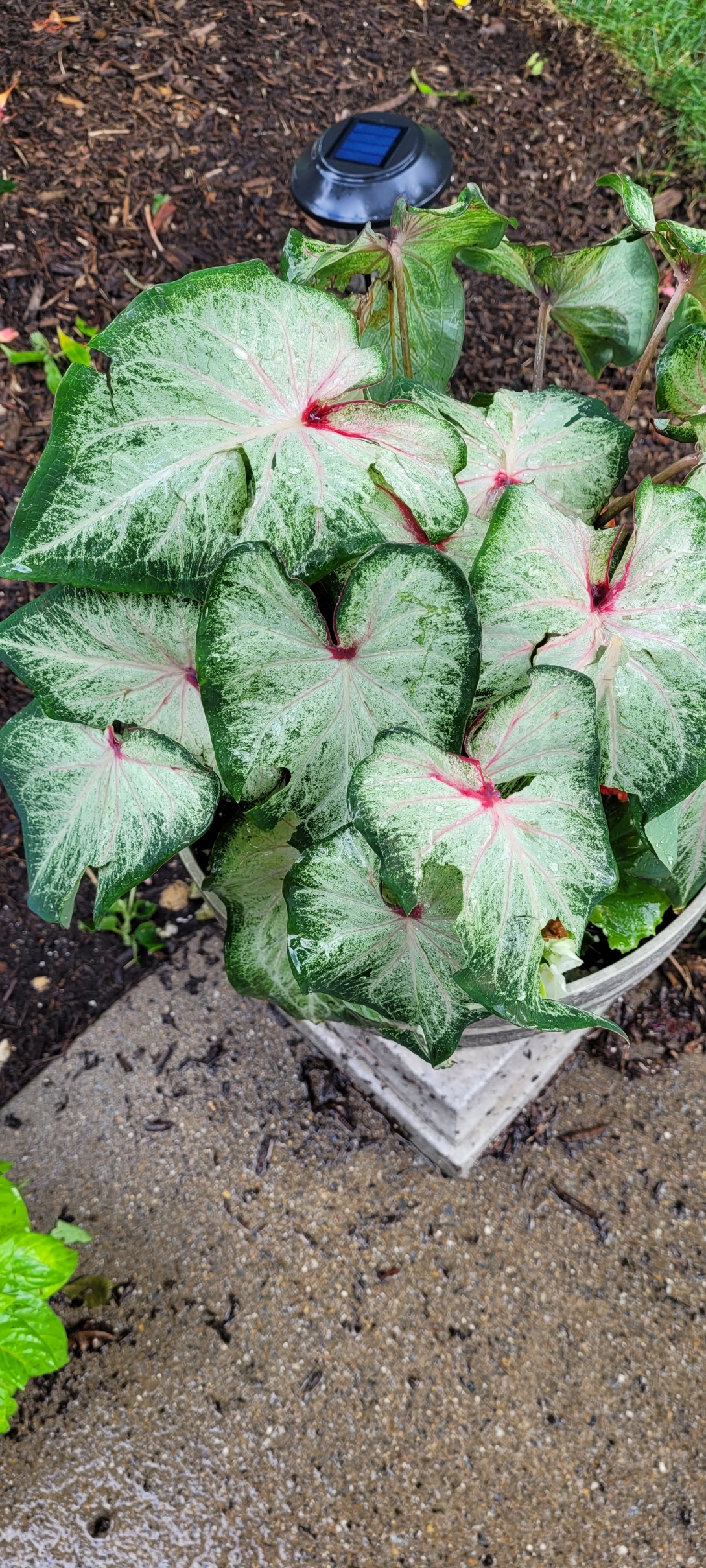
It's actually celosia that I just picked up to dry for small arrangements, as it's excellent for that purpose if you clip the flower stalks early enough, and it lasts years. Although dummy me left it out in that storm so now I don't know. The plant I pictured is one of our best ones, as I've been having general issues this year with a lot of plants probably weather related and operator error. It should be fine, although will have holes in many of the leaves as a souvenir of today's storm. Our morning glory is probably shot - the leaves are pretty fragile, and our two tomato plants are caput. I was getting annoyed with the morning glory anyway because it's throwing vines everywhere but not a single flower. And with that it's storming here again. Although not nearly like earlier.
- 1,764 replies
-
- 1
-
-
- hurricanes
- tropics
- (and 5 more)
-
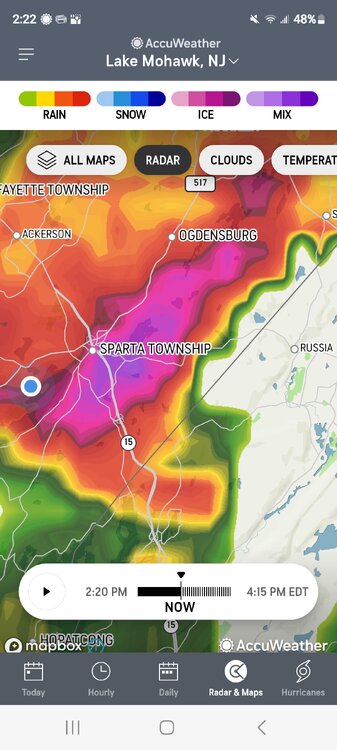
Sparta Radar of the storm just a couple minutes after the worst of it passed right over my pin.
- 1,764 replies
-
- 1
-
-
- hurricanes
- tropics
- (and 5 more)
-
The storm is winding down now. Pretty wild. No miss here today and the cell was severe warned. Some hail damage to our garden and flowers, and a lot of smaller branches and leaves scattered about from the hail and gusty winds. Several close bolts of lightening, and 0.7" of rain, including 0.52" in about 7 minutes. Hail was marble size. That magenta colored hail core when right over us, and lasted about five minutes. I would have taken a picture of the accumulation but it was too dangerous to run outside with all the lightening.

- 1,764 replies
-
- 2
-
-
- hurricanes
- tropics
- (and 5 more)
-
Unbelievable storm here. Hail, wind, CTG lightening, will keep you updated.
- 1,764 replies
-
- 1
-
-
- hurricanes
- tropics
- (and 5 more)
-
0.57" here, and the sun is back out. I'll take it. I would imagine areas a little further north got a lot more with this batch.
-
Just getting clipped by the heavy stuff this round, that tracks from here to further north. Raining hard with rumbling thunder and some wind kicked up before. Up to 0.4". I have to work the Sussex County Fair tonight, starting at 7, so it looks like this batch will be out by then.
-
Skeptical. Looks like the precipitation is what's typical southwest to northeast movement from western PA into NY state and will miss the area entirely. It matches closely the blue region on bluewave's map where much of the rainfall has formed and moved recently, over the same areas. Unless more of it forms down towards the Philly area later on. Which is always a great unknown, what forms on radar, and lately, it hasn't been much for most.
-
Looks like a rainy and stormy morning just off to my north. I would love to see a comparison of the last 45 days or so for total rainfall for Port Jervis, NY vs. Andover NJ. It seems I'm spending a lot of time this summer watching storms train off to my north while remaining high and dry here. I'm not sure where to readily pull such information myself or I would.
-
Some rumbles and funky sky with the setting sun, but it looks like almost zilch on the rain, just a few drops. The cells split me, one to the north and one to the south.
-
Overcast, but muggy. Thinking if cloudy conditions persist, that will reduce the chances of severe this afternoon.
-
just evaporates north of Atlantic City/Philly.
-
The slopes of these graphs are astounding. Close to a 2 degree increase per decade.
-
We're already there, they've been here, upper 70s, low 80s dews have been quite common this summer.
-
Several stations in NJ are reaching 80+ dewpoints, with HIs already topping 105.
-
Honest Question: Does any reputable source track average dewpoints over time? It would be interesting to see if there is a correlation toward higher dewpoints and recent changes to our climate.
-
0.65" overnight - brief but torrential rains with thunder and lightening.
-
Surprised there was no Heat Advisory today, unless I missed it. Dewpoints of 80+ can be found on a few stations, with Heat Indexes reaching 105-110. Felt just lovely.
-
A several stations, particularly in Southern, NJ, have reached 80-81 dewpoints this afternoon. Make sense given all that rain they had this morning, combining saturated ground with very humid air. Yuck!
-
0.77" total so far. It keeps backfilling, prolonging it some. Also looks like a bow could be starting again, last frame or two.
-
Quarter inch of rain in 4 minutes.
-
Getting in on it now. Absolute deluge, with thunder and lightening, but no wind yet.
-
I'm under a warning now. Cell looks nasty, maybe bowed out a bit too. Time to move the truck again. We'll see what happens.