Layman
-
Posts
502 -
Joined
-
Last visited
Content Type
Profiles
Blogs
Forums
American Weather
Media Demo
Store
Gallery
Everything posted by Layman
-
Octorcher or Roctober 2023 Discussion Thread
Layman replied to Damage In Tolland's topic in New England
Leaf/color status from here on 10/13. The colors are a little more vibrant in the sun when viewed directly - the camera seems to dull it a bit. This area is mostly pine, birch and maple. Still lots of leaves and green out there.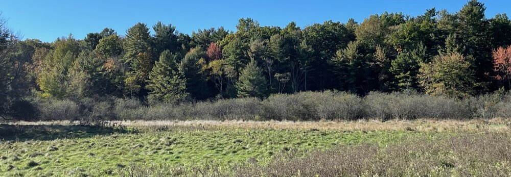
-
Octorcher or Roctober 2023 Discussion Thread
Layman replied to Damage In Tolland's topic in New England
Looking forward to the first frost to tamp down all the bugs. They're coming out in full force now which feels backwards for this time of year. Problem is, when that first frost hits, the ladybugs begin their home infiltration for winter. -
Octorcher or Roctober 2023 Discussion Thread
Layman replied to Damage In Tolland's topic in New England
Bright, sunny, warm and the lawn is still lush. Looking like a good day for a mow out this way. -
Octorcher or Roctober 2023 Discussion Thread
Layman replied to Damage In Tolland's topic in New England
The last 3 years here have been warm and rainy and whenever we did have snow, regardless of how cold it got, there was ice and rain mixed in. Not really a fan of the La Nina precip types. -
Octorcher or Roctober 2023 Discussion Thread
Layman replied to Damage In Tolland's topic in New England
Thanks. Was last year considered a weak Nino year? I seem to recall it may have been or at least a transitioning year. Those storms that tracked west along the NY/VT border weren't fun to clean up out this way. Snow, ice and rain at 28 degrees made for some sloppy conditions in the driveway. Does a moderate Nino winter promote Nor'easter type storms or more northern tier storms? Are there tools or metrics to assess the "strength" of the potential El Nino this winter? Curious if there are ways to compare to 2015 or if it's a fools errand at this lead time. -
Octorcher or Roctober 2023 Discussion Thread
Layman replied to Damage In Tolland's topic in New England
Are there any specific bullet points for what typically happens, or at least can happen in Nino winters? -
What's a "mega ski pass"? Something valid at numerous locations across the country? I've been out of the game for some time...
-
Octorcher or Roctober 2023 Discussion Thread
Layman replied to Damage In Tolland's topic in New England
37.0 for the low this morning. Colors changing now but still plenty of green. A couple mows still left in the season and then the mid-November leaf mulching before the switchover to blower and plow. Absolutely not complaints about these temps but it still feels a little too warm for stacking the firewood. -
Octorcher or Roctober 2023 Discussion Thread
Layman replied to Damage In Tolland's topic in New England
Does this have a known effect on New England weather in the fall/winter? If so, how? -
Octorcher or Roctober 2023 Discussion Thread
Layman replied to Damage In Tolland's topic in New England
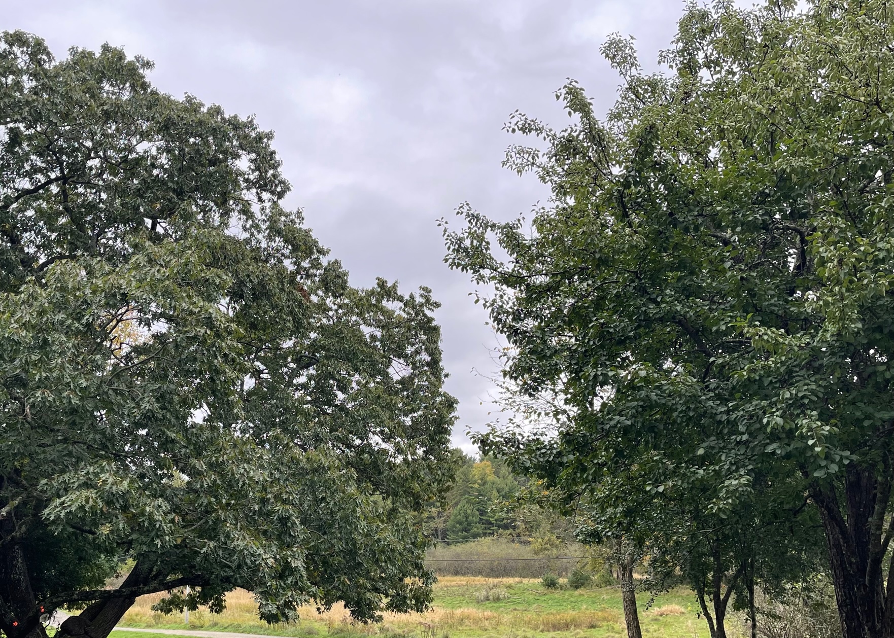
Lots of green still in my area. Feels late, but as we look through pics from prior years it seems to be right on schedule. Pic taken just now. This ancient oak is always the last to leaf out.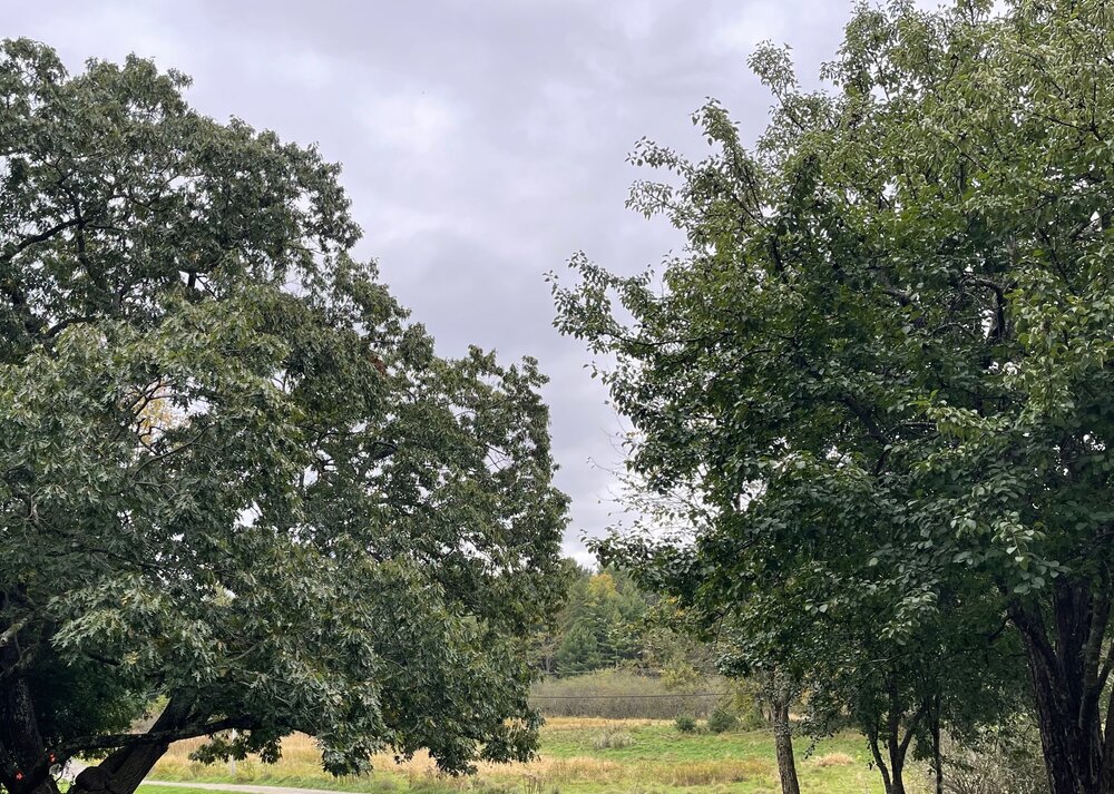
-
Thanks for the link - that's neat to see. The 1993 to 2001ish time frame is when I spent a lot of time trying to get on the slopes (the pre-kid/family years!). Those first week of October opening dates are what really stand out to me. We'd still be getting decent weather and temps on the Seacoast but you could sneak off to get some early runs in to build up the anticipation for the season to come. I'm trying to recall how we'd get updates for openings and conditions back then in the early internet days. Something makes me think there was a number we'd call to get a recorded message each morning. It was about a 2.5hr ride for us to Killington so we definitely wanted to ensure we had good data on what the conditions were. Gas was cheap, time was plentiful and priorities were properly adjusted to the important things at that time
-
Interesting, thanks for the details. We didn't realize at the time how special some of those winters would ultimately end up being. Fortunately we had the time and ability to capitalize on spending many hours on the mountains back then. My brother and I stayed in this closet-sized room at the Turn of River Lodge over there one night, with the windows rattling all night long, and got first tracks top to bottom on Great Eastern the next morning zipping along the corduroy on our first year Custom 55's (must've been 1996? The ones with the butterfly graphics). Awesome memories. Might have been the first year the Skyship went down to the base. Can't recall because it was so long ago now! The Killington Double was still operating back then. What a slow, frigid, horrible ride that was! Looking forward to seeing the temps drop and the first signs of white showing up on the cams over there.
-
Is there a known average date when Killington is typically able to fire up their guns? I remember getting over that way pretty early in the season a couple times in the early/mid 90's. Shouldn't be too long now until the cams start showing the whitening up for Superstar.
-
Octorcher or Roctober 2023 Discussion Thread
Layman replied to Damage In Tolland's topic in New England
I enjoy and appreciate your data-centric posts. While I personally believe that 100/150/200 years worth of data isn't enough to consistently confidently determine the outcomes of such a dynamic and complex system that is our weather, it's the only data we've got and it often does a respectable enough job to give us a heads up of what may be coming our way. I find it very interesting learning about similar historical data and potential analogs to current weather. -
Octorcher or Roctober 2023 Discussion Thread
Layman replied to Damage In Tolland's topic in New England
In my neck of the woods we hit 12/23/22 with as-expected Christmas warmth of 53.1 degrees and winds beginning to absolutely crank. My poorly placed PWS recorded a 42.3mph gust at about 12' off the ground. Might be the highest it's ever recorded. Lost power late 12/23 and didn't get it back until 5:30pm on 12/24, thankfully. High of 16.5 and low of 11.5 on 12/24 with winds calming but still blowing solidly. Absolutely miserable gassing up the generator in that. Christmas day was salvaged with a respectable high of 27.9, winds still blowing, but the power was on! -
Thanks everyone for the quick and concise answers. That was something I've seen talked about a lot over the years but didn't clearly understand. Interesting stuff.
-
I'm not following how temps in the mid-30's is producing frost on surfaces. Some synergistic effect? Is this akin to a winter storm "making it's own cold"?
-
Thank you @Typhoon Tip and @weatherwiz for the details, I appreciate it. I don't want to derail the thread with endless questions however, I'm curious about the known biases within the models. I've seen reference to this over the years and it seems odd to me that they can't or haven't been programmed out. Or is it more a matter that when those biases exist, the model performs better generally so it's an accepted consequence? I'm not sure if it's possible or worth it, but it seems that there's the potential for a secondary program focused specifically on removing the bias(es) to be overlayed onto the model output to "correct" it. I imagine starting to do something like could rapidly get out of hand with derivations that are miles away from the original output. Are there specific biases within the models that are suggesting their output for this weekends rain won't play out like they're currently suggesting? If so, can they be easily explained (like: "the NAM typically pushes these too far North") or are they far more involved?
-
This is a great example of what I was inquiring about yesterday regarding relying solely on model output or the combination of years of experience interpreting model data. If years of experience shows that there's a higher likelihood of one thing happening over another, why do the models not pick up on that same evolution and output that? Or do they? I recall seeing posts in the past (ensembles?) with all the numbered panels showing potential outcomes so I'm assuming they may kick out a more precise option similar to how one would interpret the data based on experience...? Sorry if this is extremely basic and known by most here. I simply don't know at this time! My interest is largely in the data, model reliability, consistency, confidence, etc strictly from a hobbyist/inquisitive perspective.
-
Interesting. Logically it makes sense that a "cone of certainty" or confidence narrows as you approach the start of a weather event but it's interesting to consider what contributes to that confidence at longer lead times. I recall a time or two last winter when you had a high level of confidence in something materializing at long lead times - 10-15 or so days out. I don't remember the finer details of the storm, but do remember one of them blossomed into a region-wide event. With respect to model improvements in recent years, is there a way to quantify that? For example, is it in terms of "Model X is correct XX% of the time" or is it more nuanced than that? I ask because it seems like there can be drastic fluctuations from run to run. One run showing an event in SNE only to have it move 100's of miles north in the next run, etc. Although, maybe pinpointing specific areas (IMBYism) is more of an individual human response rather than a testament to the reliability of a model output...? I.e.: it's going to rain in a general area and it could be SNE, CNE or some combination thereof.
-
For the meteorologists and advanced hobbyists who've been doing this for some time, when deciphering model output, would you say you have more confidence in what the models are spitting out or is it more so your interpretation based on your experience of what the models are outputting? From a 3rd party layman's perspective, it appears that determinations are made based on what a model suggests, or rather it's evolution in getting to whatever the model is currently suggesting, however that can change rather dramatically by the time the next output is delivered. Seems like highly complicated business and not really for those who like/need hard and fast, black and white answers!
-
3.66" total
-
Looks clean and consistent on this cam at the North beach wall. Hard for me to tell how big they are: https://www.cinnamonrainbows.com/surf-cam-report
-
Thank you for the detailed reply. It'll be interesting to see how the winds from this one ultimately play out compared to forecasts.
-
Non-meteorologist here (1st post as well...): is there a formula or other standard to define or predict the reduction in wind speed upon encountering land? For example, if there are sustained 60mph winds at the coastline, are there high-confidence ways to predict/forecast winds 1 mile, 2 miles, 5 and 10 miles inland? Where I'm physically situated, and from comments I've seen over the years from others, it seems that forecast gusts rarely reach the speeds predicted in the weather apps.